Powerball Posted March 2, 2015 Share Posted March 2, 2015 Both the 00z NMM and ARW produce about 2-4" of snow here before the changeover, assuming 10:1 ratios.. Link to comment Share on other sites More sharing options...
Powerball Posted March 2, 2015 Share Posted March 2, 2015 Both the 00z NMM and ARW produce about 2-4" of snow here before the changeover, assuming 10:1 ratios.. Verbatim, assuming 10:1 ratios, the 12z NAM shows 2-3" between I-94 and I-96/M-59... Link to comment Share on other sites More sharing options...
Chicago WX Posted March 2, 2015 Share Posted March 2, 2015 A little front-end thump for some on the 12z RGEM. Make sure you set the run to 12z: http://collaboration.cmc.ec.gc.ca/cmc/cmdn/pcpn_type/pcpn_type_gem_reg.html Link to comment Share on other sites More sharing options...
wisconsinwx Posted March 2, 2015 Share Posted March 2, 2015 The NAM this morning would pretty much boil my blood. Detroit could get a couple inches of front end snow while we get a dry slot lol. Link to comment Share on other sites More sharing options...
Snowstorms Posted March 2, 2015 Share Posted March 2, 2015 Based on the latest models, i'd say 2-4" is a good call for the GTA followed by some freezing rain for a while and maybe some rain, but i'd suspect it stays closer to the lake. Link to comment Share on other sites More sharing options...
cyclone77 Posted March 2, 2015 Share Posted March 2, 2015 Downturn continues in precip production for eastern IA/northern IL. Many models now well under 0.25". Looks like a 2-4hr period of precip, and then just a lot of drizzle/frizzle the rest of the day lol. Good news for snow pack lovers is there won't be any heavy rain eating away at the snow on the ground. This is the complete opposite of the GHDII storm in that it keeps trending more and more wimpy with every succeeding model run. Link to comment Share on other sites More sharing options...
A-L-E-K Posted March 2, 2015 Share Posted March 2, 2015 what a turd Link to comment Share on other sites More sharing options...
Baum Posted March 2, 2015 Share Posted March 2, 2015 what a turd Yep. Link to comment Share on other sites More sharing options...
Hoosier Posted March 2, 2015 Share Posted March 2, 2015 Guess I'll ride my call from a couple days ago. A period of sleet at onset followed by up to a tenth of an inch of ice, then rain. Link to comment Share on other sites More sharing options...
geddyweather Posted March 2, 2015 Share Posted March 2, 2015 System looks like it has slowed down from last night. Though not much, precip is setback here to start at 7am instead of 5-6am. Was hoping for a longer period of snow/sleet mix, which would help things stay cool for ice later on. Now that is looking sketchy. Really going to stink driving to school/work tomorrow, regardless. If it does start around 7, it would make close calls for some schools around here. Roads are bad enough today as it is. Link to comment Share on other sites More sharing options...
Baum Posted March 2, 2015 Share Posted March 2, 2015 See LOT going with a WWA.. Almost depressing. Link to comment Share on other sites More sharing options...
Hoosier Posted March 2, 2015 Share Posted March 2, 2015 LOT made a good point in the midday update...dewpoints are low and you have to go far to find dewpoints above freezing. Thus there will be some opportunity for evaporational cooling to keep surface warming in check initially. Link to comment Share on other sites More sharing options...
geddyweather Posted March 2, 2015 Share Posted March 2, 2015 See LOT going with a WWA.. Almost depressing. Most of the CWAs will probably go with WWAs (or maybe a freezing rain advisory/ZRA) for this one. Depressing yes, but not warranting much else... Link to comment Share on other sites More sharing options...
Brewers Posted March 2, 2015 Share Posted March 2, 2015 Might as well rain at this point.... final call 2.8" at MSP. Link to comment Share on other sites More sharing options...
Hoosier Posted March 2, 2015 Share Posted March 2, 2015 That area around I-80 could be interesting overnight...could get a sneaky burst of snow there if precip rates can keep the warm air aloft at bay. Link to comment Share on other sites More sharing options...
cyclone77 Posted March 2, 2015 Share Posted March 2, 2015 That area around I-80 could be interesting overnight...could get a sneaky burst of snow there if precip rates can keep the warm air aloft at bay. 18z HRRRRRR showing a nice burst of snow there around 3am. Shouldn't last long but could rip for a little while. Link to comment Share on other sites More sharing options...
hawkeye_wx Posted March 2, 2015 Share Posted March 2, 2015 Models are keeping the 850 freezing line south of me now, but the precip has been hacked way back to 0.10" or less. A quick burst of snow or sleet may be the best we can hope for. Link to comment Share on other sites More sharing options...
Chitown Storm Posted March 2, 2015 Share Posted March 2, 2015 Might as well rain at this point.... final call 2.8" at MSP. We'll enjoy rain later this week. But for now, we're T-minus 15 hrs to the start of the event and no one really has any idea how much snow we're going to get. I love it. Link to comment Share on other sites More sharing options...
Gilbertfly Posted March 2, 2015 Share Posted March 2, 2015 We'll enjoy rain later this week. But for now, we're T-minus 15 hrs to the start of the event and no one really has any idea how much snow we're going to get. I love it. lol....good luck up there!!! Link to comment Share on other sites More sharing options...
geddyweather Posted March 2, 2015 Share Posted March 2, 2015 Pretty big area going to be affected by this storm. Of note: Blizzard Warnings just east of the Twin Cities, Freezing Rain Advisories in Srn OH, and Flood Watches in SE OH and in WV. Link to comment Share on other sites More sharing options...
Brewers Posted March 2, 2015 Share Posted March 2, 2015 We'll enjoy rain later this week. But for now, we're T-minus 15 hrs to the start of the event and no one really has any idea how much snow we're going to get. I love it. A general 2-4" for the metro seems reasonable but may be too high. St. Cloud to Duluth will likely jackpot. We may rip for a time around 15z, otherwise forcing looks lackluster. Just not feeling it. Link to comment Share on other sites More sharing options...
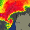
Thundersnow12 Posted March 2, 2015 Share Posted March 2, 2015 19z HRRR Link to comment Share on other sites More sharing options...
A-L-E-K Posted March 2, 2015 Share Posted March 2, 2015 looking forward to a front end slop inch followed by some slizzle and mist garbage event Link to comment Share on other sites More sharing options...
Thundersnow12 Posted March 2, 2015 Share Posted March 2, 2015 Here is the 20z run now. It's doing a fairly decent job on current temps across northern IL, a little too warm far west and slightly too cold closer to the lake. By 11z tomorrow it has temps in the low to mid 20's across the area, 24 at ORD/MDW and dews in the upper teens to low 20's. Link to comment Share on other sites More sharing options...
Thundersnow12 Posted March 2, 2015 Share Posted March 2, 2015 LOT S MENTIONED IN THE EARLIER UPDATE... A WINTER WEATHER ADVISORY WAS ISSUED FOR THE ENTIRE AREA EARLIER IN THE SHIFT FOR LATE TONIGHT THROUGH TUESDAY MORNING. MODELS ARE STILL SHOWING PRECIPITATION BEGINNING AS SNOW NORTH OF INTERSTATE 80...AND SOME FORM OF SNOW...SLEET OR FREEZING RAIN IN THE FAR SOUTH. IT COULD BE A PRETTY GOOD BURST OF WET SNOW INITIALLY BEFORE THE TRANSITION BEGINS. A WARM FRONT WILL LIFT THROUGH THE AREA DURING THE MORNING HOURS. THIS IS THE PERIOD WHERE MODELS A SHOWING A MORE SIGNIFICANT PUSH OF PRECIPITATION. WE ARE COMING OUT OF A PRETTY COLD AIR MASS..AND DEWPOINTS ARE STILL VERY LOW ACROSS THE AREA...WITH DEWPOINTS ABOVE FREEZING NOT VERY CLOSE. TEMPERATURES LOOK TO REMAIN BELOW FREEZING THROUGH AT LEAST MID MORNING AREA WIDE. MODEST PRECIPITABLE WATER VALUES IN EXCESS OF 0.75 INCHES COUPLED WITH A 35-40 KT LOW LEVEL JET FEEDING INTO THE LOW LEVEL FRONTAL ZONE WOULD SUGGEST MODEST PRECIPITATION RATES DURING THIS TIME WHEN THE LOW LEVEL (925-850 MB) TEMPERATURES ARE HEADING ABOVE FREEZING. SOME OF THE RECENT NAM/GFS WAS SLIGHTLY COOLER IN THE THERMAL PROFILE FOR THIS PERIOD SUGGESTING THAT SNOW/SLEET MAY DOMINATE...ESPECIALLY FOR THE NORTHERN METRO AREA AND POINTS NORTH TOWARD WISCONSIN... AND IF PRECIPITATION RATES CONTINUE A BIT HEAVIER THIS MAY SLOW THE LOW LEVEL WARMING. BUT THE SIGNAL IS STILL THERE FOR A SNOW-SLEET-FZRA TRANSITION AND ICE ACCUMULATION POTENTIAL. WHERE THE UNCERTAINTIES REMAIN IS IN REGARDS TO HOW MUCH ICE ACCUMULATION WILL OCCUR AND HOW FAR NORTH THE IMPACTS ARE FELT. ICE IS EXPECTED TO BE THE LEAST NORTH TOWARDS WISCONSIN AND IN THE ROCKFORD AREA WHERE IT MAY JUST BE AN ALL SNOW/SLEET SITUATION WHERE ADVISORY CRITERIA MAY NOT BE TECHNICALLY SATISFIED. GIVEN THE UNCERTAINTY AND THE RUSH-HOUR TIME...FEEL IT IS THE SAFER CALL WITH SOME SNOW/SLEET AS WELL. AND IN NW INDIANA...THE BETTER MOISTURE ADVECTION IS FOCUSED HERE WHERE THERE IS HIGHER POTENTIAL FOR ICE ACCUMULATION...BUT IT WILL BE A RACE AGAINST SURFACE TEMPS AS WELL WHICH LOOK TO WARM THROUGH THE MORNING. AS MENTIONED EARLIER...MEANWHILE...THE ECMWF/GEM ARE MORE SUPPORTIVE OF A SNOW/SLEET SOLUTION IN MANY AREAS...ESPECIALLY NORTH OF INTERSTATE 80. IT LOOKS LIKE THE TRANSITION TIME FOR MIXED PRECIPITATION SOUTH OF I-80 WILL OCCUR BEFORE DAYBREAK BASED ON THE NAM AND EARLY LOOKS AT THE RAP CLOSE TO THAT TIME FRAME. IT WOULD LIKELY BE AFTER 6-7 AM WHEN THAT TRANSITION OCCURS IN THE METRO AREA...BUT CONFIDENCE ON THAT TIMING IS NOT SUPER HIGH. Link to comment Share on other sites More sharing options...
Gilbertfly Posted March 2, 2015 Share Posted March 2, 2015 still somewhat hardpressed to find DP's even over 20 until you get South and West of the Ozarks Link to comment Share on other sites More sharing options...
michsnowfreak Posted March 2, 2015 Share Posted March 2, 2015 18z rgem is colder here. More snow than ice/rain Link to comment Share on other sites More sharing options...
Brewers Posted March 2, 2015 Share Posted March 2, 2015 Wouldn't be surprised if MKE gets more snow than MSP. Link to comment Share on other sites More sharing options...
Chitown Storm Posted March 2, 2015 Share Posted March 2, 2015 Wouldn't be surprised if MKE gets more snow than MSP. Welcome to the desert, my friend. Link to comment Share on other sites More sharing options...
Hoosier Posted March 2, 2015 Share Posted March 2, 2015 Tremendous dry layer that will need to moisten...it's even drier east of here. Link to comment Share on other sites More sharing options...

Recommended Posts
Archived
This topic is now archived and is closed to further replies.