Absolute Humidity Posted January 28, 2014 Share Posted January 28, 2014 Surprised there's no thread for this after 00Z suite ticked this thing NW like 300 miles in the last 24 hours. Anyway, looks like many could see a widespread 1 - 3" with possible 4 - 6" in Cape May and Delaware. Link to comment Share on other sites More sharing options...
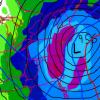
Absolute Humidity Posted January 28, 2014 Author Share Posted January 28, 2014 00z GFS Link to comment Share on other sites More sharing options...
AvantHiatus Posted January 28, 2014 Share Posted January 28, 2014 Thanks for starting a thread for this event. All models are in agreement and GFS is very close to a significantly more impactful event for coastal locations. Will be interesting to see how Mount Holly handles the advisory/WSW. Link to comment Share on other sites More sharing options...
Absolute Humidity Posted January 28, 2014 Author Share Posted January 28, 2014 Nam is nearly identical to GFS GGEM and RGEM. Only turds are Euro and Ukie but even they have precip. Link to comment Share on other sites More sharing options...
Absolute Humidity Posted January 28, 2014 Author Share Posted January 28, 2014 Thanks for starting a thread for this event. All models are in agreement and GFS is very close to a significantly more impactful event for coastal locations. Will be interesting to see how Mount Holly handles the advisory/WSW. USA_ASNOWIPER_sfc_042.gif I think you're already pretty significant. Another 50 mile NW shift of the precip shield gets Philly in the game. Link to comment Share on other sites More sharing options...
AvantHiatus Posted January 28, 2014 Share Posted January 28, 2014 I think you're already pretty significant. Another 50 mile NW shift of the precip shield gets Philly in the game. I still have 1-2" in my zone forecast, the potential is there for sure. The big amounts remain just offshore even down here, Coastal Maryland and Virginia will probably receive 8-12" out of this. Link to comment Share on other sites More sharing options...
Absolute Humidity Posted January 28, 2014 Author Share Posted January 28, 2014 HRW-NMM brings .50 into Cape May, ARW .25 - 50. I think they'll wait for 6z before upgrading down there. Virtually every model now has SE coast under .25 - 50. Link to comment Share on other sites More sharing options...
AlexD Posted January 28, 2014 Share Posted January 28, 2014 Local mets saying mount holly may upgrade to a WSW down here in the am package....currently under a WWA for 2-4".....thinking 5" is our max but could that be too conservative? Link to comment Share on other sites More sharing options...
Absolute Humidity Posted January 28, 2014 Author Share Posted January 28, 2014 Local mets saying mount holly may upgrade to a WSW down here in the am package....currently under a WWA for 2-4".....thinking 5" is our max but could that be too conservative?yeah you guys are at least 6" IMHO. Link to comment Share on other sites More sharing options...
AlexD Posted January 28, 2014 Share Posted January 28, 2014 Local mets saying mount holly may upgrade to a WSW down here in the am package....currently under a WWA for 2-4".....thinking 5" is our max but could that be too conservative?yeah you guys are at least 6" IMHO. hard to go that big....went that big for the last storm and ended up busting high so I'll wait for the morning models before I buy into totals that high. That being said, if the trends continue at 6z and 12z it'd be more realistic to me IMO Link to comment Share on other sites More sharing options...
AvantHiatus Posted January 28, 2014 Share Posted January 28, 2014 hard to go that big....went that big for the last storm and ended up busting high so I'll wait for the morning models before I buy into totals that high. That being said, if the trends continue at 6z and 12z it'd be more realistic to me IMO At least no one will need to worry about dry slots and warm temps this time. Snow ratios could possibly be around 1:15 or higher. Link to comment Share on other sites More sharing options...
AlexD Posted January 28, 2014 Share Posted January 28, 2014 hard to go that big....went that big for the last storm and ended up busting high so I'll wait for the morning models before I buy into totals that high. That being said, if the trends continue at 6z and 12z it'd be more realistic to me IMO At least no one will need to worry about dry slots and warm temps this time. Snow ratios could possibly be around 1:15 or higher. sounds about right to me....some blowhard on fb was going on about 20-1 ratios and I had to educate on how colder temps don't always equal higher ratios Link to comment Share on other sites More sharing options...
phlwx Posted January 28, 2014 Share Posted January 28, 2014 At least no one will need to worry about dry slots and warm temps this time. Snow ratios could possibly be around 1:15 or higher. you just have to worry about initial virga on the front end. Link to comment Share on other sites More sharing options...
Absolute Humidity Posted January 28, 2014 Author Share Posted January 28, 2014 6z RGEM was actually a little better than its 0z run, don't know why this most accurate piece of guidance gets ignored over the NAM. Link to comment Share on other sites More sharing options...
Heisy Posted January 28, 2014 Share Posted January 28, 2014 6z RGEM was actually a little better than its 0z run, don't know why this most accurate piece of guidance gets ignored over the NAM. RGEM is my go-to model for late trends. It gets kicked under the rug too often I think. Link to comment Share on other sites More sharing options...
Capt. Adam Posted January 28, 2014 Share Posted January 28, 2014 Mid-Atlantic forum speaks well of 12Z NAM run, would think that is a good sign for us. 6Z NAM had 3"+ accumulated for KACY, maybe more this run. Link to comment Share on other sites More sharing options...
famartin Posted January 28, 2014 Share Posted January 28, 2014 Mid-Atlantic forum speaks well of 12Z NAM run, would think that is a good sign for us. 6Z NAM had 3"+ accumulated for KACY, maybe more this run. NAM has a significant bump NW. Link to comment Share on other sites More sharing options...
TwcMan Posted January 28, 2014 Share Posted January 28, 2014 NAM bumped 50-100 miles NW. Link to comment Share on other sites More sharing options...
Birds~69 Posted January 28, 2014 Share Posted January 28, 2014 Mid-Atlantic forum speaks well of 12Z NAM run, would think that is a good sign for us. 6Z NAM had 3"+ accumulated for KACY, maybe more this run. Is it believable? Throwing some snow back into Philly.. Link to comment Share on other sites More sharing options...
KamuSnow Posted January 28, 2014 Share Posted January 28, 2014 A few hours ago I was going to post in this thread wishing those in SNJ and DE "good luck!", and I still do. I got sidetracked watching the models continuing the NW trend as noted and it's starting to get interesting even close to Philly. I know that in reality this may only amount to a dusting out this way, but it's great to see this trend. Link to comment Share on other sites More sharing options...
JoeSeNJ Posted January 28, 2014 Share Posted January 28, 2014 I was wondering if this could be similar to 1/30/2010. That was a last minute surprise. I remember 1 to 2 inches turning into ~ 6 inches. Link to comment Share on other sites More sharing options...
iceman56 Posted January 28, 2014 Share Posted January 28, 2014 Just seems to find a way to snow in PHL this winter. We will watch it slide by here in the NW 'burbs... Link to comment Share on other sites More sharing options...
LMolineuxLM1 Posted January 28, 2014 Share Posted January 28, 2014 Just seems to find a way to snow in PHL this winter. We will watch it slide by here in the NW 'burbs...Me being in southern Delco look good for some. Link to comment Share on other sites More sharing options...
KamuSnow Posted January 28, 2014 Share Posted January 28, 2014 Just seems to find a way to snow in PHL this winter. We will watch it slide by here in the NW 'burbs... Agreed on finding ways to snow. We may watch it slide by from here too, but I'm looking forward to obs (and pics please!) from the coast. Link to comment Share on other sites More sharing options...
KamuSnow Posted January 28, 2014 Share Posted January 28, 2014 Me being in southern Delco look good for some. Maybe! Link to comment Share on other sites More sharing options...
LMolineuxLM1 Posted January 28, 2014 Share Posted January 28, 2014 Maybe!Amazing I tell you, I move south expect less snow but it followed me Link to comment Share on other sites More sharing options...
snowwors2 Posted January 28, 2014 Share Posted January 28, 2014 what are other mid-day models showing? Link to comment Share on other sites More sharing options...
KamuSnow Posted January 28, 2014 Share Posted January 28, 2014 RAP just out, sounds like it trended the way we don't want...GFS was pretty close to 6Z for this area anyway. NAM was great! Link to comment Share on other sites More sharing options...
Jersey Shore snow Posted January 28, 2014 Share Posted January 28, 2014 RAP just out, sounds like it trended the way we don't want...GFS was pretty close to 6Z for this area anyway. NAM was great! 15z RAP didnt trend well for DCA/BWI, but continues to be impressive for southern NJ and coastal central NJ. .25 total qpf line runs from central Salem up to southeastern Monmouth. More south and east of that line. .10 goes through Philly/Trenton/NYC. Gradient between .10 and .30 is very tight Link to comment Share on other sites More sharing options...
Absolute Humidity Posted January 28, 2014 Author Share Posted January 28, 2014 RAP just out, sounds like it trended the way we don't want...GFS was pretty close to 6Z for this area anyway. NAM was great! GGEM also a hair wetter and 16Z Rap looks to be coming in a tic wetter at 13 than 15Z. We'll see. Link to comment Share on other sites More sharing options...

Recommended Posts
Archived
This topic is now archived and is closed to further replies.