Scarlet Pimpernel Posted November 15, 2013 Share Posted November 15, 2013 There is no question that February that year was real close to being special. Don't forget about the major east cost storm around St. Patricks Day, I know it wasn't that great for areas close to the beltways but the far north and west burbs did very well. I think we would all sign up for a February like that this year right now I vaguely recall that, actually, around St. Patrick's Day. Even inside the beltway there was cold rain that day that turned to sleet/snow (more like chunks of ice!) in the evening, and there was a crusty inch or so on the ground where I was at the following morning. You're right, I think we'd all sign up for a -9 temperature departure, along with the possibilities that month gave us! That was truly remarkable, in fact I find it hard to believe just how (brutally) cold it was in the DC area in Feb. 2007. Link to comment Share on other sites More sharing options...
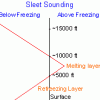
Scarlet Pimpernel Posted November 15, 2013 Share Posted November 15, 2013 It's like a glass half full. Sure, maybe February 2007 could have been an amazing 12-18" snowstorm, but it also could have been a 45 degree rain storm with all the cold air scoured out. Models trended from the former to the latter, but in the end we got something in between and very unique: 3-6" of sleet which crippled the area like a KU snowstorm, in the midst of one of the greatest cold periods of the past 15 years. As a 16 year old kid, sliding on the sleet was so much fun. Not to mention lots of great nickel and dime events, especially as I went skiing in Roundtop or Liberty where it made for a great wintry feel with frozen ponds and lakes on the way there. I remember when the models latched on to the more western low track solution, they greatly overdid the warming and scouring out the cold air. A lot of people at the time were saying "no way" was it going to get into the 40s, given the antecedent extreme cold air locked in place at the time. I recall many forecasters calling for us to remain ice overnight rather than a switch to rain. And in fact it didn't even get above freezing at the surface. Well, maybe just above for a few hours the next morning when the precip was essentially done, before it turned very cold again, which in turn froze the few inches of sleet into solid ice for days. Link to comment Share on other sites More sharing options...
snow. Posted November 15, 2013 Author Share Posted November 15, 2013 I consider 2006-07 to be similar in that regard. A heavily back-loaded winter after it was quite warm through about mid-January 2007. Extremely cold throughout February here and in much of the east (I think DCA was ~9 degrees below normal, or there about). Some snow/ice near the end of January as the pattern flipped, I recall. The February 25 heavy, wet snow event which originally was supposed to be ice (ended up ~4-6" snow). A clipper in early February and another one in early March. And, even some flakes and light coating of snow on Easter morning in early April. All-in-all, quite good for the 2nd half of winter. Of course, the biggest memory that year was the Valentine's Day storm that we just missed out on in the DC metro area, getting mostly a sleet storm instead. I had some 3" of sleet that froze into a block of ice. West of here, especially through the Ohio valley, it was a major snowstorm. A slight shift, and we were looking at a 12"+ event; in fact if memory serves me correctly, the models were indicating a coastal and just that scenario for some time for several days. Then it jogged west and we got cold-air dammed with the ice instead. If we had shared more in the V.D. storm that winter, I maintain to this day that we'd all be talking about how '06-07 was up there as one of the better winters. I liked 06-07. One of the most satisfying things about that winter was seeing certain places up north get pitiful seasonal totals. There is no question that February that year was real close to being special. Don't forget about the major east cost storm around St. Patricks Day, I know it wasn't that great for areas close to the beltways but the far north and west burbs did very well. I think we would all sign up for a February like that this year right now If you told me we would get three 1-3" events, a few events around an inch, an epic historic high QPF sleet storm that was 3" of sleet and snow, and a 4-6" daytime paste job, and a -7 month, over a WHOLE winter I would take it right now...that was a great winter that was consolidated into 6-7 weeks.....the 1st half was painful though....getting stuck in a bad pattern that wouldn't end... Link to comment Share on other sites More sharing options...
HighStakes Posted November 15, 2013 Share Posted November 15, 2013 I vaguely recall that, actually, around St. Patrick's Day. Even inside the beltway there was cold rain that day that turned to sleet/snow (more like chunks of ice!) in the evening, and there was a crusty inch or so on the ground where I was at the following morning. You're right, I think we'd all sign up for a -9 temperature departure, along with the possibilities that month gave us! That was truly remarkable, in fact I find it hard to believe just how (brutally) cold it was in the DC area in Feb. 2007. I think you have to go all the way back to Feb. 79 to find such a cold February. I was only six years old then so I only have vague memories of that winter most of which are the blizzard. I didn't realize there was a -9 departure that month, that really is very impressive. Link to comment Share on other sites More sharing options...
snow. Posted November 15, 2013 Author Share Posted November 15, 2013 I vaguely recall that, actually, around St. Patrick's Day. Even inside the beltway there was cold rain that day that turned to sleet/snow (more like chunks of ice!) in the evening, and there was a crusty inch or so on the ground where I was at the following morning. You're right, I think we'd all sign up for a -9 temperature departure, along with the possibilities that month gave us! That was truly remarkable, in fact I find it hard to believe just how (brutally) cold it was in the DC area in Feb. 2007. 2nd coldest February ever recorded at DCA since mid 1940s Link to comment Share on other sites More sharing options...
Bob Chill Posted November 15, 2013 Share Posted November 15, 2013 It would be fun to get departures like that in a low sun angle Dec-jan and have the Potomac and bay rivers freeze shore to shore again. I remember people driving pickup trucks across the the west river near Galesville In the 70s. As a kid I couldnt believe they didn't break through and sink. I think the ice was pushing 8" thick. Link to comment Share on other sites More sharing options...
snow. Posted November 15, 2013 Author Share Posted November 15, 2013 It would be fun to get departures like that in a low sun angle Dec-jan and have the Potomac and bay rivers freeze shore to shore again. I remember people driving pickup trucks across the the west river near Galesville In the 70s. As a kid I couldnt believe they didn't break through and sink. I think the ice was pushing 8" thick. we had an opportunity in January 2004 but the damn reverse gradient screwed us....Boston was like -9...coldest January there since 1893 Link to comment Share on other sites More sharing options...
WEATHER53 Posted November 15, 2013 Share Posted November 15, 2013 The cold shots have just started coming and I think that's the pattern for next two months. Dribbly little snowstorms. Often high moves off mid atlantic and we get mild then cold shot but cold shots that hang on for 3,4,5 days. Less frequently, cold Canadian high moves off New England and we don't warm up. Link to comment Share on other sites More sharing options...
HM Posted November 15, 2013 Share Posted November 15, 2013 Last yr cold shot was pretty legit for around here lately. If we beat that it's something. I agree Ian. I thought that stretch in late Jan-early Feb was impressive. I had multiple days in a row of <1" of snow and below normal temperatures. Last year really kicked some ass mid-winter and basically shut down spring from arriving, too. Link to comment Share on other sites More sharing options...
HM Posted November 15, 2013 Share Posted November 15, 2013 That was my thought and Wes's as well..volatility, perhaps extreme...more than you would see in most winters...even ninas 61-62 was our least snowy of the 9 winters from 1959 through 1968...so it actually ends up not being a bad analog in terms of generating a not terribly dissimilar snow result from some of the others....it was fairly cold...with the exception of January which was right around normal or slightly above. it could end up being an excellent analog if we get a colder winter here that tends more toward climo snow We weren't that close to climo here last winter.even if other things had worked out like early March, we still would have been below...There were other winters that I think luck was a bigger factor....I think of the 92-94, 03-04 winters...where I think we could have cleaned up with a little luck...04-05 too...I think in the ninas and crappy neutrals we mostly have maximized our potential (as crappy as that potential was). those 2 present 2 different results here which is what makes this winter so tough....When I picked 1990, I thought the NPAC might be very similar and that we would have a better PNA and AO/NAO pattern...so a slightly colder version of that winter...That was also a very volatile winter..especially January, thunderstorms...sub freezing days...all of the snow events that winter were hybrids that changed over to sleet/zr or rain....but the burbs didn't do too bad...This winter should be similar...so I know people are down about snow here, but we are going to have a lot of events to track...this won't be 12/2006 or 01-02. etc when we don't have to look at models for 6 weeks...The problem here is models...they will give us too much snow, but I think we all know that by now......I think the chances of a KU here are small.... I like your modified 1990-91 approach. By the way, I listened to your radio segment--well done. Ridiculous questions and "dumbing things down" is tougher than it looks and you handled it well. I would have crumbled, mumbled and said something either condescending or over their heads (what's the difference? lol) if I was hit with some of those questions. It's always the stupid questions that trip you up. Link to comment Share on other sites More sharing options...
NJwinter23 Posted November 15, 2013 Share Posted November 15, 2013 I agree Ian. I thought that stretch in late Jan-early Feb was impressive. I had multiple days in a row of <1" of snow and below normal temperatures. Last year really kicked some ass mid-winter and basically shut down spring from arriving, too. My 370$ jan15-feb15 electricity/heating bill agrees with you... Link to comment Share on other sites More sharing options...
WxUSAF Posted November 15, 2013 Share Posted November 15, 2013 January 15-February 15 of 2013??? There were some cold days in that stretch, but it also hit 70F at BWI on January 30. Link to comment Share on other sites More sharing options...
HM Posted November 15, 2013 Share Posted November 15, 2013 The cold shots have just started coming and I think that's the pattern for next two months. Dribbly little snowstorms. Often high moves off mid atlantic and we get mild then cold shot but cold shots that hang on for 3,4,5 days. Less frequently, cold Canadian high moves off New England and we don't warm up. Cold highs from a good source region / -EPO can trump a pretty miserable pattern. Below is the latest streamfunction anomalies through 11/12 and it looks quite "warm" for the CONUS. But these are up around 200mb. Despite the ridiculously high NAO/AO and anticyclone over us, the low-level cold kept things in check. Link to comment Share on other sites More sharing options...
snow. Posted November 15, 2013 Author Share Posted November 15, 2013 I like your modified 1990-91 approach. By the way, I listened to your radio segment--well done. Ridiculous questions and "dumbing things down" is tougher than it looks and you handled it well. I would have crumbled, mumbled and said something either condescending or over their heads (what's the difference? lol) if I was hit with some of those questions. It's always the stupid questions that trip you up. thanks...I haven't listened to his show so really didn't know what to expect....but the dude loves snow so I enjoyed it...When I testified last year in front of the DC council, the questions were more "erudite", but they were all snow haters so I had to bite my tongue a bit....I actually wouldn't mind going back on his show at some point...It definitely seems like a place where I could say what I truly feel about snow (That i hope every event is crippling and a major disruption to everyday life) and it would reach thousands of people Link to comment Share on other sites More sharing options...
uncle W Posted November 15, 2013 Share Posted November 15, 2013 Cold highs from a good source region / -EPO can trump a pretty miserable pattern. Below is the latest streamfunction anomalies through 11/12 and it looks quite "warm" for the CONUS. But these are up around 200mb. Despite the ridiculously high NAO/AO and anticyclone over us, the low-level cold kept things in check. novsf1-12.GIF low level cold is what we experience...getting the upper levels right is only half the battle...remember 2001-02 when JB kept saying he got the upper level pattern right but we baked in heat...1993-94 was a year with plenty of low level cold...Maybe that's why we had so much ice that year... Link to comment Share on other sites More sharing options...
NJwinter23 Posted November 15, 2013 Share Posted November 15, 2013 January 15-February 15 of 2013??? There were some cold days in that stretch, but it also hit 70F at BWI on January 30. Well they were talking in general from the moment it flipped cold in late Jan through the blizzard on the 10th...Despite the 70º day you mention this is what that stretch looked like Link to comment Share on other sites More sharing options...
uncle W Posted November 15, 2013 Share Posted November 15, 2013 Well they were talking in general from the moment it flipped cold in late Jan through the blizzard on the 10th...Despite the 70º day you mention this is what that stretch looked like lan 2013.png NYC managed a 15 day period with 12" of snow and an average temperature of 32.0 or lower despite the few warm days...This doesn't happen every year...The last time was in 2010-11... Link to comment Share on other sites More sharing options...
HM Posted November 15, 2013 Share Posted November 15, 2013 low level cold is what we experience...getting the upper levels right is only half the battle...remember 2001-02 when JB kept saying he got the upper level pattern right but we baked in heat...1993-94 was a year with plenty of low level cold...Maybe that's why we had so much ice that year... lol I do remember that! Yes, 1993-94 was all about the record snow cover / source region cold and bouts of favorable Pacific sending it this way. That was some of the most brutal cold I've ever experienced. We would get inland runner type storm tracks but the low-level cold was too dense to be scoured out in time. ZR down my way while you guys in NYC cashed in. Link to comment Share on other sites More sharing options...
HM Posted November 15, 2013 Share Posted November 15, 2013 January 15-February 15 of 2013??? There were some cold days in that stretch, but it also hit 70F at BWI on January 30. 70 can definitely take you out of that wintry "feel" even if it only lasts 1 day. My experience in that stretch: Link to comment Share on other sites More sharing options...
WxUSAF Posted November 15, 2013 Share Posted November 15, 2013 Well they were talking in general from the moment it flipped cold in late Jan through the blizzard on the 10th...Despite the 70º day you mention this is what that stretch looked like lan 2013.png Thanks for the map. Definitely colder the farther NE you move. Here's BWI's daily temperature anomalies for that period (Jan 21-Feb 10): 2, -11, -14, -13, -16, 0, 3, 19, 22, 13, -8, -11, -7, -6, 0, 2, -3, 4, -1, -4 That averages out to -1.6F, which matches the map well. If you do the full Jan 15-Feb 15, BWI was +1.5F. Link to comment Share on other sites More sharing options...
eurojosh Posted November 15, 2013 Share Posted November 15, 2013 Well they were talking in general from the moment it flipped cold in late Jan through the blizzard on the 10th...Despite the 70º day you mention this is what that stretch looked like lan 2013.png What's the cause of that freakish-looking anomally over the mouth of the St Lawrence? Glitch? Link to comment Share on other sites More sharing options...
wxdude64 Posted November 15, 2013 Share Posted November 15, 2013 Well they were talking in general from the moment it flipped cold in late Jan through the blizzard on the 10th...Despite the 70º day you mention this is what that stretch looked like lan 2013.png The 1/15-2/15 period was chillier than normal here by about a degree and a half with about 8 inches of snowfall. 1/28-1/30 in upper 50's - low 60's, then the warm up after the 10th took care of a lot of those negatives. Link to comment Share on other sites More sharing options...
NJwinter23 Posted November 15, 2013 Share Posted November 15, 2013 Thanks for the map. Definitely colder the farther NE you move. Here's BWI's daily temperature anomalies for that period (Jan 21-Feb 10): 2, -11, -14, -13, -16, 0, 3, 19, 22, 13, -8, -11, -7, -6, 0, 2, -3, 4, -1, -4 That averages out to -1.6F, which matches the map well. If you do the full Jan 15-Feb 15, BWI was +1.5F. Yes indeed. I only highlighted the Jan 15-Feb 15 stretch because thats how my electricity bills go month to month. The stretch as a whole was variable enough to make it far from impressive I guess, but it was a good stretch the further northeast you went obviously, and those potent cold shots were enough to send my heating bill through the roof (I'm located in CT now mind you). What's the cause of that freakish-looking anomally over the mouth of the St Lawrence? Glitch? Im sure that's a glitch Link to comment Share on other sites More sharing options...
Ian Posted November 15, 2013 Share Posted November 15, 2013 Thanks for the map. Definitely colder the farther NE you move. Here's BWI's daily temperature anomalies for that period (Jan 21-Feb 10): 2, -11, -14, -13, -16, 0, 3, 19, 22, 13, -8, -11, -7, -6, 0, 2, -3, 4, -1, -4 That averages out to -1.6F, which matches the map well. If you do the full Jan 15-Feb 15, BWI was +1.5F. Even as 'remarkably' cold the shorter stretch was I remember we kinda pulled that 20+ out of thin air as we tend to do with warmth. So much easier than cold around here. Link to comment Share on other sites More sharing options...
mitchnick Posted November 15, 2013 Share Posted November 15, 2013 Yes indeed. I only highlighted the Jan 15-Feb 15 stretch because thats how my electricity bills go month to month. The stretch as a whole was variable enough to make it far from impressive I guess, but it was a good stretch the further northeast you went obviously, and those potent cold shots were enough to send my heating bill through the roof (I'm located in CT now mind you). Im sure that's a glitch frankly, I find nothing memorable about met winter last year it was a snowy spring though Link to comment Share on other sites More sharing options...
WxUSAF Posted November 15, 2013 Share Posted November 15, 2013 Even as 'remarkably' cold the shorter stretch was I remember we kinda pulled that 20+ out of thin air as we tend to do with warmth. So much easier than cold around here. Funny you mention that. When I looked back at the climo stats, I think I remember talking about that period on here. We waited and waited to get that cold blast, and we did have 4 days of double-digit departures. We knew a warm up was coming and then boom...3 days of almost +20s that just completely wiped out the cold period's negative anomalies. So much easier to get warmth then cold. Link to comment Share on other sites More sharing options...
Bob Chill Posted November 15, 2013 Share Posted November 15, 2013 So much easier to get warmth then cold.True, but the tides seems to have turned to some extent since Feb. We had quite a few invasions of continental air over the last 9 months. That trend seems to want to continue. Having an endless SE ridge isn't really normal but it sure became normal. Especially in the 3 summers preceding this last one. Maybe the general winter pattern this winter keeps pac zonal and se ridge limited. I don't mind warm ups in winter when they are quick hitters. I want to vomit when they sign a 1 month lease. Link to comment Share on other sites More sharing options...
EastCoast NPZ Posted November 15, 2013 Share Posted November 15, 2013 Even as 'remarkably' cold the shorter stretch was I remember we kinda pulled that 20+ out of thin air as we tend to do with warmth. So much easier than cold around here. We do one thing really well around here.... warmth. We can pull +20 out of a hat in winter, spring, and fall.... and can come damn close even in mid-summer. Link to comment Share on other sites More sharing options...
wxdude64 Posted November 15, 2013 Share Posted November 15, 2013 We do one thing really well around here.... warmth. Two- warmth wind Link to comment Share on other sites More sharing options...
EastCoast NPZ Posted November 15, 2013 Share Posted November 15, 2013 Two- warmth wind 1. Warmth 2. Wind 3. Dry Heavy emphasis on #1. Link to comment Share on other sites More sharing options...

Recommended Posts
Archived
This topic is now archived and is closed to further replies.