icebreaker5221 Posted April 30, 2013 Share Posted April 30, 2013 If you could have state-of-the-art satellite data (vis, IR, rapid scan, polar orbiter) and radar data (dual pol and all it's capabilities) for one weather event, which would you choose? Could be an event that happened a long time ago before current technology, or maybe something overseas in an area where there isn't radar coverage... I would choose the Labor Day Hurricane (1935), which I envision looked something like Cyclone Monica did except over the FL Keys. Hurrican King (1950) would be a close second, just because it had such a tight core, the damage path from the eyewall was initially thought to have been a large tornado. Link to comment Share on other sites More sharing options...
Ed Lizard Posted April 30, 2013 Share Posted April 30, 2013 Various degrees of IMBY-sim, either 1938 all the way from the deep tropics to whatever it looked like at landfall, and 1900 Galveston. Link to comment Share on other sites More sharing options...
icebreaker5221 Posted April 30, 2013 Author Share Posted April 30, 2013 Various degrees of IMBY-sim, either 1938 all the way from the deep tropics to whatever it looked like at landfall, and 1900 Galveston. You and me both I like your choices, both of which were long-lived easterly waves and would have been fun to watch evolve. I doubt many would have expected Galveston to reintensify after shredderola as effectively as it did. Link to comment Share on other sites More sharing options...
CandymanColumbusGA Posted April 30, 2013 Share Posted April 30, 2013 It would be awesome to have dual pol data from Washington's crossing of the Delaware on Christmas of 1776, just for the historical significance. Then seeing the evolution of the Dust Bowl from space. Some of the before and after pictures from the Plains would be astounding, at least I think so. Link to comment Share on other sites More sharing options...
okie333 Posted April 30, 2013 Share Posted April 30, 2013 Winter 1880-1881. Second choice would be March 1843. Link to comment Share on other sites More sharing options...
Ed Lizard Posted April 30, 2013 Share Posted April 30, 2013 Radar of the Tri-State tornado would have been something. Link to comment Share on other sites More sharing options...
Stebo Posted April 30, 2013 Share Posted April 30, 2013 I am going to go local with both of mine and say the 1965 Palm Sunday outbreak and the 1974 Super Outbreak. I am sure the words "oh my god" would have been uttered several times while looking at the radars for either event. Also going way back the May 1896 tornado sequence would have been an interesting one to track both locally and nationally. Link to comment Share on other sites More sharing options...
icebreaker5221 Posted April 30, 2013 Author Share Posted April 30, 2013 A lot of those tornado cases would have been epic. Classic hooks with debris balls no doubt. Winter 1880-1881. Second choice would be March 1843. Not particularly familiar with either of those timeframes. What happened? Link to comment Share on other sites More sharing options...
Hoosier Posted April 30, 2013 Share Posted April 30, 2013 Radar of the Tri-State tornado would have been something. So much to pick from but that is probably what I would go with. Link to comment Share on other sites More sharing options...
andyhb Posted April 30, 2013 Share Posted April 30, 2013 Tri-State tornado, Glazier/Higgins/Woodward tornado and the Blackwell/Udall supercell. For larger events, any one of 4/3/74, 4/11/65, 5/15-27/1896, 5/25-6/6/1917, 2/19-20/1884 (Enigma Outbreak) and perhaps the first Palm Sunday outbreak on 3/28/1920. Link to comment Share on other sites More sharing options...
Hambone Posted April 30, 2013 Share Posted April 30, 2013 Hurricane Dog from 1950. Never made landfall, but holds the record for the longest duration category 5 hurricane in the Atlantic Basin. My second choice would be the tornado that took Dorothy and Toto away from Kansas. Link to comment Share on other sites More sharing options...
isohume Posted April 30, 2013 Share Posted April 30, 2013 The Chicxulub asteroid impact. Man, watching the world come to an end through GOES-R and MODIS would've been epic. Link to comment Share on other sites More sharing options...
BillB Posted May 1, 2013 Share Posted May 1, 2013 Parochial of me, but... The 3-day June 1953 tornado outbreak. Nebraska, (Flint) Michigan, Worcester. Link to comment Share on other sites More sharing options...
Stebo Posted May 1, 2013 Share Posted May 1, 2013 Parochial of me, but... The 3-day June 1953 tornado outbreak. Nebraska, (Flint) Michigan, Worcester. This is a good pick as well, would definitely loved to have seen the radar for the Flint-Beecher tornado. Link to comment Share on other sites More sharing options...
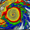
Floydbuster Posted May 1, 2013 Share Posted May 1, 2013 The '35 Hurricane no doubt. Can you imagine? 185 mph winds and an 892 mb pressure within a tiny eye. It probably had a visible satellite image like that of Wilma or Gilbert, but much more tiny. Link to comment Share on other sites More sharing options...
Torchageddon Posted May 9, 2013 Share Posted May 9, 2013 First that comes to mind is the 1974 Super Outbreak so that would be #1. 2nd would be satellite and radar of late January to early February 1947 in Canada but focussing in on Lake Huron for March 3 of that year. 3rd would be the Tri-State tornado, seeing how long that perfect signature would have been. More than that I think I would actually rather see an actual picture of the tornado that is clear because most of my life I wondered what it looked like and searched for pics (none that we know of exist). For Tropical Cyclones I would say certainly the Labor Day Hurricane would be the top one and 2nd I sometimes think what the Lesser Antilles "The Great Hurricane" during mid-October 1780 looked like; a satellite loop of its life. Maybe the storm that claimed 22,000 lives wasn't that strong. Link to comment Share on other sites More sharing options...
andyhb Posted May 9, 2013 Share Posted May 9, 2013 First that comes to mind is the 1974 Super Outbreak so that would be #1. 2nd would be satellite and radar of late January to early February 1947 in Canada but focussing in on Lake Huron for March 3 of that year. 3rd would be the Tri-State tornado, seeing how long that perfect signature would have been. More than that I think I would actually rather see an actual picture of the tornado that is clear because most of my life I wondered what it looked like and searched for pics (none that we know of exist). For Tropical Cyclones I would say certainly the Labor Day Hurricane would be the top one and 2nd I sometimes think what the Lesser Antilles "The Great Hurricane" during mid-October 1780 looked like; a satellite loop of its life. Maybe the storm that claimed 22,000 lives wasn't that strong. I'm going to guess it may have looked somewhat like the Joplin tornado but perhaps not quite as rain-wrapped, maybe something like the TCL-BMX or Phil Campbell tornadoes at times on 4/27. Link to comment Share on other sites More sharing options...
Mallow Posted May 9, 2013 Share Posted May 9, 2013 Gotta be a homer... Either the Columbus Day Storm (10/1962) or the Portland-Vancouver F3 tornado (4/1972). Link to comment Share on other sites More sharing options...
andyhb Posted May 9, 2013 Share Posted May 9, 2013 Gotta be a homer... Either the Columbus Day Storm (10/1962) or the Portland-Vancouver F3 tornado (4/1972). Pacific NW represent. Yeah that Columbus Day storm would be something else, it is one of the kings of the Pacific NW windstorms, if not the king. Link to comment Share on other sites More sharing options...
Mallow Posted May 10, 2013 Share Posted May 10, 2013 Pacific NW represent. Yeah that Columbus Day storm would be something else, it is one of the kings of the Pacific NW windstorms, if not the king. Yep. The only two that come close are the "Storm King" of 1880, and the December 2007 "Great Coastal Gale" (which, while incredible, only impacted the immediate coastal regions). Link to comment Share on other sites More sharing options...
Hoosier Posted May 10, 2013 Share Posted May 10, 2013 I'm going to guess it may have looked somewhat like the Joplin tornado but perhaps not quite as rain-wrapped, maybe something like the TCL-BMX or Phil Campbell tornadoes at times on 4/27. It's all speculation but I always got the impression that it was pretty well rain wrapped. There are accounts of people not knowing what it was until it was basically on top of them. Link to comment Share on other sites More sharing options...
huronicane Posted May 10, 2013 Share Posted May 10, 2013 It's all speculation but I always got the impression that it was pretty well rain wrapped. There are accounts of people not knowing what it was until it was basically on top of them. From the abstract for http://www.ejssm.org/ojs/index.php/ejssm/article/view/109/89'>Johns, et al. (2013): The tornado event was associated with what began as a classic supercell in Missouri, transitioning to high-precipitation mode in Illinois and Indiana. Link to comment Share on other sites More sharing options...
JoMo Posted May 10, 2013 Share Posted May 10, 2013 I'm going to guess it may have looked somewhat like the Joplin tornado but perhaps not quite as rain-wrapped, maybe something like the TCL-BMX or Phil Campbell tornadoes at times on 4/27. I've read reports where it looked different at different times. Most of the time it sounds like it was an HP rain-wrapped wedge, other reports of people that saw it at a later time say it was possibly a visible multi-vortex tornado. Considering it's forward speed was reported to be 73 MPH, it came up on people very quickly. There were also reports that it became 'like night' outside. During the Joplin tornado, it was very much 'like night' outside, extremely dark and very poor contrast with the rain. The Joplin truck driver video where he drove into the tornado without knowing it probably shows this pretty well. The driver was probably going 65-70 before all the rain and you can see how quickly he came up on the 'darkness', it only took a couple of minutes so you can imagine yourself back in 1925 with the 'darkness' approaching that quickly. Link to comment Share on other sites More sharing options...
Santa Claus Posted May 10, 2013 Share Posted May 10, 2013 I've read reports where it looked different at different times. Most of the time it sounds like it was an HP rain-wrapped wedge, other reports of people that saw it at a later time say it was possibly a visible multi-vortex tornado. Considering it's forward speed was reported to be 73 MPH, it came up on people very quickly. There were also reports that it became 'like night' outside. During the Joplin tornado, it was very much 'like night' outside, extremely dark and very poor contrast with the rain. The Joplin truck driver video where he drove into the tornado without knowing it probably shows this pretty well. The driver was probably going 65-70 before all the rain and you can see how quickly he came up on the 'darkness', it only took a couple of minutes so you can imagine yourself back in 1925 with the 'darkness' approaching that quickly. That footage is absolutely staggering. My vote is for Hurricane Able 1951. Would've loved data on SST, and any other reasons it formed when it formed and for the meandering path it took. Link to comment Share on other sites More sharing options...
andyhb Posted May 10, 2013 Share Posted May 10, 2013 Yep. The only two that come close are the "Storm King" of 1880, and the December 2007 "Great Coastal Gale" (which, while incredible, only impacted the immediate coastal regions). The biggest one for me (since the 2007 Gale wasn't as huge further inland) was the Hanukkah Eve storm in 2006, and that was something else, although I can only imagine if that was bad (which it was), how much worse 1962 or 1880 was. Link to comment Share on other sites More sharing options...
WXheights Posted May 10, 2013 Share Posted May 10, 2013 Hurricane of 38 from deep tropics and its tremendous forward advancement. Link to comment Share on other sites More sharing options...
icebreaker5221 Posted May 10, 2013 Author Share Posted May 10, 2013 I've read reports where it looked different at different times. Most of the time it sounds like it was an HP rain-wrapped wedge, other reports of people that saw it at a later time say it was possibly a visible multi-vortex tornado. Considering it's forward speed was reported to be 73 MPH, it came up on people very quickly. There were also reports that it became 'like night' outside. During the Joplin tornado, it was very much 'like night' outside, extremely dark and very poor contrast with the rain. The Joplin truck driver video where he drove into the tornado without knowing it probably shows this pretty well. The driver was probably going 65-70 before all the rain and you can see how quickly he came up on the 'darkness', it only took a couple of minutes so you can imagine yourself back in 1925 with the 'darkness' approaching that quickly. Every time I think I've seen it all from the Joplin tornado, another crazy video comes along! Link to comment Share on other sites More sharing options...
Ground Scouring Posted May 10, 2013 Share Posted May 10, 2013 Winter 12 January 1886 arctic outbreak Children’s Blizzard (12 January 1888) Blizzard of ’88 (11–17 March 1888) 1895–1896 arctic outbreaks (29–30 December 1895 and 8–9 February 1896) 13–14 February 1899 arctic outbreak Great Lakes or White Hurricane (7–10 November 1913) 2–6 February 1917 arctic outbreak Great Appalachian Blizzard (24–27 November 1950) Columbus Day Storm (PAC NW), 1962 Ash Wednesday nor‘easter, 1962 (6–8 March) 18–19 January 1977 cold snap / snowfall in S FL 5–7 February 1978 blizzard Severe 22–23 April 1883 tornado outbreak—With a major, broad-based, negatively-tilted trough over the Plains, spawned 13+ undocumented and at least 17 documented tornadoes from LA to SC, including 3+ F4s (a few possible F5s near Beauregard, MS, and Parrott, GA) and two likely F4s near Rutherford, TN, and Harrisville, MS 21–23 March 1913 sequence (NE–IA F4s)—The most intense Plains outbreak ever recorded at so early a date, with four F4s (03/13/1990 had one F4 in IA, outside the Plains) including the near-F5 Omaha tornado 18 March 1925 Tri-State tornado—Extremely persistent longevity of intensity and path across MO/IL/IN, with several other F3+ tornadoes, 2+ F4s, in the MS Valley, including one probable F5 near Mauckport, KY 7 July 1915 Ohio Valley derecho—One of the worst on record in the region, with numerous deaths on overturned ships and hurricane-force winds lasting six minutes at Cincinnati 12–13 April 1917 sequence (Rocksprings, TX, F5)— Record 2 days consecutive each with ≥ 4 F4-F5: 05/26 (5+) & 05/27 (4) Record AL 24h # tornadoes with ≥ 5 deaths each: 5, 05/27-05/28 (until 03/21-03/22/1932) 2nd-deadliest KY tornado: 65 deaths in-state 4 January 1946 outbreak (two F4s in SE TX)—Major event in the region not matched until 11/07/1957 and 11/21/1992 18 April 1953 TN Valley derecho—One of the worst severe wind events in the region and the worst in AL up to that time 8–9 June 1953 Flint/Worcester outbreaks—Three F4+ in MI, one likely F5 in OH, and a de facto F5 (according to The Tornado: Nature’s Ultimate Windstorm, Thomas Grazulis later called it an F5) in MA, easily one of the most imposing supercells in New England history 2–3 April 1956 Great Plains/upper Midwest outbreak—Four F4s and a bunch of strong tornadoes after 03Z on the Great Plains, then a widespread Midwest outbreak with five F4–F5, three of them (one F5) in MI 4 April 1966 FL outbreak (Gibsonia F4)—Occurred around morning rush hour, 13Z, with major F3+ tornadoes hitting urban Tampa, St. Petersburg, Lakeland, and Cocoa Beach 18–19 June 1972 Agnes Outbreak—More than 30+ tornadoes, including www.youtube.com/watch?v=oh2SsVX04-g'>undocumented ones over the Everglades, and 11 F2+ in FL alone and seven tornado-related deaths, deadliest TC outbreak in FL history 3–4 April 1974 Super Outbreak—The training supercells over S IN / N KY and N AL would have been particularly incredible to see on NEXRAD. Link to comment Share on other sites More sharing options...
Ground Scouring Posted May 10, 2013 Share Posted May 10, 2013 I've read reports where it looked different at different times. Most of the time it sounds like it was an HP rain-wrapped wedge, other reports of people that saw it at a later time say it was possibly a visible multi-vortex tornado. Considering it's forward speed was reported to be 73 MPH, it came up on people very quickly. There were also reports that it became 'like night' outside. During the Joplin tornado, it was very much 'like night' outside, extremely dark and very poor contrast with the rain. The Joplin truck driver video where he drove into the tornado without knowing it probably shows this pretty well. The driver was probably going 65-70 before all the rain and you can see how quickly he came up on the 'darkness', it only took a couple of minutes so you can imagine yourself back in 1925 with the 'darkness' approaching that quickly. Now this video truly exemplifies why so many people perished in Joplin and other HP cases. The ending is just...chilling. The roar is truly like that of a fighter jet perched atop the truck. The vehicle clearly appears to have been thrown...hopefully, the driver did not die (did he?). How that video camera survived, probably due to its lightness and size, is remarkable. Re: the darkness in the Joplin and Tri-State supercells, a similar instance of intense darkness occurred in Meridian, MS, and other areas of MS and AL during the morning outbreak of 04/20/1920 (another event which I would love to record scientifically and with modern technology). All of the six major F4+ tornadoes on this date were rain-wrapped due to very low LFC levels (one source notes that “the cloud appeared to he a mass dragging over the surface”). Here are some remarkable excerpts from the Monthly Weather Review: At Meridian [in Mississippi before the F4 tornado struck] the cloud layers gradually thickened between 10:15 a.m. and 10:30 a. m., when it, was very dark, with occasional flashes of vivid lightning. The darkness between 10:30 and 10:39 a. m. was as intense as would be common for a cloudy moonless night at 9:30 or later, and though lights were on in business houses (but no streetlights were in operation), pedestrians could distinguish each other only with great difficulty. There were a great. many excited people on the streets, and in many of the office buildings and department stores there and in many of the office buildings and department stores there was nearly a panic among the employees and others who were hurriedly leaving the buildings. The pal1 of darkness was so unnatural that it was extremely weird. People riding in automobiles state that steering was difficult even with lights on. At 10:31 a. m. the clouds in the southwestern horizon took on a greenish tinge, and at 10:36 a. m. the darkness was less intense for about three minutes. At 10:39 a. m., the darkness returned, the greenish tint being now of a yellowish green, pulsating in different degrees of intensity. The second period of darkness continued until about 10:55 a. m., and was, perhaps, more intense than the first period. The sky during the tlarkncss was covered by a heavy curtain of clouds of stratus to nimbus structures, hanging nearly to the horizon, which was a narrow ring of light. http://docs.lib.noaa.gov/rescue/mwr/048/mwr-048-04-0203b.pdf Very intense darkness was reported from various points in the path of the parent supercell, with one observer near "Waco" noting that there was no daylight and conditions were "dark as midnight".[4] http://en.wikipedia.org/wiki/User:CapeVerdeWave/Sandbox3 http://docs.lib.noaa.gov/rescue/mwr/048/mwr-048-04-0205.pdf Link to comment Share on other sites More sharing options...
JoMo Posted May 10, 2013 Share Posted May 10, 2013 Now this video truly exemplifies why so many people perished in Joplin and other HP cases. The ending is just...chilling. The roar is truly like that of a fighter jet perched atop the truck. The vehicle clearly appears to have been thrown...hopefully, the driver did not die (did he?). How that video camera survived, probably due to its lightness and size, is remarkable. Re: the darkness in the Joplin and Tri-State supercells, a similar instance of intense darkness occurred in Meridian, MS, and other areas of MS and AL during the morning outbreak of 04/20/1920 (another event which I would love to record scientifically and with modern technology). All of the six major F4+ tornadoes on this date were rain-wrapped due to very low LFC levels (one source notes that “the cloud appeared to he a mass dragging over the surface”). Here are some remarkable excerpts from the Monthly Weather Review: He survived, he said his truck flipped once and it then slid into a ditch probably 30 feet away. This was when the tornado was an EF-3 and weakening, but you can still see how dark it was at 5:45 PM in late May inside that thing and compare how quickly it got that dark with his forward speed since the forward speed of the tri-state tornado was very rapid. I imagine it would seem like the end of the world to people in the 1920's during the tri-state tornado. Thanks for the other links, really interesting stuff. Link to comment Share on other sites More sharing options...

Recommended Posts
Archived
This topic is now archived and is closed to further replies.