Riptide Posted August 10, 2011 Author Share Posted August 10, 2011 That is some mad cheese on the 0z GFS and I'm hungry.......hungry for canes. Link to comment Share on other sites More sharing options...
hurricaneman Posted August 10, 2011 Share Posted August 10, 2011 I think this is just the sacrifical lamb for the low pressure behind it, which I believe will be 93l Link to comment Share on other sites More sharing options...
phil882 Posted August 10, 2011 Share Posted August 10, 2011 Does anyone remember how long it took Danielle last year to consolidate because of competing disturbances? My hunch is that 92L will have this problem initially but once that process is completed, the developing plume of high TPW combined with low shear should support development. The system noted on the 00z GFS is actually the wave behind 92l and the disturbance merging with 92l. Link to comment Share on other sites More sharing options...
Riptide Posted August 10, 2011 Author Share Posted August 10, 2011 I think this is just the sacrifical lamb for the low pressure behind it, which I believe will be 93l It looks like the GFS also develops 92L later on but it goes fishing. Future 93L is definitely the real conus threat that we should pay attention. Link to comment Share on other sites More sharing options...
OHweather Posted August 10, 2011 Share Posted August 10, 2011 Per the GFS image Mad Cheese posted, looks like there is some global model support for a potentially well organized cyclone approaching 60W in 7-8 days. The 0z GFS appears to develop a well defined polward outflow channel and possible equatorward outflow channel by hour 174: The 12z Euro shows a trackable area of vorticity to about 58W/33N at hour 144, but doesn't show any sort of surface reflection past hour 72. However, as was well documented in this thread, the 0z Euro was more interesting (although that may have been the wave behind 92L it developed). Right now there is only a broad area of mid level rotation assocaited with scattered moderate convection centered near 14N, 29W. Based on the low level cloud/SAL motion evident west of this feature, these is not yet a defined closed center as there appear to be no low level clouds with any easterly compontent to their movement. Right now it appears as though 92L is attempting to separate from the ITCZ, however the invest is still part of a large, stretched out area of low level vorticity that appears to be directly associated with the ITCZ, which will make it difficult for the invest to spin up in the short term: The invest is clearly battling dry air as can be seen on the satellite image above. However, shear analysis shows less than 10 knots of shear over the invest along with an upper level anticyclone over the invest, so slow development should be possible. None of the 12z globals were high on development, but I would say there is about a 30% chance of genesis by Saturday if the invest can maintain a good mid level circulation and continue to fire convection, despite some dry mid level air which may continue to be a problem over the coming days. The 12z Euro does show a much less dry environment around the invest by 12z Saturday: Link to comment Share on other sites More sharing options...
ohleary Posted August 10, 2011 Share Posted August 10, 2011 00Z GFDL develops it nicely but it's a fish storm. HWRF keeps it going NNW through 126 hours and develops that wave behind it as well. Link to comment Share on other sites More sharing options...
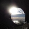
Ed Lizard Posted August 10, 2011 Share Posted August 10, 2011 Early morning vis floater on 92L- it should be more than a lemon, IMHO. It looks darn close to being a TD already, and I'd drop a mandarin on it. Maybe even a low end cherry. It appears to have a closed circulation and a blob of storms over it. Link to comment Share on other sites More sharing options...
Juliancolton Posted August 10, 2011 Share Posted August 10, 2011 Early morning vis floater on 92L- it should be more than a lemon, IMHO. It looks darn close to being a TD already, and I'd drop a mandarin on it. Maybe even a low end cherry. It appears to have a closed circulation and a blob of storms over it. It's a huge, sprawling area of disturbed weather with no real dominant MCS. I don't think we see any substantial development before the weekend. Link to comment Share on other sites More sharing options...
MarkSC Posted August 10, 2011 Share Posted August 10, 2011 Nice naked swirl on visible. If it develops, it's going to be a fun one to watch with the NAO finally looking to go neutral to positive next week if the models are to be believed. Could be a close call with the departing trough. Currently, long range fantasy GFS shows out to sea, but Euro and Nogaps, which develop it slower and more realistically imo, show more threat to east coast. Climatology would certainly say fish if it were to develop as fast as the GFS shows. Link to comment Share on other sites More sharing options...
Ed Lizard Posted August 10, 2011 Share Posted August 10, 2011 Even if the GFS is a little off to the North on 92L, still hard to see this one not sleeping with Luca Brazzi. Link to comment Share on other sites More sharing options...
CUmet Posted August 10, 2011 Share Posted August 10, 2011 92L continues to gradually become better organized, and I would say this is likely to become the next TD. It'll take some time though...I suspect we won't see TD status until probably Friday or Saturday. Assuming the ECMWF/GFS are handling the track pretty well over the next 5-6 days, this system should undergo a significant amount of westerly shear starting Sunday, and may continue for quite some time afterwards. It's got a tough road ahead in the medium-long range. Link to comment Share on other sites More sharing options...
Ed Lizard Posted August 10, 2011 Share Posted August 10, 2011 Recon may be tasked way out near 53ºW on Friday. Link to comment Share on other sites More sharing options...
k*** Posted August 10, 2011 Share Posted August 10, 2011 Recon may be tasked way out near 53ºW on Friday. I thought that 55w was the absolute max for them? Link to comment Share on other sites More sharing options...
MarkSC Posted August 10, 2011 Share Posted August 10, 2011 Looks like zombie Emily might be a source of shear in a few days if the GFS is to be believed. It loops that vorticity all the way to the gulf. It would be sad if the zombie kills off a new storm. Link to comment Share on other sites More sharing options...
Doorman Posted August 10, 2011 Share Posted August 10, 2011 NHC Model Data for Low (Invest 92L) in Google Maps http://tropicalatlan...ooglemaps.shtml http://oiswww.eumets...TS/MPE/AMERICA/ Link to comment Share on other sites More sharing options...
Doorman Posted August 11, 2011 Share Posted August 11, 2011 I take it she aint sexy enough??? I am out of here Link to comment Share on other sites More sharing options...
Ed Lizard Posted August 11, 2011 Share Posted August 11, 2011 I thought that 55w was the absolute max for them? I. ATLANTIC REQUIREMENTS 1. NEGATIVE RECONNAISSANCE REQUIREMENTS. 2. OUTLOOK FOR SUCCEEDING DAY.....NEGATIVE 3. ADDITIONAL DAY OUTLOOK: POSSIBLE LOW LEVEL INVEST NEAR 18.0N 52.5W AT 13/1800Z. Saturday, maybe... Link to comment Share on other sites More sharing options...
OHweather Posted August 11, 2011 Share Posted August 11, 2011 Thoughts on 92L: Invest 92L continues to be a rather large, disorganized area of disturbed weather to the west of the Cape Verdes. Right now there are only subtle signs of mid level rotation, however there is some low level vorticity pooling with 92L, and in a smaller area than last night, possibly showing that the system has detached from the ITCZ and is trying to consolidate. 92L is currently surrounded by a good amount of dry air/SAL,however the amount of strato-cumulus evident on satellite imagery is less than yesterday, possibly indicating the SAL/Dry air has diminished some around the large system. 92L is under an upper level anti-cyclone, which is limiting wind shear over the cyclone and promoting good outflow in both the northern and southern quadrants. This will promote further deep convection and minimize dry air intrusions. 92L is fairly far north for how far east it is, at 13-14N, and is on the southern side of a large high pressure centered near the Azores. Ridging is strong north of the Greater Antilles west towards the Gulf of Mexico; however a weakness in ridging is clearly evident near 50W. Even if 92L follows the low level steering currents, it will slowly turn more towards the right, and might already be doing so slowly as it is gaining latitude as it moves west-northwest. The 0z GFS shows 92L (western feature on this image) remaining near the upper level anti-cyclone over the coming days as it moves off towards the WNW, and indicates the potential exists for continued good outflow over the coming days. The 12z Euro also slowly decreases the dry air/SAL around92L over the coming days until by 3-4 days out, when the invest is a well defined pouch with no significant dry air around it as it approaches the northern Lesser Antilles. With this said however, the GFS/Euro are both not particularly bullish on development prospects over the coming days. Both of the models keep 92L as a trackable feature, but do not show development for at least 72 hours, at which point both models attempt to develop 92L into a relatively weak TC. With this said, given low shear and good outflow but dry air which may hamper convection somewhat but should decrease gradually over thecoming days, 92L should continue to slowly organize. However, visible images from this morning and current IR images reveal a rather large gyre with no organized/dominant LLC (although visible loops revealed some low level eddies spinning around Wednesday morning). This means 92L still needs to organize a good bit before becoming a tropical cyclone, and I still think genesis chances before Saturday are at about 30%. However, there seems to be a better than 50/50 chance of tropical cyclone chances shortly thereafter as dry air decreases and upper level conditions remain quite favorable for development. Given what will likely be a slow development over the next few days of 92L, an immediate recurve probably won’t occur. Although subtropical ridging will be strongest over the eastern Atlantic, there will be no large trough over the western Atlantic until about day 5, when both the GFS/ECM show a slow moving upper trough moving off the east coast. This will likely recurve whatever 92L develops into east of the US coast as it will move off the coast well before 92L approaches the US. Link to comment Share on other sites More sharing options...
PDIII Posted August 11, 2011 Share Posted August 11, 2011 Thoughts on 92L: Invest 92L continues to be a rather large, disorganized area of disturbed weather to the west of the Cape Verdes. Right now there are only subtle signs of mid level rotation, however there is some low level vorticity pooling with 92L, and in a smaller area than last night, possibly showing that the system has detached from the ITCZ and is trying to consolidate. 92L is currently surrounded by a good amount of dry air/SAL,however the amount of strato-cumulus evident on satellite imagery is less than yesterday, possibly indicating the SAL/Dry air has diminished some around the large system. 92L is under an upper level anti-cyclone, which is limiting wind shear over the cyclone and promoting good outflow in both the northern and southern quadrants. This will promote further deep convection and minimize dry air intrusions. 92L is fairly far north for how far east it is, at 13-14N, and is on the southern side of a large high pressure centered near the Azores. Ridging is strong north of the Greater Antilles west towards the Gulf of Mexico; however a weakness in ridging is clearly evident near 50W. Even if 92L follows the low level steering currents, it will slowly turn more towards the right, and might already be doing so slowly as it is gaining latitude as it moves west-northwest. The 0z GFS shows 92L (western feature on this image) remaining near the upper level anti-cyclone over the coming days as it moves off towards the WNW, and indicates the potential exists for continued good outflow over the coming days. The 12z Euro also slowly decreases the dry air/SAL around92L over the coming days until by 3-4 days out, when the invest is a well defined pouch with no significant dry air around it as it approaches the northern Lesser Antilles. With this said however, the GFS/Euro are both not particularly bullish on development prospects over the coming days. Both of the models keep 92L as a trackable feature, but do not show development for at least 72 hours, at which point both models attempt to develop 92L into a relatively weak TC. With this said, given low shear and good outflow but dry air which may hamper convection somewhat but should decrease gradually over thecoming days, 92L should continue to slowly organize. However, visible images from this morning and current IR images reveal a rather large gyre with no organized/dominant LLC (although visible loops revealed some low level eddies spinning around Wednesday morning). This means 92L still needs to organize a good bit before becoming a tropical cyclone, and I still think genesis chances before Saturday are at about 30%. However, there seems to be a better than 50/50 chance of tropical cyclone chances shortly thereafter as dry air decreases and upper level conditions remain quite favorable for development. Given what will likely be a slow development over the next few days of 92L, an immediate recurve probably won’t occur. Although subtropical ridging will be strongest over the eastern Atlantic, there will be no large trough over the western Atlantic until about day 5, when both the GFS/ECM show a slow moving upper trough moving off the east coast. This will likely recurve whatever 92L develops into east of the US coast as it will move off the coast well before 92L approaches the US. I like your write up. Very informative. I went back and looked at the GFS 850 MB Vort Max for days 4-6.. it looks like by day six the trough and the low pressure associated with it begins to weaken and there seems to be some stalling or atleast very slow movement.... Do you think it is possible that 92L gets "tucked-up" underneath of the low and the dragging front? Or will the westerly flow be the dominant factor in steering/ recurving it? Let me know what you think... I dont have a lot of exp with this.. trying to learn! Link to comment Share on other sites More sharing options...
am19psu Posted August 11, 2011 Share Posted August 11, 2011 I think this tells the whole story here, folks. Unlike what we usually expect, the lead wave is in a much more favorable position for early development. Which, of course, means it is likely to be a fish storm, but hey, at least we'll have a fish hurricane. Link to comment Share on other sites More sharing options...
Srain Posted August 11, 2011 Share Posted August 11, 2011 It's a shame that Nick is no longer there to give us the first hand accounts... THE MODEL GUIDANCE GENERALLY AGREES ON TROUGHING HOLDING NEAR BOTH COASTS...THOUGH THEY WEAKEN WITH TIME AS THE FLOW PATTERN BECOMES LESS AMPLIFIED/MORE ZONAL. ISSUES BEGIN WITH THE WEST COAST TROUGH...WHICH THEN TRANSLATE THROUGH SOUTHWEST CANADA AND THE NORTHERN PLAINS. THE 00Z ECMWF BECOMES OUT OF PHASE WITH THE OTHER DETERMINISTIC/ENSEMBLE MEAN GUIDANCE BY THE END OF THE PERIOD ACROSS THIS REGION...SO IT COULD NOT BE USED AFTER TUESDAY MORNING. THE 00Z CANADIAN HAS A LESSER VERSION OF THIS PROBLEM AS WELL...AND ADVERTISES A FULL-BLOWN HURRICANE WEST OF BERMUDA LATE IN THE PERIOD SOMEWHAT NORTHEAST OF THE COORDINATED POINTS FROM THE 17Z COORDINATION CALL WITH NHC...WHICH IF PREFERRED WOULD HAVE REQUIRED SUBSTANTIAL WEAKENING OF THE PRESSURES IN ITS VICINITY BY AGREEMENT. THE 00Z GFS FIT BEST WITH THE 00Z GEFS/12Z ECMWF ENSEMBLE MEAN GUIDANCE...SO FOUND IT USABLE THROUGH THE PERIOD. THE PRESSURES WERE DERIVED FROM A 00Z GFS/00Z ECMWF COMPROMISE INTO TUESDAY MORNING BEFORE SWITCHING TO A 00Z GFS/12Z ECMWF ENSEMBLE MEAN SOLUTION THEREAFTER. THIS LED TO SOME SLOWING TO THE SYSTEM PROGRESSION ACROSS SOUTHERN CANADA/THE NORTHERN PLAINS FROM CONTINUITY. OFFSHORE THE SOUTHEAST...USED THE POINTS COORDINATED BETWEEN HPC/NHC AT 17Z YESTERDAY AND MERGED THE TROPICAL FEATURE WITH THE FRONTAL WAVE IN ITS VICINITY BY NEXT THURSDAY MORNING. Link to comment Share on other sites More sharing options...
HurricaneJosh Posted August 11, 2011 Share Posted August 11, 2011 It's a shame that Nick is no longer there to give us the first hand accounts... It's an even bigger shame that we're again talking about Bermuda crap. Didn't we just go through this last year? Zzzzzzzzz. P.S. It was cool when Nick lived there-- at least we could be happy a friend was gettin' action. Now it just sucks. Link to comment Share on other sites More sharing options...
MarkSC Posted August 11, 2011 Share Posted August 11, 2011 92L lost some organization overnight. Looks pretty sickly now. Link to comment Share on other sites More sharing options...
Ed Lizard Posted August 11, 2011 Share Posted August 11, 2011 Possible silver lining for storm lovers, staring at loops, I think the system, if it develops, will be closer to the ITCZ. Looks like best track is 13.1ºN, but it looks better closer to 10ºW, and double bonus, besides maybe a further South origination point, if it has to separate from the ITCZ, it'll take at least a couple of days and follow the lower level flow while weak. Just my take looking at the visible floater and the broader Central Atlantic satellite. Link to comment Share on other sites More sharing options...
NorEaster27 Posted August 11, 2011 Share Posted August 11, 2011 another year of the fish storms, rainstorm FTW Link to comment Share on other sites More sharing options...
Ed Lizard Posted August 11, 2011 Share Posted August 11, 2011 another year of the fish storms, rainstorm FTW The 1938 storm happened around the Equinox. A small shift Westward on the Euro 240 hour ensembles opens up much of the East Coast for a landfall. Link to comment Share on other sites More sharing options...
Ed Lizard Posted August 11, 2011 Share Posted August 11, 2011 More staring at satellite, and I wouldn't be surprised completely if it developed and got enough separation to allow the ITCZ disturbance to also develop, assuming the convective cluster near 15ºN is 92L. Link to comment Share on other sites More sharing options...
Ivanhater Posted August 11, 2011 Share Posted August 11, 2011 Well the 12z Canadian does not develop 93L but does develop 92L. Also shows a building high off the east coast. Link to comment Share on other sites More sharing options...
Ivanhater Posted August 11, 2011 Share Posted August 11, 2011 Up to 40 percent A BROAD AREA OF LOW PRESSURE CENTERED ABOUT 750 MILES WEST OF THE SOUTHERN CAPE VERDE ISLANDS IS PRODUCING A LARGE AREA OF DISORGANIZED SHOWERS AND THUNDERSTORMS. THIS DISTURBANCE IS SHOWING SIGNS OF ORGANIZATION...AND ENVIRONMENTAL CONDITIONS APPEAR FAVORABLE FOR GRADUAL DEVELOPMENT OVER THE NEXT SEVERAL DAYS. THIS SYSTEM HAS A MEDIUM CHANCE...40 PERCENT...OF BECOMING A TROPICAL CYCLONE DURING THE NEXT 48 HOURS AS IT MOVES TOWARD THE WEST-NORTHWEST AT 15 MPH. Link to comment Share on other sites More sharing options...
Ed Lizard Posted August 11, 2011 Share Posted August 11, 2011 Obvious question- if 92L and 93L both do develop, will 93L surpress the track of 92L and vice versa, and the automatic fish has a shot at the Caribbean and the 'favored' Caribbean storm goes North of the Caribbean? Link to comment Share on other sites More sharing options...

Recommended Posts
Archived
This topic is now archived and is closed to further replies.