Search the Community
Showing results for tags 'Models'.
-
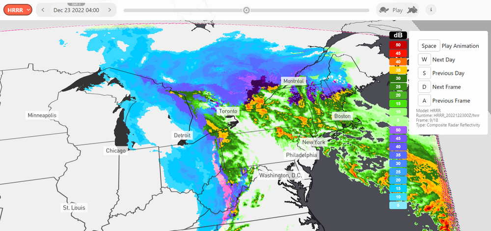
Hey everyone! I recently created a website that allows you to track weather patterns and storms using radar reflectivity maps. I made it for my own use, but I thought others might find it useful too. If you're interested in checking it out, I'm open to any feedback or ideas you might have for improving the site. Currently it features the GFS model at .25deg resolution, the NDFD snowfall forecast, and the HRRR composite radar reflectivity. https://snowdar.com/ If you have any spare time to mess around with it, feel free! Thanks everyone!
-
While all model snowfall output has to be taken with a grain of salt, which platform do you all think uses the Kuchera snowfall method most properly? It seems WeatherBell is always cranking out higher totals than Pivotal - despite using the "same" method (Kuchera). Thanks!
-
Models are on the uptick state wide with the GFS being downright aggressive. So if figured we may as well have a last minute forecast and Obs thread for it.
-
I need to work with historical weather data (temperature and precipitation), we use meteoblue.com. There (https://docs.meteoblue.com/en/meteo/data-sources/data-sources#data-sources) they write about three different types of models: weather reanalysis models weather simulation models satellite (observation) data Comparing ERA5 (reanalysis) vs NEMS (simulation): daily mean temperature is almost the same in both models ERA often gives 2-4 times higher amounts for total monthly precipitation, which is just too big difference (it's for Europe, I'm interested in past 20 years) I tried to read about the models, but couldn't find any comparison. Also don't really understand how such big differences might occur and which model shall I use.
-
- models
- reanalysis
-
(and 1 more)
Tagged with:
-

**12z Model Update for storm this weekend**
USCAPEWEATHERAF posted a blog entry in Once a legend always a legend
Most of the afternoon and late morning model guidance has trended towards a much larger and more severe event with the exception being the GFS, while the GFS produces over 8" of snow for the Cape, it also is weaker with the storm for Saturday. We are less than 72 hours away from the first impacts of this winter storm, mix with rain is possible on the MA coastline, including the islands of Nantucket and Martha's Vineyard. Winter storm watches could be issued as soon as Thursday afternoon from Taunton and as early as tonight for the Deep Southern states of LA, TX, GA, FL, and NC and SC. This storm reminds me of the 2004 Boxing Day Snowstorm, December 26-27th 2004 -

**12z Model Update for storm this weekend**
USCAPEWEATHERAF posted a blog entry in Once a legend always a legend
Most of the afternoon and late morning model guidance has trended towards a much larger and more severe event with the exception being the GFS, while the GFS produces over 8" of snow for the Cape, it also is weaker with the storm for Saturday. We are less than 72 hours away from the first impacts of this winter storm, mix with rain is possible on the MA coastline, including the islands of Nantucket and Martha's Vineyard. Winter storm watches could be issued as soon as Thursday afternoon from Taunton and as early as tonight for the Deep Southern states of LA, TX, GA, FL, and NC and SC. This storm reminds me of the 2004 Boxing Day Snowstorm, December 26-27th 2004

