Search the Community
Showing results for tags 'Great Plains'.
-
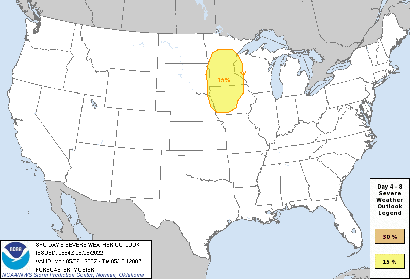
Looking more like a June weather pattern than a May one over the northern plains. There was an area highlight for Sunday but that was taken off today. Jet stream is really constant with trough ejections. Medium-range guidance is in good agreement that the overall upper pattern amplifies significantly on D4/Sunday and D5/Monday as western CONUS troughing deepens and upper ridging along the MS Valley builds. Position of the upper trough leads to deep southwesterly flow aloft across the Plains. At the same time, strong moisture advection will occur, with mid 60s dewpoints reaching eastern KS by D4/Sunday and into much of IA by D5/Monday. By D6/Tuesday, a large area of 70+ dewpoints may exist from the Arklatex north into IA. This low-level moisture, coupled with the EML fostered by the deep southwesterly flow aloft, is forecast to result in strong instability across at least some portion of the Plains and/or Upper/Mid MS Valley from D4/Sunday through at least D6/Tuesday. The somewhat stagnant upper pattern and lack of progressive surface features leads to dearth of forcing for ascent for D4/Sunday, leading to predictability issues. Some elevated thunderstorms are possible across the northern Plains, but uncertainty on location and overall severity merit precluding any outlook areas. Somewhat more discernible/predictable surface features are expected on D5/Monday, with a front moving into the upper MS Valley. Given the forecast buoyancy and shear, any storms that do develop will likely be severe. Some severe potential may persist across the Upper/Mid MS Valley on D6/Tuesday, but guidance varies crucially on the position of various surface features, limiting predictability. Additionally, guidance indicates that upper ridging will build west across more of the Plains on D6/Tuesday and D7/Wednesday, likely shifting the potential for storms back west towards the High Plains.
- 49 replies
-
- northern plains
- great plains
-
(and 2 more)
Tagged with:


