TellicoWx
-
Posts
2,283 -
Joined
-
Last visited
Content Type
Profiles
Blogs
Forums
American Weather
Media Demo
Store
Gallery
Everything posted by TellicoWx
-
TN valley heavy rain/flooding week of whenever
TellicoWx replied to janetjanet998's topic in Tennessee Valley
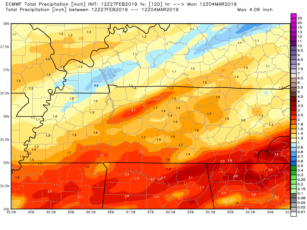
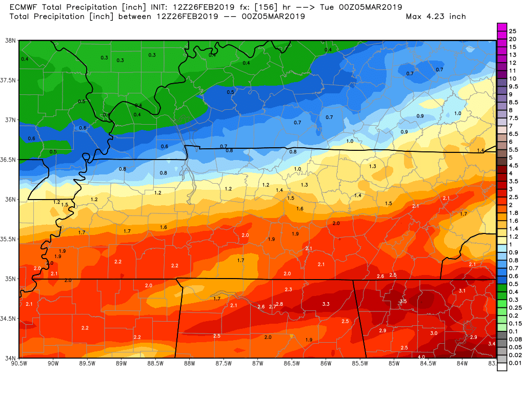
Definitely need to keep an eye on the weekend system across SE TN...Euro/NAM/CMC 12z suite showing 3"-5" across NW GA. GFS has similar range further south over Atlanta. -
TN valley heavy rain/flooding week of whenever
TellicoWx replied to janetjanet998's topic in Tennessee Valley
12z Euro
-
Spring/Summer 2019 medium to long range discussion.
TellicoWx replied to John1122's topic in Tennessee Valley
00z EURO is Lakes Cutter, ramps thunderstorms up Sun afternoon. -
TN valley heavy rain/flooding week of whenever
TellicoWx replied to janetjanet998's topic in Tennessee Valley
Pic from Knox Mayor of a sinkhole just opened this morning in Powell -
TN valley heavy rain/flooding week of whenever
TellicoWx replied to janetjanet998's topic in Tennessee Valley
Reports of a landslide on Northshore Dr in Knoxville now -
TN valley heavy rain/flooding week of whenever
TellicoWx replied to janetjanet998's topic in Tennessee Valley
Don't believe snow is happening south of 40. Models have overplayed the reach of cold all winter, don't think this is any different. Region hopefully doesn't end up of the battle zone with stalled fronts. Much more of a NW shift on modeling and even the Cumberland region will be in the axis with these next waves. -
Spring/Summer 2019 medium to long range discussion.
TellicoWx replied to John1122's topic in Tennessee Valley
12z 3k drops heavy rainfall even with the first wave (Euro has hinted at this) over those areas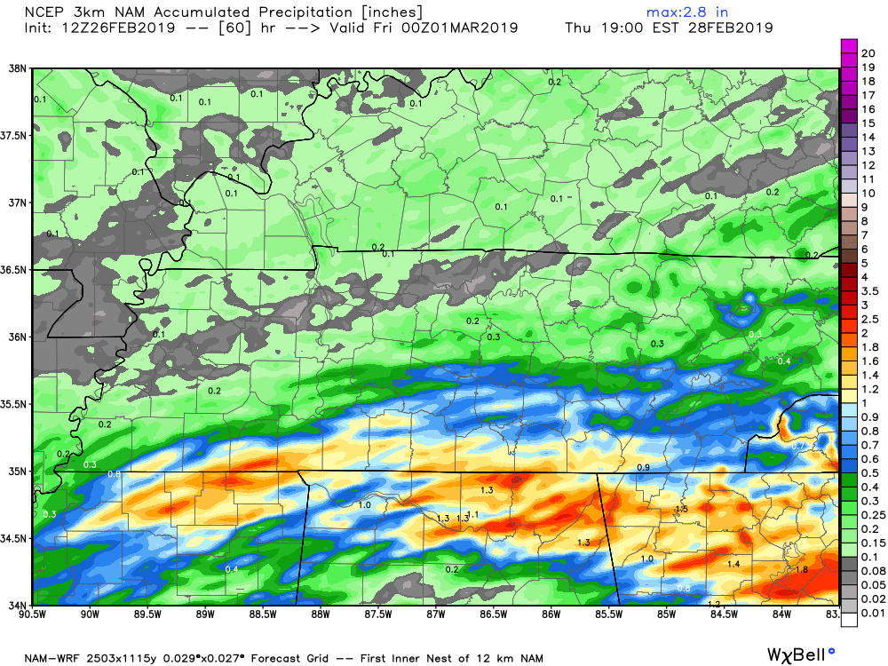
-
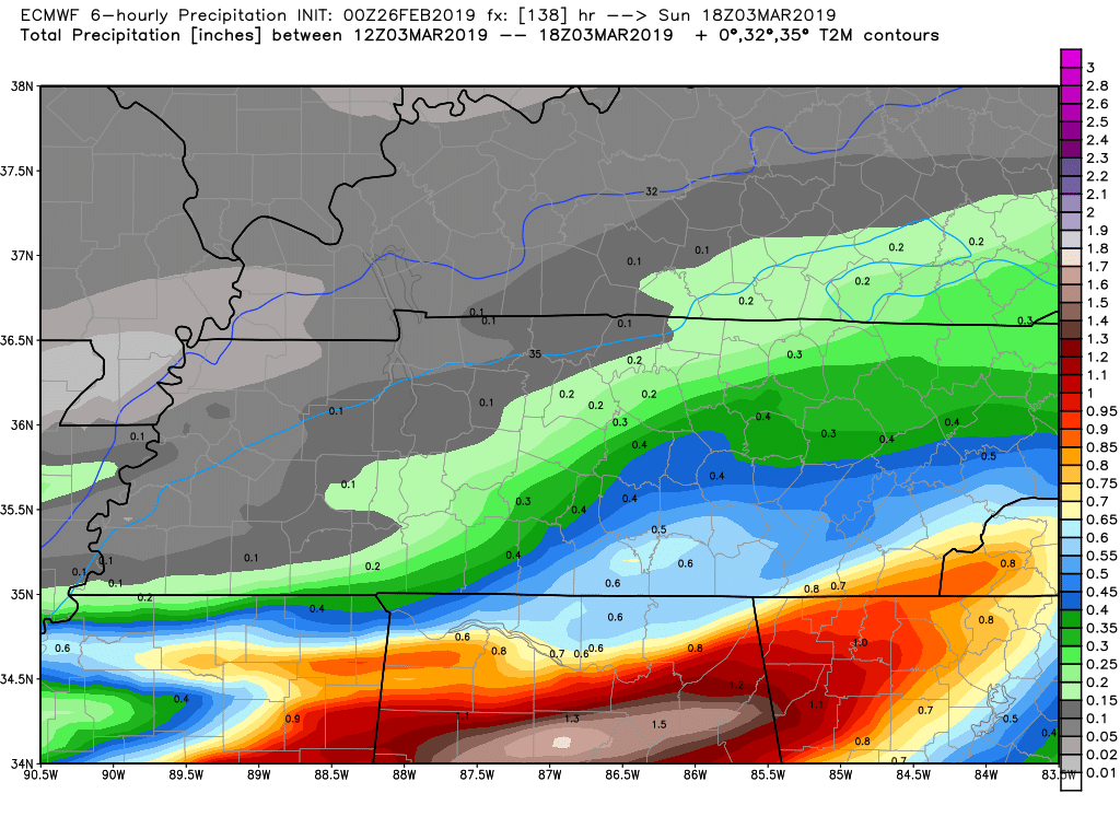
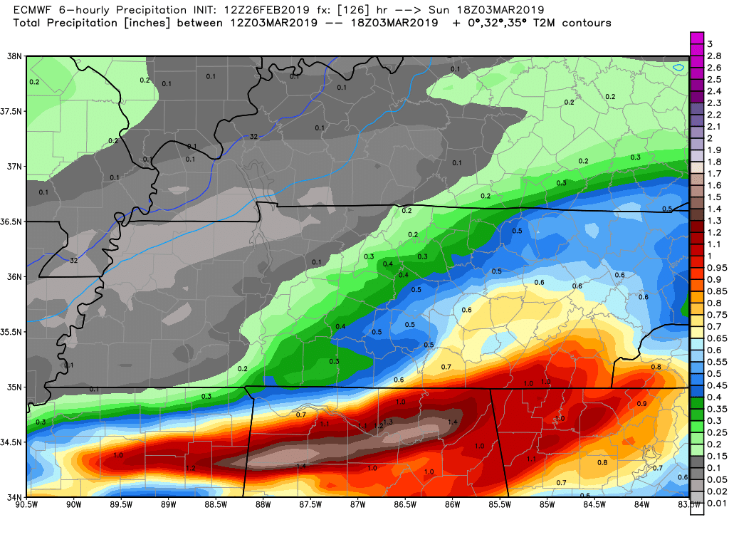
Spring/Summer 2019 medium to long range discussion.
TellicoWx replied to John1122's topic in Tennessee Valley
6 hr totals...00z vs 12z...axis shifting north. Last thing the counties along the TN/AL border need.

-
Spring/Summer 2019 medium to long range discussion.
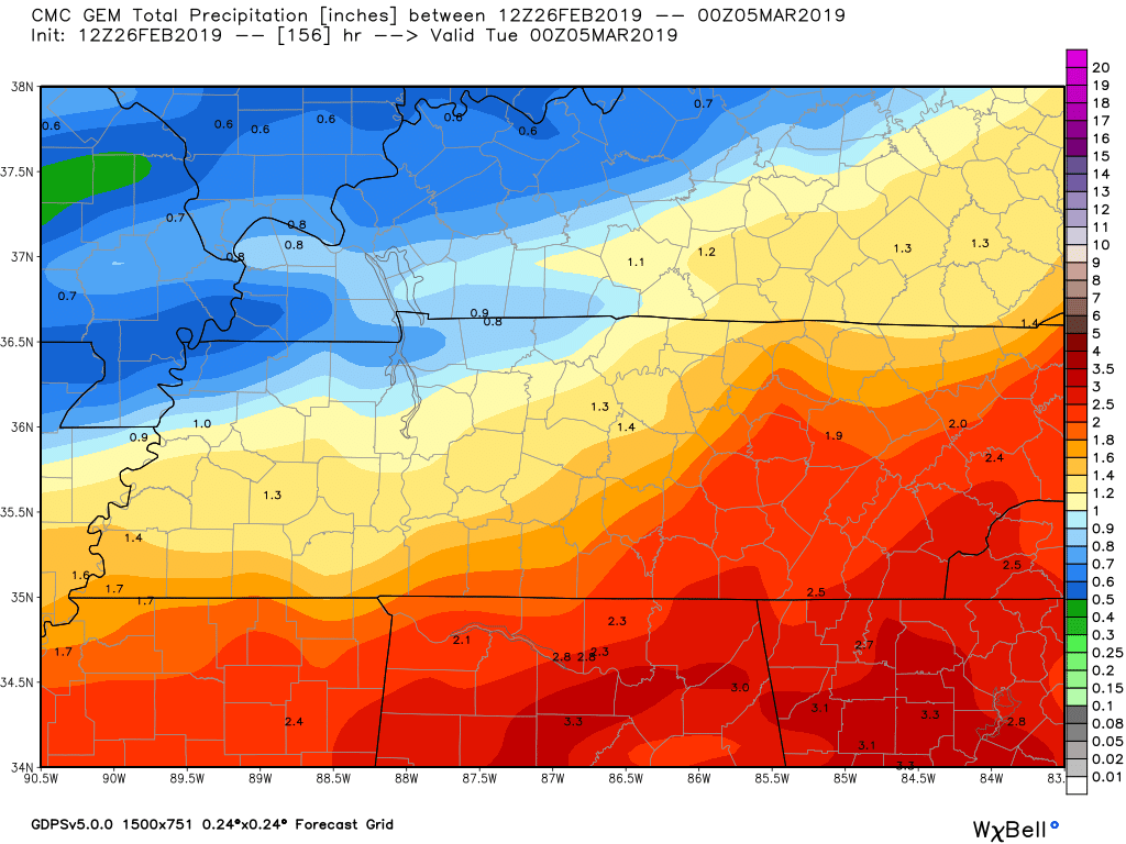
TellicoWx replied to John1122's topic in Tennessee Valley
CMC very similar to EURO...GFS is alone with the southern solution.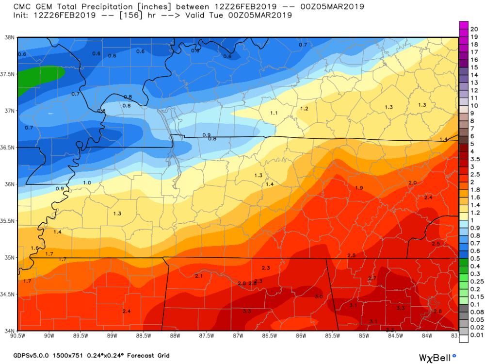
-
TN valley heavy rain/flooding week of whenever
TellicoWx replied to janetjanet998's topic in Tennessee Valley
EURO keeps shifting the axis of heaviest precip more N...something to keep an eye on over next 72 hrs. -
Spring/Summer 2019 medium to long range discussion.
TellicoWx replied to John1122's topic in Tennessee Valley
Here's a big problem with the system pulling north (12z Euro)...its keeps inching the axis of heavy rainfall over areas trying to dry out.
-
Spring/Summer 2019 medium to long range discussion.
TellicoWx replied to John1122's topic in Tennessee Valley
You know that run has to be right then lol -
Spring/Summer 2019 medium to long range discussion.
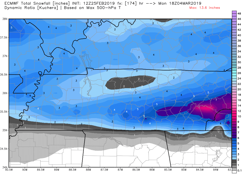
TellicoWx replied to John1122's topic in Tennessee Valley
Sig ice just south snow line..kuchera really hits E TN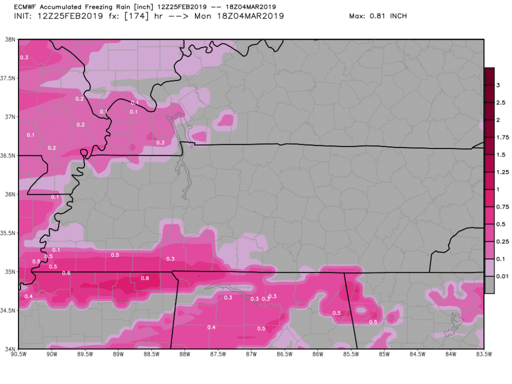

-
Spring/Summer 2019 medium to long range discussion.
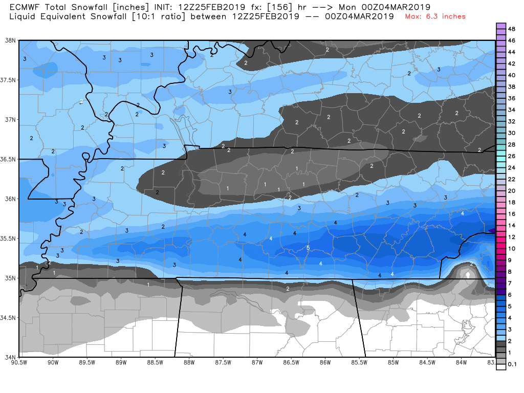
TellicoWx replied to John1122's topic in Tennessee Valley
EURO close to something bigger at 156, still nails southern half TN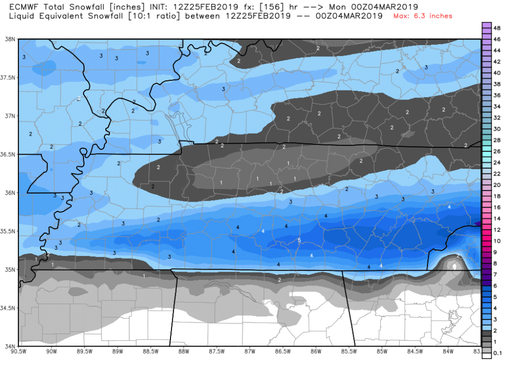
-
Spring/Summer 2019 medium to long range discussion.
TellicoWx replied to John1122's topic in Tennessee Valley
ICON has a decent little event, while CMC crushes AR into W TN with ice. -
Spring/Summer 2019 medium to long range discussion.
TellicoWx replied to John1122's topic in Tennessee Valley
GEFS individuals...decent consensus at this range for someone across the upper south. -
Spring/Summer 2019 medium to long range discussion.
TellicoWx replied to John1122's topic in Tennessee Valley
Jump on the GEFS day 8...must be some big members -
Spring/Summer 2019 medium to long range discussion.
TellicoWx replied to John1122's topic in Tennessee Valley
00z EPS improved if you are looking for snow...HP over the Midwest isn't so overbearing and allowed more LP clusters to come NW along the Gulf and across the FL panhandle. -
Spring/Summer 2019 medium to long range discussion.
TellicoWx replied to John1122's topic in Tennessee Valley
GEFS and EPS are not far from that Euro Op run...its been there a few days. Definitely peaked my interest, while ops have been varied with suppression (Euro bias), individual members aren't varying as much on either ensemble. With the load pattern moisture wise we have been in, it would not surprise me. I actually give it a 30% chance at this range. Yeah would definitely be a kick in the junk. Something else I worry about, the extremely high soil moisture content and freezing temps. Once it thaws back out, risk of slides will only go up. -
TN valley heavy rain/flooding week of whenever
TellicoWx replied to janetjanet998's topic in Tennessee Valley
No slides on anywhere here, unless it's in the CNF itself, off the roadways. Really has surprised me so far. -
Spring/Summer 2019 medium to long range discussion.
TellicoWx replied to John1122's topic in Tennessee Valley
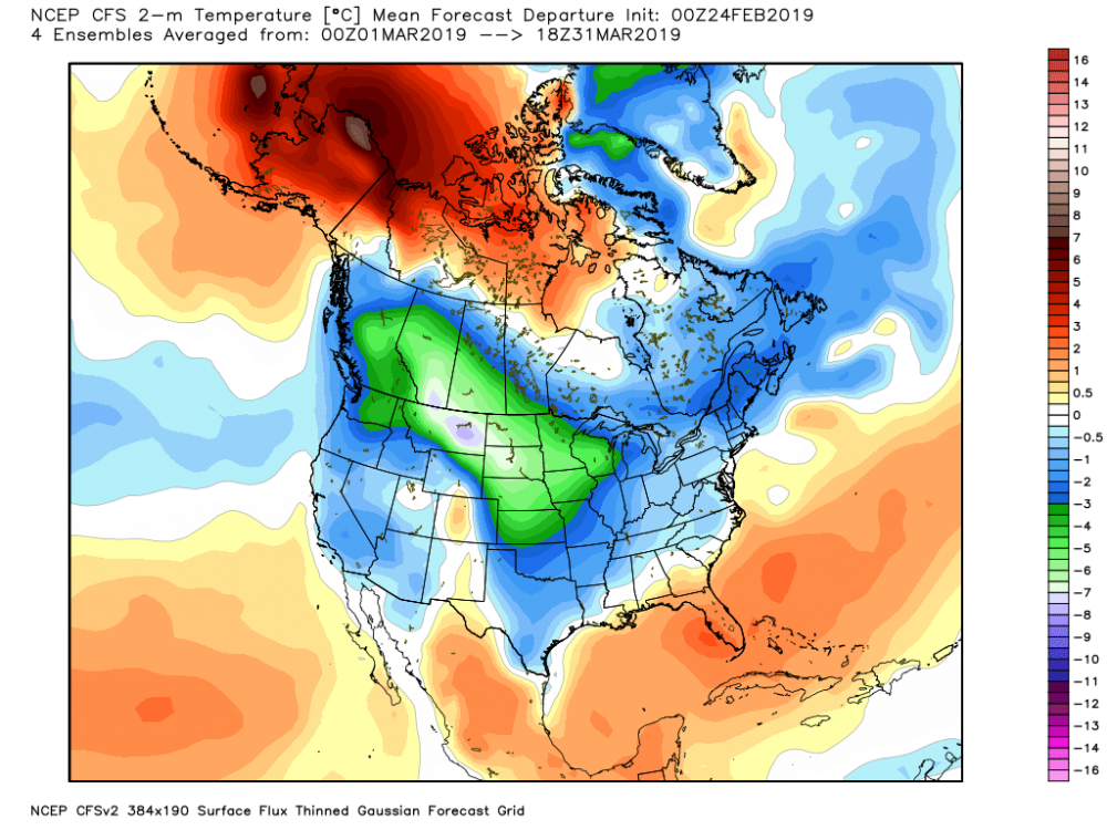
CFS has been trending wetter into Cali (how that translates East will be interesting) and dumping cold into the Midwest.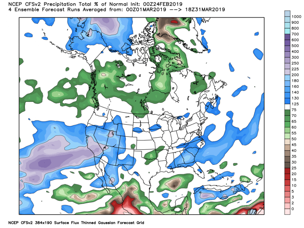
-
TN valley heavy rain/flooding week of whenever
TellicoWx replied to janetjanet998's topic in Tennessee Valley
Overall, it was the 64th highest recording. SE TN mountains were spared the worst part. -
TN valley heavy rain/flooding week of whenever
TellicoWx replied to janetjanet998's topic in Tennessee Valley
Broke the daily flow record here on the Tellico, prev record was 1962. -
TN valley heavy rain/flooding week of whenever
TellicoWx replied to janetjanet998's topic in Tennessee Valley
That's my biggest concern here...heaviest rate look aimed more south of 40. River here didn't get to recede much and is right at bank full...need the stuff over N Al to weaken. -
TN valley heavy rain/flooding week of whenever
TellicoWx replied to janetjanet998's topic in Tennessee Valley
Columbus, MS just took a direct hit