TellicoWx
-
Posts
2,283 -
Joined
-
Last visited
Content Type
Profiles
Blogs
Forums
American Weather
Media Demo
Store
Gallery
Everything posted by TellicoWx
-
Tennessee Valley 2019 Fall Speculation/Forecasting
TellicoWx replied to AMZ8990's topic in Tennessee Valley
Definitely would like to see the GEFS start to have some agreement with the OP, GEFS in same type camp as Euro...more of a glancing shot for the SE. Those temps tho on that run lol...fun to see what a little snow can do. After the last few years, starting to think whatever used to be normal output for the analogs, ENSO, and everything else we use...now just needs flipped. Atmosphere almost acts in reverse compared to normal as far as long range.- 574 replies
-
- 2
-

-
- early winter
- leaves changing
- (and 3 more)
-
Tennessee Valley 2019 Fall Speculation/Forecasting
TellicoWx replied to AMZ8990's topic in Tennessee Valley
Still was able to generate first weenie map of the winter lol..
- 574 replies
-
- 4
-
-
- early winter
- leaves changing
- (and 3 more)
-
Tennessee Valley 2019 Fall Speculation/Forecasting
TellicoWx replied to AMZ8990's topic in Tennessee Valley
18z Goofus was close to something..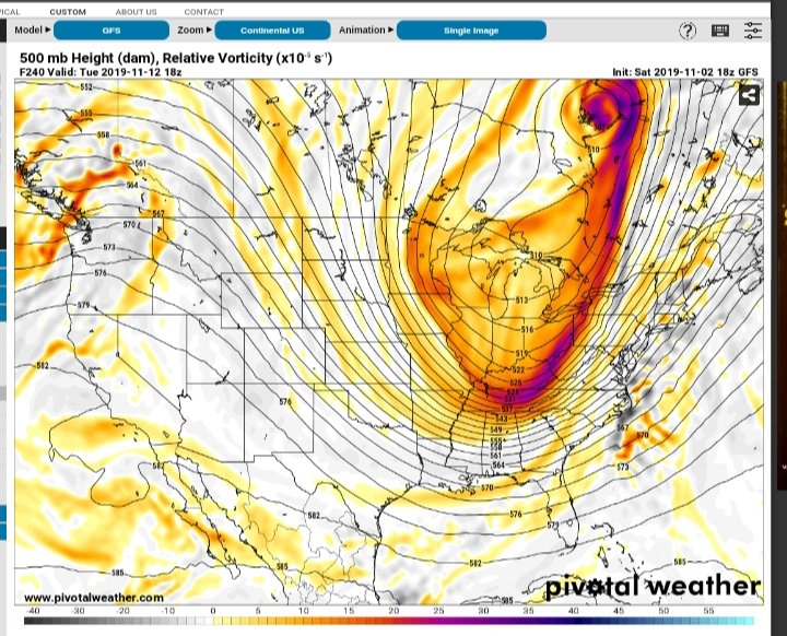
-
Tennessee Valley 2019 Fall Speculation/Forecasting
TellicoWx replied to AMZ8990's topic in Tennessee Valley
Lots of energy in the modeling across the northern stream, driving that high south. If somehow could get a little more action from the southern stream....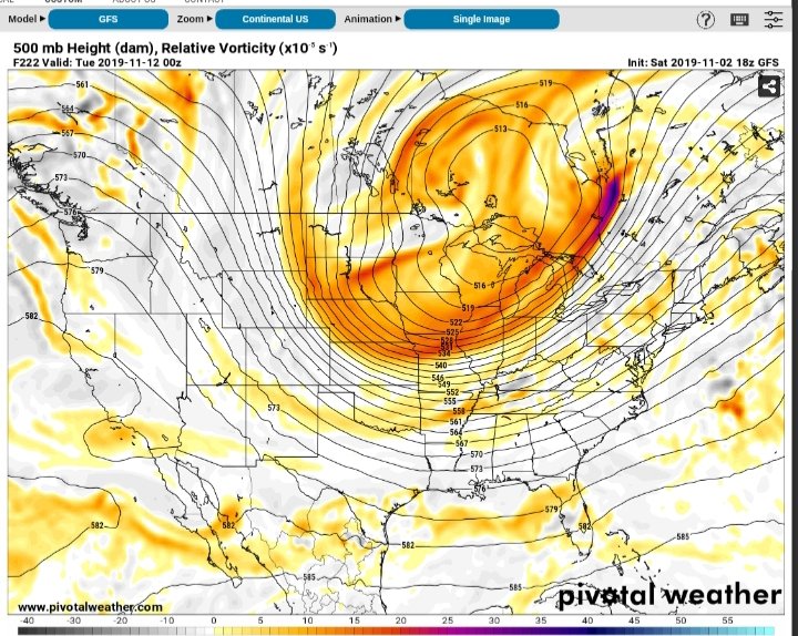
-
Completely agree with the mini "Chinook" effect Carver. Today was a good example of the tons of microclimates around the area. Due to the angle approach of the wind field with the front, the downsloping was not as pronounced over the southern foothills and valley....which is why I think there was more wind energy (and damage) across the central/northern valley counties. As far as winter storm effects, Tellico is a great area to study exactly what you are referring to. We sit in a horseshoe here in town, so it's easy to watch how the downsloping plays out. What I've noticed is when there is a warm 850 layer, with decent wind speeds, it does seemingly mix the 850 temps to the surface quicker....kinda going hand in hand with each other (downslope/warm nose). End result is usually Tellico has a quicker changeover to rain in that scenario, compared to all the other locations in the county.
- 179 replies
-
- 2
-
-
- record heat
- transition
- (and 4 more)
-
Graph of how the downsloping kicked in this morning as the front approached
- 179 replies
-
- 2
-
-
- record heat
- transition
- (and 4 more)
-
Tennessee Valley 2019 Fall Speculation/Forecasting
TellicoWx replied to AMZ8990's topic in Tennessee Valley
Lol, mother nature def pulling out all the Tricks for Halloween...not so much on the Treats.- 574 replies
-
- 2
-
-
- early winter
- leaves changing
- (and 3 more)
-
Tennessee Valley 2019 Fall Speculation/Forecasting
TellicoWx replied to AMZ8990's topic in Tennessee Valley
NWS Memphis receiving reports of light snow/flurries across northern Shelby Co.- 574 replies
-
- 2
-
-
- early winter
- leaves changing
- (and 3 more)
-
Tennessee Valley 2019 Fall Speculation/Forecasting
TellicoWx replied to AMZ8990's topic in Tennessee Valley
Front just reached the plateau, always interesting to see how quickly the cold can spill over it.
-
Tennessee Valley 2019 Fall Speculation/Forecasting
TellicoWx replied to AMZ8990's topic in Tennessee Valley
3k def would agree with you Carver, and with how quick the drop is in temps, plus the upslope squeezing whatever moisture trails behind I wouldn't be too surprised.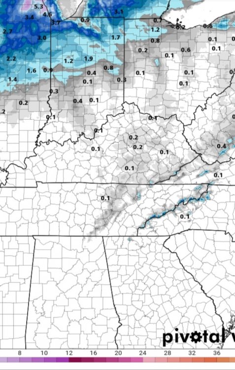
- 574 replies
-
- 1
-
-
- early winter
- leaves changing
- (and 3 more)
-
Tennessee Valley 2019 Fall Speculation/Forecasting
TellicoWx replied to AMZ8990's topic in Tennessee Valley
Almost 30° swing across the state behind the front...Happy Halloween lol.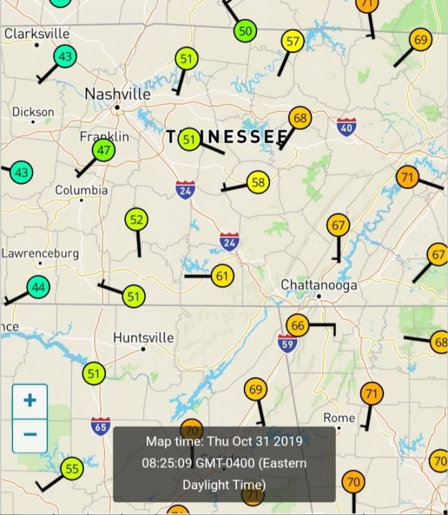
- 574 replies
-
- 2
-
-
- early winter
- leaves changing
- (and 3 more)
-
I live in Tellico on the Skyway, highest station in elevation was at Indian Boundary on the TN side but it no longer reports. There is a couple of military areas near the peak, but have never seen anywhere you can access the info.
- 179 replies
-
- 1
-
-
- record heat
- transition
- (and 4 more)
-
Tennessee Valley 2019 Fall Speculation/Forecasting
TellicoWx replied to AMZ8990's topic in Tennessee Valley
Yeah been watching the 10/31-11/1 timeframes on the GEFS for a few days now. It's been showing a fairly decent front passage in that window. 18z temps for the for the 30th have been trending up each day (+16° so far). Frontal timing has been wavering between early morning hours on 31st and during the overnight on 31st. Fairly decent chance of first potential freeze following here. -
The common analog on SARS the last several runs is 4/18/69. That system produced an F4 in Greenville, AL killing 2. A total of 13 tornadoes formed, mostly in the F0-F2 range. A 218 mi path was also recorded in southern GA and rated F2. Storm caused 50 injuries, besides the 2 deaths in the F4.
-
Yeah, I got the counties crossed. 00z backed off. With the main low trending further north, the threat is lessening some.
-
By no means am I saying this is how it will play out, but it is a little unnerving the date of the analogs on the 18z NAM. April 1998 was the F5 in Davidson Co.
-
3.3 earthquake Maynardville area
- 117 replies
-
- 1
-

-
- grieving winter
- hoping for sunshine
- (and 2 more)
-
TN valley heavy rain/flooding week of whenever
TellicoWx replied to janetjanet998's topic in Tennessee Valley
Flash Flood Watch for Whitley Co due to a possible dam about to fail: Including the cities of Corbin and Williamsburg 351 PM EST Mon Mar 4 2019 ...FLASH FLOOD WATCH IN EFFECT THROUGH TUESDAY AFTERNOON... The National Weather Service in Jackson has issued a * Flash Flood Watch for a portion of south central Kentucky, including the following area, Whitley. * Through Tuesday afternoon * Recent heavy rains have led to the strong potential of a dam failure on a dam on located along Corinth road in the Little Spruce Creek drainage about 2 miles southwest of Woodbine. * If the dam were to completely fail, flash flooding is expected for a couple of miles downstream of the dam. -
TN valley heavy rain/flooding week of whenever
TellicoWx replied to janetjanet998's topic in Tennessee Valley
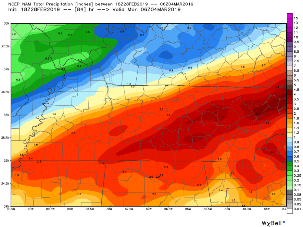
Almost time to breakout the purples again unfortunately...12z GEFS -
TN valley heavy rain/flooding week of whenever
TellicoWx replied to janetjanet998's topic in Tennessee Valley
Will bust a little higher than most modeling (way higher than MRX/local forecasts). Most areas between Huntsville and southern Mid TN picked up around 1.5" -
TN valley heavy rain/flooding week of whenever
TellicoWx replied to janetjanet998's topic in Tennessee Valley
Yeah, GEFS has been putting a bullseye across parts of the upper/mid south for a couple days now...EURO has too, but with a little lesser amounts. -
TN valley heavy rain/flooding week of whenever
TellicoWx replied to janetjanet998's topic in Tennessee Valley
Most of the bright returns over west TN is brightbanding. 3k was a little to slow and Euro a little too far south, but so far amounts in west TN are close to what GFS had. Big question is does the convection develop over central/southern AL robbing the moisture transport north. -
With the shift on the 00z EURO for this weekend storm, I'm redefining my definition of short/med/long range. Short: <6hrs Med: 6-18hrs Long: 24hrs or greater These models seem to be getting worse lol.
- 116 replies
-
- 6
-
-

-
- banter
- chewing the fat
- (and 5 more)
-
TN valley heavy rain/flooding week of whenever
TellicoWx replied to janetjanet998's topic in Tennessee Valley
Picked up 1.14" so far here and still pouring -
TN valley heavy rain/flooding week of whenever
TellicoWx replied to janetjanet998's topic in Tennessee Valley
Big jump N on the 18z NAM...hopefully on overcorrection