TellicoWx
-
Posts
2,283 -
Joined
-
Last visited
Content Type
Profiles
Blogs
Forums
American Weather
Media Demo
Store
Gallery
Everything posted by TellicoWx
-
February/March 2020 Winter's Last Chance Thread
TellicoWx replied to John1122's topic in Tennessee Valley
This is definitely a repeating pattern I wouldn't wanna see (last week), just from a rainfall stand point. But, unfortunately, I think you may end up correct. -
SPC Day 4:
-
TN valley heavy rain/flooding week of whenever
TellicoWx replied to janetjanet998's topic in Tennessee Valley
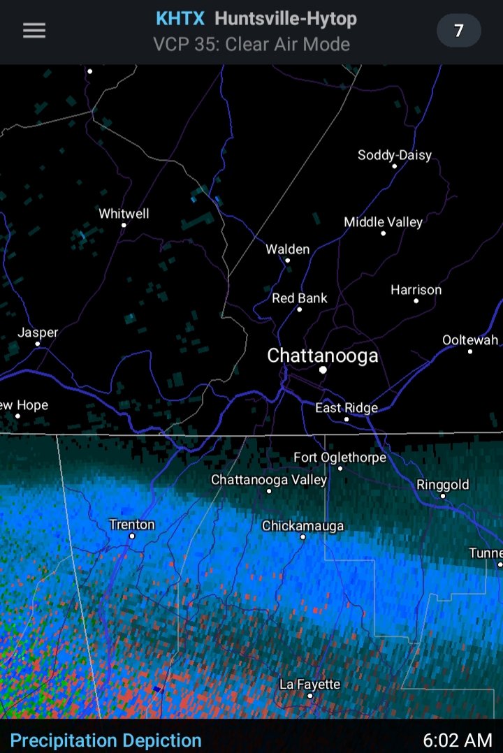
Not surprising, a Flood Watch has been posted for south of I40. With area streams currently stressed (Tellico River is still running 200% above normal and is barely falling now) plus the snowpack up along the mountaintops that will melt and add to the totals, if any members (or family/friends) live in a flood prone area/ or potential to be cutoff by flooding across southeast TN...would be putting together some form of evacuation plan now. Add in SPC now has a 30% Day 4 severe near Chatt, looks like its gonna be a rough weather week. -
Southeast Valley Special Obs and Last Min Forecasts.
TellicoWx replied to John1122's topic in Tennessee Valley
Wow...looks like extremely low visibility on the cam at Chickumaga Dam -
Southeast Valley Special Obs and Last Min Forecasts.
TellicoWx replied to John1122's topic in Tennessee Valley
Interstate turning into a mess...I75 at the 64 Bypass -
Southeast Valley Special Obs and Last Min Forecasts.
TellicoWx replied to John1122's topic in Tennessee Valley
I24 on Monteagle is now covered, cars starting to slide off the roadway -
Southeast Valley Special Obs and Last Min Forecasts.
TellicoWx replied to John1122's topic in Tennessee Valley
I 24 at the TN/GA line starting to whiten up the roadway as well -
Southeast Valley Special Obs and Last Min Forecasts.
TellicoWx replied to John1122's topic in Tennessee Valley
Monteagle: -
Southeast Valley Special Obs and Last Min Forecasts.
TellicoWx replied to John1122's topic in Tennessee Valley
Snow knocking on Chattys door now...Latest RAP and HRRR shifted north some, with the 10z HRRR showing 1.9" for Chattanooga.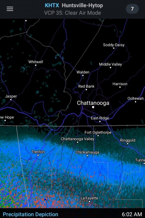
-
Southeast Valley Special Obs and Last Min Forecasts.
TellicoWx replied to John1122's topic in Tennessee Valley
First snow report along the leading edge in AL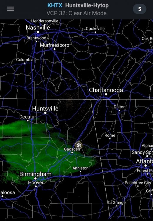
-
Southeast Valley Special Obs and Last Min Forecasts.
TellicoWx replied to John1122's topic in Tennessee Valley
FFC upgraded the GA border counties to a WSW..now calling for 2"-4" for those counties. Best lift an dynamics looks to slide just to the south of Monroe/McMinn counties. -
February/March 2020 Winter's Last Chance Thread
TellicoWx replied to John1122's topic in Tennessee Valley
4z HRRR slightly shifted the precip NNW..wave entering MS now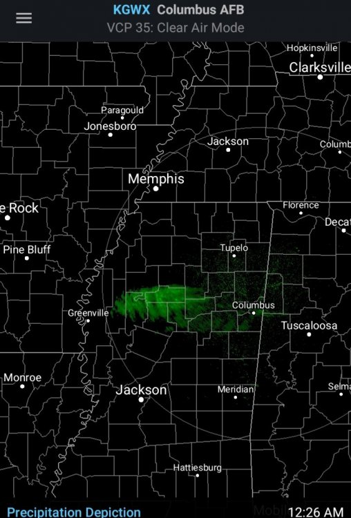
-
February/March 2020 Winter's Last Chance Thread
TellicoWx replied to John1122's topic in Tennessee Valley
Really hope the GFS is off its rocker for this upcoming week. It really wants to point the firehouse at the southern valley. Combine the 4"-5" being shown on the 0z op with the melting snowpack on the mountain peaks..the foothills and areas along creek/river banks would possibly be in trouble. Add in the drastic back and forth temp swings (freezing the saturated soil, then quickly thawing it on top of the rainfall) and mudslides are going to start being an issue as well. -
February/March 2020 Winter's Last Chance Thread
TellicoWx replied to John1122's topic in Tennessee Valley
Think you are in a good spot..with the way the last few winters have been 1" to 2" would be a big win sadly. With the corridor of lift being so narrow..any slight shift could make a big difference either direction. Not sold that any model currently has it right. -
February/March 2020 Winter's Last Chance Thread
TellicoWx replied to John1122's topic in Tennessee Valley
WWA out for the southern valley: Winter Weather Advisory URGENT - WINTER WEATHER MESSAGE National Weather Service Morristown TN 941 PM EST Fri Feb 7 2020 TNZ081>086-098>101-081100- /O.EXB.KMRX.WW.Y.0004.200208T1000Z-200208T1800Z/ Sequatchie-Bledsoe-Rhea-Meigs-McMinn-Northwest Monroe-Marion- Hamilton-Bradley-West Polk- Including the cities of Cagle, Dunlap, Cartwright, Lone Oak, Old Cumberland, Palio, Melvine, Mount Crest, Pikeville, Brayton, Dayton, Evensville, Old Washington, Grandview, Spring City, Big Spring, Athens, Clear Water, Dentville, Etowah, Sweetwater, Madisonville, Bullet Creek, South Pittsburg, Haletown (Guild), Jasper, Martin Springs, Whitwell, Powells Crossroads, Monteagle, Chattanooga, Cleveland, Tasso, Conasauga, Archville, Benton, Parksville, and Reliance 941 PM EST Fri Feb 7 2020 /841 PM CST Fri Feb 7 2020/ ...WINTER WEATHER ADVISORY IN EFFECT FROM 5 AM EST /4 AM CST/ TO 1 PM EST /NOON CST/ SATURDAY... * WHAT...Snow expected possibly mixed with sleet or rain at times. Total snow accumulations of 1/2 to one inch but up to 2 inches across the higher elevations. Snowfall mainly over grassy and elevated surfaces. * WHERE...Southern Plateau and southeast Tennessee. * WHEN...From 5 AM EST /4 AM CST/ to 1 PM EST /noon CST/ Saturday. * IMPACTS...Slippery road conditions are possible across the higher elevations and elevated surfaces, such as bridges and overpasses. -
February/March 2020 Winter's Last Chance Thread
TellicoWx replied to John1122's topic in Tennessee Valley
I would gladly cut it to a 1/10 at this point lol. Yeah it seems like it's been a bad stretch here in SE TN for awhile now. I think cutting the earlier snow totals fits well with all the combined model guidance, but mainly because the best FGEN forcing and lift passes too far south. Best outcome would be around an inch for McMinn/Monroe, with the border counties along TN/GA closer to 2". -
February/March 2020 Winter's Last Chance Thread
TellicoWx replied to John1122's topic in Tennessee Valley
00z HRRR looking better in its run so far * vs the previous couple runs...still not as good as the 18z -
February/March 2020 Winter's Last Chance Thread
TellicoWx replied to John1122's topic in Tennessee Valley
Moisture aloft is building back over N MS currently..not sure if its reaching the ground.
-
February/March 2020 Winter's Last Chance Thread
TellicoWx replied to John1122's topic in Tennessee Valley
Sounding from the ARW2 would support 10:1 even at the lowest elevations..problem with it is probably way over juiced. Sounding for 9am Sat morning over the southern valley. -
February/March 2020 Winter's Last Chance Thread
TellicoWx replied to John1122's topic in Tennessee Valley
Looks like the ARW2..the accumulation on it starts just after daybreak Saturday morning. It will be moved out by tomorrow night. -
February/March 2020 Winter's Last Chance Thread
TellicoWx replied to John1122's topic in Tennessee Valley
Not what you wanna see right now after the last day or so...18z GFS -
February/March 2020 Winter's Last Chance Thread
TellicoWx replied to John1122's topic in Tennessee Valley
As for the long range...18z GFS is a nightmare for flooding for the Eastern valley. -
February/March 2020 Winter's Last Chance Thread
TellicoWx replied to John1122's topic in Tennessee Valley
Good example of sun angle was today here...areas below 950' still has a light dusting in shade spots, areas above 950' have between 1" to 3" on the ground. Difference was the thermal layer, above 950' hovered between 32/33, while below was closer to 34/35. Sun angle had little to no effect where the thermal was closer to freezing between snow showers. Also, looks like the Skyway got hammered today. Crazy considering the Tellico River had close to a top 5 crest yesterday and a few mudslides. -
February/March 2020 Winter's Last Chance Thread
TellicoWx replied to John1122's topic in Tennessee Valley
Yeah that was the laughable part, plus the switch over. Not saying it's not possible, but thos soundings looked fairly decent for temps to hang around 32-33 and dont see any warm nose. -
February/March 2020 Winter's Last Chance Thread
TellicoWx replied to John1122's topic in Tennessee Valley
Only argument I can come up with of the top of my head for sun angle in the first half of Feb would be if the precip shield is more broken..in between bands if the thermal profile is borderline, then it could add just enough heat to the asphalt to cause melt. Shady areas would still stay covered for the most part. Which is what i believe they were alluding too...if models continue to show the snow, i could see them adding some accumulation but mainly on grassy surfaces in the wording. Also, this disturbance is just started appearing on short range models again. So, they are probably wanting to see if they continue the trend or if it was just a blip. Another thing is most AFDs are written close to when the 12z suite is finishing up, so the data from this morning wasn't as good for snow lovers.