TellicoWx
-
Posts
2,283 -
Joined
-
Last visited
Content Type
Profiles
Blogs
Forums
American Weather
Media Demo
Store
Gallery
Everything posted by TellicoWx
-
If I lived within 50-75 miles of where the front (ice) was progged, I wouldn't let my guard down. Front is moving thru Nashville..Goodlettsville has been steadily falling just to the NW.
-
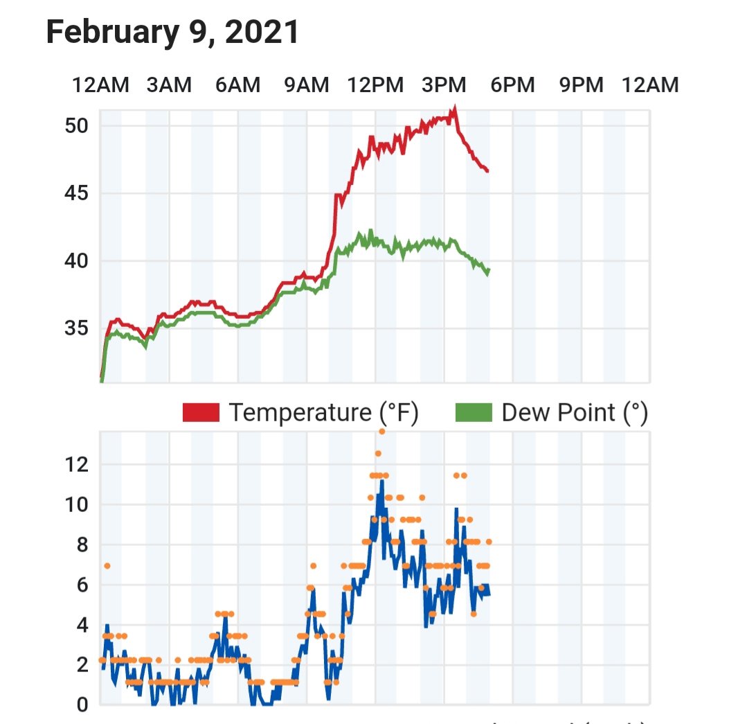
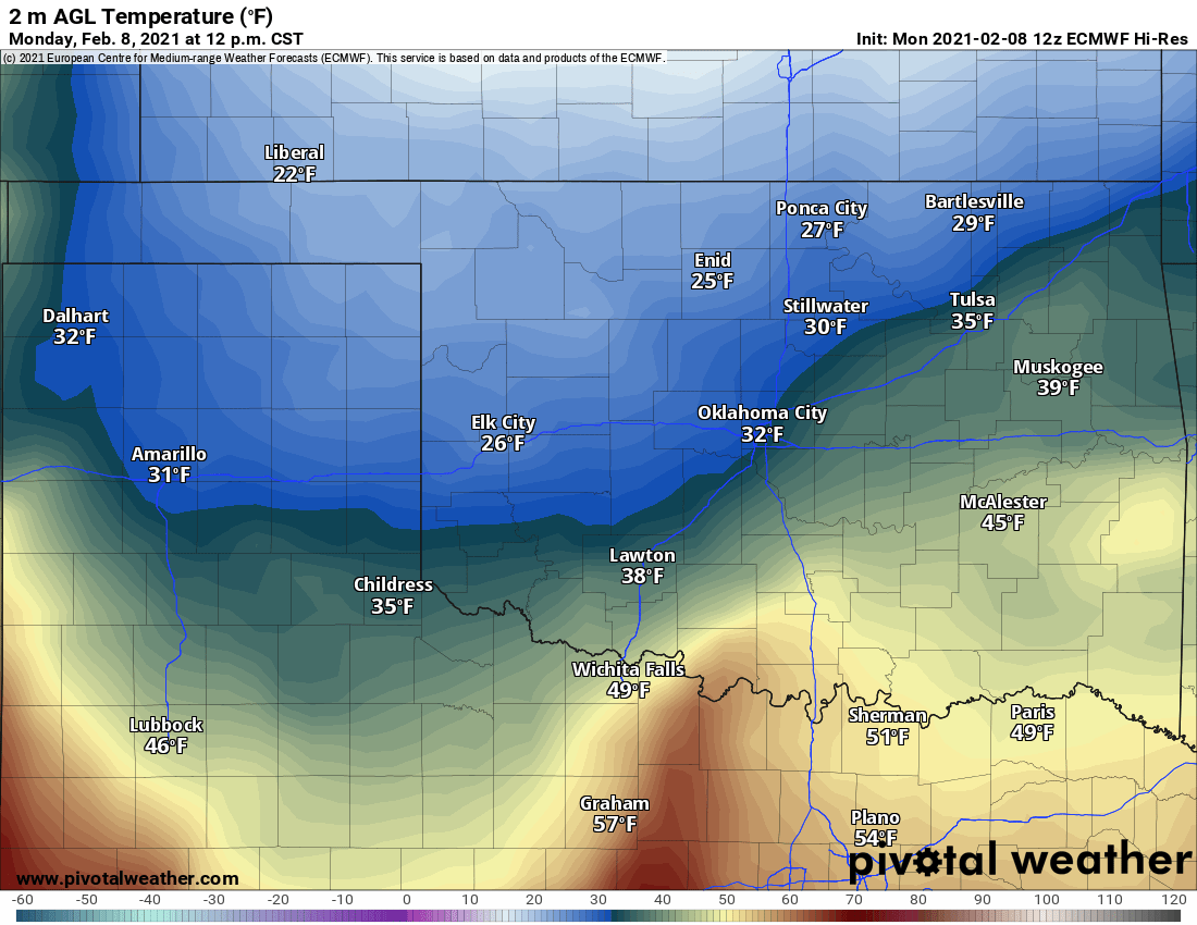
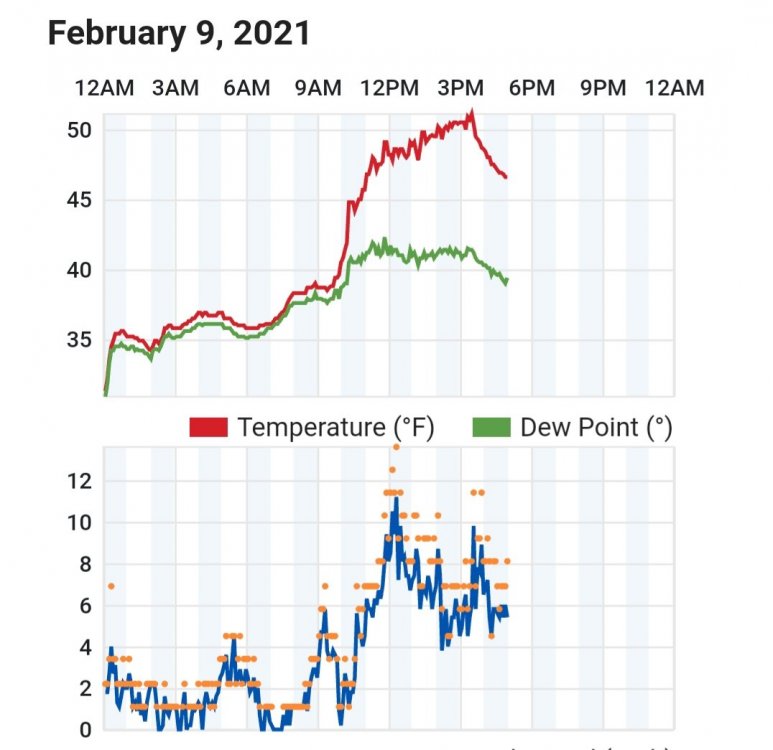
Euro has already failed in west TN vs reality (similar to how Oklahoma was playing out yesterday). 7pm modeled vs now
-
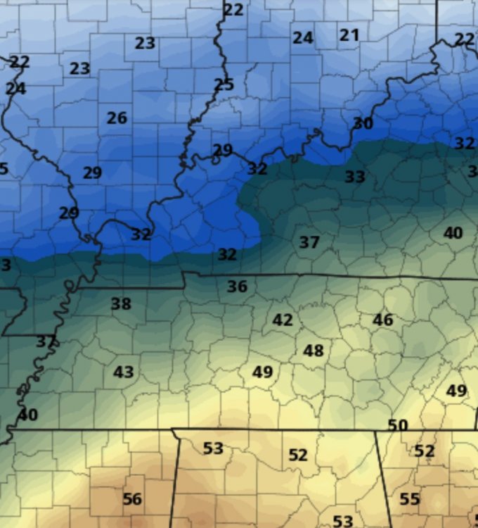
Posted by Alan Gerard on Twitter..excellent example of how globals near surface resolution don't allow them to see shallow level cold that well.

-
While the NAO can assist the TN valley (more the eastern side vs western side), the Pacific still/ and will always rule the roost. Until we can get the ridging off the west coast nudged closer to shore (GFS hints at that evolution toward day 7-8 beyond), I'm not that confident the cold will get shoved far enough east for the eastern valley..(different story for the western areas). Due to the shape of the state (horizontally oriented), it's what makes getting a statewide event so difficult. Place the ridge far enough offshore (west thrives), right against shore (east thrives/but systems can't get the moisture far enough back to help the west side.
-
Two things (which some of us have already discussed) #1 temps are usually overdone on high side at mid/long range modeling, and #2 models tend to underperform on qpf vs reality. Taking those two things in account, with the setup across all 12z modeling...those maps may unfortunately be on the light side if everything holds together.
-
12z CMC
-
CMC in general agreement on the setup (just a tad slower)...looks to turn the lights out on the entire state.
-
Winter weather isn't as difficult to forecast as it seems, starts with pattern recognition at 500. What is difficult, is living and dying by every model run. Remember models are just one small piece of the puzzle. Learn from Carvers/Jax/John/Holston (just to name a few), and figure out if what those mods are showing makes any sense.
-
Ended up with close to 1.5" here
-
Moderate snow, ground has turned white...down to 31
-
Down to 32, all snow (fine flakes)...got a coating on elevated surfaces
-
Temp crashing like a rock here...moderate wet flakes..melting as quick as they land
-
Mix bag of fat wet flakes/rain/sleet here now
-
Heavy rates out that way..Sparta reporting 1/2" in 15 mins
-
Getting a rain/snow mix here now...temp 36
-
01z HRRR continues the up trend in valley
-
12k NAM
-
0z 12k says I wanna join the plateau game
-
RAP and HRRR playing a game of one up's manship for the plateau..6" ha, let's go 7" 0z RAP
-
Watching southern middle TN, what happens there in next couple hours will shed some light on how the evolution may go
-
0z HRRR
-
HRRR about to put 1"+ all way to Chatty
-
How well is it laying there?
-
23z HRRR ups totals for central valley, backs 2" line down to McMinn now
-
Same here, outside of the random sprinkle