TellicoWx
-
Posts
2,283 -
Joined
-
Last visited
Content Type
Profiles
Blogs
Forums
American Weather
Media Demo
Store
Gallery
Everything posted by TellicoWx
-
Huntsville switched back to sleet
-
You can see on the 01z HRRR it pivots the heavy rates over Huntsville, up the Plateau/Valley..accum maps don't account for sleet, so even if it says nothing, could still be dealing with a mess in the valley with those type rates...plateau counties would get hammered. Think the model is having a hard time with the depiction, due to the column bordering right at 32
-
Rate they are going...3-4 is gonna be on the light side lol. 40-50dbz all snow on radar
-
They now are reporting between 2"-2.5"..pounding them right now
-
No, they were under a WWA this afternoon..just got upgraded to a Warning an hour or so ago
-
Hope it does for you guys...should be the lift the MCD was talking about
-
Huntsville has went from nothing to 1.5" in the past 15-20 mins
-
01z HRRR has the latest low/mid level data in it now..let's see what it spits out.
-
Sleet beginning here now..36
-
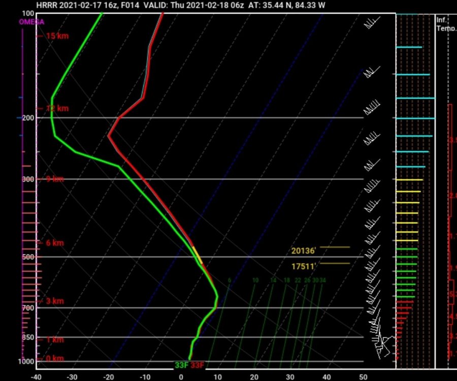
Plateau isn't holding the cold dry air back..soundings over the valley has -10° DP overhead. It's a race between the moisture penetrating to the surface (which it already is with the sleet reports coming in from the southern valley). Also, the reason MRX kept Hamilton in a WWA and HUN is now playing catch-up in their area. Models have done a poor job reflecting how quickly the moisture is reaching the surface. Warm air advection is still hours away. 00z HRRR sounding over McMinn..
-
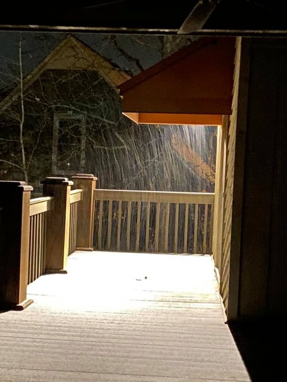
From Twitter, pic out of Cullman, AL...
-
Puking sleet just north of Birmingham (Cullman, Al), ground completely covered...Huntsville has transitioned to all snow in the city.
-
Starting to get reports of sleet SW of Chatt now as well
-
My image of MRX everytime I look at that map..."Oh, you're from Monroe/McMinn...

-
Weather done has now been fully deployed here in the southern valley...starting to know what a donut holes feels like.
-
22z HRRR ingested the 21z RAP and followed, so 23z should hold serve just glancing at the 22z RAP
-
Somewhat..soundings thru the column are bouncing between 32-33 each run..so what's there at 32, may be sleet and gone at 33 on the next run
-
For those who don't know..this is how the HRRR ingests it's data. So right now it's running off 12z data, while trying to ingest the previous hours RAP, current hour sim radar/obs. If the HRRR is going to make a move, it should happen at the 01z run (if the new data is any different from the 12z.) The HRRR is initialized from the RAP one hour prior to the forecast start time. Then the model is advanced for one hour, assimilating radar reflectivity observations every 15mins. This is referred to as a one hour pre-forecast. Following the pre-forecast step, final data assimilation and hydrometeor analysis occurs. Most of the 00/12 UTC radiosonde observations are assimilated into the 00/12 UTC HRRR. The 00/12 UTC HRRR uses an "early" data dump of the available observations, which includes approximately 2/3 of the of the radiosonde data (mostly lower-to-mid levels). The 01/13 UTC HRRR runs benefit from the complete radiosonde observations via the initial conditions from the 00/12 UTC RAP.
-
Sleet now reported in Birmingham and Tuscaloosa..so the leading edge must be overcoming the dry air
-
I've noticed it's not counting the sleet in the snow accum or freezing rain categories..may not amount to much but with temps right at the freezing line, it's something to watch
-
Sleet being reported just to the NW of Birmingham (Dora, AL) with a temp/dp of 41/25. Those returns weren't picked up by the HRRR
-
Topped out (so far lol) at 42.1 down to 40.3 now (DP also falling again). It's like any other winter system in the central/southern valley...will have to thread a very small needle. Cold retreats too quick (moisture streams in) get rain...cold holds too long/stronger (moisture gets wasted on virga)
-
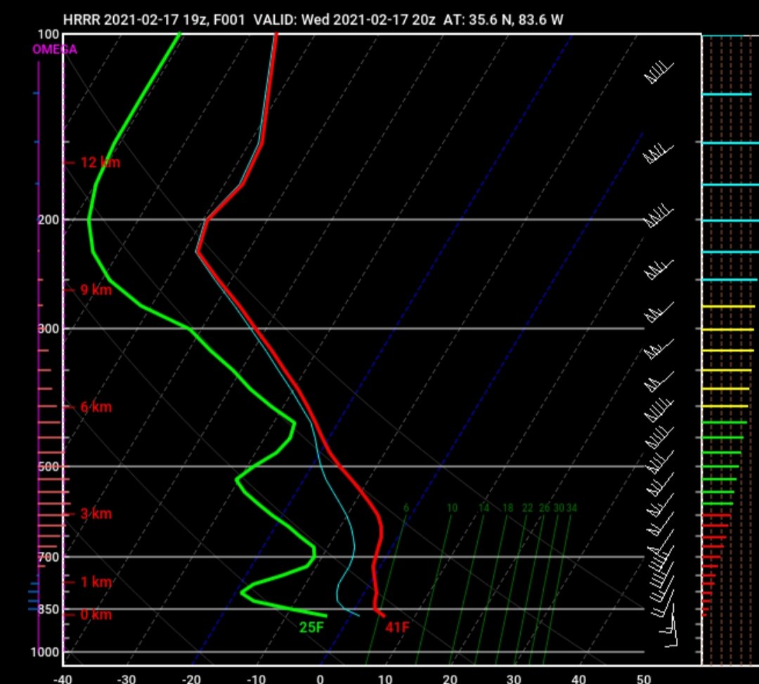
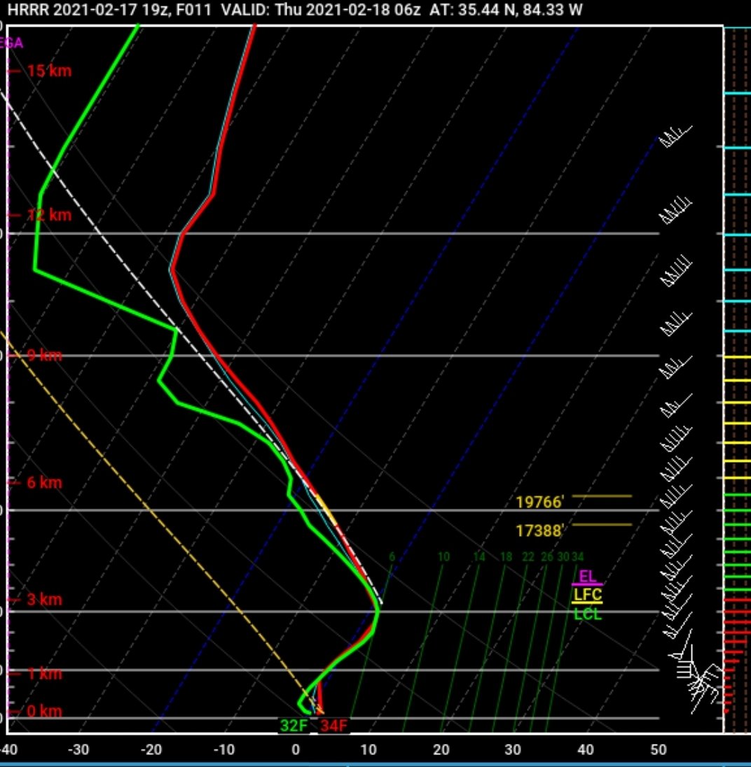
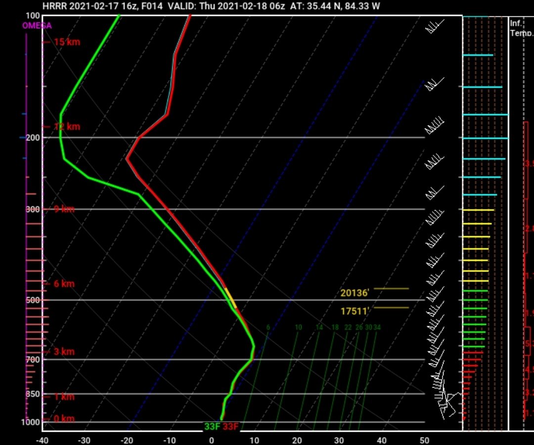
Not necessarily...look at the DP, they are setting in very dry air (heats up quicker with sunshine)...you can see how dry it is on the soundings. Problem with the HRRR now, isn't the cold retreating..it's a moisture problem. It's now seeing a dry nose hold longer in the valley vs the earlier runs. 19z vs 16z


-
You can see what the HRRR is starting to pickup on in the globals. If you look at the 1022 line on the 12z Euro vs 12z NAM...you can see how the HP gets wedged down the valley (snow/ice) vs letting go and retreating north (rain)
-
Yeah, 16z top..12z bottom