TellicoWx
-
Posts
2,283 -
Joined
-
Last visited
Content Type
Profiles
Blogs
Forums
American Weather
Media Demo
Store
Gallery
Everything posted by TellicoWx
-
Get that 850 and jet streak to stay down at TN southern border and you got another board wide event (GFS is missing that piece vs Euro/CMC)
-
Glad you said that...got use to snow and 80
-
12z vs 06z...decent move south on 850 placement plus that 50kt jet streak pulling into it (12z doesn't blast it north into TN/KY line)...very close to lighting a fuse.
-
Very close to a big one..if the 850 just digs a hair more
-
Uh oh Euro comes a little further south with 850 low...surface low going to take more southern track
-
One thing definitely going for the system if it pans out, not dealing with record warmth heading into it
-
12z GEFS is first run without last night's system affecting the maps. Some decent members statewide again. To me the Euro has lost some of its shine since 2020. Little system hopefully works out for those 40 and North that missed out this past system.
-
Excellent analysis for the KCHA area Jeff, completely agree. I always feel for you guys. Not a ton of elevation difference or distance between Chatt and Madisonville, yet it's like they are on two different playing fields.
-
Looks like closer to the 411 corridor did better here, still decent amount on the ground and snow on the emergency lanes.
-
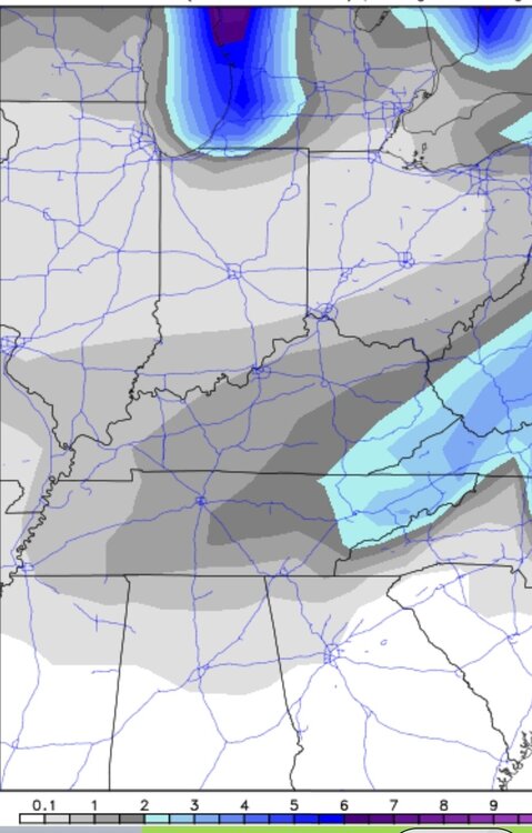
I know for mby, the snow depth charts wasn't too far off on most the short range models. While I have little doubt the snow accum maps verified from some of the rates were falling across the county. What hurt more than the warm ground, was the heavy rain before transition due to the latent heat release all the ground moisture gave off imo.
-
Haven't heard...they went down to 32° about an hour and a half before I did...my guess is they got nailed. All the mountain is out of power.
-
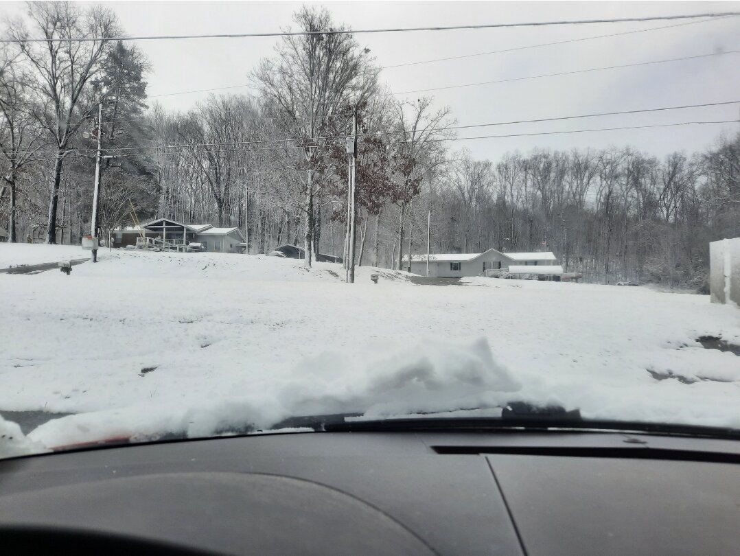
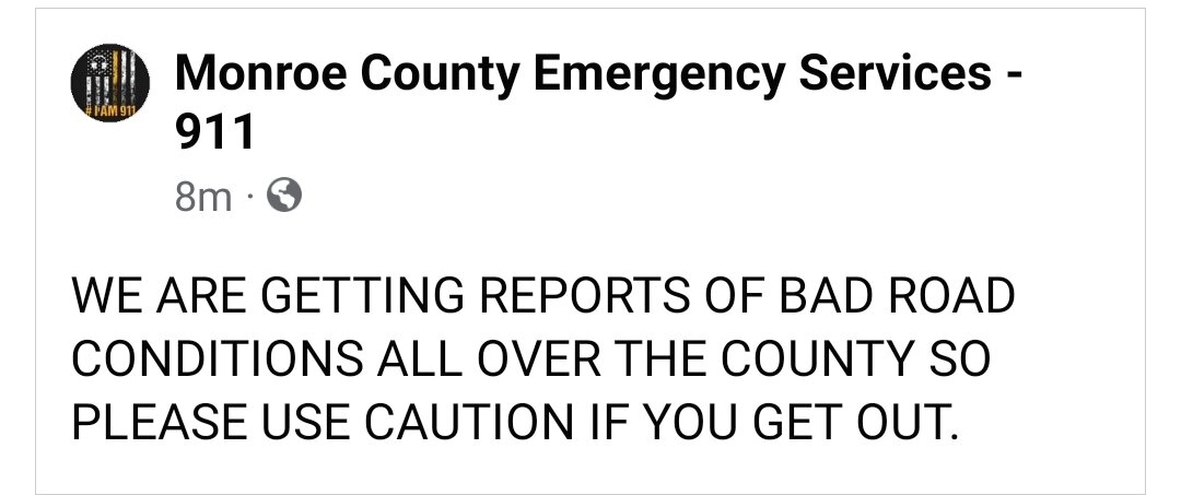
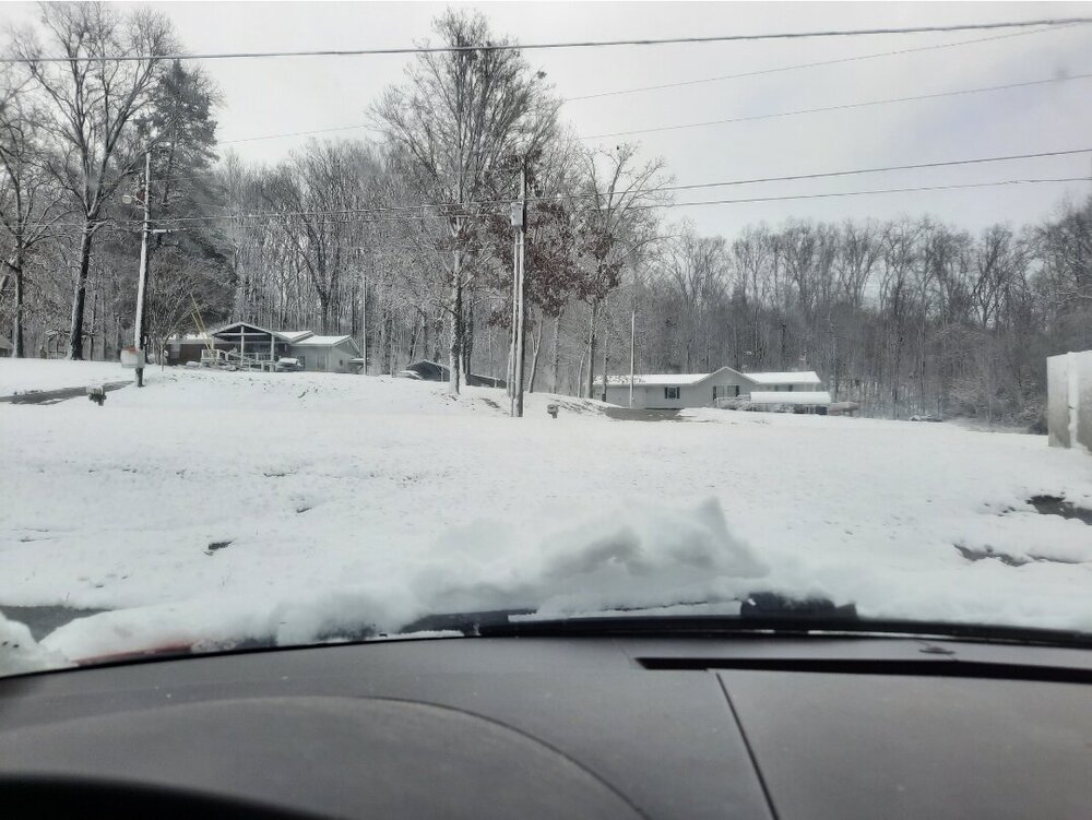
We have trees down everywhere here, FLEC reporting 4200 power outages, lots of cars slid of the roadways this morning around the county. Still have 3"-4" of paste, which considering the melting/compaction..models wasn't too far off on snowfall outputs here.
-
Picked up 1.5" so far, little melting and compaction happening as well.
-
Ground has turned white here...surprised how quick it did..picked up 1.03" of rain before the switch. Goose feathers falling now.
-
Well that escalated quickly...pouring snow, roof already turning white
-
5° temp drop here in last 10 mins....39 to 34.
-
Changeover happening here...big wet flakes mixing in now
-
Snow line is falling fairly quickly...here (900') and Coker Creek (1800'), was both at 42...im at 39 and Coker creek is at 34 now.
-
Unless theses modeled snowflakes can swim, don't know how it would accumulate..falling a flood here
-
Pouring rain and 42.2
-
Roadways becoming snow covered in Huntsville, and lighting detected on radar in the deform band west of BHam...absolutely pouring snow across N AL
-
Rain/snow line has definitely accelerated east across Southern middle TN/ northern AL in last 30 min or so as seen on HUN CC scans
-
Colbert Co, AL EMA reporting 2" and heavy snow