TellicoWx
-
Posts
2,283 -
Joined
-
Last visited
Content Type
Profiles
Blogs
Forums
American Weather
Media Demo
Store
Gallery
Everything posted by TellicoWx
-
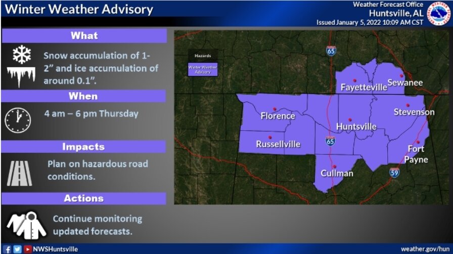
Just noticed HUN went with a WWA
-
If I was MRX, I would hold off until 0z on any changes. But if I had to make a decision now, upgrade WSW to a Warning and WWA Loudon/Blount north. 1" or less south of that in the valley.
-
Agree...its like someone switched the CMC and Ukie.
-
I think since last year that the old bias doesn't apply anymore...Euro seems to lost some of its shine, Ukie has turned into garbage, and somehow the GFS has found a way to be more steady (can remember it holding steady last year while the Euro caved to it). Believe there's a new set of bias that needs figured out. As far as this system, think the pieces are so weak that if you move them 1 county north or south, shear them 3 hrs sooner/later, or even the angle of the press from the northern stream..it has big changes to the final solution. Think the answer is somewhere in the middle.
-
15z vs 9z RAP is a good example of the speed/shearing earlier...6z has a more pronounced 850 while 15z has already begun shearing apart....as they reach the plateau.
-
Biggest thing I see is 1) Globals shear the 850 sooner vs HiRes...less time for the LLJ to nose up the valley. 2) Speed of the 850...some of the HiRes such as NAM has sped it up, while RGEM for example is the slowest. Globals have held steady. Faster solution/ less LLJ influence.
-
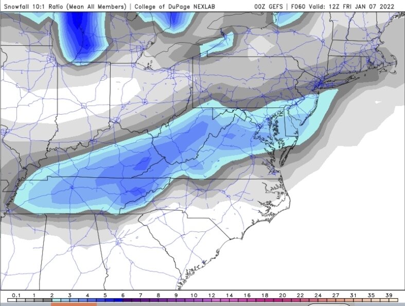
0z GEFS
-
Nice mean on the GEFS so far, almost whole state covered by 2" mark
-
Gfs goes south lol
-
3k precip shield looks better than what the snowfall map paints imo
-
Yeah, kinda went off the rails that frame
-
Possible Namming inbound lol
-
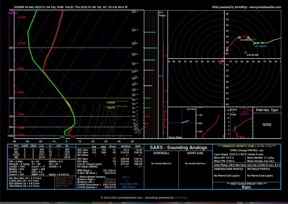
Ever slight warm nose (even though the column is very close to that 32° line, it interprets it as rain/mix)
-
Mixing issues
-
18z Euro
-
Have to love Broadcast Mets lol
-
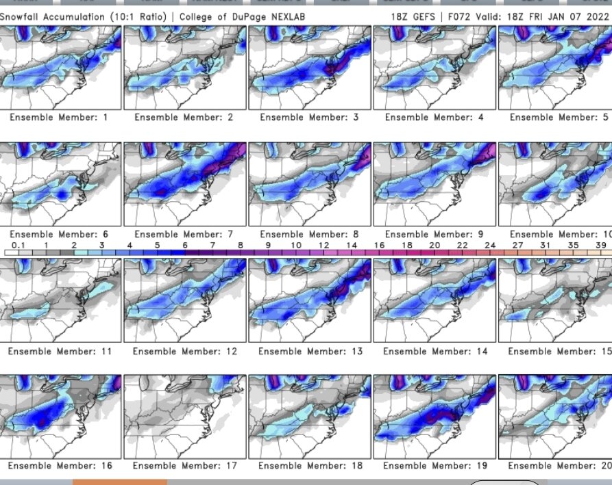
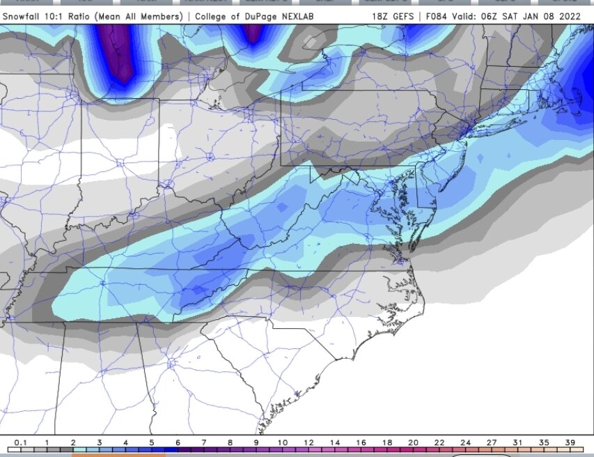
18z GEFS
-
As @John1122noted earlier, a slower solution allows a little more amping. Rob Peter to pay Paul depending on if you are in the NW or SE corners of the state. Shap of TN is what makes a state wide snow that much more difficult.
-
Keeping the LLJ south of the border brought @nrgjeffinto play on the GFS
-
4"...alot of melting/compaction or would have been closer to 6"
-
18z GFS keeps the LLJ south of TN border
-
RGEM takes the LLJ winds up to Monroe/Loudon line...NAM takes it to N. Knox, maybe a little too much amping on the Nam
-
18z RGEM a little more pronounced warm nose..I would basically draw a line from Spring City, Loudon, to Maryville...if you are above that line, I think confidence is good. Alot of uncertainty south of it..doesn't take much wiggle from the 850 to have a big consequence below it.
-
18z NAM looks better with the LLJ not running too far out in front...should help western forum areas