TellicoWx
-
Posts
2,283 -
Joined
-
Last visited
Content Type
Profiles
Blogs
Forums
American Weather
Media Demo
Store
Gallery
Everything posted by TellicoWx
-
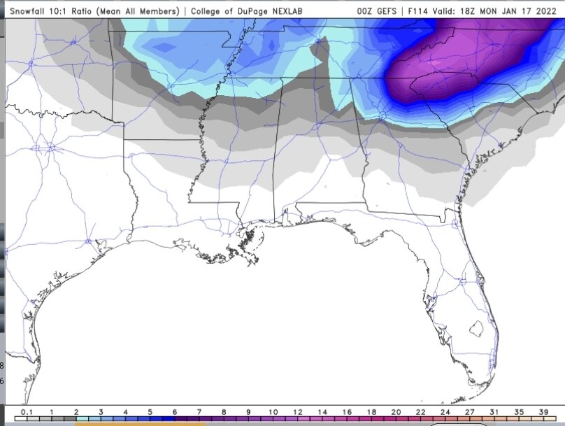
Yeah, NBM carries alot of weight when it comes to their forecast grids as you pointed out. 0z NBM is basically everything 18z suite spit out, plus some..and there's the final result. It's the experimental building block to reach their WRN goals.
-
NBM runs on 10k resolution, and uses every model from the HRRR to the NAVGEM, plus some models I have never heard of (EKDMOS, LAMP, etc)...with latest upgrade it uses 40+ different ones blended together. How it is "blended" first, the blending in the NBM does not use simple averaging, and Prof. Mass’s paper talkes about how this may work, in some detail. The blending in NBM is much more sophisticated than a simple average, and it is able to improve the skill of the result as well as retain detail in the data. secondly, the input models to the blend are from a wide variety of sources, both from NOAA and from outside of NOAA. For example, models from both Canada and the US Navy are included as elements of the blend. Both high resolution regional models and global models are considered. In a way, the NBM is a meta-ensemble, an advanced blending of other ensemble (and non-ensemble) models
-
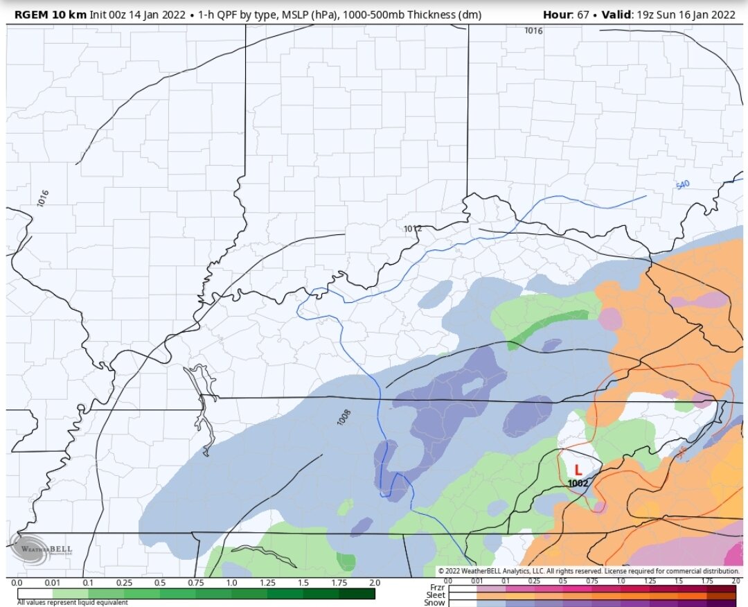
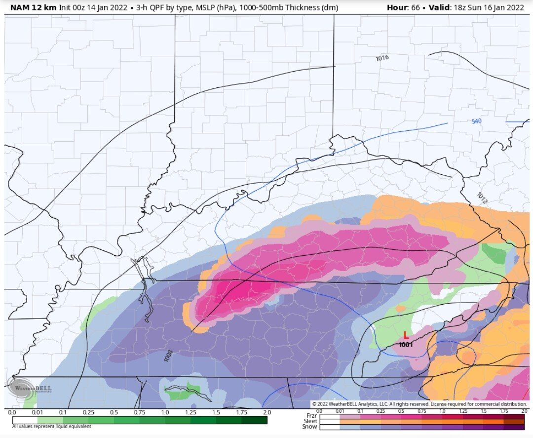
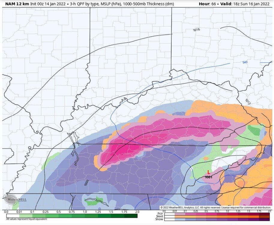
Both 0z NAM and 0z RGEM @66...both take a low right into the Smokies. RGEM started having it on the 18z run.

-
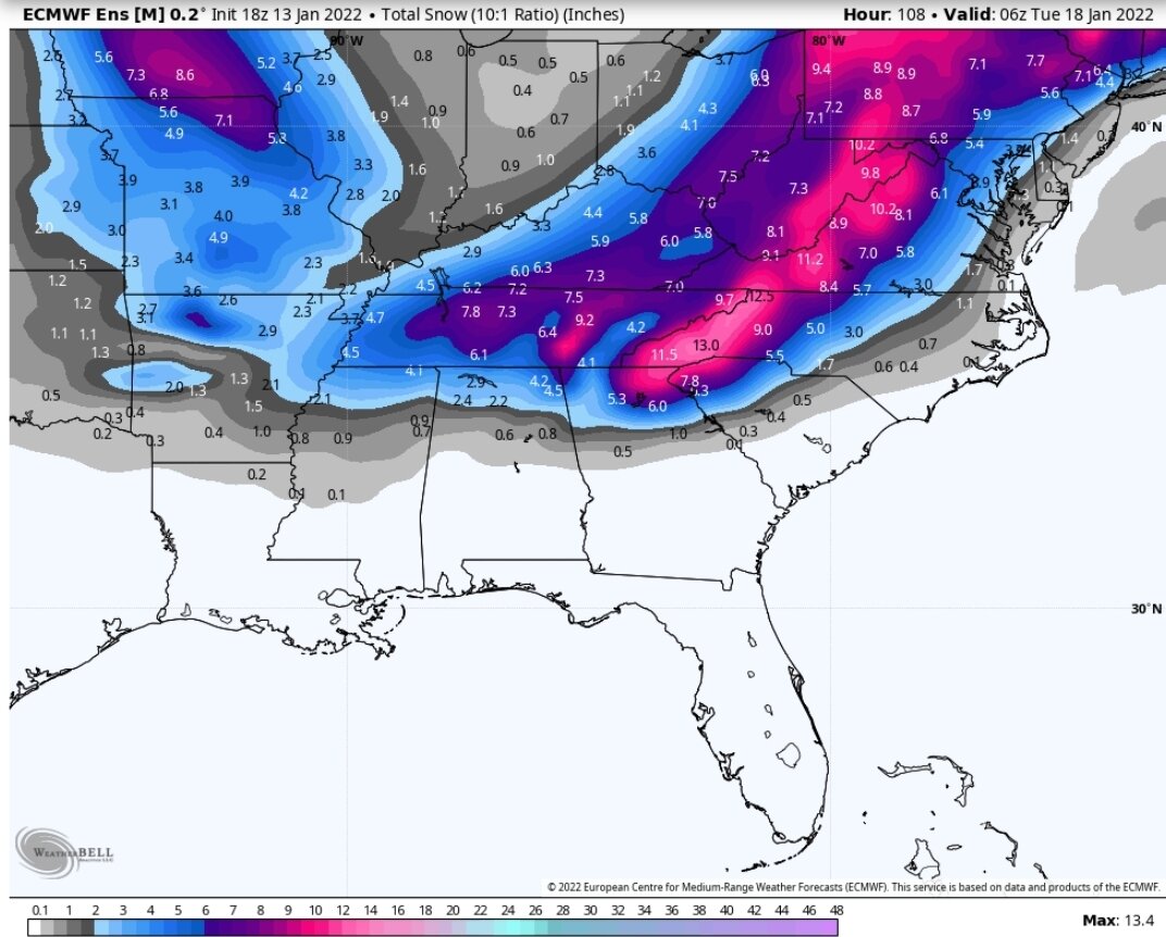
18z EPS

-
Needs to outrun the energy behind it entering the northern plains...it is ever so slightly tugging on our system
-
18z Euro moved north a little
-
Here's the 12z Euro for KCHA...let's see what 18z has for us
-
Lol...im still on the fence, even tho it looks a lot better now then 24-36 hrs ago. As long as models keep showing that 850 jumping north (even if very weak), I'm leary of any solution.
-
BNA to FFC track or transfer between those two and historically that's money...comes in closer to HUN or too far south of BNA (unless it's a bomb) and valley ends up with issues.
-
If I was in southern middle back to Memphis, I would be telling the waiter "check please"
-
So basically you have every model (NAM, RGEM, EURO, CMC, UKIE, NOGAPS, Santa's 1K Experimental) all showing an 850 centers directly over or within 25 miles of BHam @78...then Goofy up on the TN/AL border...thats a pretty good consensus. What happens after 78 is debatable.
-
This feels like the old days lol...both globals find the system, one loses it in the 3-5 day window, just to end up refinding the storm again as we get closer.
-
There ended up being a subtle hint of the 850 trying to jump north (a little later than CMC and way weaker reflection)...something to watch.
-
850 was about 50 miles south of 6z track...in line with the NAM
-
Euro kicks down the magic wall in the CMC and continues east
-
Ukie is trash lol
-
If you want sanity...turn on the 850 wind field maps and follow the swirl...dont need any other map on model runs...north/northwest of the swirl...golden. over the top of you/east/south...move on to the next run
-
There is .0001% chance of the CMC playing out that way between 78 & 84...unless a magic brick wall forms lol
-
12z GEFS
-
12z CMC was very close to following the NAM...has the 850 over Birmingham @78, then unexplainably jumps it dur north @84 to the TN/KY border...an almost 90° turn in track
-
If you put the 850 position of the NAM in GFS spot..Chattanooga would get nailed. NAM tries to run the LLJ out ahead, up and over the Apps..that leads to the wonky solution northern valley.
-
That's the million dollar question...how does the 850 track. While the setup is different, the 850 is close to the same track as the last system. Globals were off with it (kept the 850 close to the TN border), when it actually came up to almost I40. 850 has to slide south of your area, or this storm will be a No Go. If this was a stacked system, then the actual surface reflection would have more weight.
-
Part of reason it looks like GEFS cut totals, was so.e member jumped far enough south that north precip goes south of the area. Definitely has a greater spread in outcomes now
-
0z GEFS