TellicoWx
-
Posts
2,283 -
Joined
-
Last visited
Content Type
Profiles
Blogs
Forums
American Weather
Media Demo
Store
Gallery
Everything posted by TellicoWx
-
Good example of how conservative it is on accum maps, look at the KY/IL/IN area. Most models right now have at least a 2" swath thru there for the mid week system. But the NBM only puts out .5". So for it to be putting out 2" amounts in our area 5 days out seems like pretty loud honking from it.
-
Since watching the NBM the last 2 systems, it seems to get the area...but is really conservative on totals. So the 0z run is interesting. 0z 120 hr
-
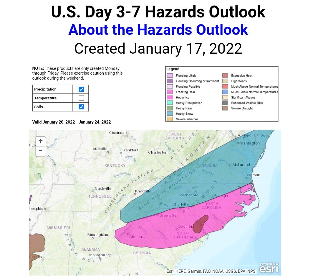
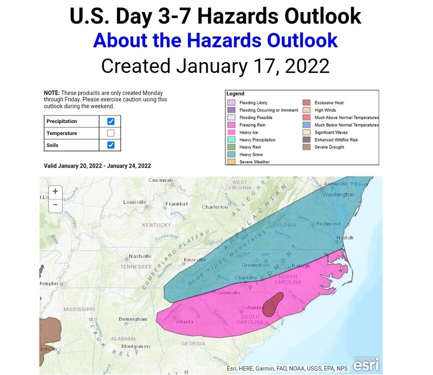
WPC, wouldn't take much of a NW trend in their thoughts to be in the game. The area with slightly higher confidence (albeit not "that" high given lingering model spread) is the Southeast and Mid-Atlantic. The aforementioned jet streak on Thursday sticks around into Friday with a favorable low level baroclinic environment hovering atop the Southeast. How long the region is under the influence of this potentially wintry setup depends on how a pair of upper level disturbances interact. The Euro ensembles suggest a slower and more amplified look on Friday while the GEFS are more progressive, but still wintry nonetheless with just under half of is 12Z members showing freezing rain potential in the Carolinas to close out the week. Have introduced heavy snow and sleet/freezing rain areas for parts of the Mid-Atlantic and Southeast where these regions may witness potentially up to a few days worth of wintry weather.
-
All I have to see is the name...Ken Weathers is one of the biggest jokes of a meteorologist (and I use that term loosely for him).
-
We need a good Ole Triple Phaser...seems like it's been forever lol
-
Got some light snow moving thru again
-
Picked up around 1.5" before it melted down to .5" for first round...then this evening band put down another 2.5". So 4" overall...close to what most short range models had for me.
-
Had quite a few wrecks on the river road...Rescue Squads 4x4 has to take EMS up with them
-
Finally made it back to Tellico, 68 is horrible. 15 min drive to about 45 mins
-
Roads turning bad here...absolutely pouring
-
Visibility down to 1/4 mile or less
-
Ripping here in Madisonville
-
Still snow here, but lower rates and borderline BL, temp has rose back up to 34...alot of melting right now. One of reasons I hate daytime snow lol.
-
Only 2nd time I've ever heard 68 close..MRX really should upgrade...afraid alot of valley may get caught off guard like Tellico
-
Hwy 68 is being shutdown just outside Tellico going toward Coker Creek...road is impassable and car wrecks everywhere
-
Hardest it has snowed all day...and that's saying quite a bit.
-
Sister sent video from Tellico..pouring there. Everything solid white
-
That's been in back of my mind...curious to see how it unfolds
-
Roads are snow covered in Coker Creek area
-
Temp finally down to 32 in Tellico
-
Trying to stick on grass here in Madisonville...yards white (heavy dusting to 1/2") back home in Tellico
-
Pouring snow here in Madisonville now
-
Rain/snow mix now in Madisonville
-
HRRR hammers the valley