

ILoveWinter
-
Posts
1,136 -
Joined
-
Last visited
Content Type
Profiles
Blogs
Forums
American Weather
Media Demo
Store
Gallery
Posts posted by ILoveWinter
-
-
SN+ reported at CPK in latest update
-
-
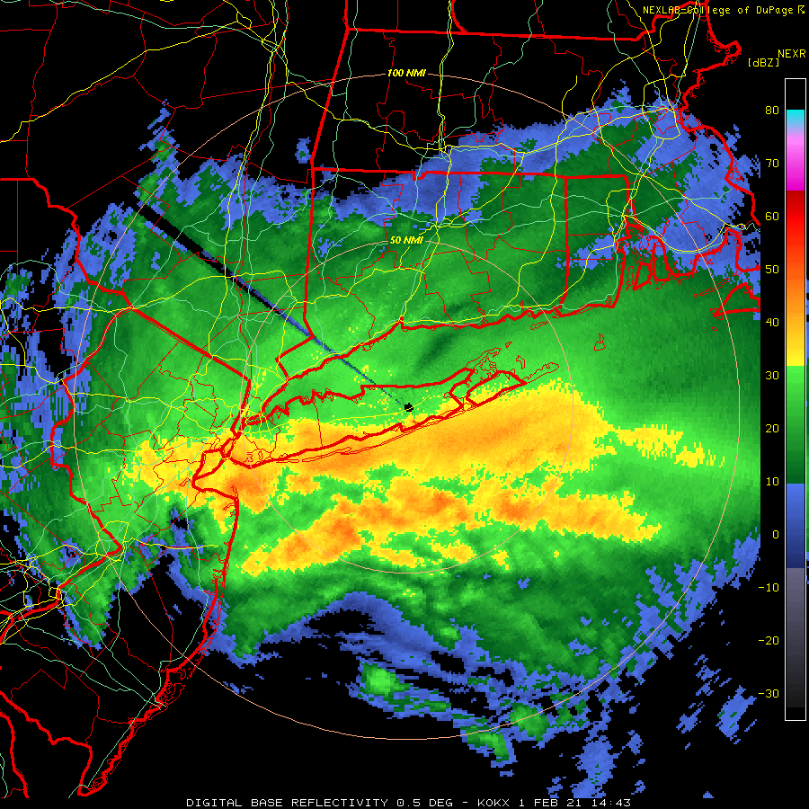
Nice banding over the NYC metro and especially just west into NJ
https://weather.cod.edu/satrad/nexrad/?parms=DIX-N0Q-0-24-100-usa-rad
-
Moderate to Heavy in the UWS though not sticking yet
-
-
Flurries in the UWS
edit: which graduated into a steady light snow within minutes
-
Not that this one is a done deal for snow but it often seems like models show a storm a week out then lose it for a few days before coming back.
-
Nice echoes developing south of Nassau and heading into the city
https://weather.cod.edu/satrad/nexrad/?parms=DIX-N0Q-1-24-100-usa-rad
-
1 minute ago, nycsnow said:
Looks like the mix line dissipated over nyc area can anyone confirm?
Never changed over here in UWS and still snowing though not as hard as earlier
-
Still coming down nicely in the UWS, no sleet
-
1 minute ago, nycsnow said:
Sorry meant DONT see how any boroughs record 20 or more unless something changes fast
Still snowing heavily in UWS, maybe we luck out here but tough to say
-
 1
1
-
-
4 minutes ago, hooralph said:
Heaviest of the day here on the UWS.
Agree!
-
Getting smoked in the UWS, don't yet see the characteristic large flakes associated with an imminent changeover to sleet
-
Just now, hooralph said:
Just measured 9.5" of pure powder on the ground here on UWS. Back inside now, I'm hearing what sounds like a few pings on the windows and air conditioners.

I'm in the UWS, don't hear or see any sleet. Prob just the wind blowing the snow around.
-
1
-
-
8 minutes ago, NJwx85 said:
Looks like two bands rotating in from the SE. The first runs from SW CT down through Westchester, Rockland and points SW into NJ.
Then an area of subsidence in between.
The second band is about to enter LI and the rest of the coast off the ocean.
Probably easily 1-2" per hour in the Western band and 2-4" per hour in the one coming off the ocean.
I am in this area of subsisdence and I'd call it "less heavy" snow, lol
-
1
-
-
Wow, just wow at the persistency of this heavy snow for the past 90 mins
-
2
-
-
Just now, SnowGoose69 said:
The NYC ASOS reported .03 in 11 minutes to start the hour. That’s probably a 4 inch per hour rate if you assume we a tad better than 10:1 right now
Wouldn't be surprised, crazy out right now
-
Heaviest of the day in the UWS now, visibility very low
-
Blitzed in UWS, prob 1-2"/hr rates
-
1
-
-
1 minute ago, forkyfork said:
very impressive. it's consolidating right over the metro
Incoming insanity for the NYC area
-
1
-
-
Whether the sleet line makes it into the NYC area later on or not, enjoying a heavy and relatively high ratio snow now in the UWS, pretty awesome stuff!
-
1
-
-
9 minutes ago, Phillycane said:
Pouring snow here in the Upper East Side. Unless there is a dramatic difference within 3 miles in Manhattan, it's likely a camera or building illusion in the coverage down in Madison Square Park.
Yea agree with this as it's been ripping in the UWS for some time now
-
1
-
-
Absolutely ripping in the UWS
-
Just now, Rittenhouse said:
The models seem to underestimate overrunning/front-end snows but overestimate back-end snows for NYC. Not sure the science behind it.
Yea very true, it's rare the NYC area scores big on back end snows (upstate and New England are another story though)

OBS and nowcast Thursday morning 2/18 - 11PM Friday 2/19/21
in New York City Metro
Posted
Seems like it is near Philly on this radar: https://weather.cod.edu/satrad/nexrad/?parms=DIX-N0C-1-24-100-usa-rad