brooklynwx99
-
Posts
5,630 -
Joined
-
Last visited
Content Type
Profiles
Blogs
Forums
American Weather
Media Demo
Store
Gallery
Everything posted by brooklynwx99
-
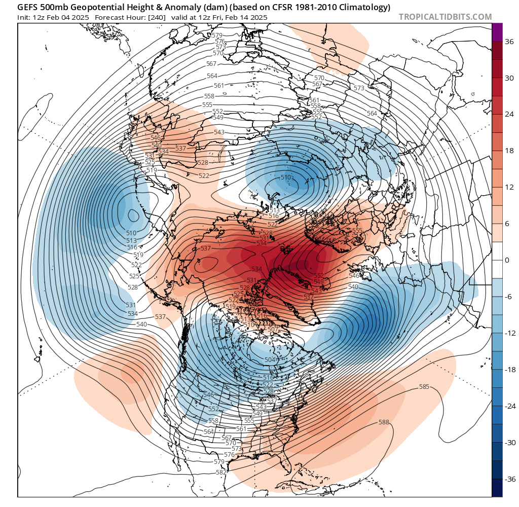
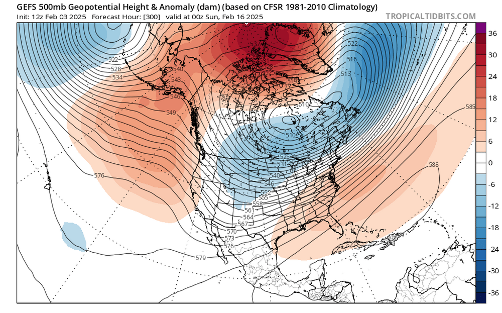
 comparing the two setups, this one is more favorable for a more potent storm. lower downstream heights in SE Canada help foster coastal redevelopment and a better thump
-
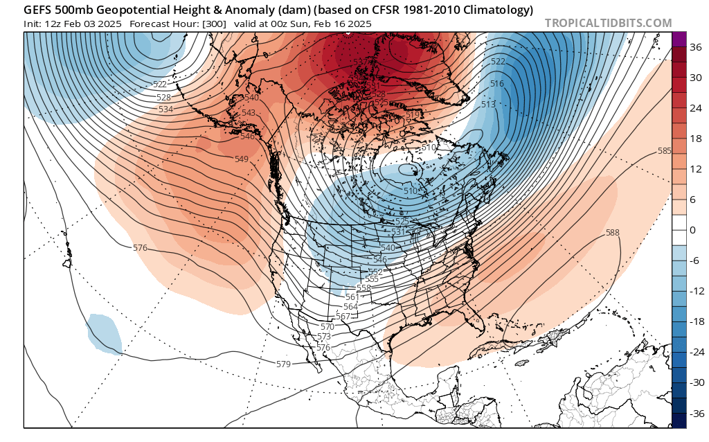
comparing the two setups, this one is more favorable for front end snow for NYC. lower downstream heights in SE Canada help

-
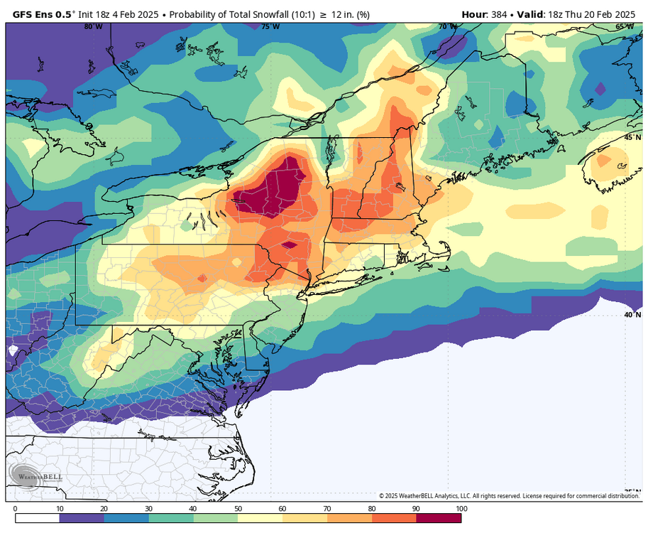
i mean yeah i get the skepticism but these probabilities are objectively ridiculous
-
yeah, moves towards the typical KU pattern at that point
-
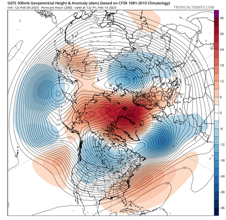
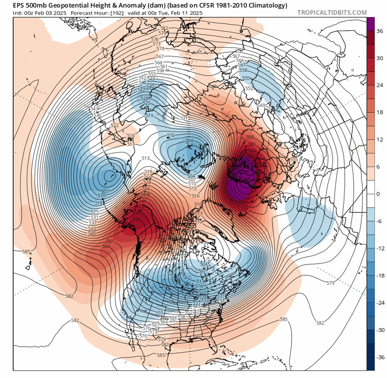
ridiculous Arctic blocking on the GEFS
-
that Arctic blocking is wow

-
jesus

-
why even bother talking about a potential pattern hiccup when this is on the horizon? lmao
-
it looks temporary. not really worried about that
-
luckily with this kind of thermal gradient you can get a significant event with like a 1015mb low
-
lol
-
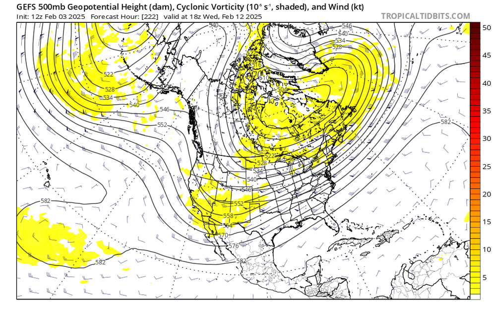
also, big signal on the GEFS for the 12th

-
this is your takeaway?
-
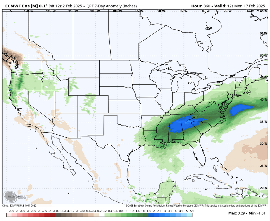
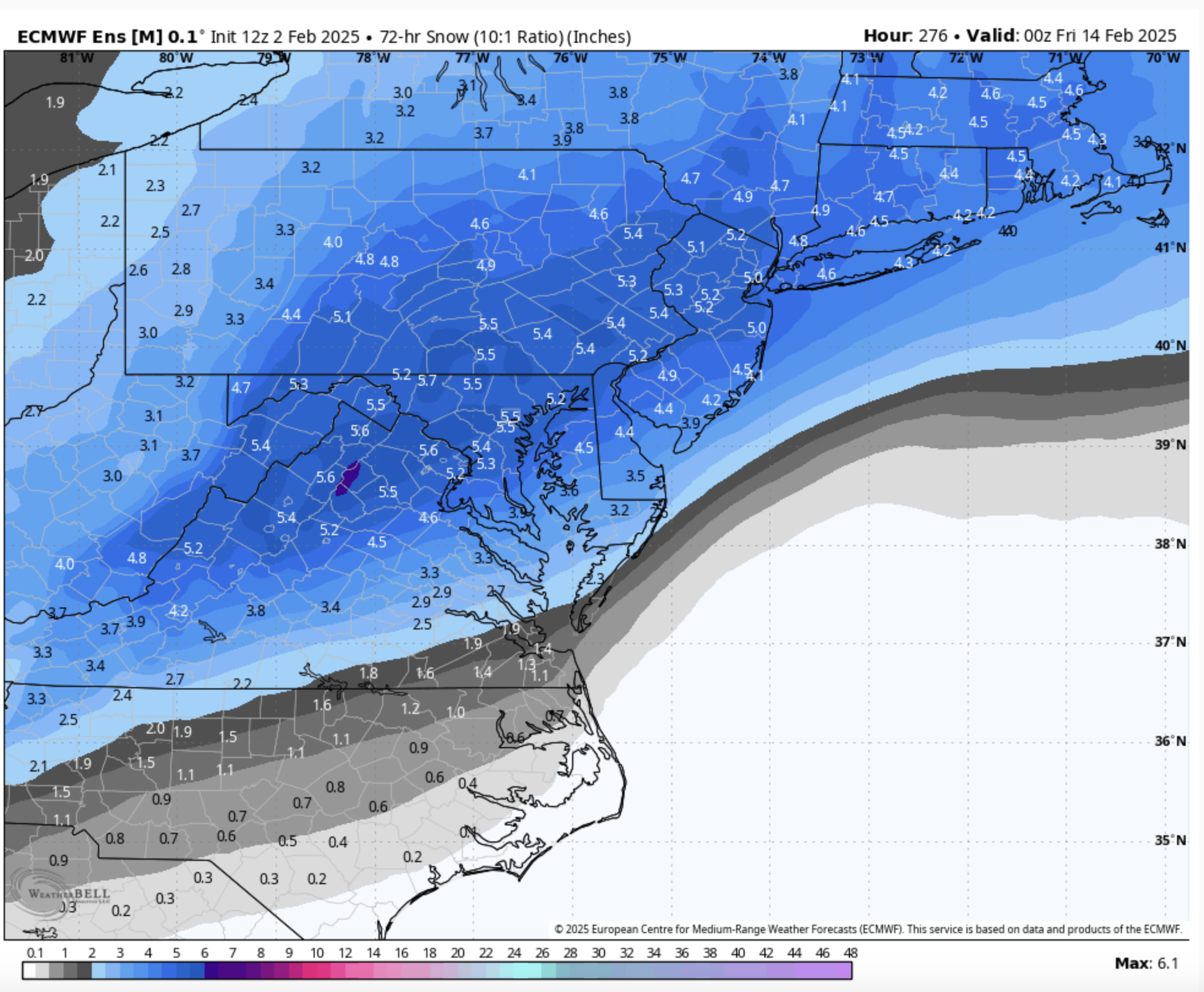
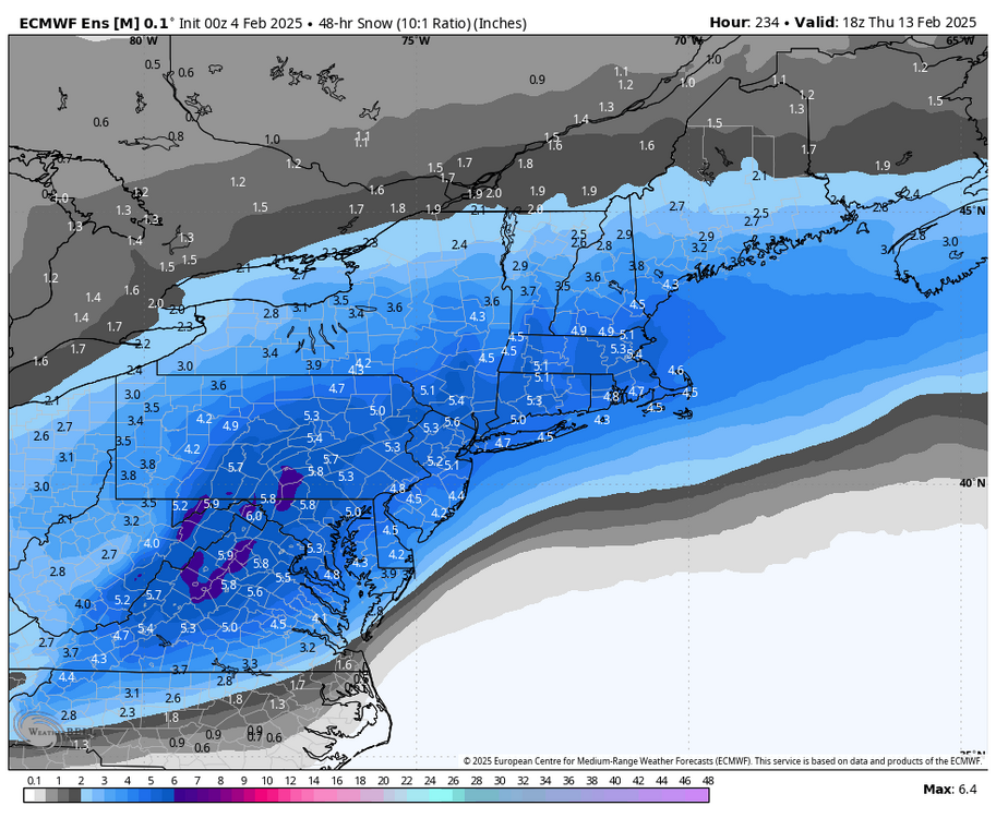
the thing that's really wild about these runs is that they're prolific before the most favorable window, which is when the block rots. these runs have DC-NYC getting 1-2 feet through the 16th, which is when the block is still developing. the timeframe from the 16-23rd is when you'd expect to see the greatest shot at a true MECS so the fact that ensembles are showing 8-12" from NYC to DC without a well defined MECS signal is ridiculous
-
depends...

-
IMO this is more of a bottom-up event... the 50mb impacts on the stratosphere are more important for influencing the troposphere most of the time anyway, and a significant disruption is likely. the SPV stuff is only serving to bolster the tropospheric processes that will occur over the next two weeks
-
the stratospheric impacts are likely going to lead to more stable blocking, IMO. it's all part of a bigger picture
-
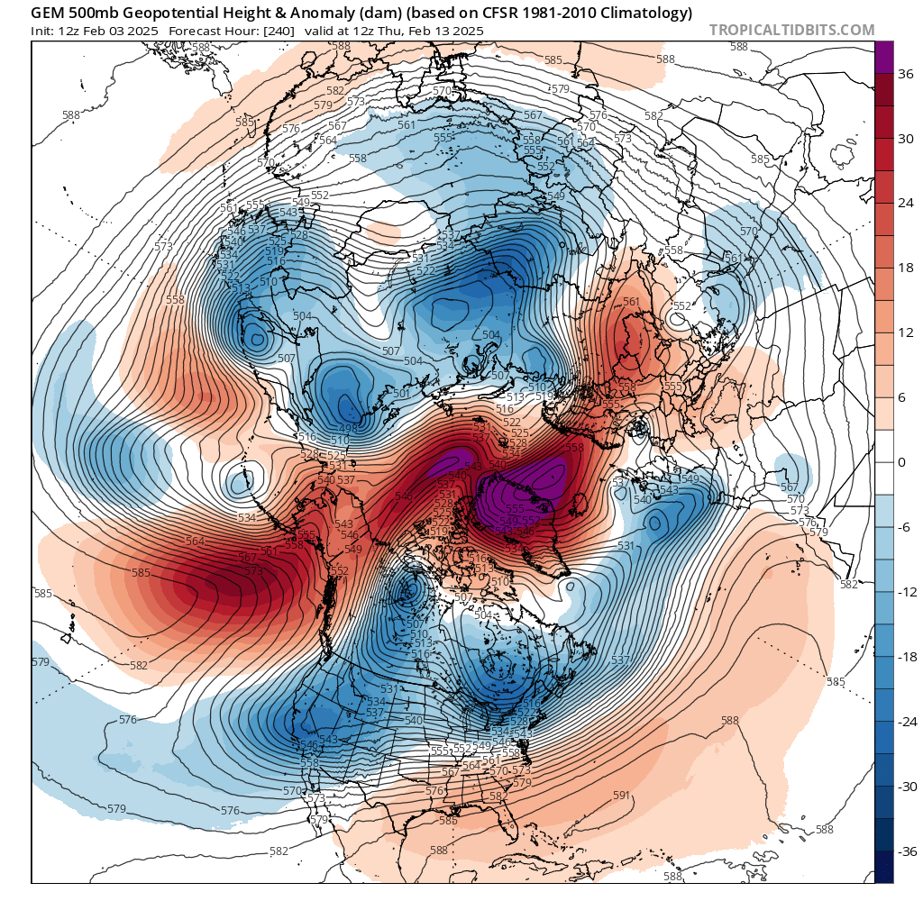
this retrograding and decaying Scandi block along with the elongated TPV is often a precursor to some of our larger storms, historically. there are risks before this occurs, mainly around the 8th and 12th, but there's certainly a window for a more prototypical coastal storm between the 18-23rd

-
this retrograding and decaying Scandi block along with the elongated TPV is often a precursor to some of our larger storms, historically. there are risks before this occurs, mainly around the 8th and 12th, but there's certainly a window for a more prototypical coastal storm between the 18-23rd
-
this is also just ridiculous

-
nothing is ever permanent in weather. always roll my eyes when i see stuff like that
-
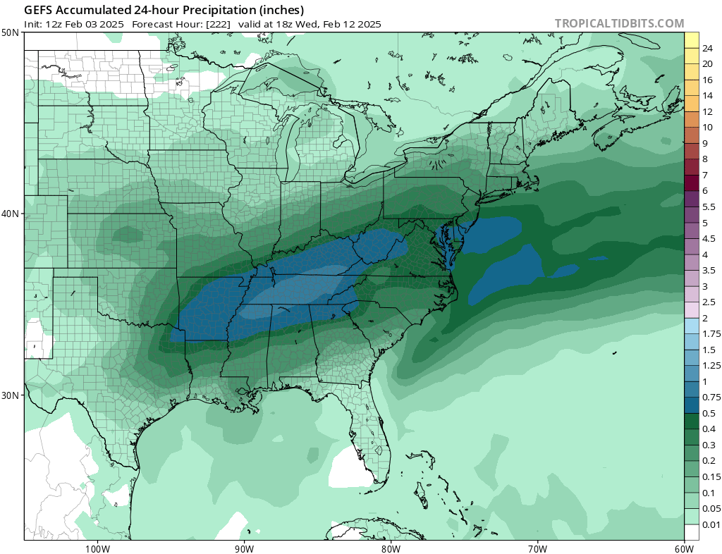
the 6th and 8th look like potential front end thumps. i doubt they’re all snow or anything like that but some here sneezing at the potential for 2-4” to mix to rain is laughable given how lame the last few years have been after the 10th things really open up. it’s also, you know, snowing this evening
-
love to see it