brooklynwx99
-
Posts
5,630 -
Joined
-
Last visited
Content Type
Profiles
Blogs
Forums
American Weather
Media Demo
Store
Gallery
Everything posted by brooklynwx99
-
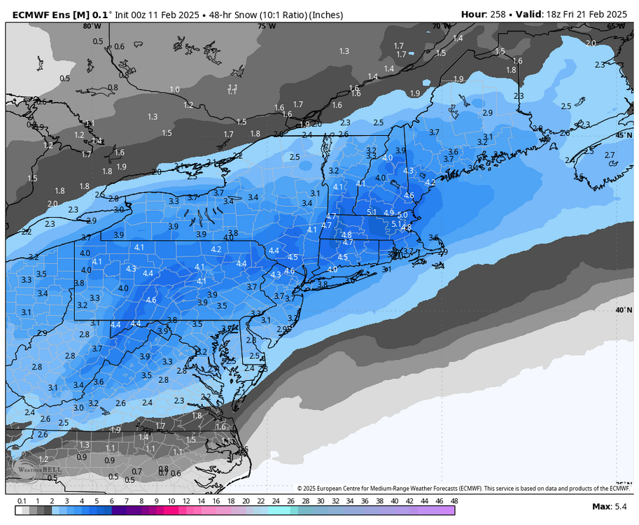
what a monster
-
honestly, the AIFS hasn't been any more consistent than any other model, and this storm is 8 days out. too much emphasis is placed on it IMO
-
there is some interest

-
nah i could go without being the scapegoat for less frozen water falling from the sky. i'm good
-
lol no model shows a cutter. could it get a little too close for comfort for the immediate coast, sure, but i find it highly unlikely that we see a system cut through the Apps. more likely to see suppression than a wet outcome here
-
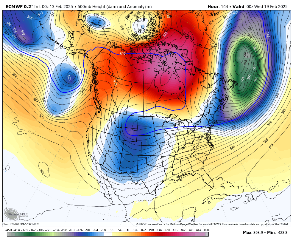
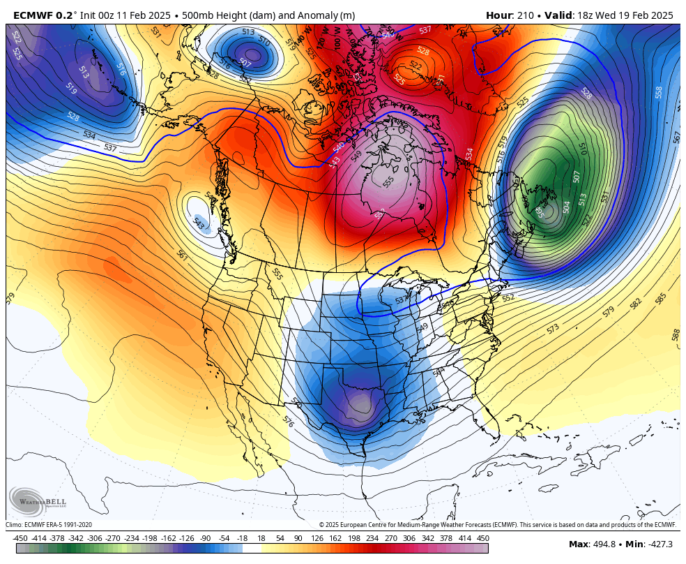
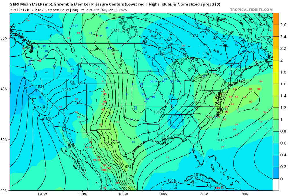
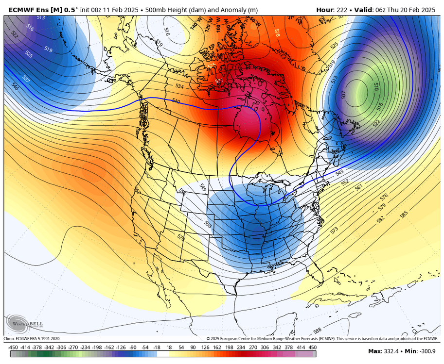
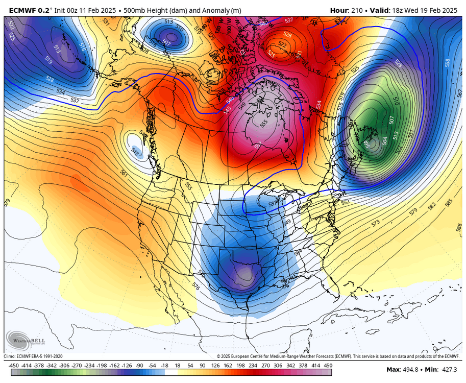
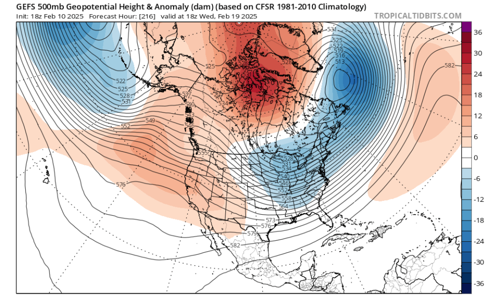
just a massive signal here
-

-
like I can't look at this and not get a little excited. it has every synoptic feature you're looking for

-
all we can use is the data we have right now. if things change, we can change our view on the pattern. right now, things look really good... we'll see what happens over the next few days. it's worth it to temper expectations but also acknowledge that there is heightened potential for a significant to even major storm around the 20th
-
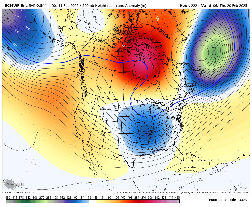
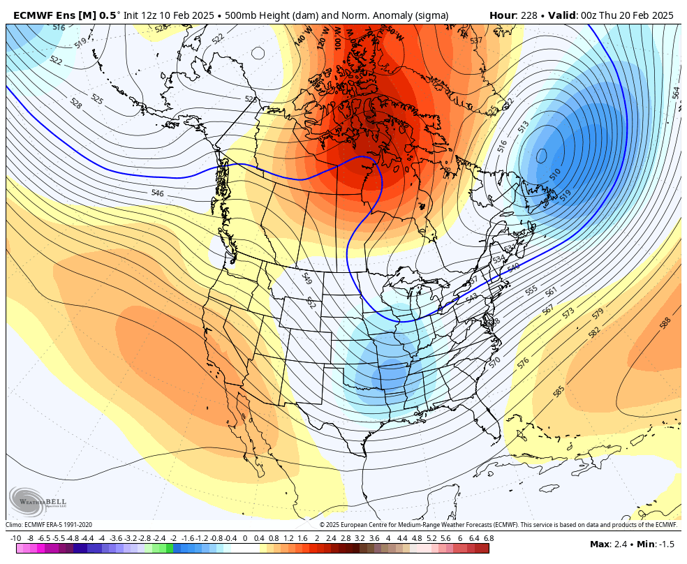
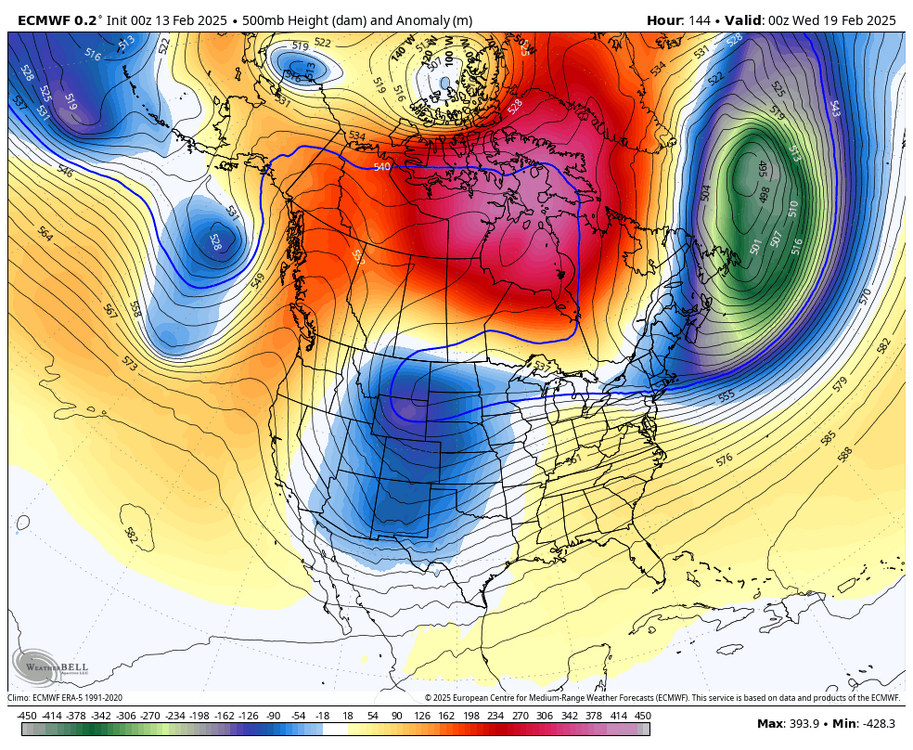
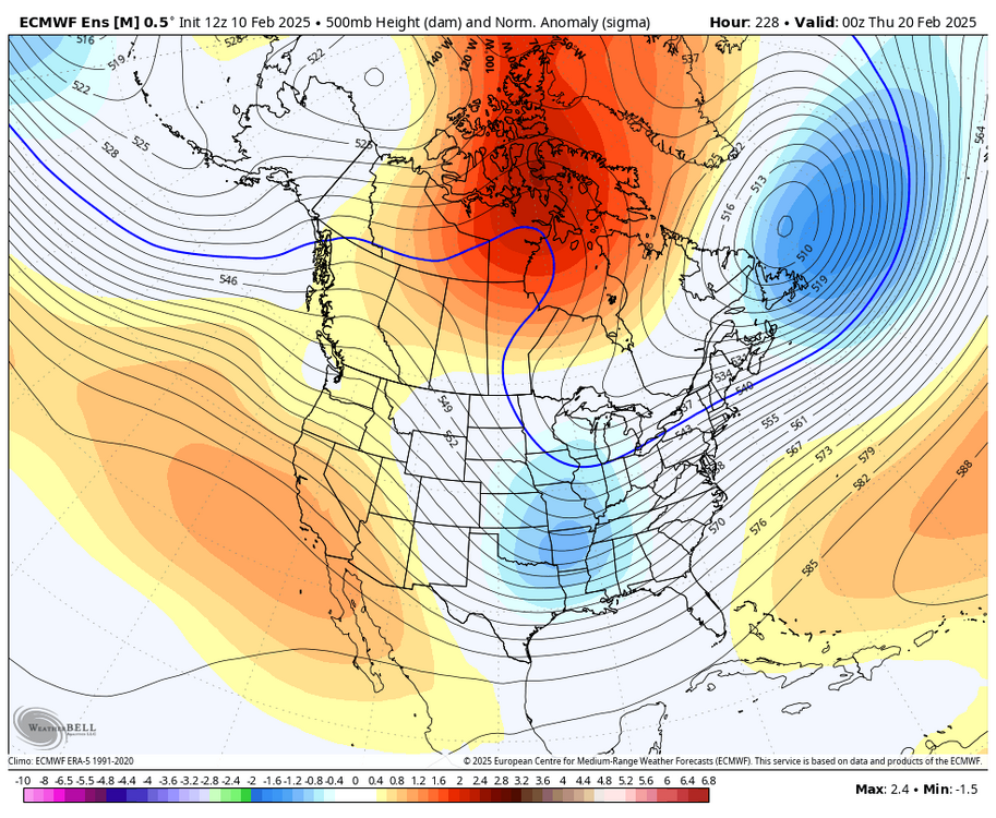
the EPS is wild again. stronger -NAO and 50/50, too, which I like. strong confluence is always a good thing here
-


-
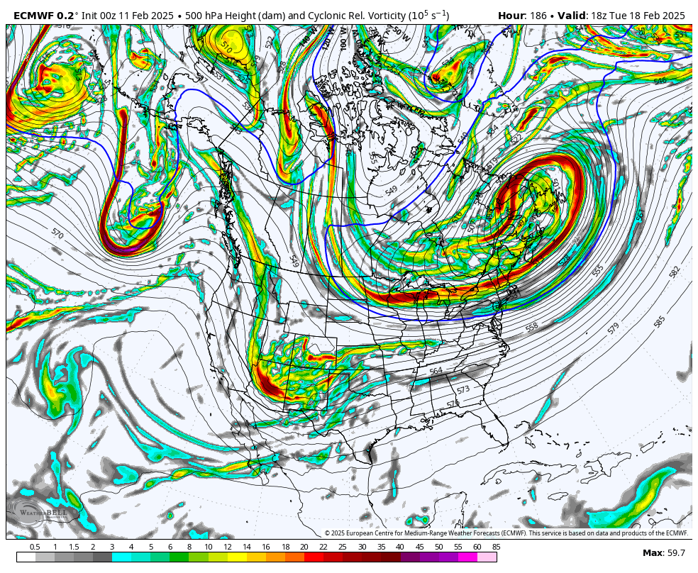
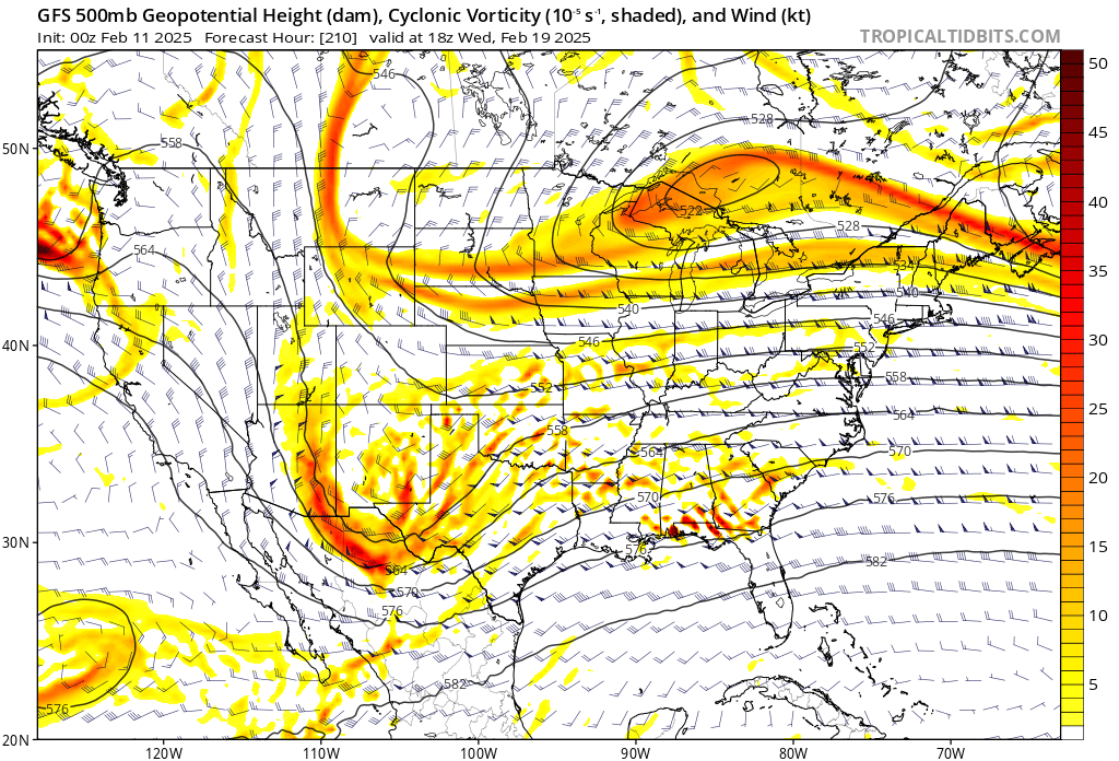
i mean, what is there to say? it's all there lmao
-
ECMWF is nuclear

-
this ring a bell? i’m not gonna say it out loud

-
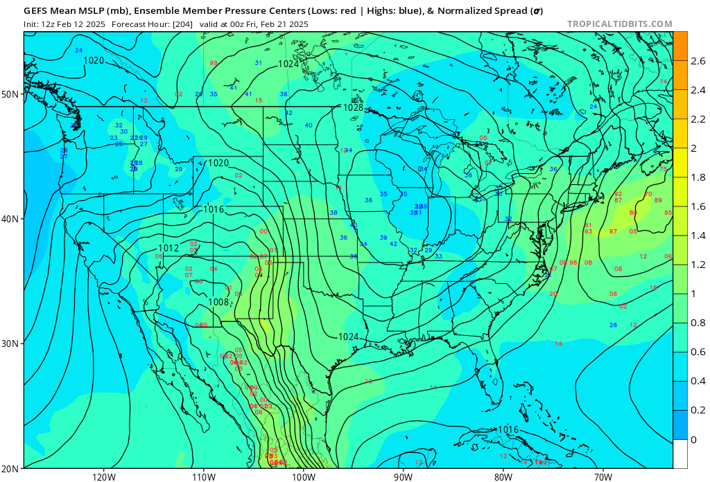
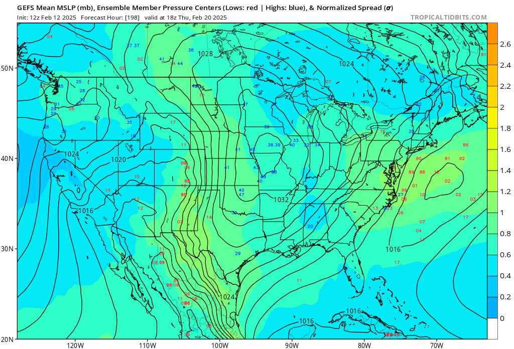
GEFS liking it
-
December 2022 had -PNA issues and Feb 2024 never really got going with the block never forming. this is inside of D10 so it's no longer pure fantasy and the PNA region is more favorable
-
the block for Feb 2024 was tenuous and it never really formed. late Feb 2023 was in March, so it could have delivered, but it was too warm. and I don't recall March 2022 this time, the block is going to form and retrograde in an ideal location. just need to iron out the details
-
not like this, though. not sure the last time we had a signal like that show up on all ensembles. maybe Feb 2021
-
could be the one. this is a highly favorable look with the decaying block
-
agreed. want to get into that D5-6 timeframe but for now, it seems as though a lot is aligning. hopefully we can pull together a thump for the NW posters with the 15-16th. unfortunate to see the confluence weaken in the worst spot
-
this is so sick lmao

-
the 20th was always the most favorable window as the block fully matured, by the way
-
if this isn't anything but a highly favorable setup on the EPS then some of you are being a bit dishonest. everything is in the right spot with the decaying block over central Canada linking up with the developing +PNA

-
considering it will snow three times in a week for some in this subforum including this weekend, I would say right around now
-
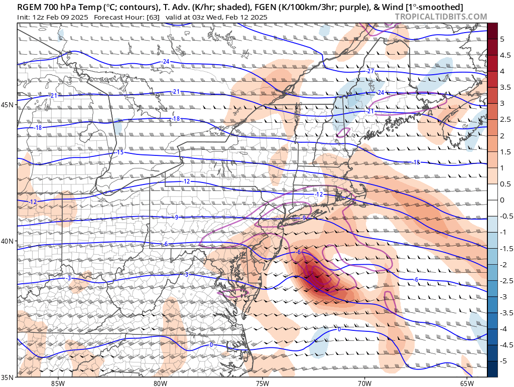
 there absolutely is the potential for some fluff factor in the northern area of the precip shield... factor in a strong 250mb jet and 700 FGEN and it wouldn't be shocking to see an area of enhanced, higher ratio snow