brooklynwx99
-
Posts
5,630 -
Joined
-
Last visited
Content Type
Profiles
Blogs
Forums
American Weather
Media Demo
Store
Gallery
Everything posted by brooklynwx99
-

December 2024 - Best look to an early December pattern in many a year!
brooklynwx99 replied to FXWX's topic in New England
yeah, that's true. I guess a clearer way to write what I meant is that you always sorta run the risk for dry periods when you have a cold pattern... you just increase the risk of cashing in when you do get moisture. gotta take the dryness to get the snow most of the time -
December 2024 - Best look to an early December pattern in many a year!
brooklynwx99 replied to FXWX's topic in New England
basically, yes. all ENS are showing a 2014-15 pattern here after the first several days of the month. we'll see if it verifies, but we're already seeing good AK blocking and +PNA in the short range. better Pacific than we've seen in years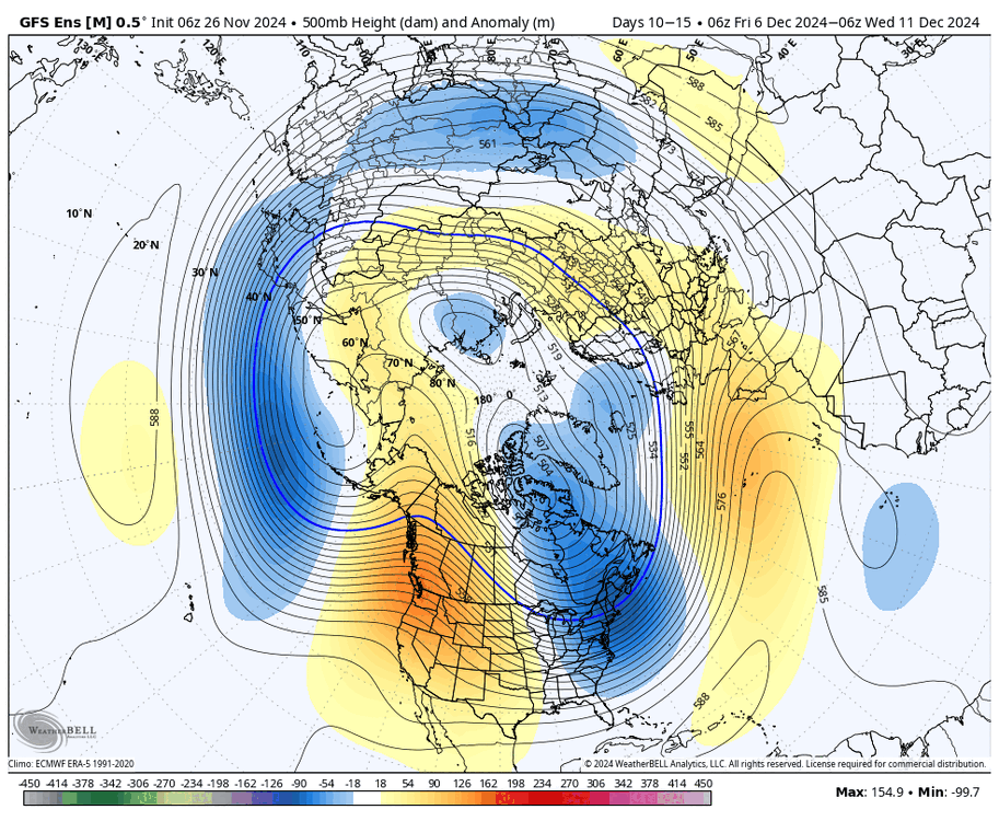
-
December 2024 - Best look to an early December pattern in many a year!
brooklynwx99 replied to FXWX's topic in New England
cold and dry is also kind of a cop out for longer time scales. of course it's going to be drier than average if it's cold. rather that than last year's 8" of rain in Dec -
December 2024 - Best look to an early December pattern in many a year!
brooklynwx99 replied to FXWX's topic in New England
we've seen that Rex block look with a monster -EPO trapping a black hole over San Fran multiple times over the last few years. sickening -
December 2024 - Best look to an early December pattern in many a year!
brooklynwx99 replied to FXWX's topic in New England
I agree. the reason why these patterns can appear cold and dry for a time before threats pop up is because of setups like this... this is the type of vort that can easily trend more amped and lead to miller B or strong clipper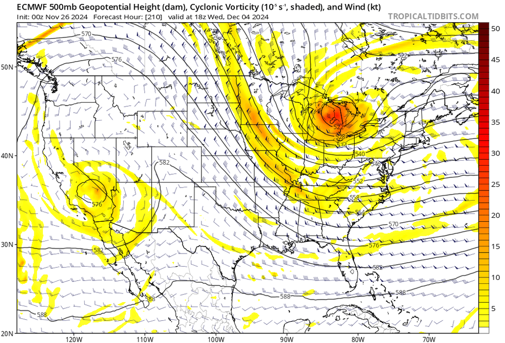
-
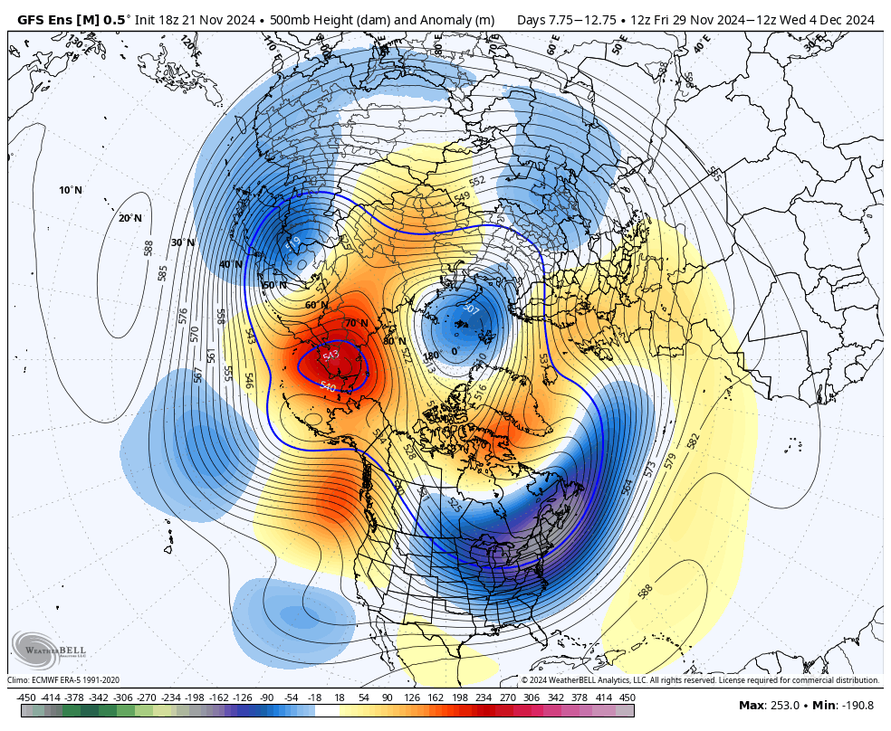
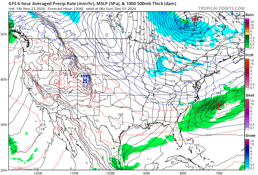
FWIW the 12z models have shown some interest in allowing the Dec 1 wave to become more of its own entity, as seen on the GEFS. the airmass is much better and the -NAO is more established, so this is worth watching IMO

-
Blowvember - and not named for wind potential
brooklynwx99 replied to Go Kart Mozart's topic in New England
FWIW the 12z models have shown some interest in allowing the Dec 1 wave to become more of its own entity, as seen on the GEFS. the airmass is much better and the -NAO is more established, so this is worth watching IMO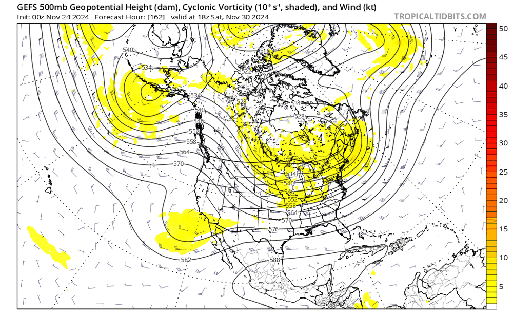
-
Blowvember - and not named for wind potential
brooklynwx99 replied to Go Kart Mozart's topic in New England
models start bringing the baroclinic zone northward with more precip around the 5th. luckily we should have a cold airmass established unlike with the Thanksgiving storm -
Blowvember - and not named for wind potential
brooklynwx99 replied to Go Kart Mozart's topic in New England
also, I agree with your point about the first week of Dec... there's a signal for a large 50/50 ULL and decaying block over the Davis Strait. climo is better and cold air is more firmly in place. this is probably the main window to watch if I had to pick one at this juncture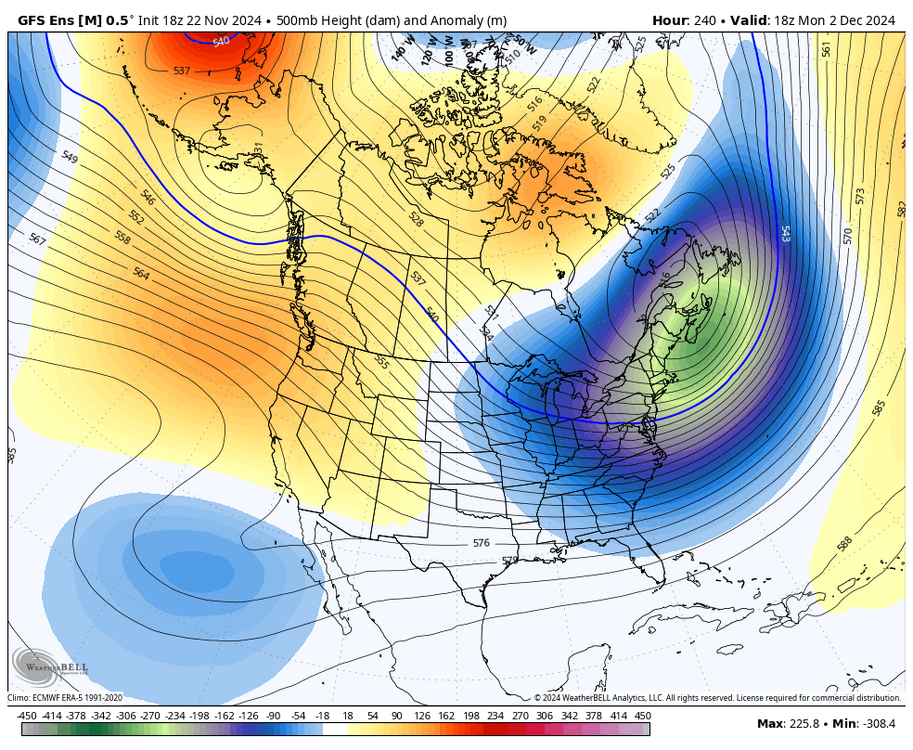
-
the timeframe around the 5th looks conducive for something bigger regionwide... anomalous 50/50, a decaying block over the Davis Strait, and persistent cross-polar flow. combine with an active STJ for split flow and there's a lot to like here

-
Blowvember - and not named for wind potential
brooklynwx99 replied to Go Kart Mozart's topic in New England
that's why I think holding the shortwave back with stronger confluence makes more sense. the GFS tried but it was just a bit too sloppy. I like its general evolution -
Blowvember - and not named for wind potential
brooklynwx99 replied to Go Kart Mozart's topic in New England
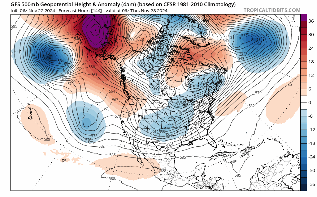
FWIW the NAO pays off as it decays later in the run: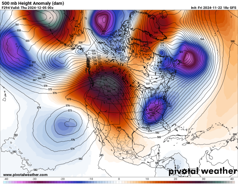
-
Blowvember - and not named for wind potential
brooklynwx99 replied to Go Kart Mozart's topic in New England
offshore. the overall synoptic setup was more favorable... Wiz is saying the same thing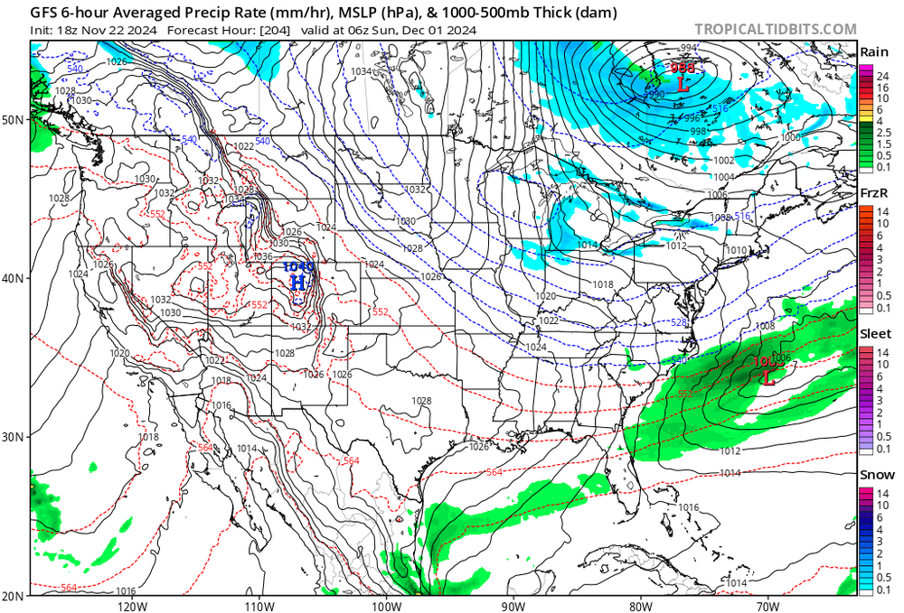
-
Blowvember - and not named for wind potential
brooklynwx99 replied to Go Kart Mozart's topic in New England
right? that -NAO really slows down the flow. I think we want to see a more hung back vort overall, but seeing the confluence trend stronger is also important -
Blowvember - and not named for wind potential
brooklynwx99 replied to Go Kart Mozart's topic in New England
i know we've been burnt over the last few winters but come onnnnnn -
Blowvember - and not named for wind potential
brooklynwx99 replied to Go Kart Mozart's topic in New England
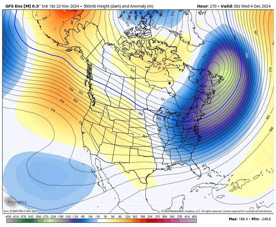
GFS has a much more interesting solution for next week... holds the main wave back and allows the block to go to work more. we've seen confluence and the -NAO trend stronger, which is nice to see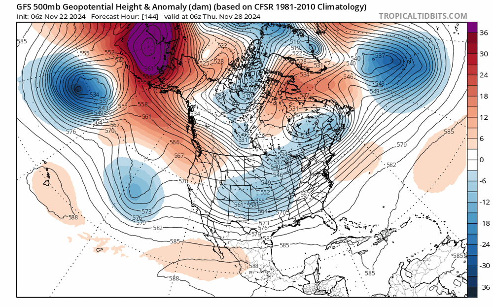
-
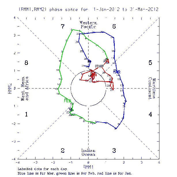
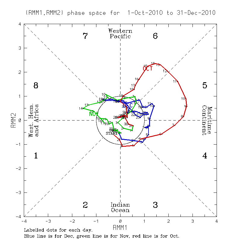
similar progression occurred in 2010
-
yup, it was in the "good phases" in Feb 2012 as well
-
Blowvember - and not named for wind potential
brooklynwx99 replied to Go Kart Mozart's topic in New England
yeah, the stronger that gets, the better if you can nose that -NAO more into central Canada you can also pop transient HP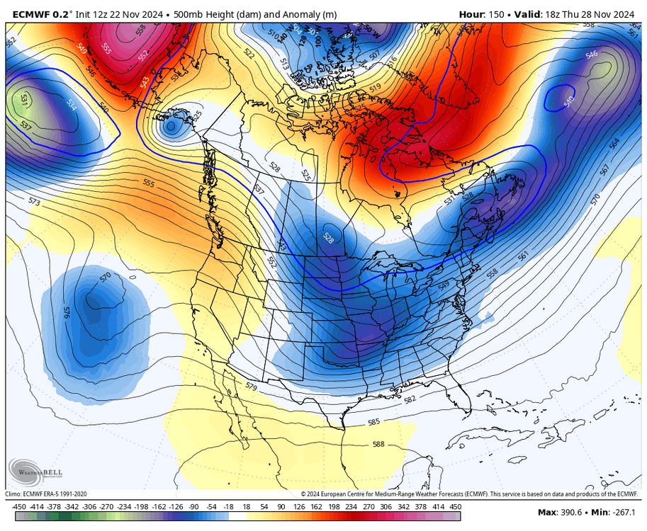
-
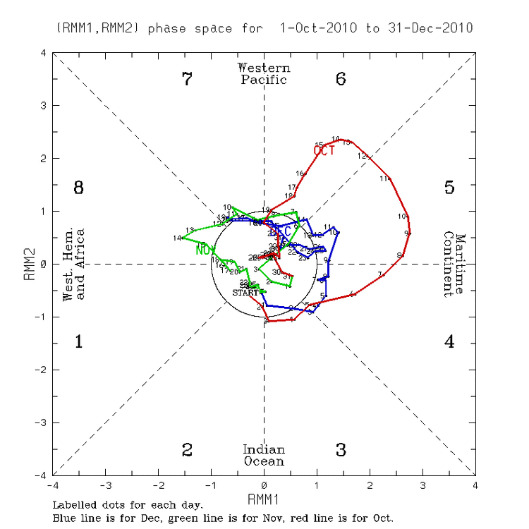
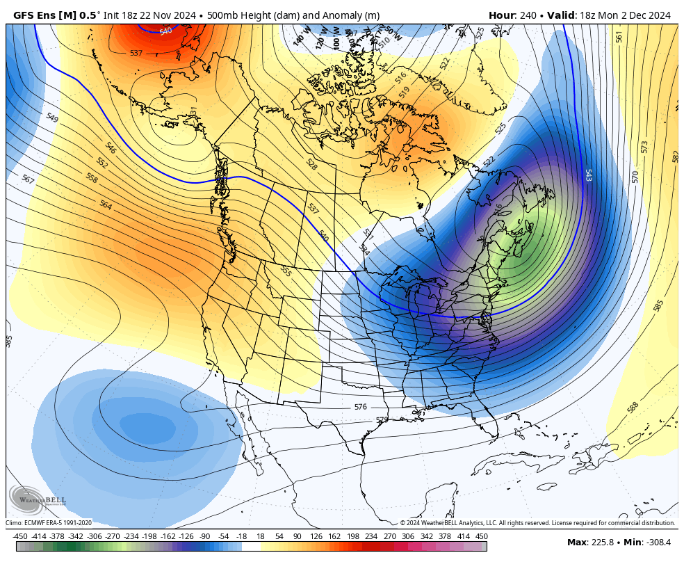
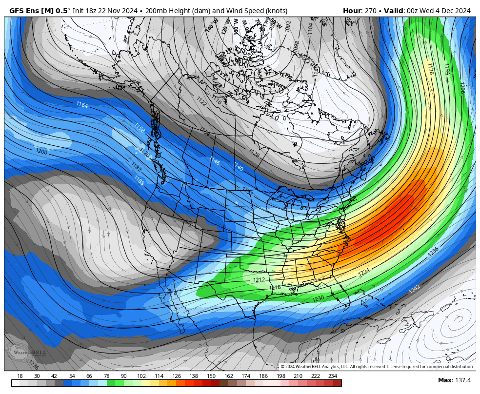
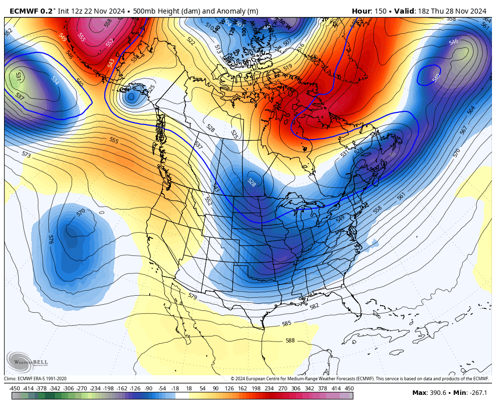
my initial impression of late Nov into early Dec so far is that the persistently +AAM that's being forecasted combined with +EAMT event is extending the Pacific jet more than is typical of La Nina. extensions are often favorable for us, and I believe these factors are overriding the largely unfavorable MJO passage this general pattern favors +EAMT into early Dec, allowing for a persistently extended Pacific jet that leads to an Aleutian trough. the MJO isn't a silver bullet, and i do think we're seeing a break in the typically strong MJO correlation
.thumb.png.dfca4aef181ced2db143bc661e4c0ea5.png)
.thumb.png.f014b072cd1e72e1096b8e45213c83fa.png)
.thumb.png.133ce1961aeeb2a919875d67c8fbd66b.png)
.thumb.png.859189809d3c96e1f1d2d768c68ec3ca.png)
.png.cb0a4ebd92a9dd2c2706967d5580c0e8.png)
-
Blowvember - and not named for wind potential
brooklynwx99 replied to Go Kart Mozart's topic in New England
my initial impression of late Nov into early Dec so far is that the persistently +AAM that's being forecasted combined with +EAMT event is extending the Pacific jet more than is typical of La Nina. extensions are often favorable for us, and I believe these factors are overriding the largely unfavorable MJO passage this general pattern favors +EAMT into early Dec, allowing for a persistently extended Pacific jet that leads to an Aleutian trough. the MJO isn't a silver bullet, and i do think we're seeing a break in the typically strong MJO correlation.thumb.png.2f403d00eb7e0ad6b232c27b40a8bba4.png)
.thumb.png.fe93f64cb4f503d451273cd8b533c6af.png)
.thumb.png.a5f311887ef8179540858125d3968ef6.png)
.thumb.png.02f53b897ac616c61544f6b190fd88a0.png)
.png.57efa670851e70d830414d675db3aa97.png)
-
my initial impression of late Nov into early Dec so far is that the persistently +AAM that's being forecasted combined with +EAMT event is extending the Pacific jet more than is typical of La Nina. extensions are often favorable for us, and I believe these factors are overriding the largely unfavorable MJO passage this general pattern favors +EAMT into early Dec, allowing for a persistently extended Pacific jet that leads to an Aleutian trough. the MJO isn't a silver bullet, and i do think we're seeing a break in the typically strong MJO correlation. never been happier to be wrong about a forecast, let me tell you
.thumb.png.9b063c1fc6a1097a5cca1216e171848d.png)
.thumb.png.bbc8e530ebd92f494a10fd7b9083e586.png)
.png.43bc4698c98e97b4b1530fd51122b5fc.png)
.thumb.png.c094d4326fe63a994ded128857a22350.png)
.thumb.png.ba2e49dd3f8623f81cdbf8510ebfd485.png)
-
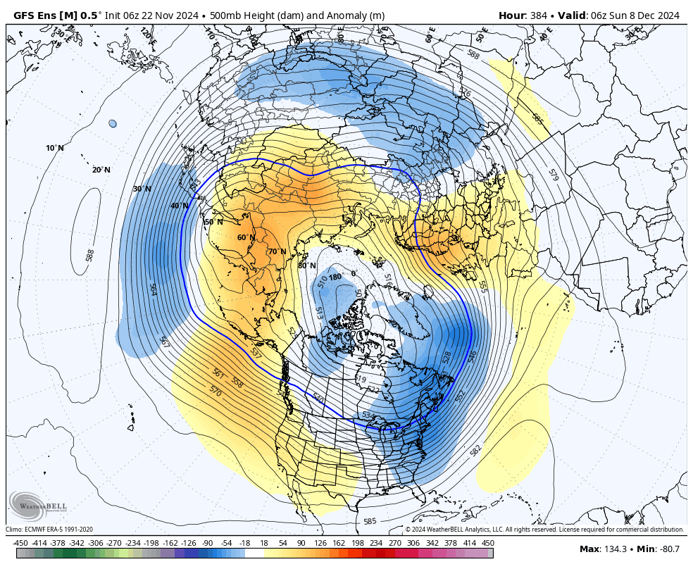
nothing about this says 60s to me. all of the cold air is on this side of the globe and cross polar flow remains established

-
Blowvember - and not named for wind potential
brooklynwx99 replied to Go Kart Mozart's topic in New England
@ORH_wxman and to your point, both Greenland and the N Pac have only trended better over the last few days opposite of the last few years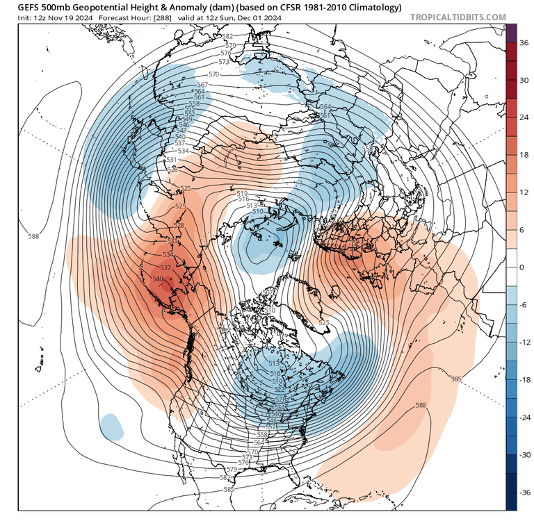
-
Blowvember - and not named for wind potential
brooklynwx99 replied to Go Kart Mozart's topic in New England
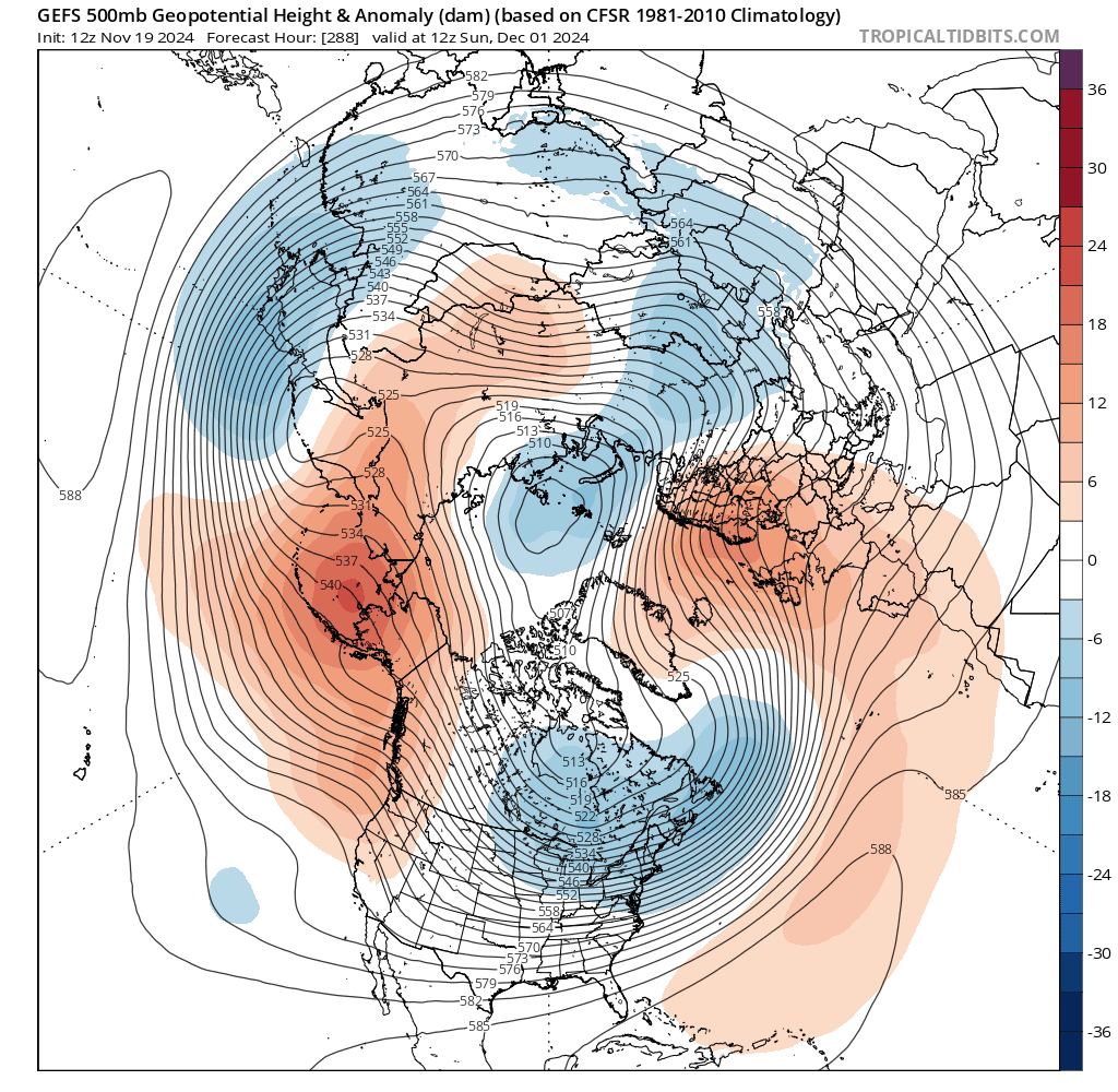
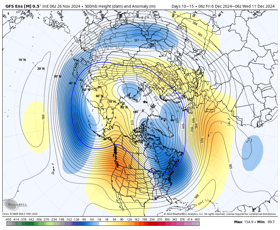
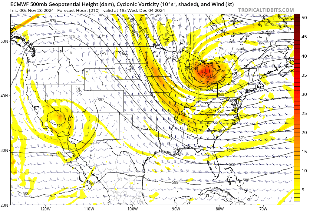
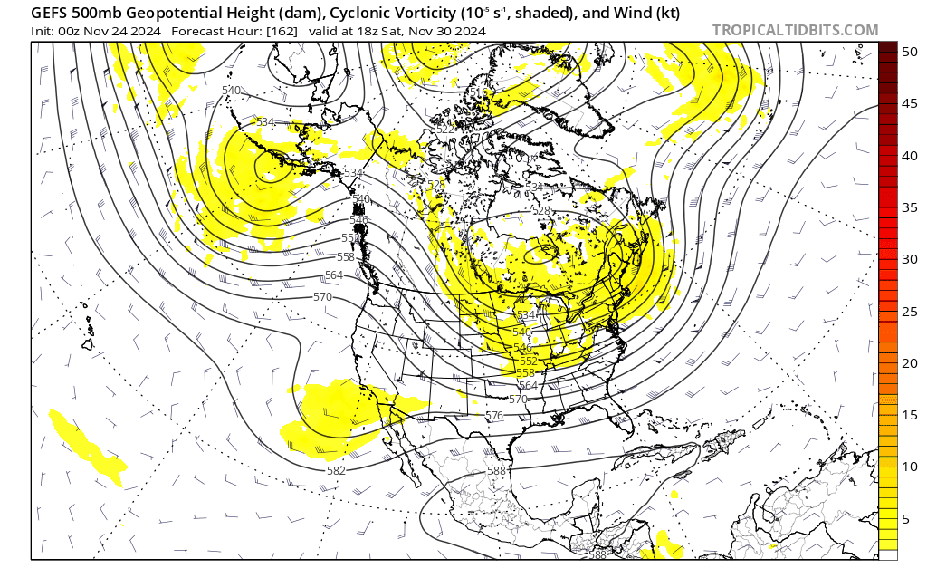
yup. you’d have to turn the clock a back a decade for looks like these


.png.21044396f855319e420990b1c55b08a6.png)
.png.4ae157444c152ca0fe3c13344684ef97.png)
.png.9e9a8d433b15c0e2a99d7f20ad0dc554.png)
.png.02b0f7cdcf73dd810f0c5e1b033d8745.png)
.png.cf828ecbf8fc008833a408e2142db7d0.png)
.png.46ca819a6a89d0e7262758d506b8d5fd.png)
.png.7c10969d3b0a830bdae84ac787a77ee1.png)
.png.9418ac69ad425f9608853702d784f66c.png)
.png.97048201cca3102b99dd841999831827.png)
.png.9abc163df4e4e0955455141e8511cd88.png)
.png.018b65d8afdda39d7c1464918c7362ed.png)
.png.17848db3f464092fe13db48dab427088.png)