brooklynwx99
-
Posts
5,630 -
Joined
-
Last visited
Content Type
Profiles
Blogs
Forums
American Weather
Media Demo
Store
Gallery
Everything posted by brooklynwx99
-
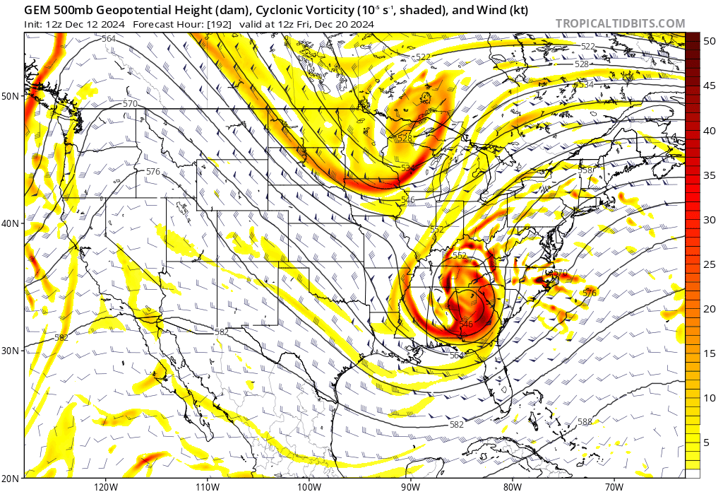
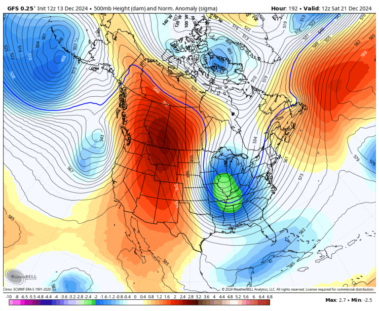
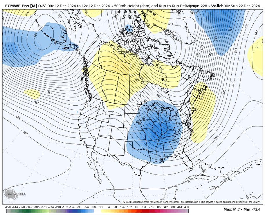
can't really ask for much more from a general synoptic perspective here. 2.5-3 sigma ridge in an ideal spot with a potent vort diving into the Plains. details will get ironed out but it's nice to see the models keying in more on the second wave
-
 LOL i think this thread is held to a bit higher standard when discussing the synoptics
 -
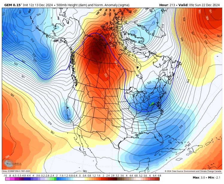
given the taller +PNA spike towards the 21-22, I think the wave on the 19-20 likely gets more and more washed out. the CMC is a good example of that
-
December 2024 - Best look to an early December pattern in many a year!
brooklynwx99 replied to FXWX's topic in New England
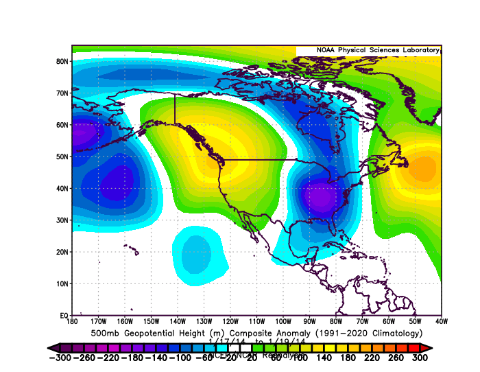
we have had a similar longwave pattern for Jan 2022 and Jan 2014. tall ridge over the Pac NW / NW Rockies, deep trough with TPV interaction into the OH Valley, and a WAR pushing into Nova Scotia. not calling for a MECS or anything but there are similarities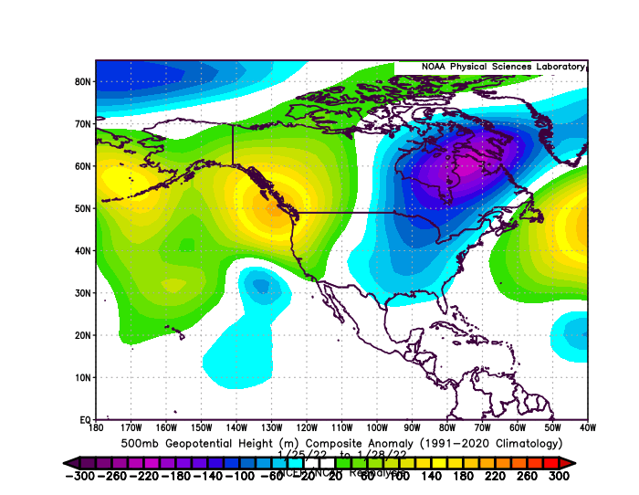
-
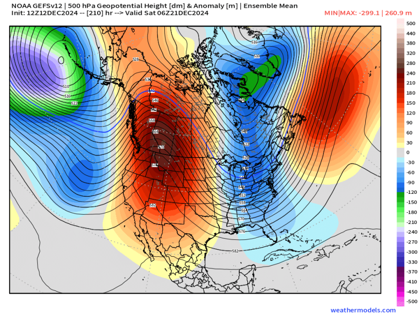
not sure what more someone can ask for at this range. massive PNA ridge in an ideal spot amplifying a TPV lobe / polar vort


-
it’s there, just south of the Mason-Dixon line
-
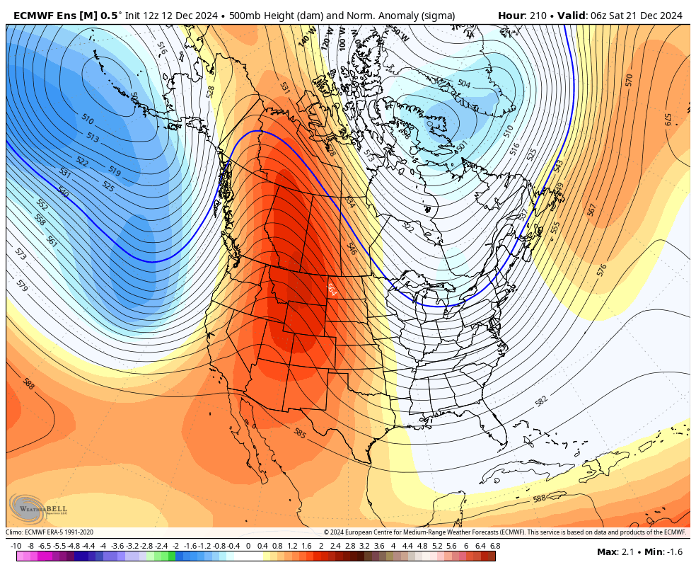
also seeing favorable trends out west for the Christmas timeframe could be a seasonal trend to underdo western ridging

-
pretty major change

-
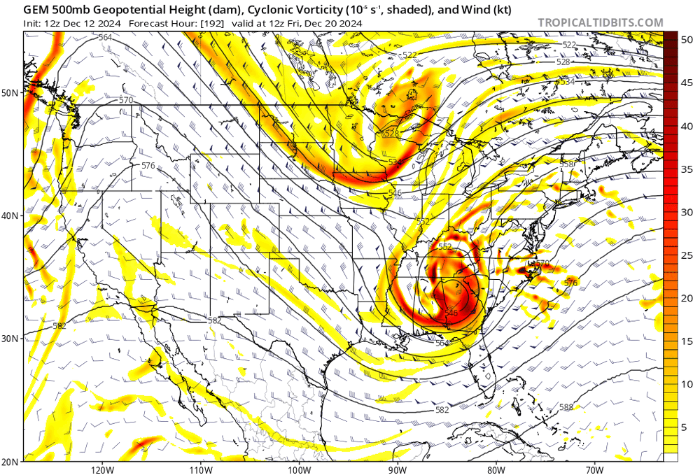
i could see a weaker vort that drags the baroclinic zone south and brings in a better airmass before a larger system on the 21-22. not sure if that would be considered two storms, per se
-
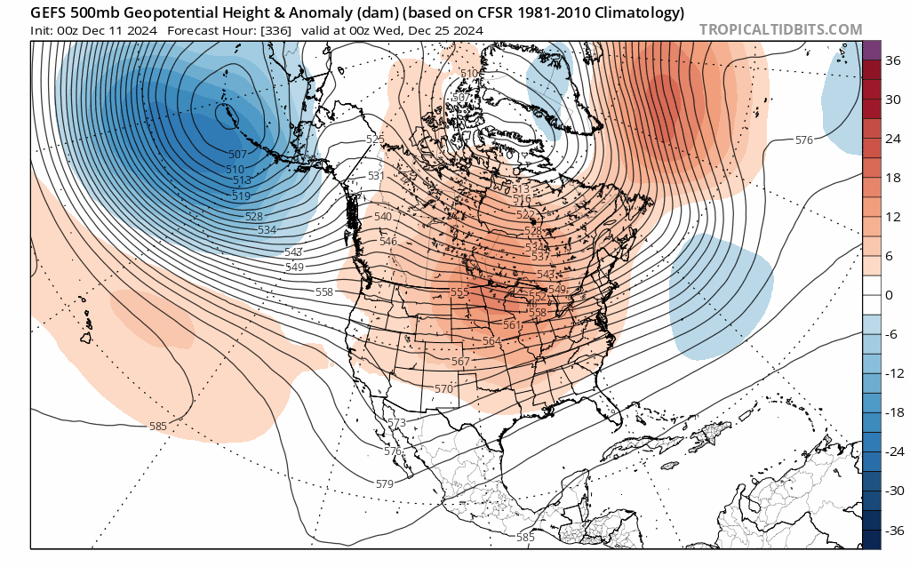
near ideal ridge axis for a coastal storm. right over ID/MT into western Canada

-
near ideal ridge axis for a coastal storm. right over ID/MT into western Canada

-
like this is the exact shift you want
-
EPS also has a taller PNA and more favorable trough axis for the trailing energy

-
i think the main way to win here is for the first wave to establish a colder airmass and for the second one to buckle into the colder airmass with fresh HP in SE Canada if, of course, there are actually two distinct waves
-
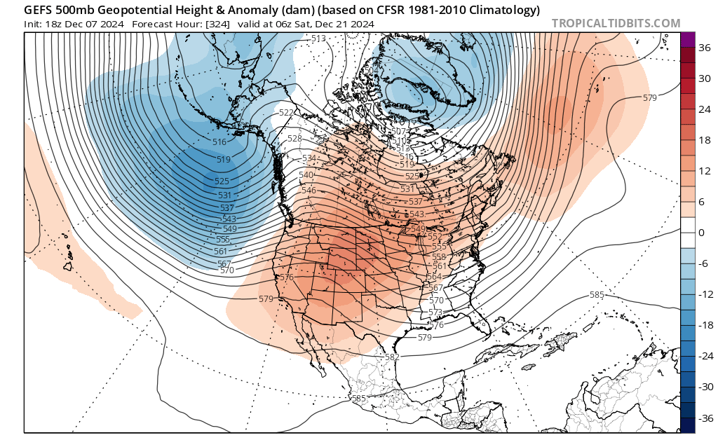
i don't think one could draw up a more ideal +PNA
-
this will do it. that +PNA is bonkers
-
December 2024 - Best look to an early December pattern in many a year!
brooklynwx99 replied to FXWX's topic in New England
good enough. anywhere in that general vicinity usually puts the trough axis in a good spot -
December 2024 - Best look to an early December pattern in many a year!
brooklynwx99 replied to FXWX's topic in New England
LOL i thought you meant the ridge. i was like "really? it's in a perfect spot" -
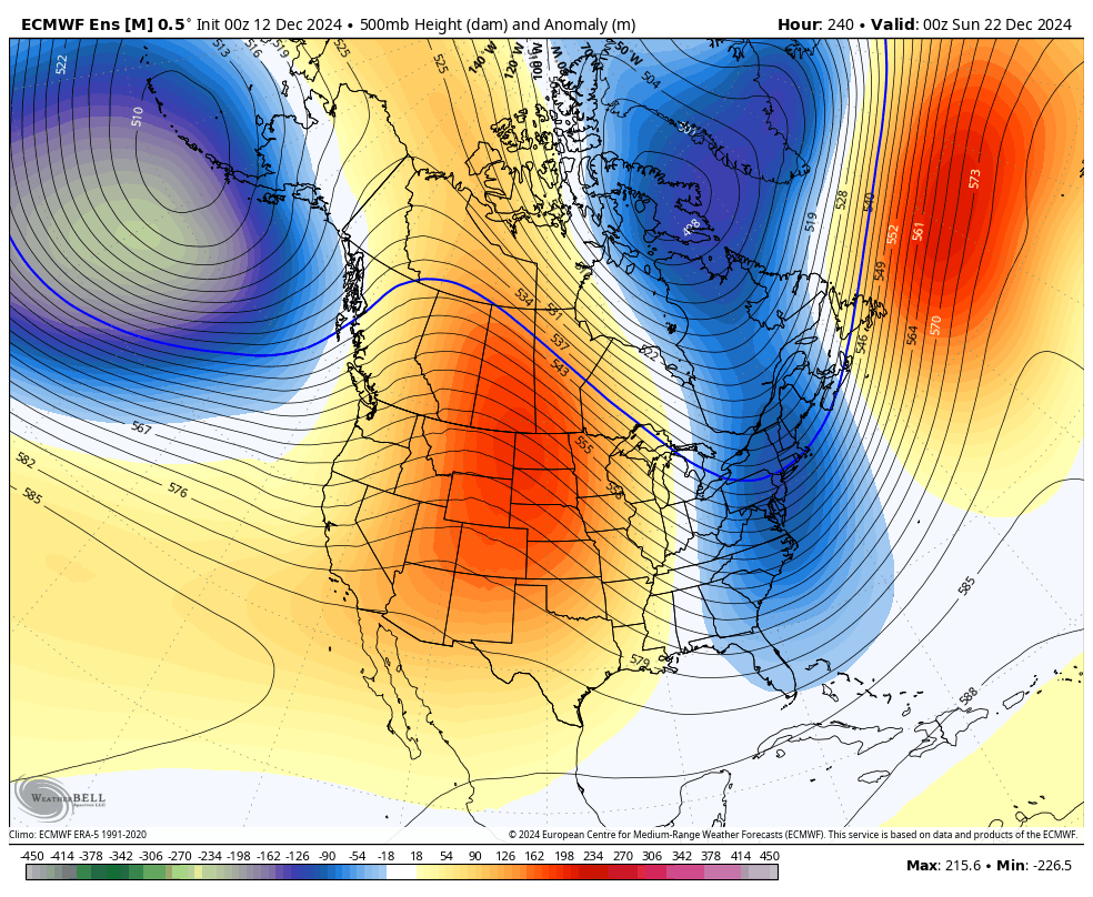
EPS and GEFS both show another +PNA ridge spike around Christmas. could be another risk for a storm, would have a much better airmass as well
-
EPS and GEFS both show another +PNA ridge spike around Christmas. could be another risk for a storm, would have a much better airmass as well
-
December 2024 - Best look to an early December pattern in many a year!
brooklynwx99 replied to FXWX's topic in New England
EPS and GEFS both show another +PNA ridge spike around Christmas. could be another risk for a storm, would have a much better airmass as well -
front end thump
-
i wouldn’t have posted it, but verbatim it’s 6” for NYC
-
notice how the Pacific trough has been trending more equatorward with more AK ridging
-
you often need a strong Pacific trough to get a tall ridge like that. can't have one without the other the trough will knock the ridge down after it builds... there's always some needle threading with these kinds of setups