brooklynwx99
-
Posts
5,630 -
Joined
-
Last visited
Content Type
Profiles
Blogs
Forums
American Weather
Media Demo
Store
Gallery
Everything posted by brooklynwx99
-
 ECMWF is closer to an actual coastal than 00z, just too sloppy
 -
I don't see that at all... there's strong HP over the top as the coastal takes shape. this looks like snow or bust with the evolution on the 12z GFS / CMC
-
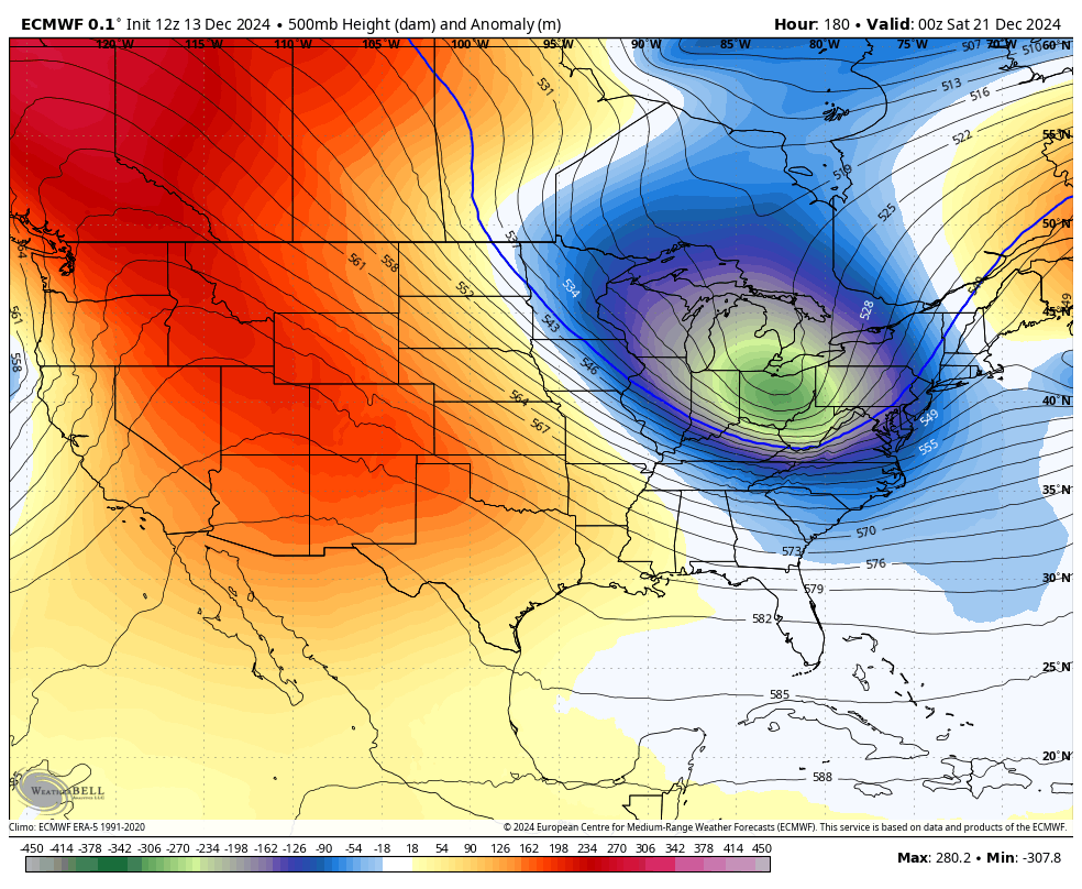
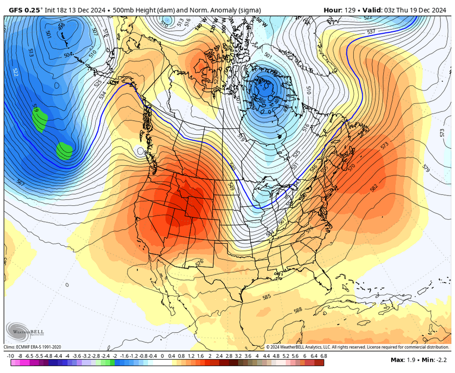
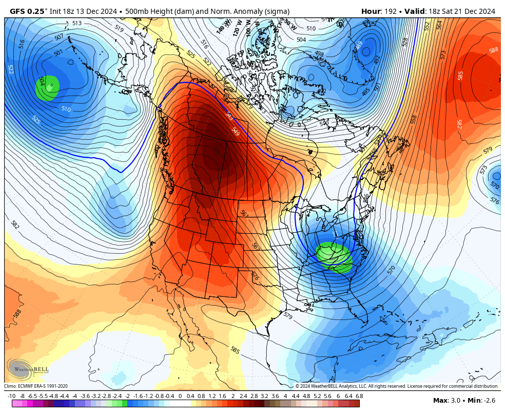
PNA is so much more meridional over southern Canada... even though it's just as strong, per se, it's functionally improved

-
what an improvement here

-
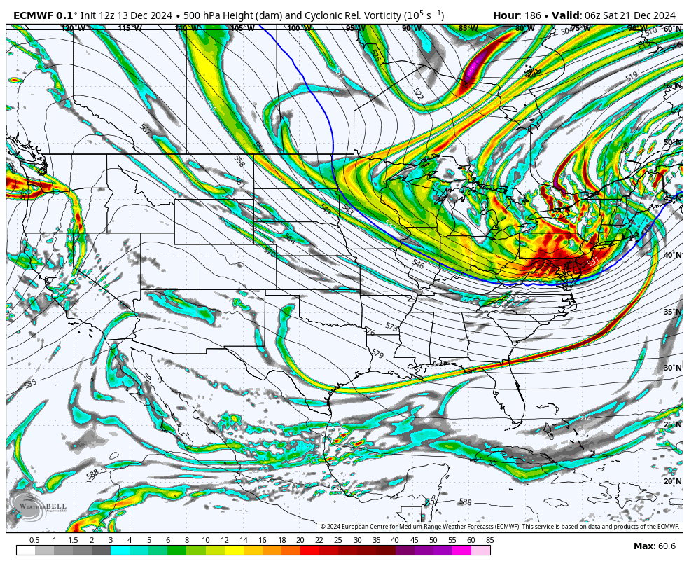
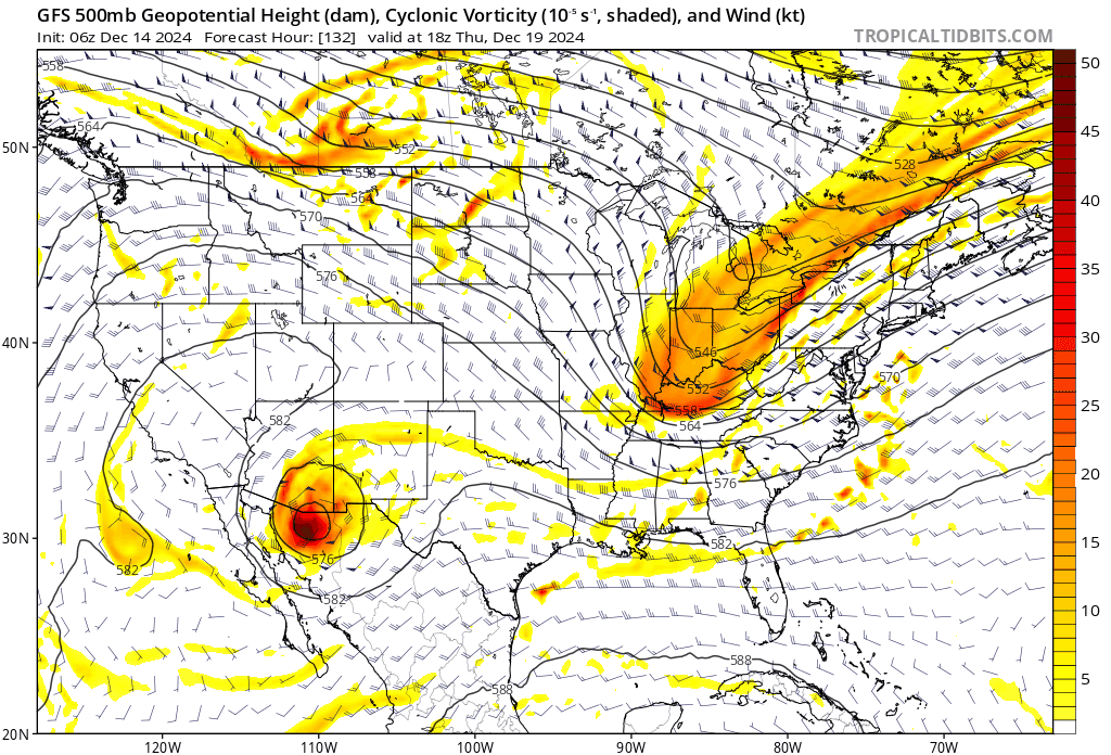
much stronger second vort on the GFS/CMC. much easier to amplify a system into cold air rather than hope for a cutter in a shit airmass to weaken. that never happens lmao also an easier way to get a storm compared to the 12/18z GFS yesterday where the entire TPV buckled
-
much stronger second vort on the GFS/CMC. much easier to amplify a system into cold air rather than hope for a cutter in a shit airmass to weaken. that never happens lmao also an easier way to get a storm compared to the 12/18z GFS yesterday where the entire TPV buckled
-
i'd also much rather want amplification of a strong vort into a cold airmass rather than praying for a system to trend weaker in a marginal one. the former happens all the time while the latter is quite rare. we've dealt with the latter a lot over the last couple of years lmao
-
like lol this is SO much better

-
like that is a wholesale change. much easier to get a ripping S/W south of you instead of depending on some massive TPV buckle like 12/18z yesterday
-
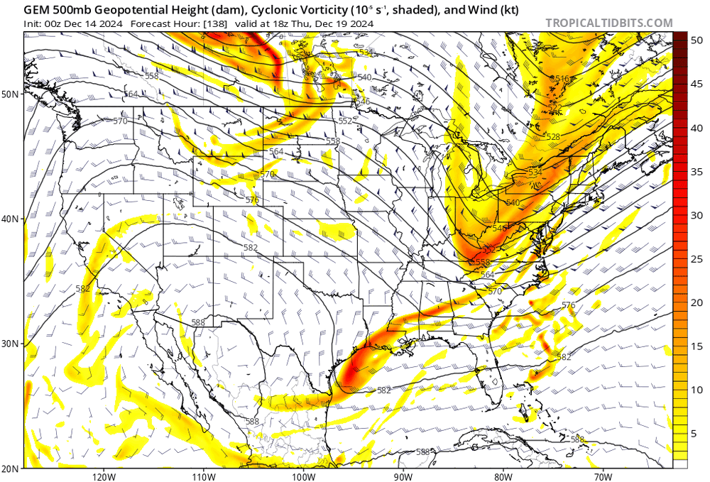
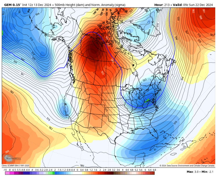
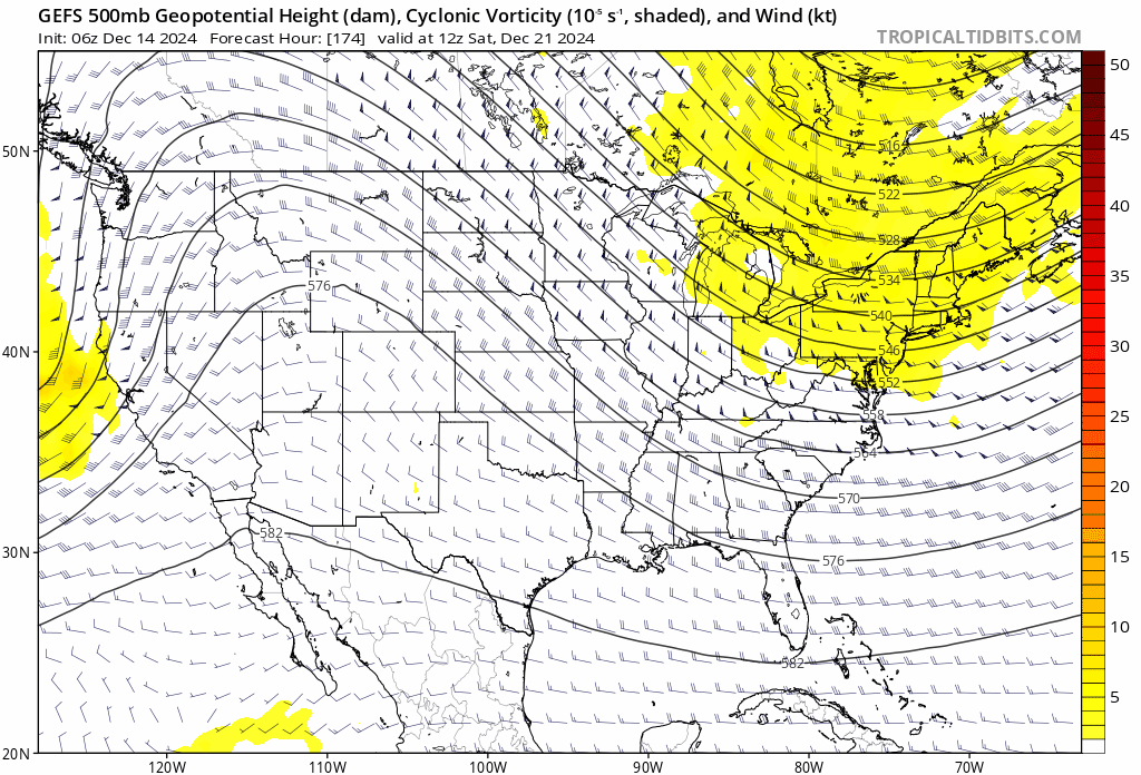
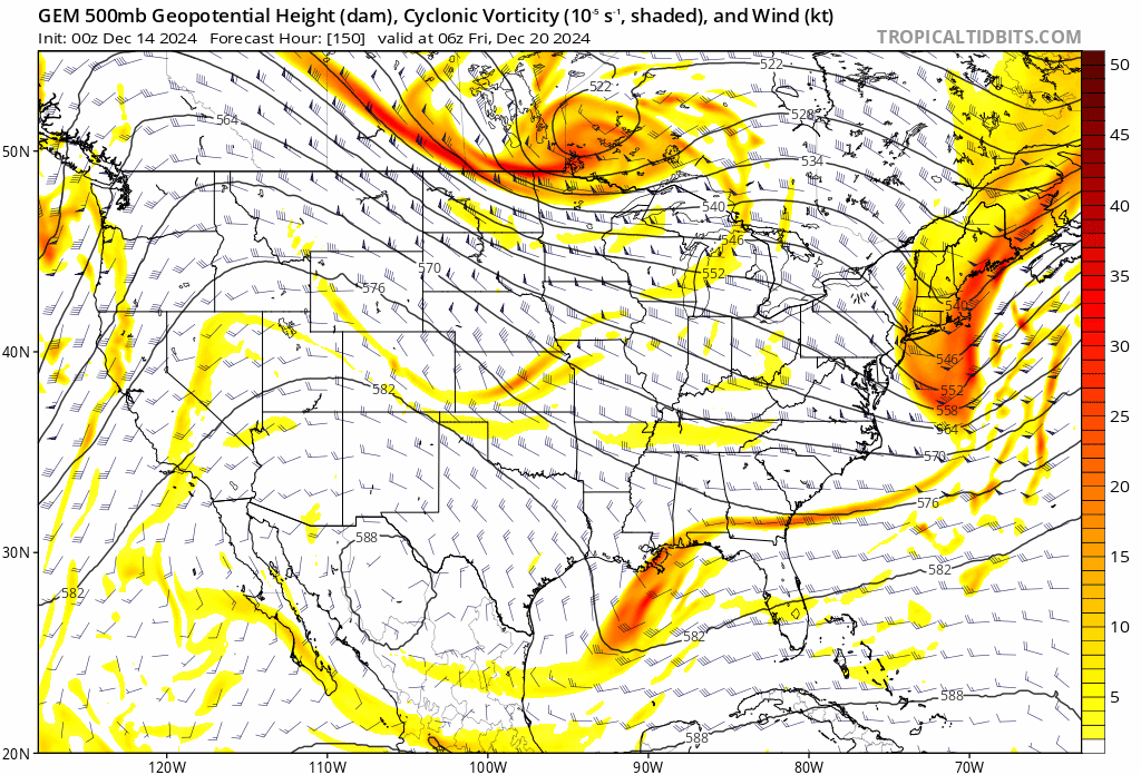
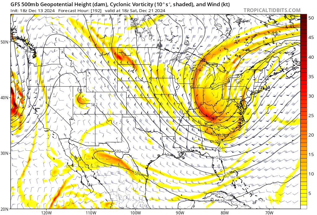
GFS and CMC both really amped up the second vort
-
yeah, the ridge amplitude lessening is kinda making this more difficult. we’ll see if it corrects back or if it’s more of a definite trend downwards today
-
GFS had the same idea, didn't buckle in time. it's a day 8 OP run
-
also the more significant +PNA occurs on the 20-21st which encourages a larger wave anyway. you're talking about another standard deviation

-
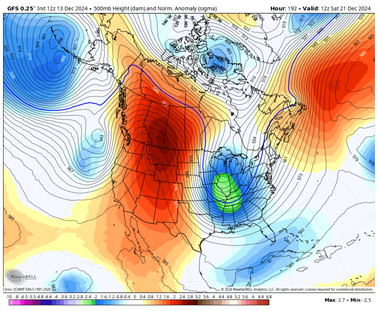
since it's weaker this run, heights in SE Canada remain much lower, which allows the second wave to amplify into a colder airmass. it's a MECS verbatim
-
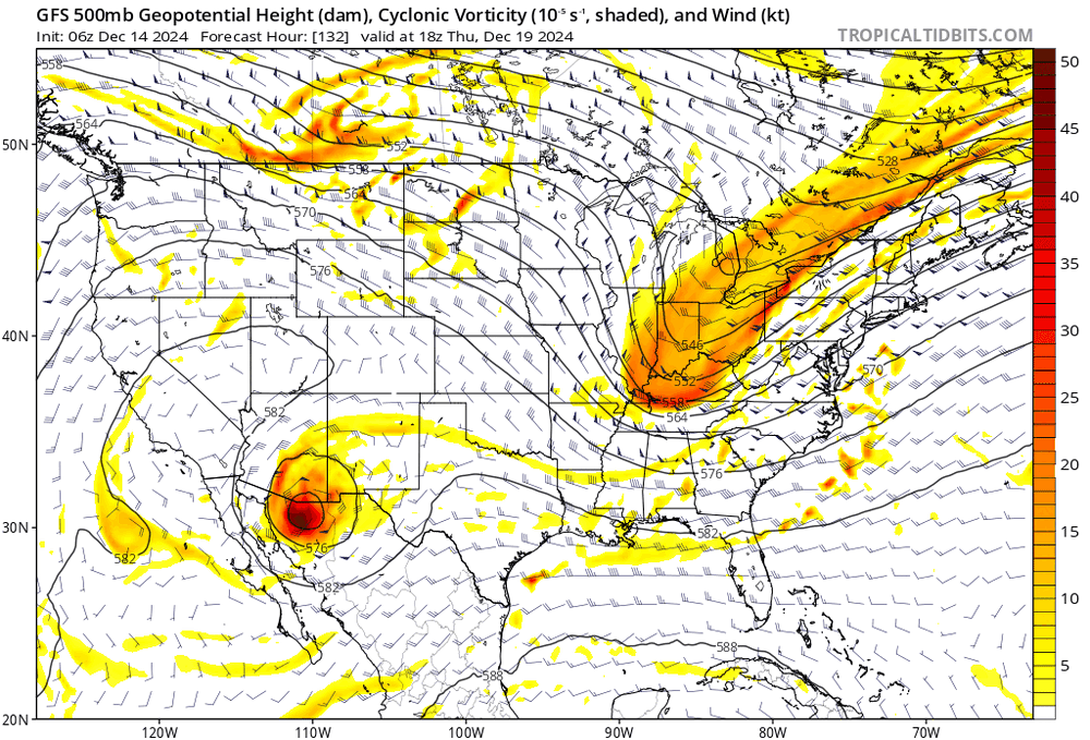
first wave continues to crap out on the GFS. should lead to better spacing this run
.thumb.gif.9366a719349f542675814ed96c9cb6e9.gif)
-
part of the reason why this subforum has gotten so quiet IMO
-
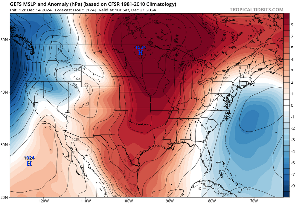
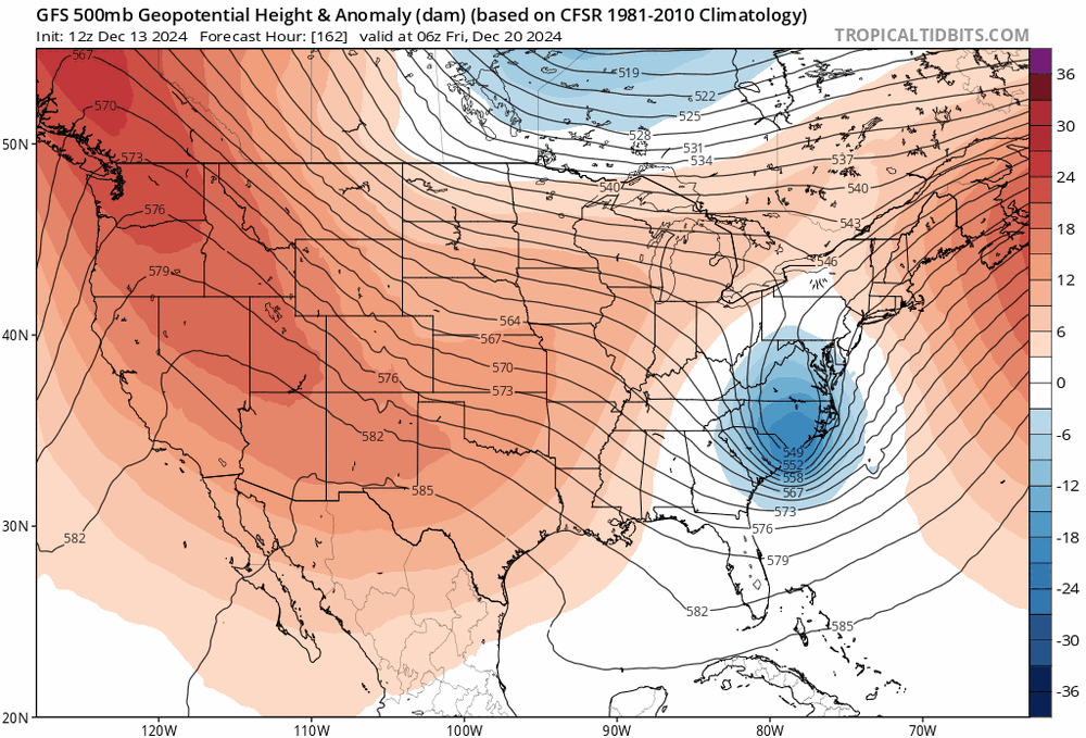
very strong ridging will encourage some kind of low pressure (potentially strong) somewhere over the E US. not sure how the first wave will impact the second as the ridge in the west builds, but models are beginning to key in one the second one more and weaken the first a bit. the pattern is favorable for some kind of coastal. the jury is out on how and where a storm forms (if one even does)
-
i'm prepared for this exact outcome lmao but we'll see how it pans out
-
yeah the wave spacing on the ECMWF ruins it verbatim. seems like models today are keying in more on the second wave rather than the first so we'll see if it continues
-
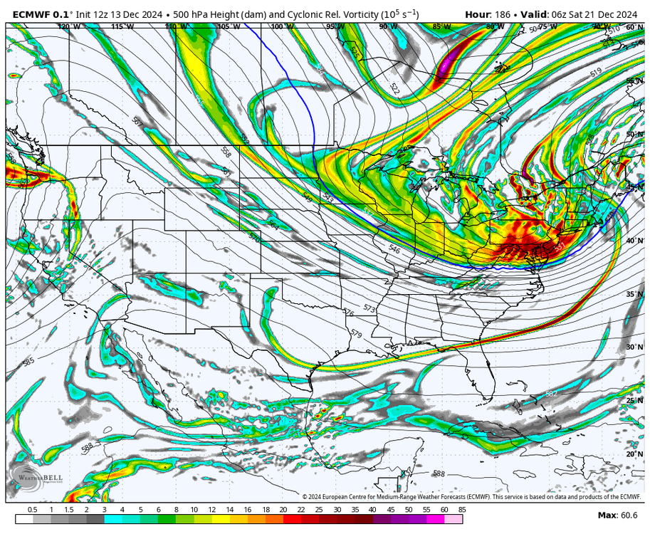
ECMWF has a more progressive first wave and a hellacious vort pass for the second wave. more similar to the CMC than GFS
-
December 2024 - Best look to an early December pattern in many a year!
brooklynwx99 replied to FXWX's topic in New England
verbatim it's a version of late Feb 2010 that even fucks over NYC (sorry) -
December 2024 - Best look to an early December pattern in many a year!
brooklynwx99 replied to FXWX's topic in New England
that is true, I generally agree... it has been done before, though. i would kinda argue that you want a bit of a WAR. things can become suppressed if you have a massive PNA ridge alongside a large 50/50, especially up by you guys. that's often how you get the NYC-DC specials -
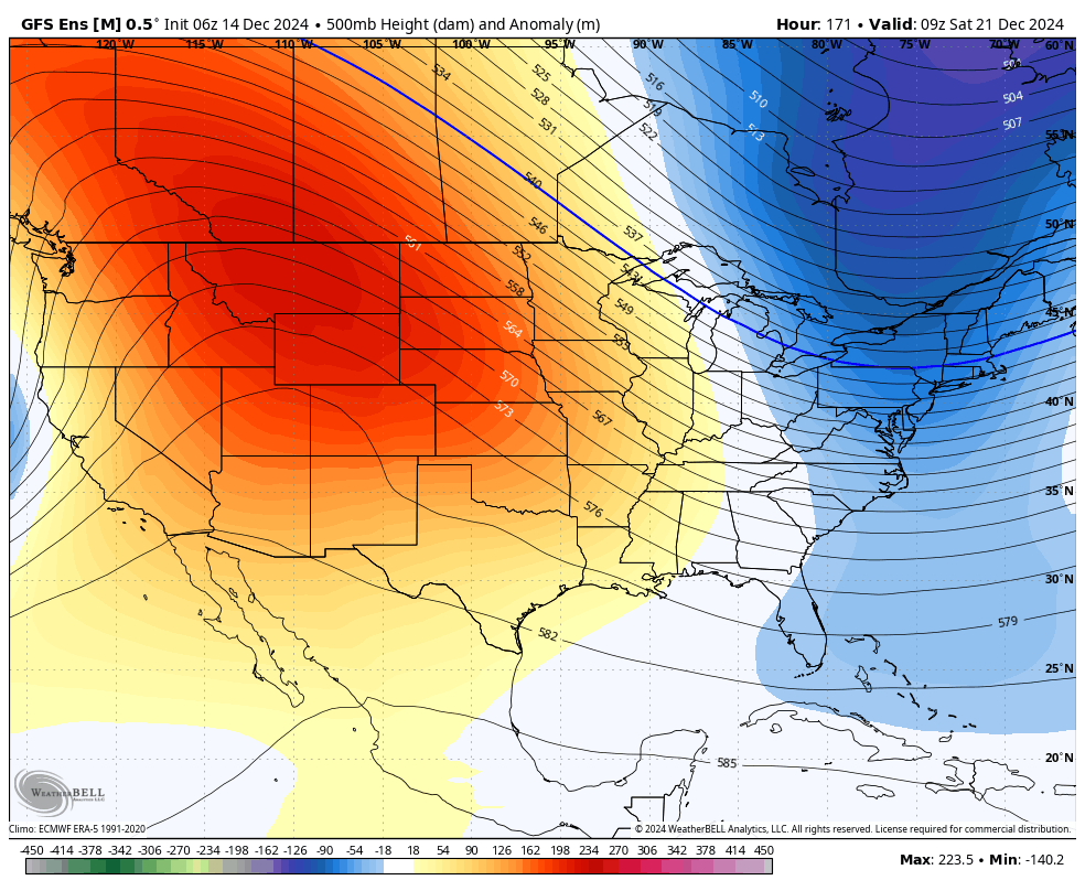
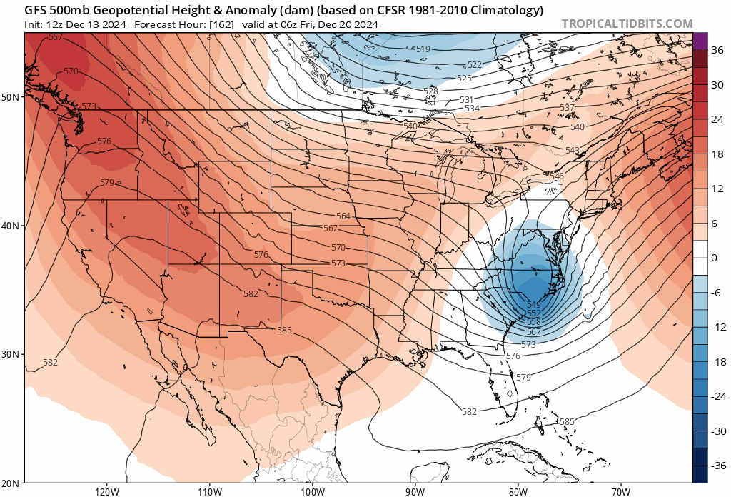
can't really ask for much more from a general synoptic perspective here. 2.5-3 sigma ridge in an ideal spot with a potent vort diving into the Plains. details will get ironed out but it's nice to see the models keying in more on the second wave


.gif.ebf4824ece8ee346c05e98e412823311.gif)