brooklynwx99
-
Posts
5,630 -
Joined
-
Last visited
Content Type
Profiles
Blogs
Forums
American Weather
Media Demo
Store
Gallery
Everything posted by brooklynwx99
-
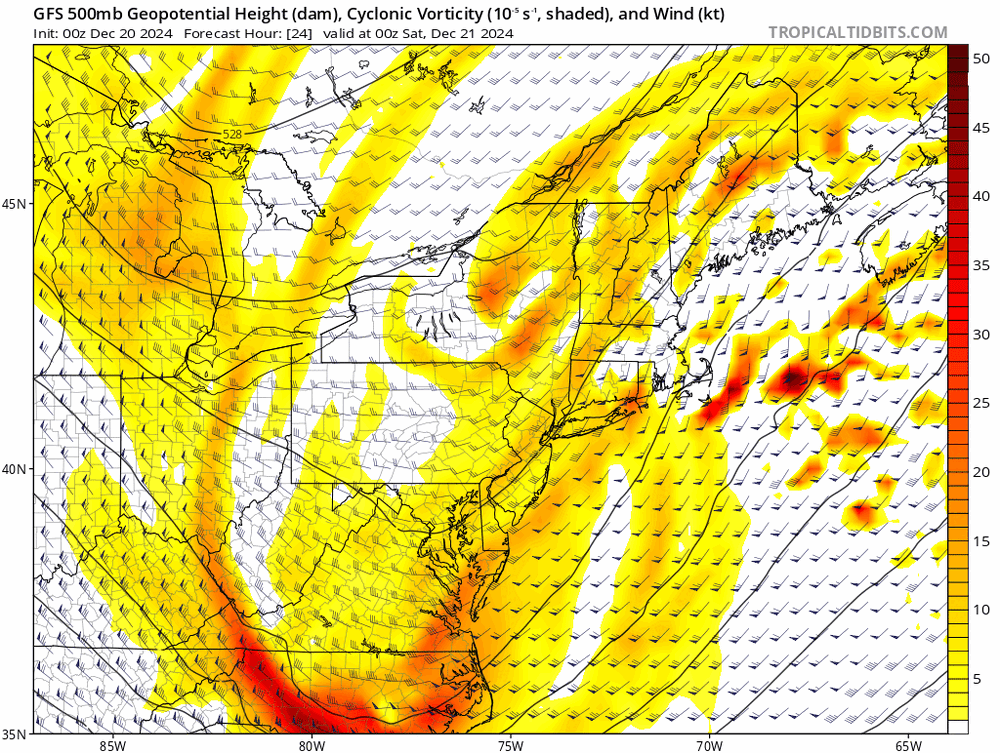
ok, so the progression on every single ensemble is going to be wrong? is that what you're saying? also, there's a trough in the east for two weeks on the extended GEFS and three weeks on the Weeklies. that is what the extended products are showing. it's not transient
-
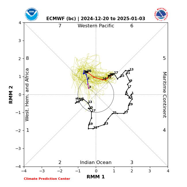
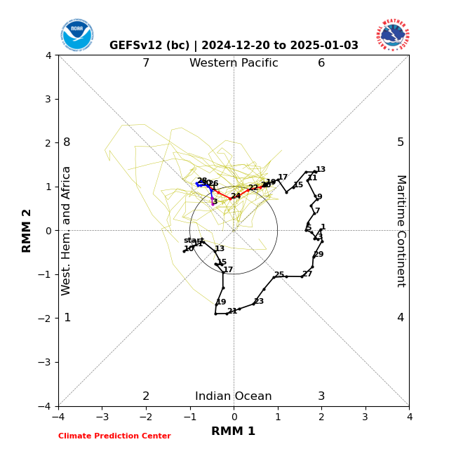
the MJO is quite weak... seems like other intraseasonal factors are going to have more of an impact. also, I wouldn't consider a mean trough in the east for 2-3 weeks transient. extended guidance could easily be overdoing the impact of ENSO. it did the same thing last year
-
that screenshot of the pattern is misleading. a static image won't paint an accurate picture of what's actually occurring
-
that trough is transient, though. it's normal for there to be a transient trough in the west when the EPO drops... the pattern is in the process of transitioning there
-
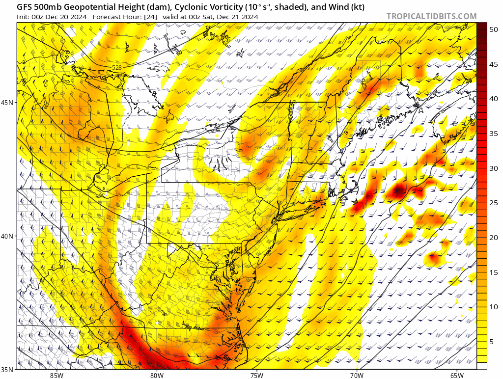
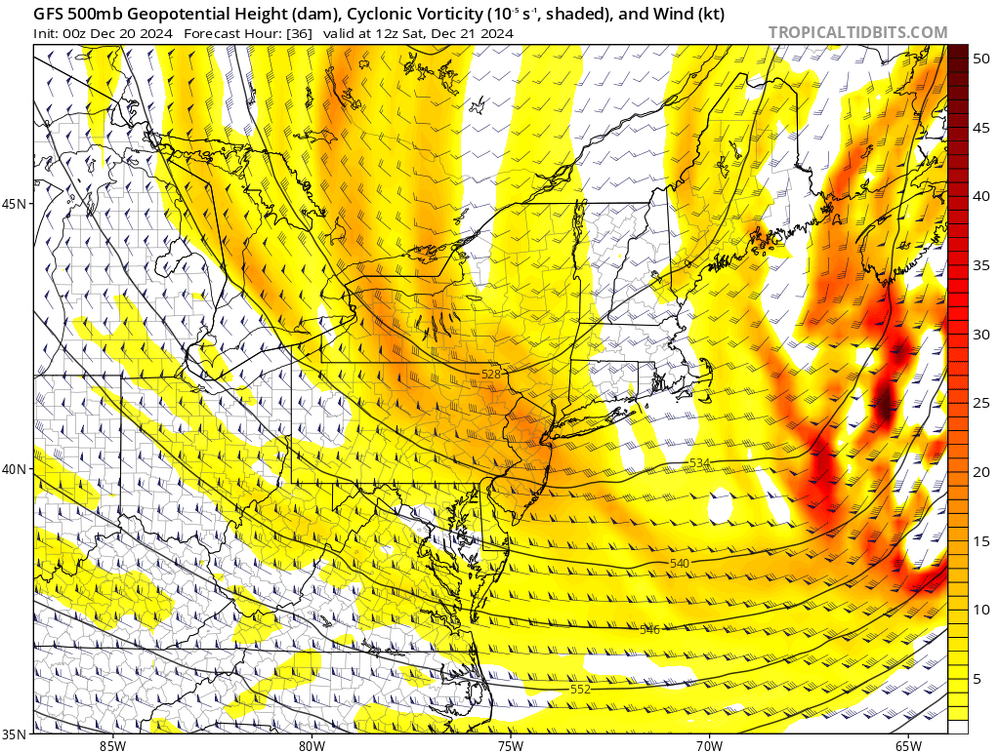
 the GFS showing the solution it does is a big deal
 -
it's funny, I know you've been mentioning this, but the GFS presentation is what one would "expect" given the synoptics. just odd that we would have had to wait this long for it
-
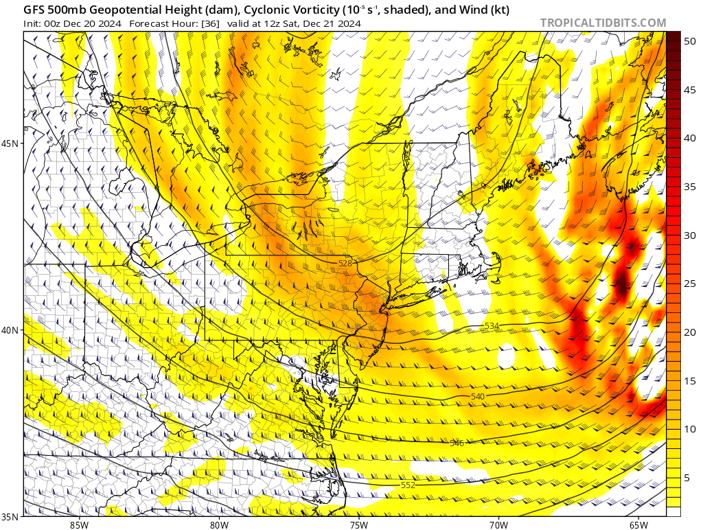
yeah, this is definitely more of a signal than whatever the NAM is showing. PVA is more NW
.thumb.gif.1c49345226c25dc764aa45cf58151817.gif)
-
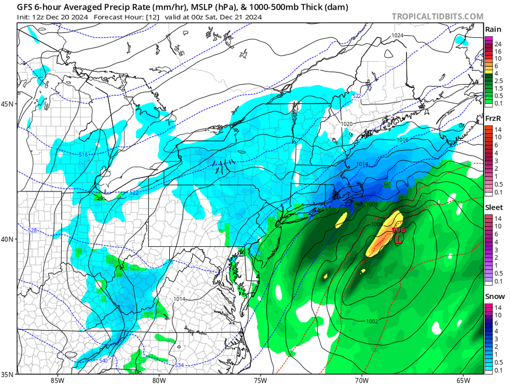
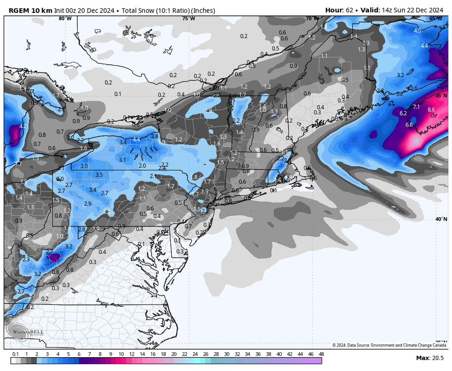
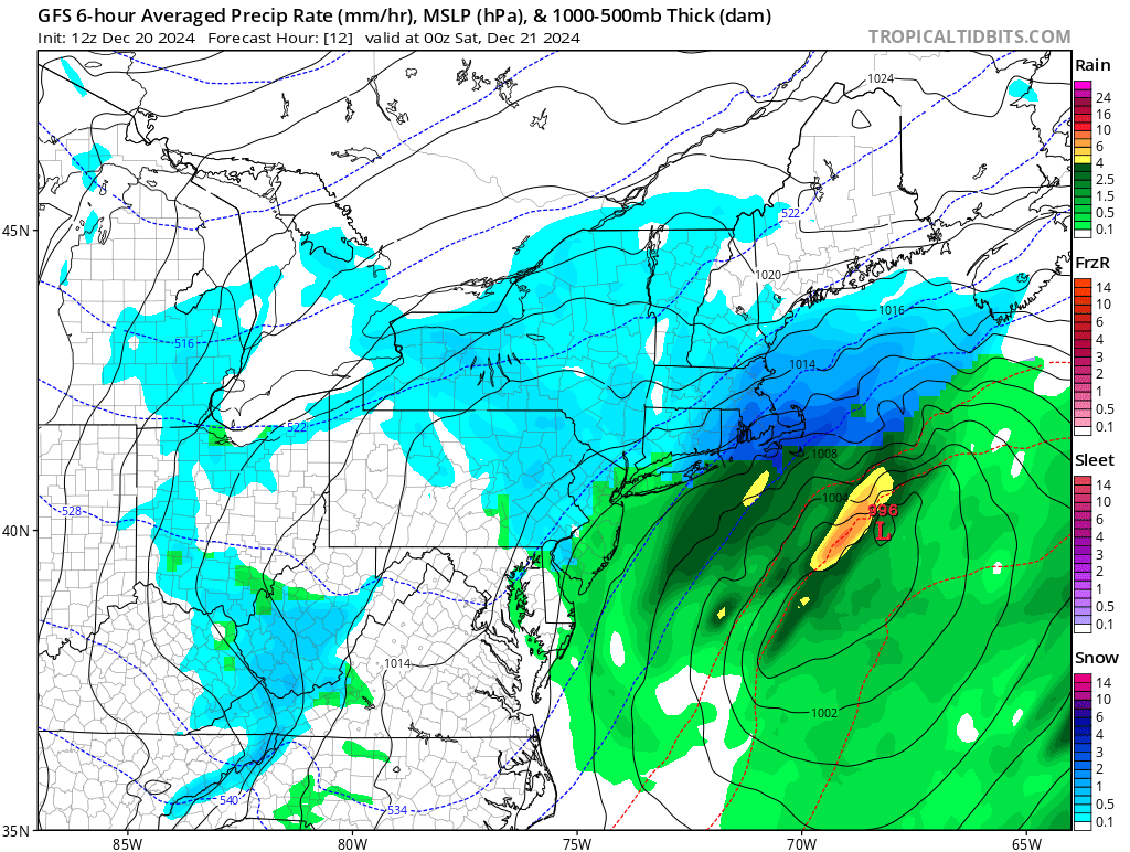
it probably does. not certainly but I wouldn't expect advisory snow into NYC from the coastal. regardless, late tonight into tomorrow morning looks good for NYC's first measurable snow
-
the RGEM and HRRR are also mesoscale short term models and are nowhere near it
-
I have a hard time believing the NAM given that it has absolutely no support, but crazier things have happened. the RGEM/HRRR seem much more realistic
-
I still think RI, E MA and SE MA are likely in for a solid advisory snow… the NAM where advisory snow gets into NYC with warning snow into E CT? bit rich
-
yeah the HRRR not biting gives me pause again. if the RGEM makes a big move its full steam ahead IMO
-
GEFS cooking with oil now too

-
yeah the GFS moving NW makes me pretty confident for advisory snows in RI into E / SE MA
-
NYC likely sees its first measurable snow as the trailing vort pivots through… looking like light snow with temps cold enough. general C-1” type stuff
-
RGEM looks pretty realistic. main WAA push with the vort into the HV/far W CT, C CT kinda gets skunked, then the coastal front enhances precipitation as the coastal gets going into RI/E MA. BL issues neuter accumulations down to PYM/Cape
-
could the NAM be right? sure, but it’s been super erratic and you would think that global models would support it more. if the RGEM craps on it, it would be a big red flag. if it makes a big move, i’ll be more intrigued
-
i’m gonna toss the NAM until it has support from a single reliable model. the LR RAP doesn’t count lmao if the RGEM moves NW i’ll be intrigued
-
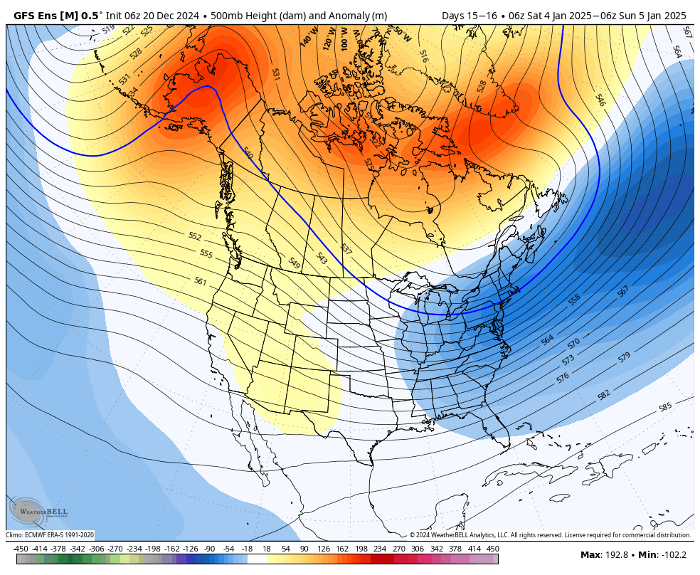
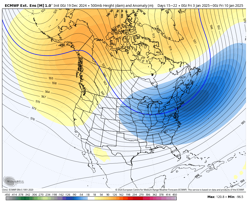
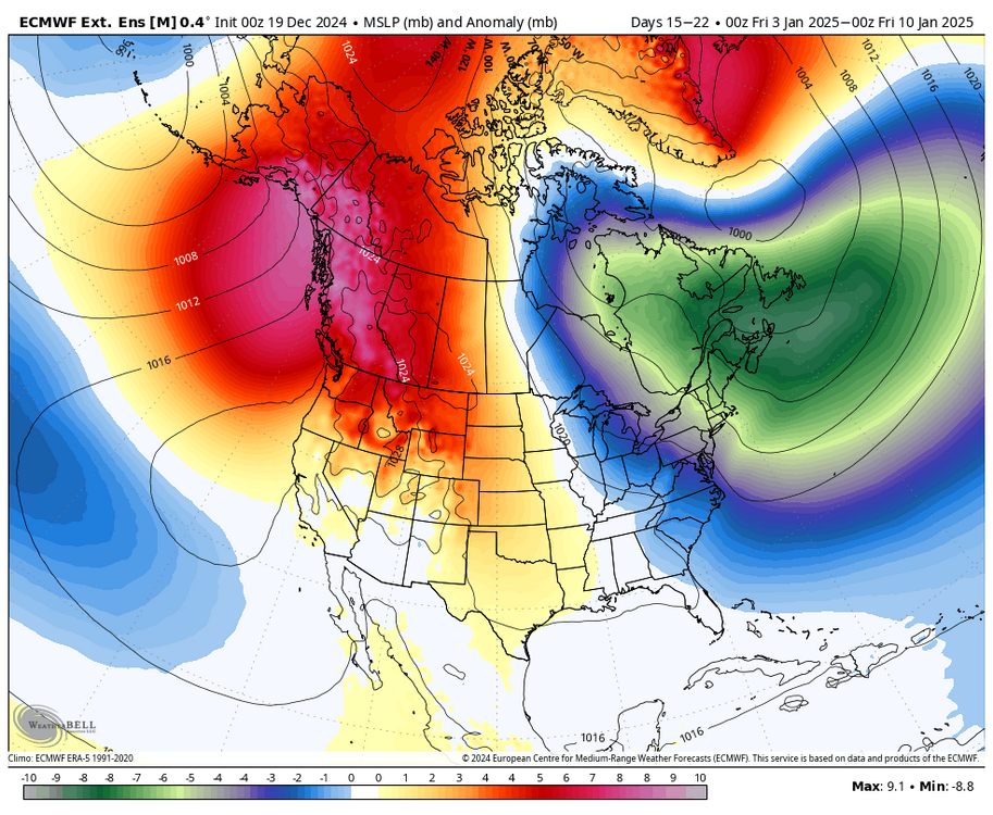
I think the overall pattern here is a lot safer since the Pacific looks locked into moving favorably... last year was pretty much fully dependent on the Atlantic, and the Atlantic itself was contingent on a cutter leading to massive wave breaking. very precarious
-
also, that look is 2-3 weeks out, not 5-6 weeks out like last year. it's continuing the progression on the ensembles, so it's not like it's showing that for no reason
-
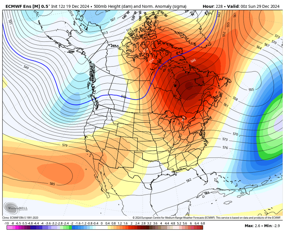
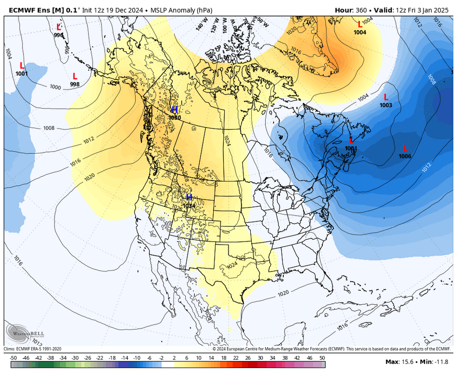
i mean, the -EPO developing during the first week of Jan is a near certainty, we are going to have that feature barring a complete mishandling of the Pacific. the potential -NAO just ups the ante, and there is increasing confidence that one is going to form. it's showing up on all ensembles around day 10 I want to wait another 5-7 days to see if it sticks around, but it's promising. I'm not going to let last year's debacle influence my thinking all that much
-
considering the blocking doesn’t rely on a cutter and the Pacific seems a lot more favorable, this seems a bit more solid i’d like to give this another week though
-
lol this is ridiculous too. 50/50 signal at 2-3 weeks out is kinda wild. this is the kind of stuff we were looking for last year

-
no, it's actually forming at the end of Dec. this is also a block. it just advects northward and retrogrades. kind of a weird evolution but still a valid one note the LP dipole in the Atlantic. it's jamming stuff up downstream, so it's not one of those bootleg positive anomalies that does nothing to slow the flow down
-
even a 50/50 signal as the block decays

.gif.5829594643223f1e45b5324f585bb201.gif)