brooklynwx99
-
Posts
5,630 -
Joined
-
Last visited
Content Type
Profiles
Blogs
Forums
American Weather
Media Demo
Store
Gallery
Everything posted by brooklynwx99
-

January: Medium/ Long Range: May the Force be with Us....
brooklynwx99 replied to Weather Will's topic in Mid Atlantic
@psuhoffman i know you had mentioned 1996 before… look at this lmao the similarities are uncanny obviously not calling for anything like that, but the N ATL blocking dipole, -EPO and split flow with active STJ is begging for something big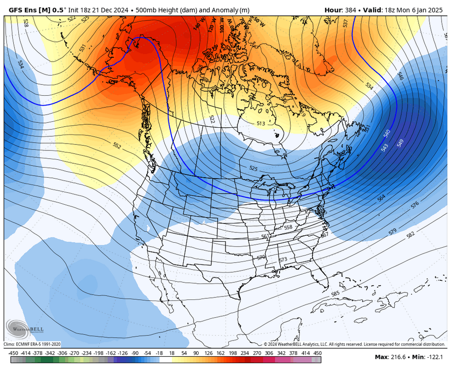
-
December 2024 - Best look to an early December pattern in many a year!
brooklynwx99 replied to FXWX's topic in New England
yeah, I kinda like the 3-6th more... Arctic airmass gets entrenched with a 50/50 ULL sitting nearby, block weakening and an open STJ. fireworks with this kind of look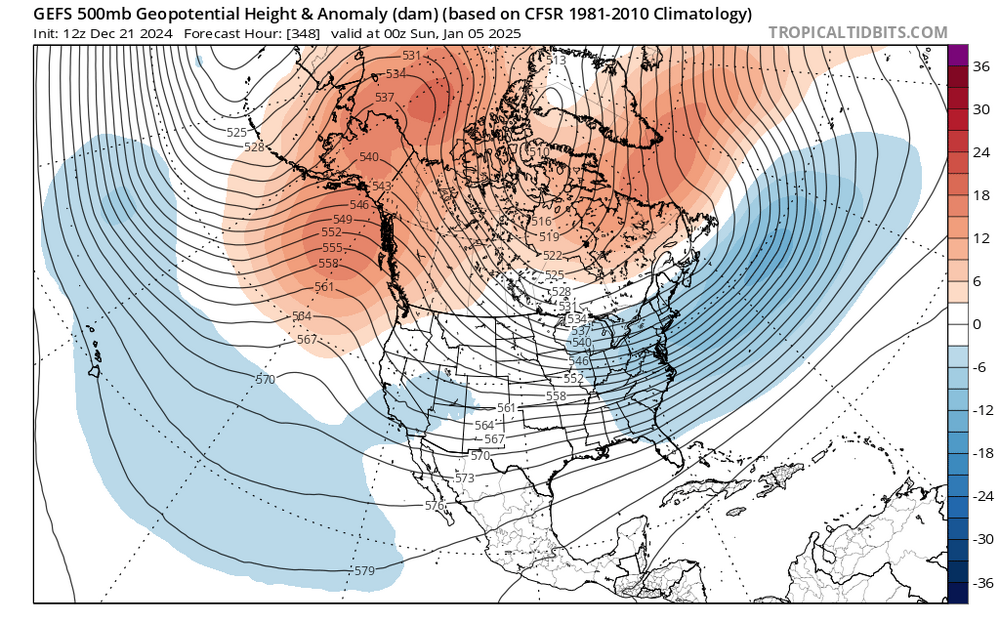
-
yeah this is the timeframe I like for a larger snow event... very cold airmass has been established with a potent -EPO, there's a N ATL dipole with lots of confluence in the 50/50 region, and split flow. the STJ undercutting is something out of the Modoki Nino handbook too
-
December 2024 - Best look to an early December pattern in many a year!
brooklynwx99 replied to FXWX's topic in New England
I'm worried about the airmass for that threat, though. I think there's some kind of wave that moves through afterwards as that one you mentioned establishes a 50/50 ULL that can be a larger snow threat -
January: Medium/ Long Range: May the Force be with Us....
brooklynwx99 replied to Weather Will's topic in Mid Atlantic
EPS is actually trending better, somehow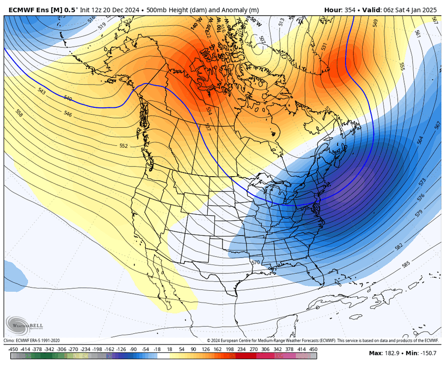
-
January: Medium/ Long Range: May the Force be with Us....
brooklynwx99 replied to Weather Will's topic in Mid Atlantic
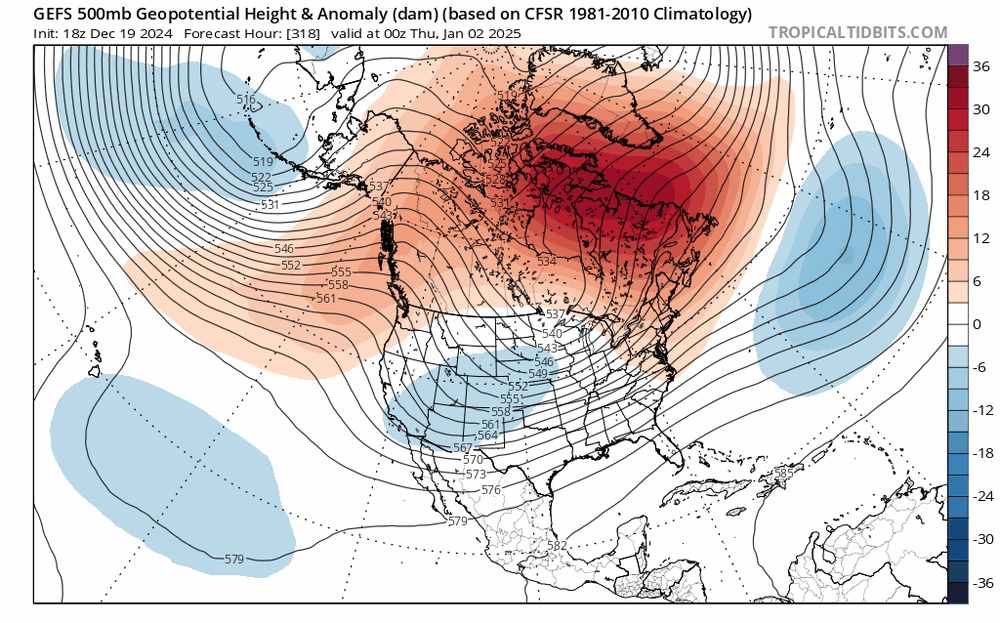
well defined trend on the GEFS to develop the AK ridge sooner and remove the trough from the SW
-
well defined trend on the GEFS to develop the AK ridge sooner and remove the trough from the SW
-
about 3.1” in Morristown! what a nice little event can’t ask for more in late December
-
indeed. it’s been a long time. got about 2” in Morristown
-
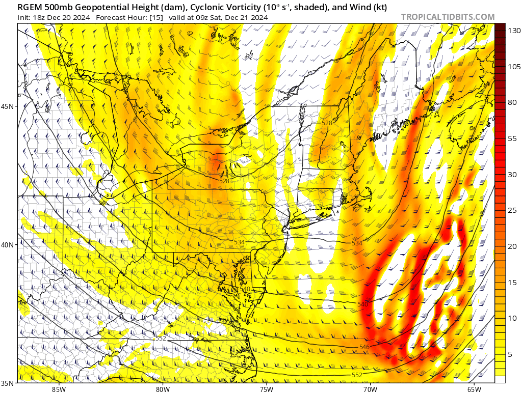
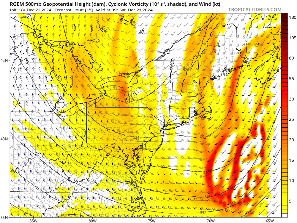
the vort moving through over the next 6-12 hours should spark some decent snow over NNJ. likely some coatings up to 1-2”
-
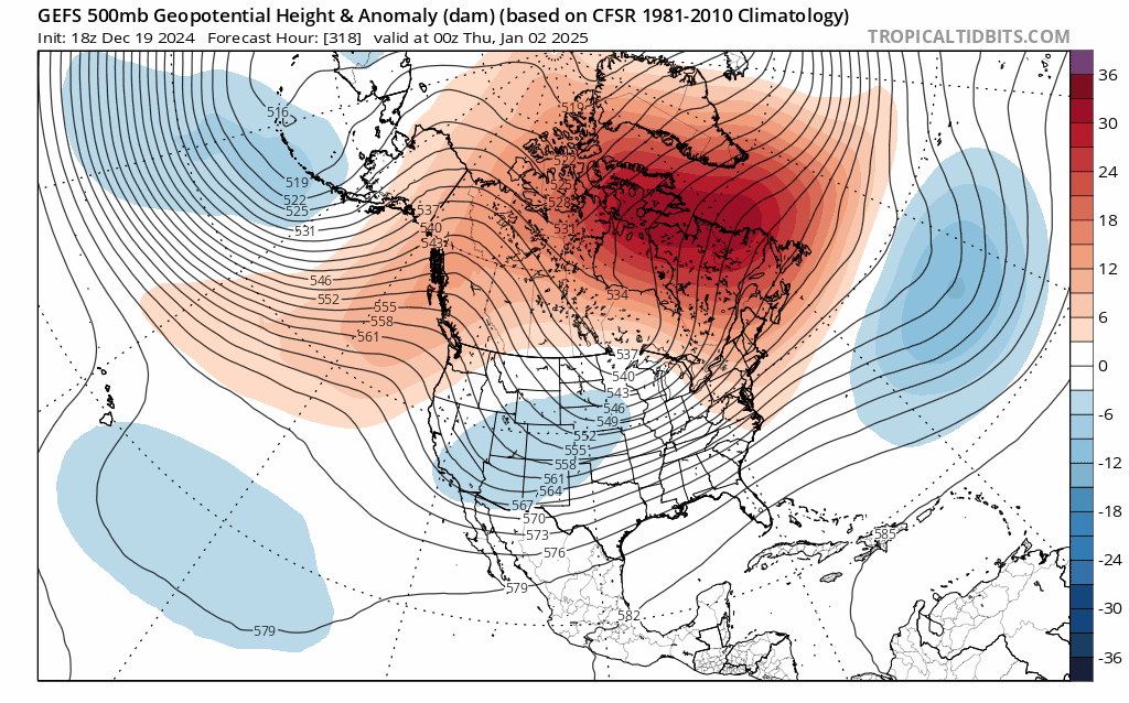
can’t wait for people to say this is cold and dry. this is perfect for amplification into confluence along with a decaying block and an Arctic air mass feeding in IF this is legit, this is the kind of pattern that presents high end potential from DC-BOS. just need to give it another week to see if the block is real… i think the Pacific is going to end up favorable
-
yeah, it’s a very open flow… ripe for amplification. the block is actually doing its job too with the clogged up N ATL
-
fantabulous, actually
-
it can be +15 over N Canada and it would be more than cold enough for us
-
you want them to torch… means it’s a -AO pattern with cold air being displaced
-
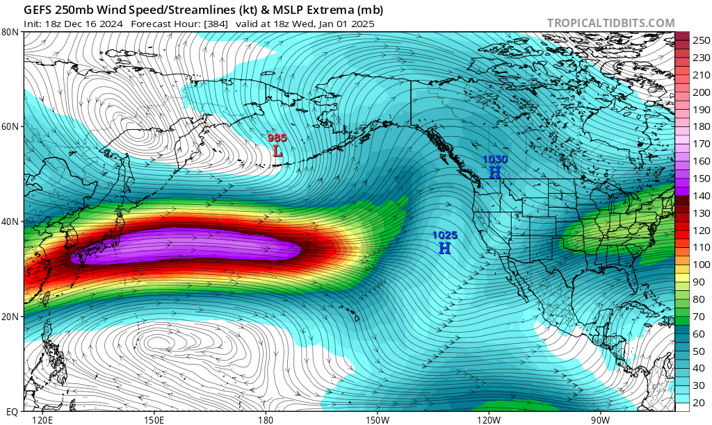
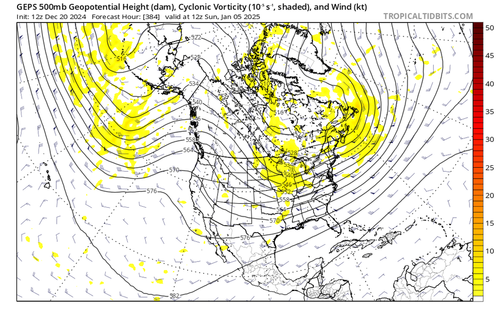
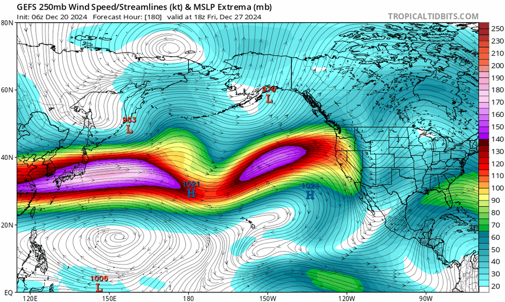
the GEPS sees the vision at 15 days out lmao perfect synoptics
-
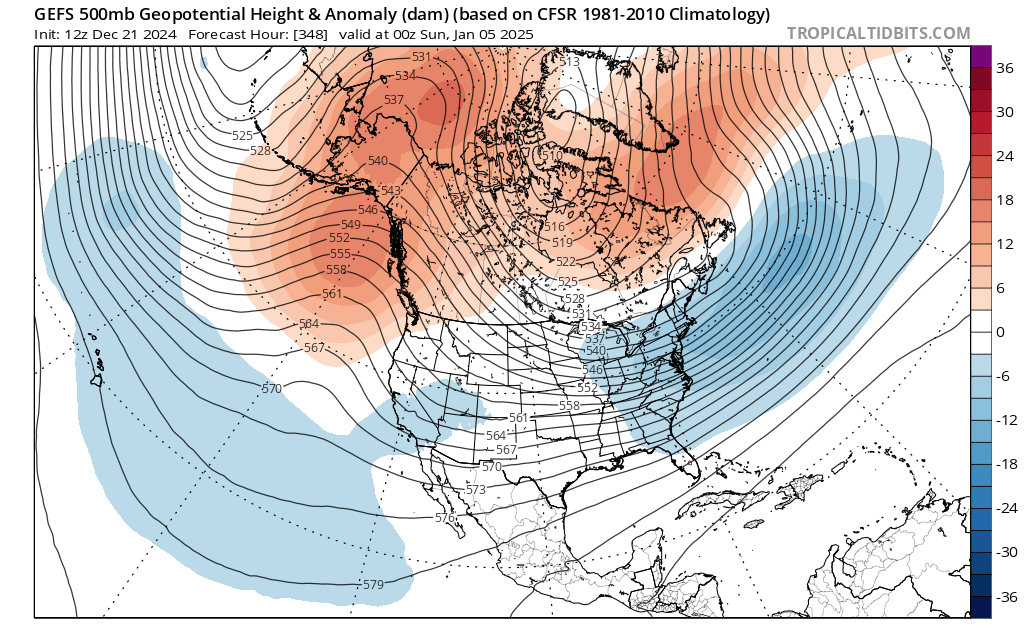
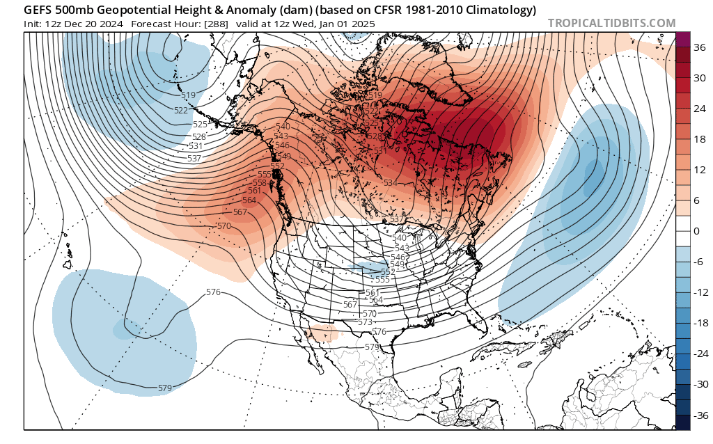
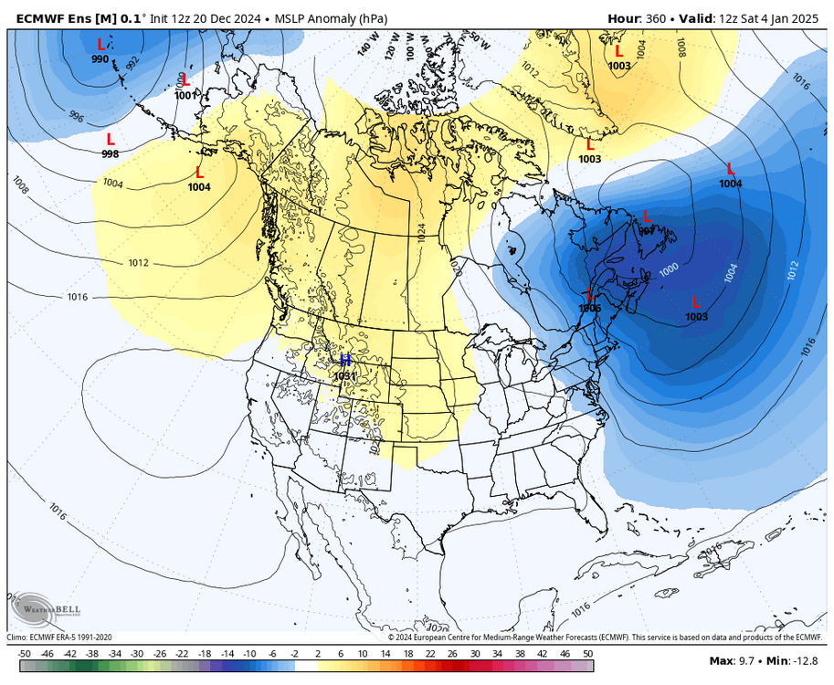
big 50/50 showing up trapped by the -NAO. could have something larger showing up around the 6-10th, but that's a ways out there. lots of the pieces seem to be in place. very high confidence in a -EPO, and confidence in a -NAO is increasing by the day
-
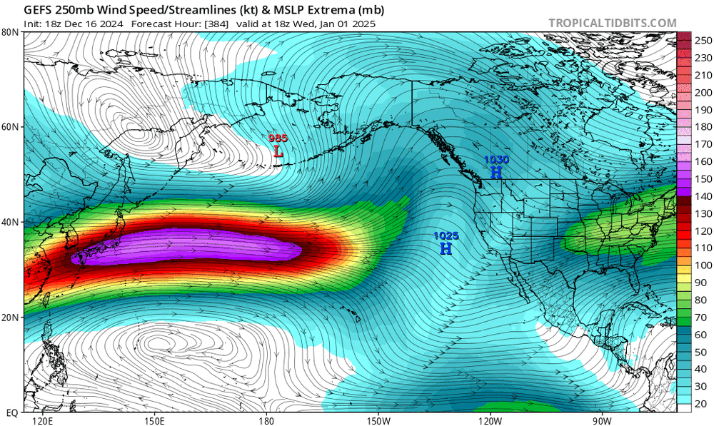
would be hilarious if we got the Modoki pattern during a La Nina. open STJ and everything

-
GEFS is amazing. notice the open STJ too, true split flow

-
they are showing that for like 24-48 hours. do you think that will be an issue after the 3-5th? honest question
-
by the way, the Pacific jet actually trended weaker for early Jan, not stronger. it was significantly stronger a few days ago
-
also, if the Pacific jet is also going to be stronger than forecast for much of the winter, wouldn't that mean that the retraction on the extended guidance for late Jan into Feb is overdone, shifting the prospective Aleutian ridge more into AK and the WC, leading to a colder E US pattern? but nobody is using that logic in that fashion for whatever reason
-
also, just logically speaking, in order for us to go from the overextended jet like we have now to the supposed retracted jet SE ridge pattern in late Jan that some are advertising, there HAS to be a period where the jet is in a favorable position for WC and AK ridging and a mean trough in the east. the jet can't just magically hop from one place to the other
-
but the Pacific jet is going to retract. the pattern isn't going to remain static forever. the jet extension we just saw was well forecast
-
so you think that trough isn't transient on average? just to be clear? and you do not believe the ensembles just a couple of days after that screenshot with a mean trough in the E US?