brooklynwx99
-
Posts
5,630 -
Joined
-
Last visited
Content Type
Profiles
Blogs
Forums
American Weather
Media Demo
Store
Gallery
Everything posted by brooklynwx99
-
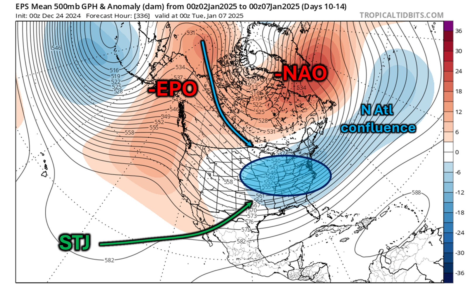
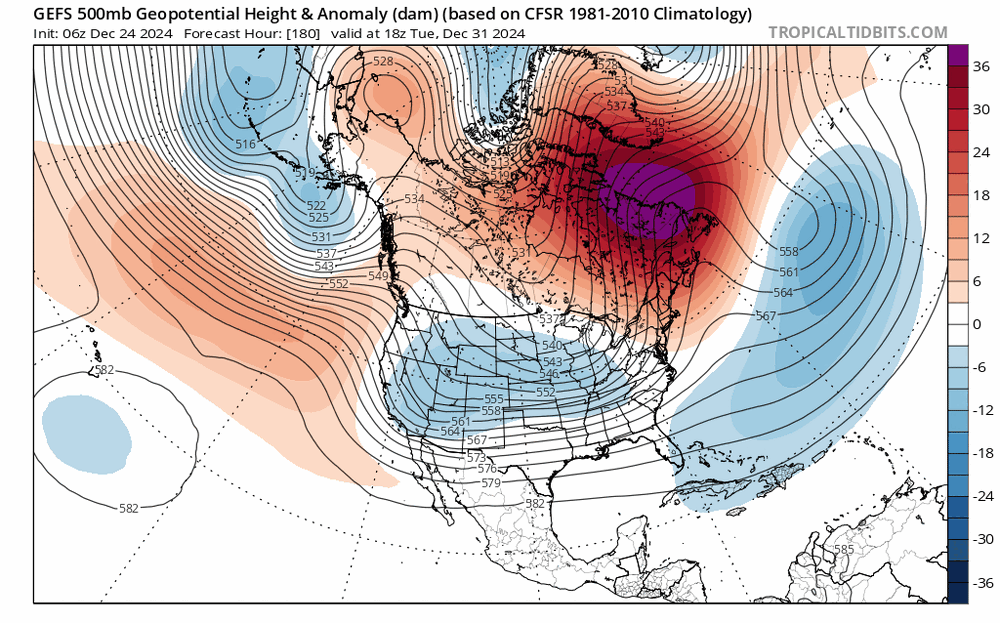
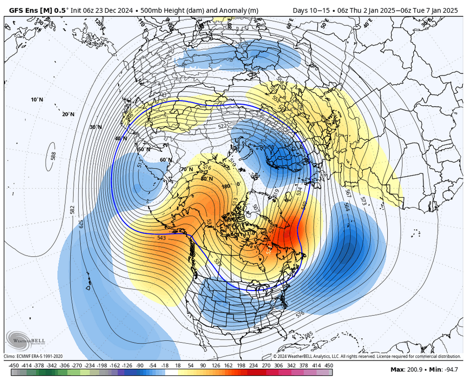
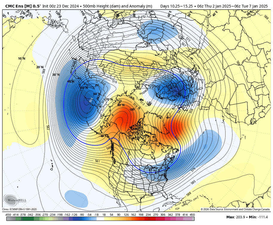
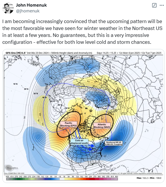
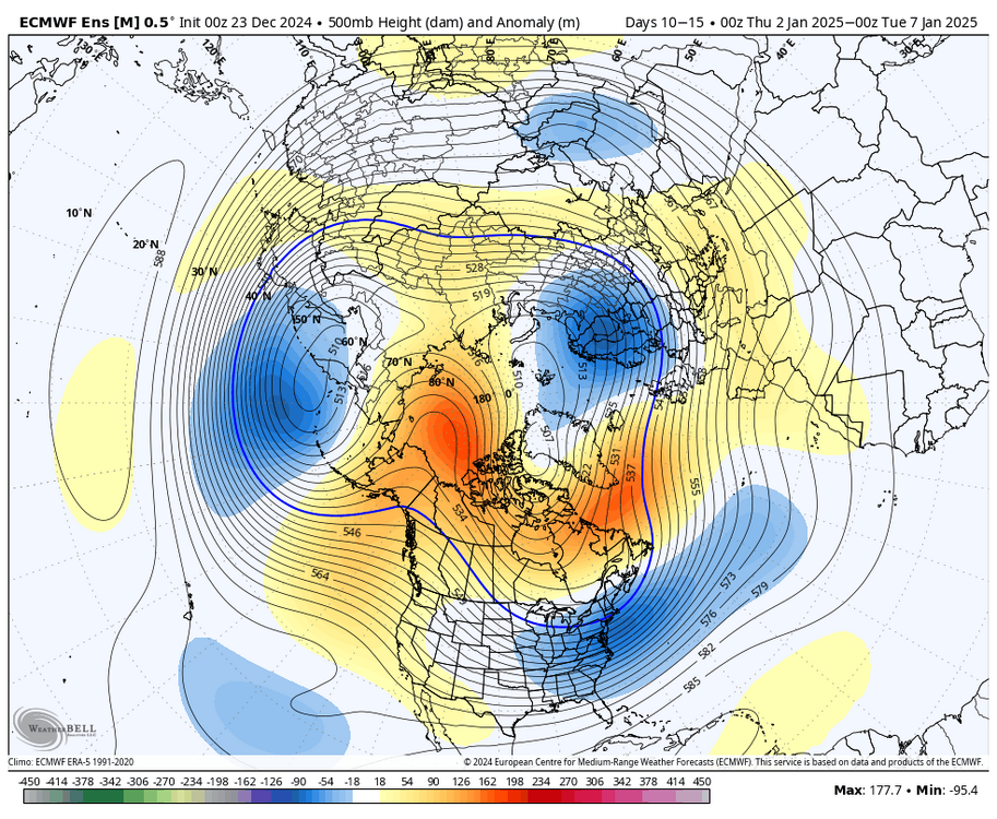
as we pass the 3rd or so, we probably do enter a pretty damn favorable pattern with -EPO/-NAO and a strong signal for N ATL confluence that will help press storms to the south alongside ample cold air. there's even a hint of sagginess off Baja California indicating a somewhat active STJ. overall, this presents the chance of phasing potential over the OH / MS valleys with 50/50 confluence in place now, the strength and character of the -NAO still needs to be worked out, as this will dictate the confluence... this isn't a shoe in and there is still time for things to change, of course. I would like to see this look persist towards NYE. it's relatively high confidence overall regardless of if you're pessimistic or optimistic, objectively, this should be our best shot at seeing a larger snowstorm since Feb 2021

-
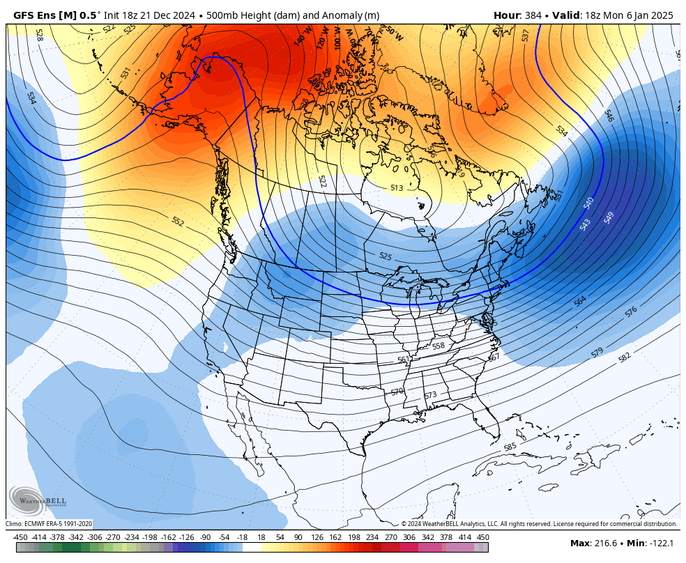
the GEFS just made a pretty large move towards the EPS line of thinking with much lower heights in the GoA before the pattern gets going. leads to less crap getting stuck behind
-
also the upcoming pattern for most of early-mid Jan objectively looks very good. people can shit on it and PTSD reverse psychology their way out of it all they want but it doesn't change what pretty much every ensemble is showing
-
lol i guess all it takes is two crap winters for people to start trashing a respected met. god bless
-

January: Medium/ Long Range: May the Force be with Us....
brooklynwx99 replied to Weather Will's topic in Mid Atlantic
I still think the 8th is the larger storm signal with the confluence more established, but the 5th can definitely work if you indeed eject a decent vort into confluence -
January: Medium/ Long Range: May the Force be with Us....
brooklynwx99 replied to Weather Will's topic in Mid Atlantic
fixed. even the GEFS becomes highly favorable after the 5th
-
January: Medium/ Long Range: May the Force be with Us....
brooklynwx99 replied to Weather Will's topic in Mid Atlantic
that isn’t a weak blocking signal at all for 10+ days out. not every block is going to be +300m at that range -
pretty good agreement overall
-
what does your ideal pattern look like? there is troughing showing up over the N ATL that will encourage confluence, it's not like there's a WAR or a massive ridge over Nova Scotia
-
I'm inclined to agree
-
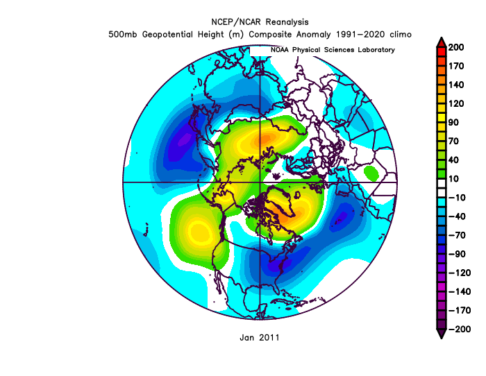
i mean, the pattern is analogous to Jan 2011. no denying that. probably the best the E US has seen for cold and snow in quite some time
-
at that point, the slight troughiness out west can just be a storm signal showing up
-
if this is trending in the wrong direction, sign me up

-
GEFS has an overrunning type setup for the 4-5th btw. potent SS vort running into confluence. this is probably the first shot at snow for most in this pattern

-
this is the "look at long range OP runs" to get yourself worked up part of the LR forecasting process apparently lmao
-
January: Medium/ Long Range: May the Force be with Us....
brooklynwx99 replied to Weather Will's topic in Mid Atlantic
yeah the GEFS looks good with the 4-6th timeframe. juiced SS vort potentially running into confluence... the thing is that you can have a cutter if 1) the SS vort cuts off for whatever reason or 2) if there isn't sufficient confluence. but every setup has its fail modes
-
January: Medium/ Long Range: May the Force be with Us....
brooklynwx99 replied to Weather Will's topic in Mid Atlantic
this is also really nice. love the confluence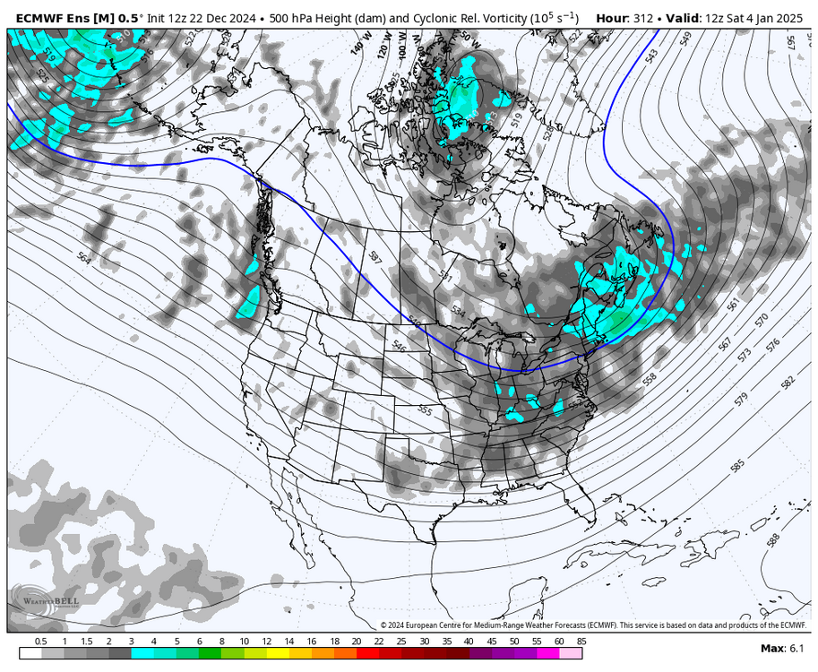
-
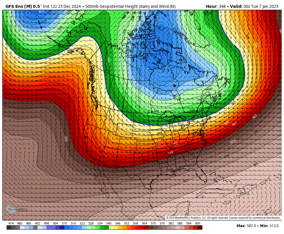
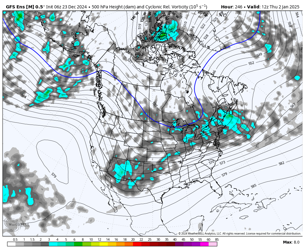
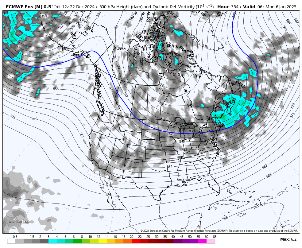
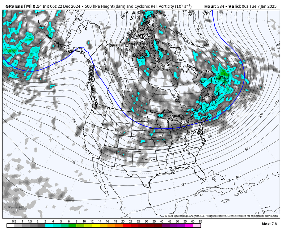
lol this is a ridiculous look. split flow, -EPO, elongated TPV, 50/50 ULL, and vorticity hanging out over the SW

-
January: Medium/ Long Range: May the Force be with Us....
brooklynwx99 replied to Weather Will's topic in Mid Atlantic
this is so loaded. personally I think the larger threat is after the 5th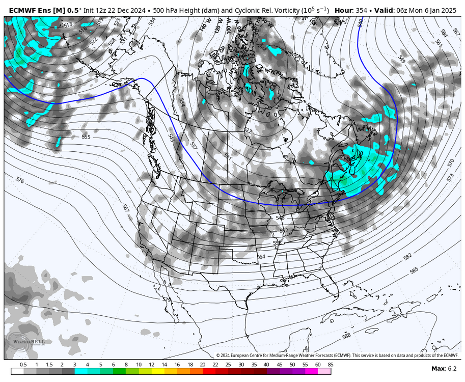
-
personally i think 13-14 is a better analog than 10-11 but it’s clear that we’re breaking colder. i think we moderate in late Jan and then who knows what happens in Feb. with all of the lingering Nino influence i’m not totally resigned to a super warm Feb
-
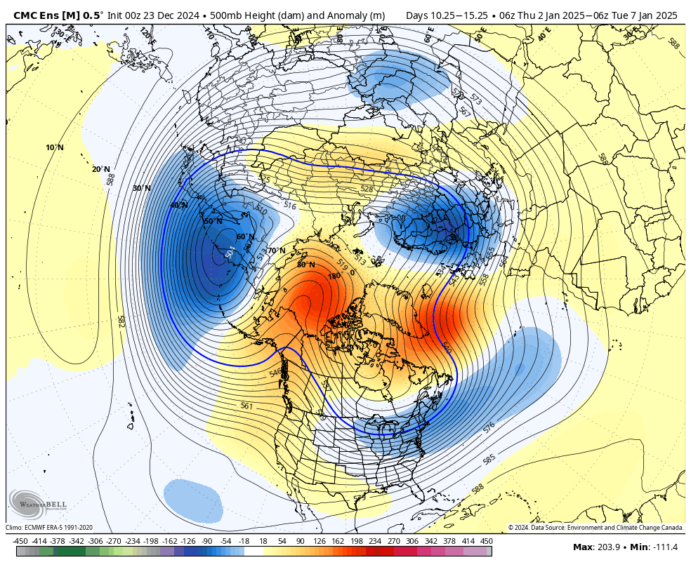
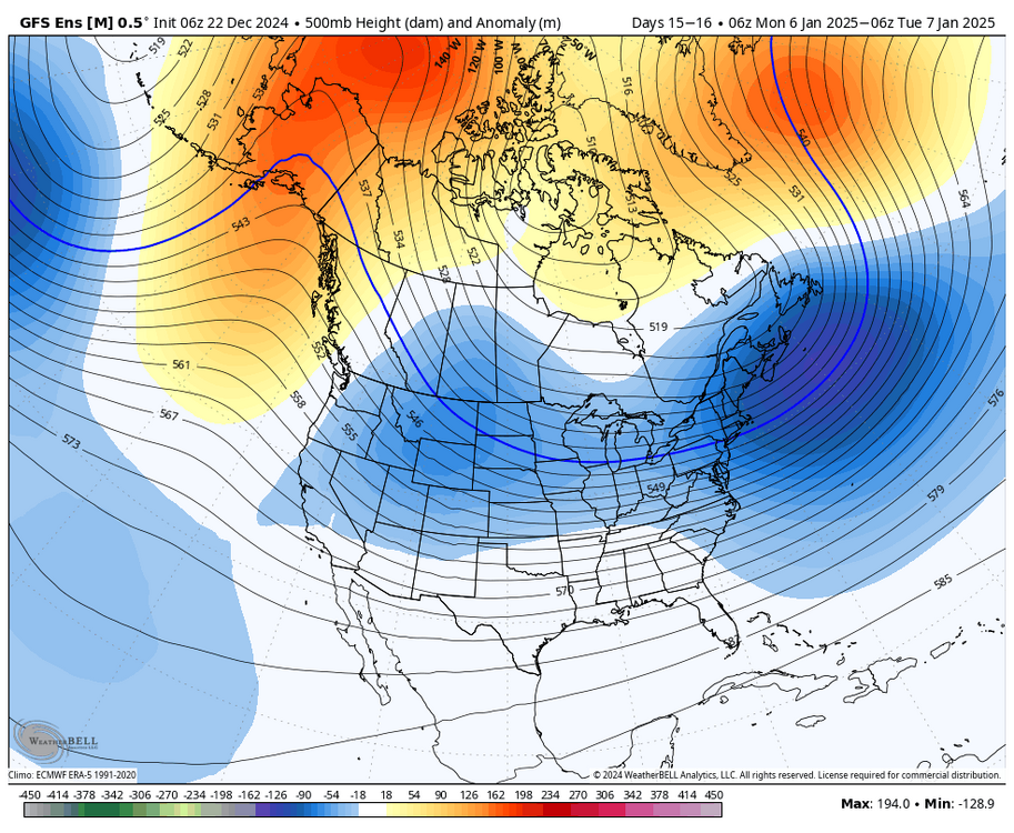
that negative anomaly over the Rockies is likely the GEFS trying to parse some larger storm signal more than anything IMO. you can see it on the vorticity plot kind of a ridiculous look with the AK ridging, 50/50, -NAO, and vorticity from the Plains into the SW. the elongated TPV is also a classic feature of these blocking patterns
-
i know what you're referring to, but the difference between this look and the last couple of years is that the core of the negative anomalies is over the Rockies and northern Plains. there's also a crap ton of confluence showing up. I see a potent Rockies vort running into confluence with cold air in place without the confluence? sure, not great, but the Atlantic changes the entire pattern
-
sorry for conflating the favorable pattern / big storm stuff. usually one just leads to the other haha
-
I think that system establishes a 50/50 for a larger threat afterwards
-
lol i know you’re on the big storm train. the similarities are uncanny, obviously not calling for anything this massive but the pattern really is analogous