brooklynwx99
-
Posts
5,630 -
Joined
-
Last visited
Content Type
Profiles
Blogs
Forums
American Weather
Media Demo
Store
Gallery
Everything posted by brooklynwx99
-
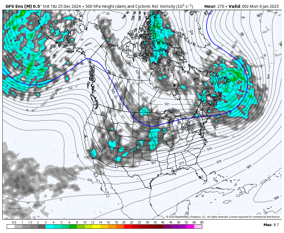
i don't think I need to explain this one very much
-
i’m a degreed meteorologist that does long range forecasting professionally. i’m actually quite conservative for my job, believe it or not. i have been looking at this stuff since I was 10 years old why be so condescending? you have some kind of nerve acting like you know better than me because of some crap I post on a weather forum. like seriously, how could you take the time to write all of this up and think it doesn’t sound incredibly sanctimonious. basically saying that i don’t even understand what i’m posting and some of you wonder why so many mets have left this subforum. posts like this. my god
-
i guess. i mean you never know if this is going to pan out verbatim, but if it did, that’s split flow with blocking over the top
-
lol this can’t be a serious post

-
would you like me to make posts about when the pattern is crappy? usually everyone knows when it’s not going to snow so i don’t really bother wasting any more space on it here you go. warm and wet, garbage pattern for the next week. no snow to speak of. is that enough balance?
-
i agree. I’m not calling for a monster storm or anything like that, but the advertised pattern after the 3rd or so does look highly favorable for snow and possibly a larger storm
-
even if you use that definition, i don’t see all that much support for a suppressive pattern. we don’t have a mega south based block or anything like that, and the ridge out west isn’t over the Plains. it’s not super active since there isn’t a roaring STJ like in a Nino, but it’s still favorable for cold and snow
-
so, if Jan ends up -3F and like -0.5” liquid, i would bet that it’s snowier than average. it’s really tough to predict snowfall though outside of like 7 days
-
let’s say the average liquid for a month is 4”. if it’s a cold and dry month in terms of total liquid, it can be -3F and 3” total liquid… there’s less liquid because it’s cold. so it’s technically a “dry” month however, since you get 10” of snow for every 1” of liquid, that inch less in total liquid doesn’t really matter that much anymore when the proportion of liquid that falls as snow is higher
-
also, when it’s cold, especially well BN, you have lower PWATs, so you just aren’t dealing with the same amount of moisture than a seasonable or AN temp pattern. it’s quite difficult to get a legitimately cold and not very snowy pattern here
-

January: Medium/ Long Range: May the Force be with Us....
brooklynwx99 replied to Weather Will's topic in Mid Atlantic
4th also looks better now
-
January: Medium/ Long Range: May the Force be with Us....
brooklynwx99 replied to Weather Will's topic in Mid Atlantic
wow. 7th continues to have a very cohesive signal
-
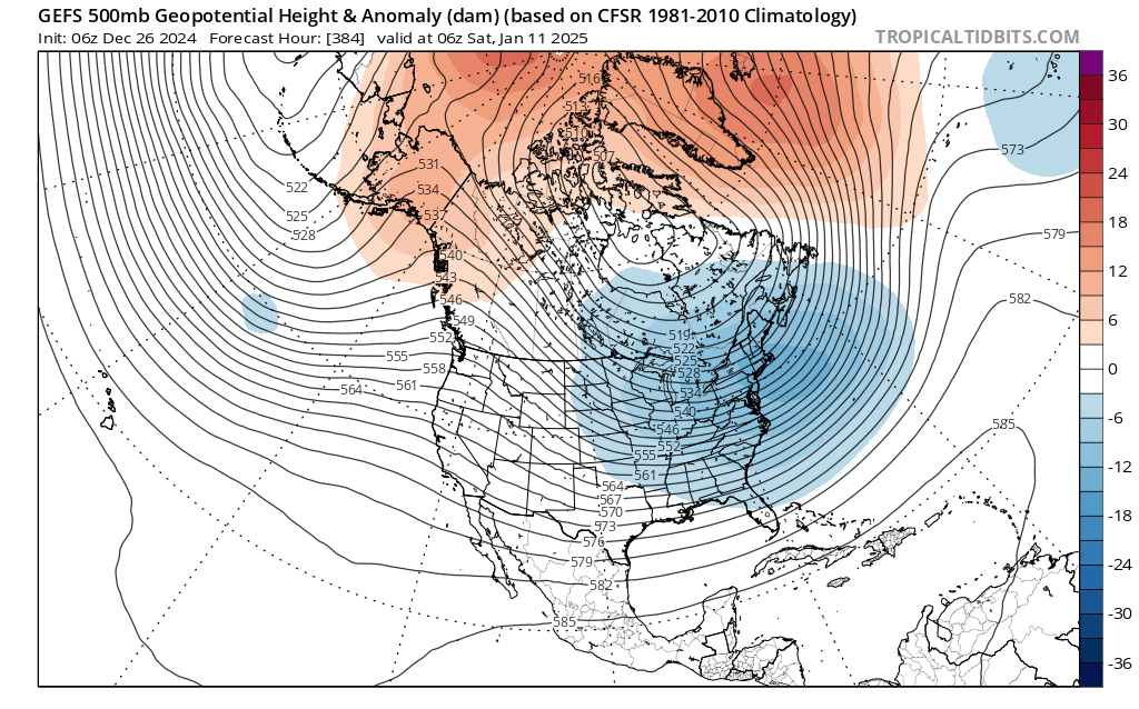
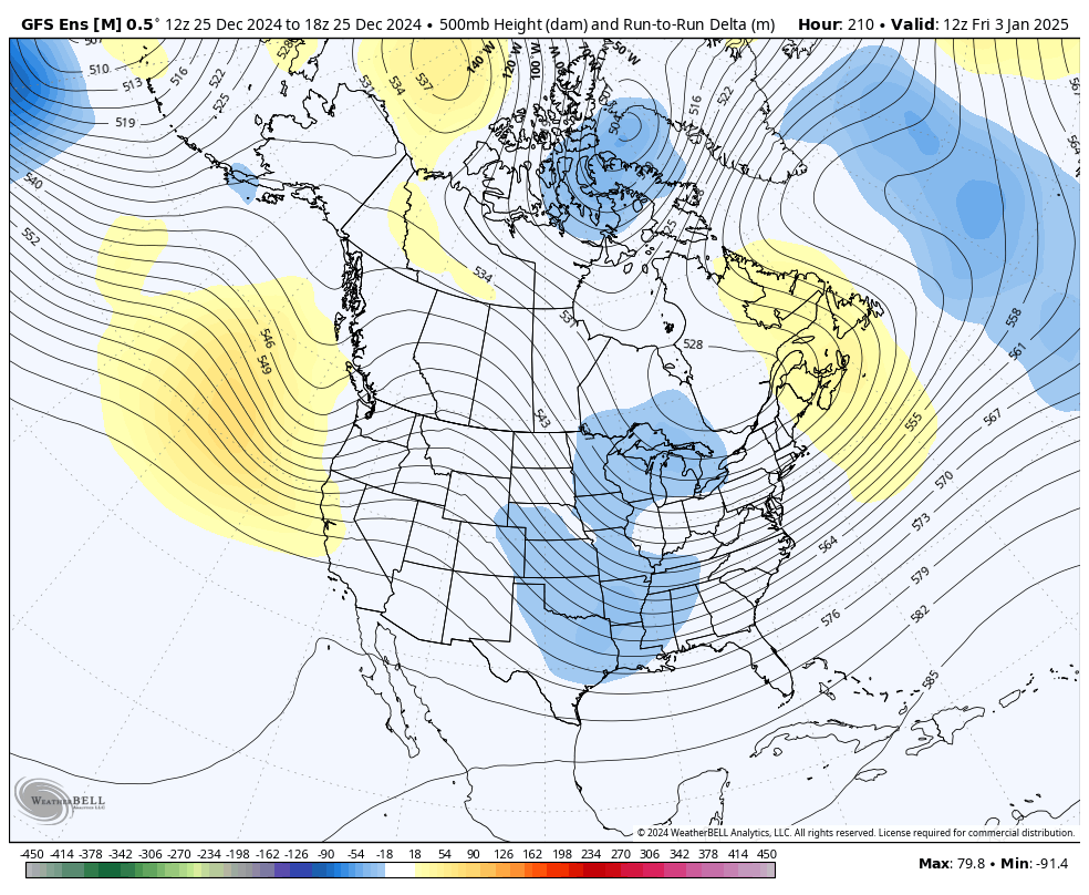
they’re definitely much more useful than OP runs past 7 days out, though. they’re used to identify periods of risk. i’ve seen way too much emphasis on day 10-15 OP runs recently on multiple forums and i find it odd
-
January: Medium/ Long Range: May the Force be with Us....
brooklynwx99 replied to Weather Will's topic in Mid Atlantic
7th still looking spicy. lots of confluence, good airmass in place, and a potent vort swinging through
-
lol this is pretty much a cave to the EPS guidance

-
i’d consider this a cave to the EPS guidance
-
January: Medium/ Long Range: May the Force be with Us....
brooklynwx99 replied to Weather Will's topic in Mid Atlantic
total cave
-
January: Medium/ Long Range: May the Force be with Us....
brooklynwx99 replied to Weather Will's topic in Mid Atlantic
GEFS masterclass
-
GEFS masterclass

-
GEFS masterclass

-
lol imagine getting weenied for pattern analysis. the absolute state of this place
-
any reason why?
-
January: Medium/ Long Range: May the Force be with Us....
brooklynwx99 replied to Weather Will's topic in Mid Atlantic
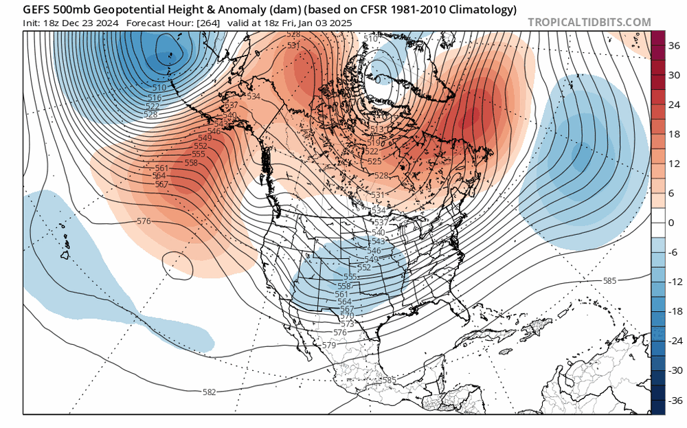
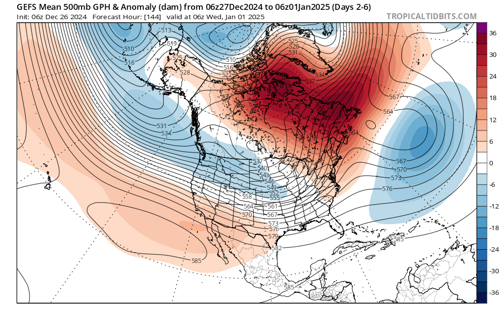
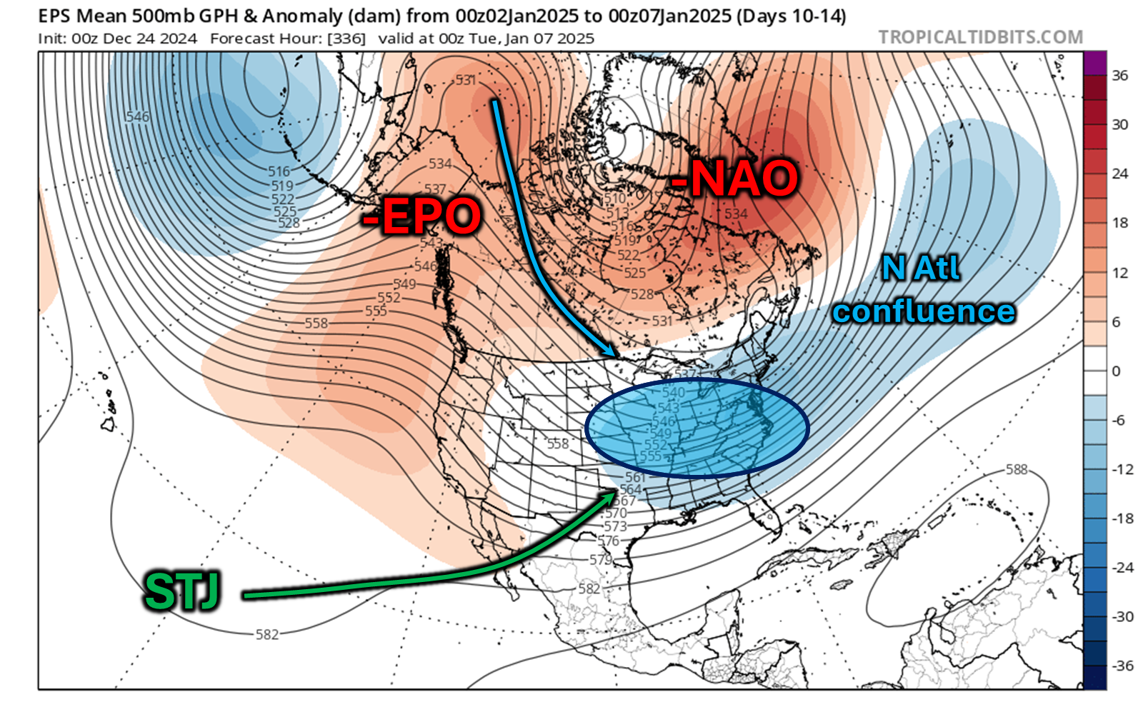
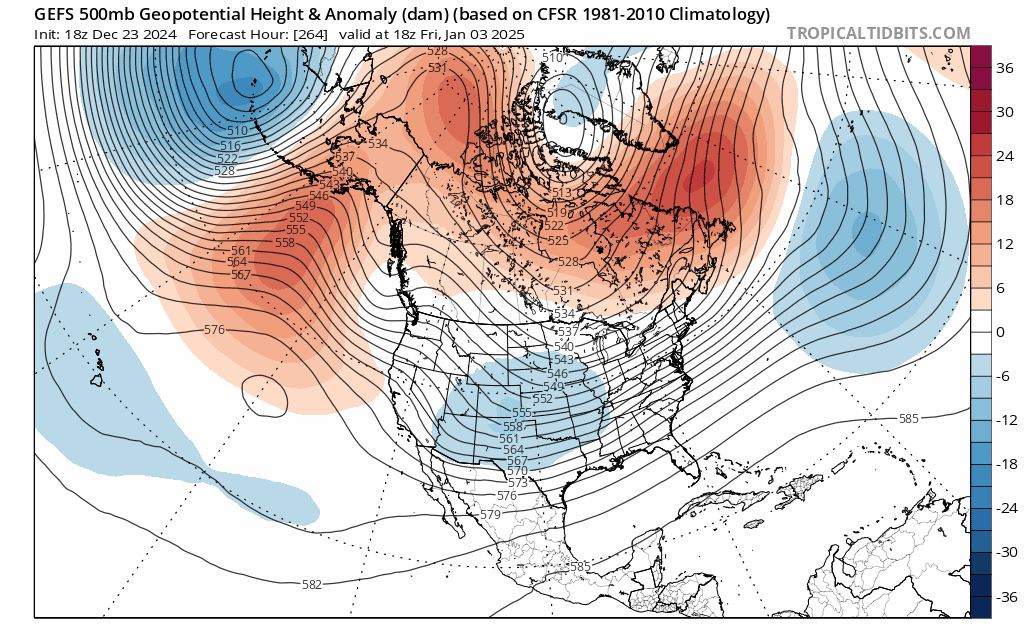
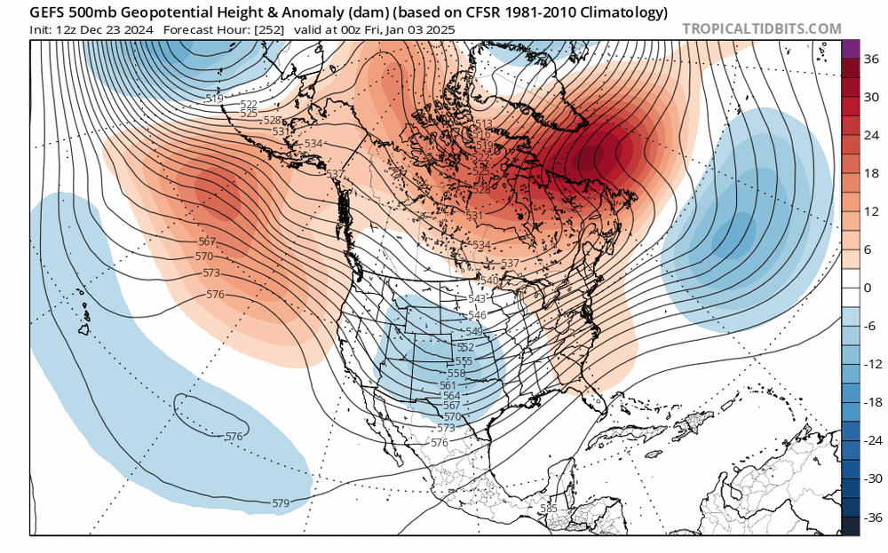
here are my thoughts I posted in the NYC forum: as we pass the 3rd or so, we probably do enter a pretty damn favorable pattern with -EPO/-NAO and a strong signal for N ATL confluence that will help press storms to the south alongside ample cold air. there's even a hint of sagginess off Baja California indicating a somewhat active STJ. overall, this presents the chance of phasing potential over the OH / MS valleys with 50/50 confluence in place now, the strength and character of the -NAO still needs to be worked out, as this will dictate the confluence... this isn't a shoe in and there is still time for things to change, of course. I would like to see this look persist towards NYE. it's relatively high confidence overall regardless of if you're pessimistic or optimistic, objectively, this should be our best shot at seeing a larger snowstorm in a while
-
here are my thoughts I posted in the NYC forum: as we pass the 3rd or so, we probably do enter a pretty damn favorable pattern with -EPO/-NAO and a strong signal for N ATL confluence that will help press storms to the south alongside ample cold air. there's even a hint of sagginess off Baja California indicating a somewhat active STJ. overall, this presents the chance of phasing potential over the OH / MS valleys with 50/50 confluence in place now, the strength and character of the -NAO still needs to be worked out, as this will dictate the confluence... this isn't a shoe in and there is still time for things to change, of course. I would like to see this look persist towards NYE. it's relatively high confidence overall regardless of if you're pessimistic or optimistic, objectively, this should be our best shot at seeing a larger snowstorm in a while

-
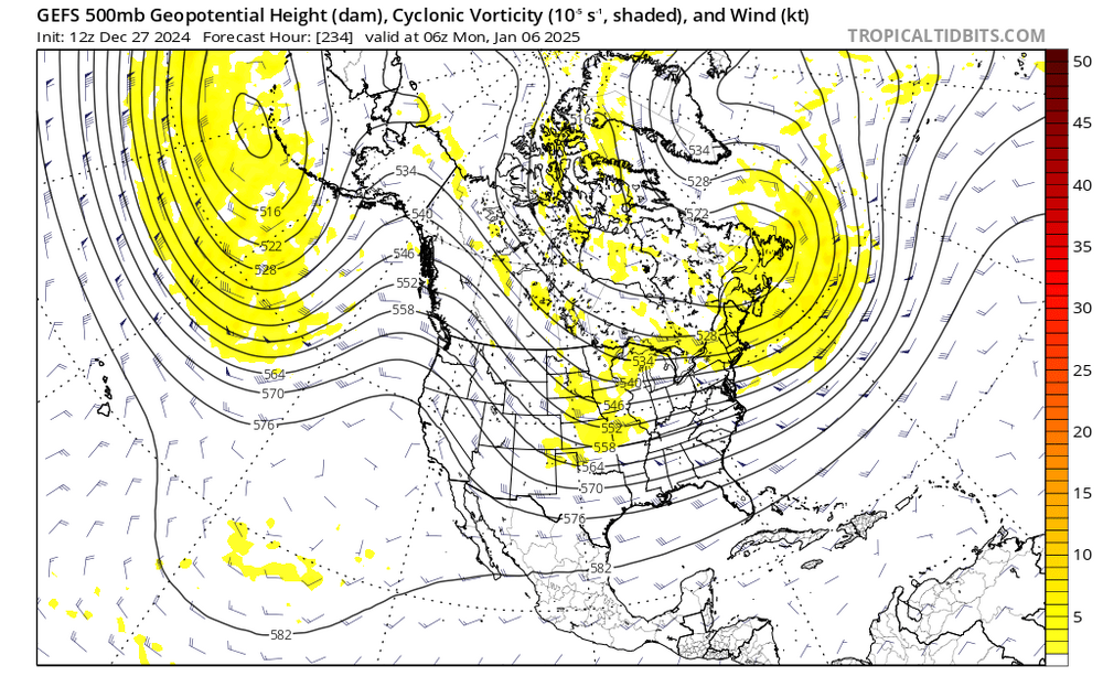
GEFS looks like it's caving to the EPS. and yeah the airmass will suck until around the 3rd... first storm risk is Jan 4-5, then a larger one Jan 6-8