

brooklynwx99
-
Posts
5,630 -
Joined
-
Last visited
Content Type
Profiles
Blogs
Forums
American Weather
Media Demo
Store
Gallery
Everything posted by brooklynwx99
-
i think the 6th might present suppression issues with the 50/50 ULL so close by, but I can see SNE getting in on it if that trends weaker or if the S/W trends stronger (the latter seems more likely)... overall this presents as a DC-NYC type event but it's still out there afterwards, the ensembles are definitely honking for a larger trough amplification as the +PNA pumps somewhere between the 8-11th as Tip mentioned. there is certainly the potential for something significant to major in this window... the pattern also persists through the 15th, so you'll have multiple opportunities to cash in, especially as the blocking eases
.thumb.png.f8777720ecc272a49c900edfec24ce44.png)
-

January: Medium/ Long Range: May the Force be with Us....
brooklynwx99 replied to Weather Will's topic in Mid Atlantic
I'm starting to like the 6th... the longwave pattern is such that if you get a decent wave, it'll just launch into the confluence and lead to a nice gradient with FGEN. 50/50 is locked in, so pretty much no risk of a cutter, would just be a Miller B if the wave is super amped or a thump to drizzle at worst. pretty much a snow or nothing kind of setup. unlikely to see anything major, but a 3-6" or 4-8" event is certainly on the table. this is a pretty typical DC-NYC setup (probably favoring PHL south)
-
I'm starting to like the 6th... the longwave pattern is such that if you get a decent wave, it'll just launch into the confluence and lead to a nice gradient with FGEN. 50/50 is locked in, so pretty much no risk of a cutter, would just be a Miller B if the wave is super amped or a thump to drizzle at worst. pretty much a snow or nothing kind of setup. unlikely to see anything major, but a 3-6" or 4-8" event is certainly on the table

-
January: Medium/ Long Range: May the Force be with Us....
brooklynwx99 replied to Weather Will's topic in Mid Atlantic
yeah I think the OP is a bit much with the suppression but it's a possibility in these patterns. gotta deal with the risk of suppression if you want larger storms, though -
January: Medium/ Long Range: May the Force be with Us....
brooklynwx99 replied to Weather Will's topic in Mid Atlantic
that's around the 5-6th, though. moves into the more ideal 50/50 position around the 8-9th, which is probably the first shot at a big one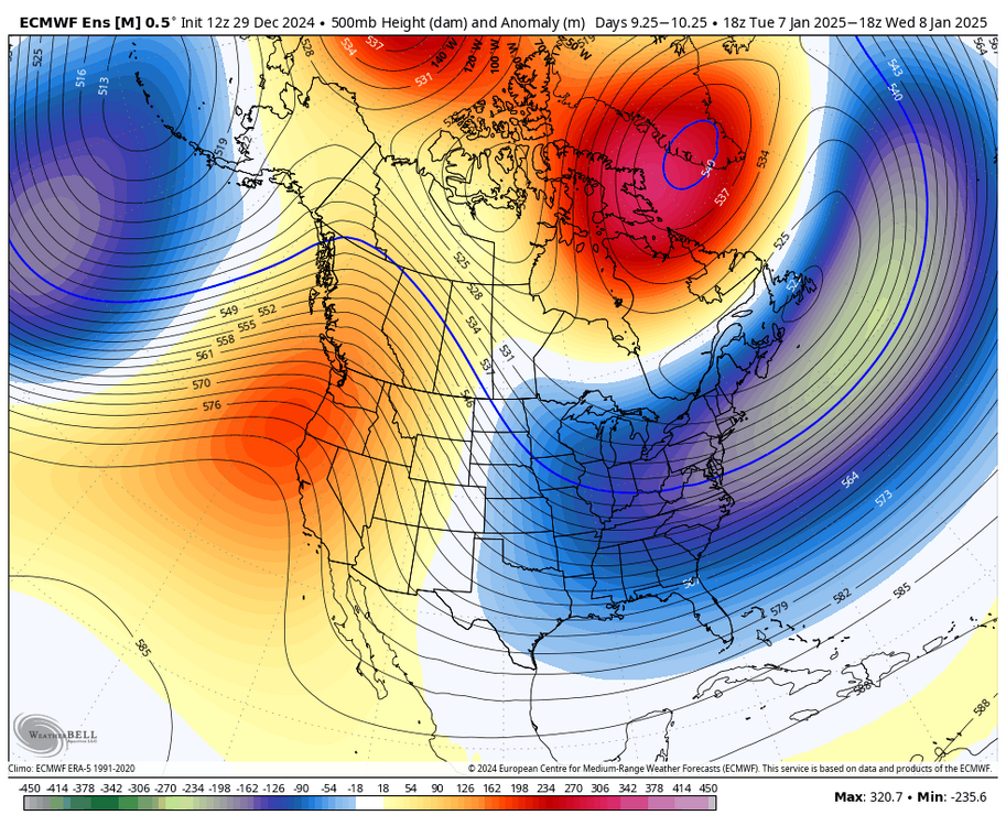
-
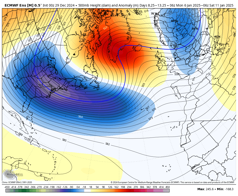
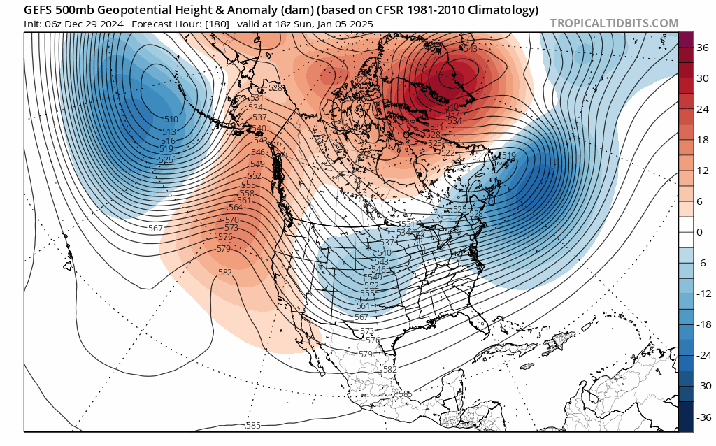
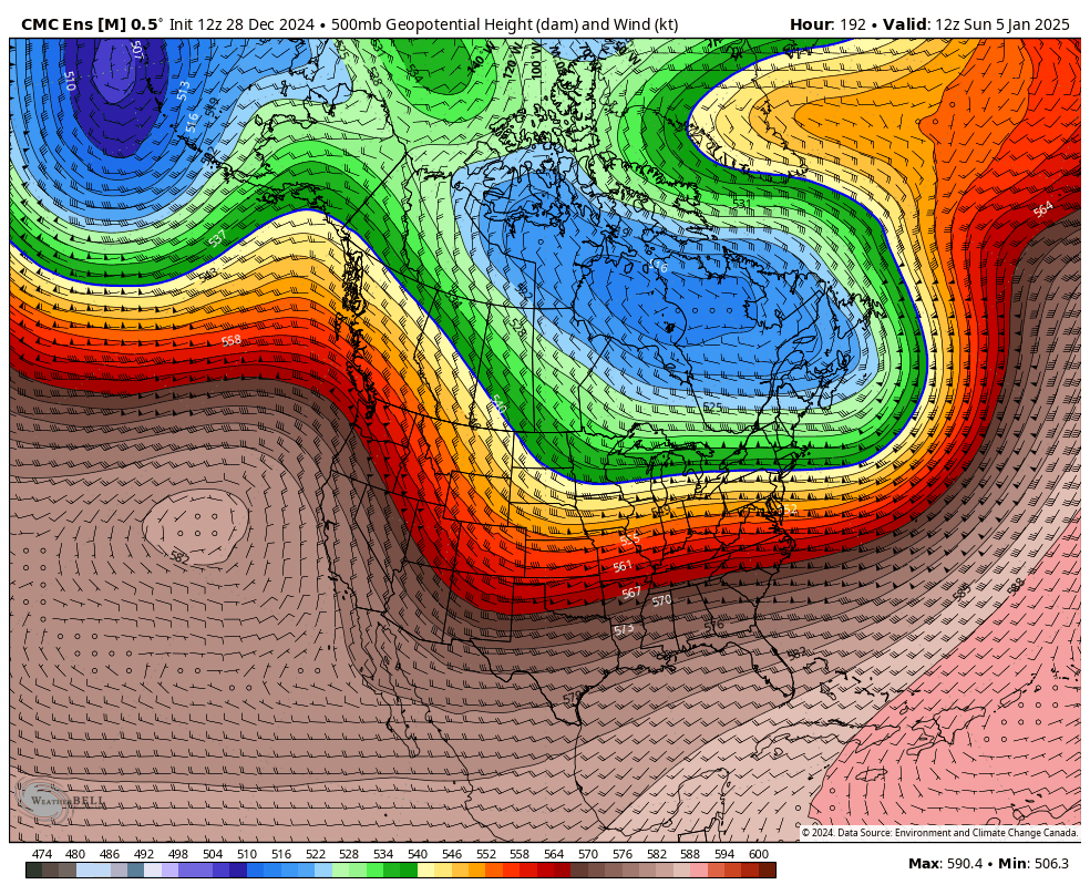
what a sick trend. we've gone from a rather transient east-based Greenland ridge to a true west-based retrograding Davis Strait block. this will lead to legit potential for a significant to major storm when it decays, as is usual this pattern generally favors NYC down to RIC honestly

-
January: Medium/ Long Range: May the Force be with Us....
brooklynwx99 replied to Weather Will's topic in Mid Atlantic
what a sick trend. we've gone from a rather transient east-based Greenland ridge to a true west-based retrograding Davis Strait block. this will lead to legit potential for a KU when it decays, as is usual this pattern generally favors NYC down to RIC honestly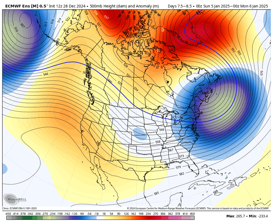
-
January: Medium/ Long Range: May the Force be with Us....
brooklynwx99 replied to Weather Will's topic in Mid Atlantic
yup, it doesn’t really matter as long as the block is actually doing its job and… blocking stuff. the Atlantic is clogged up here. this isn’t some bootleg Greenland ridge, it’s a legit -NAO that’s trended stronger and more west based with time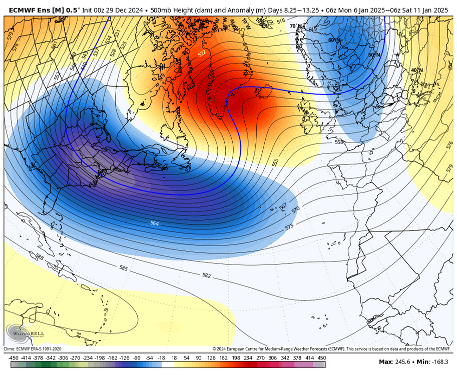
-
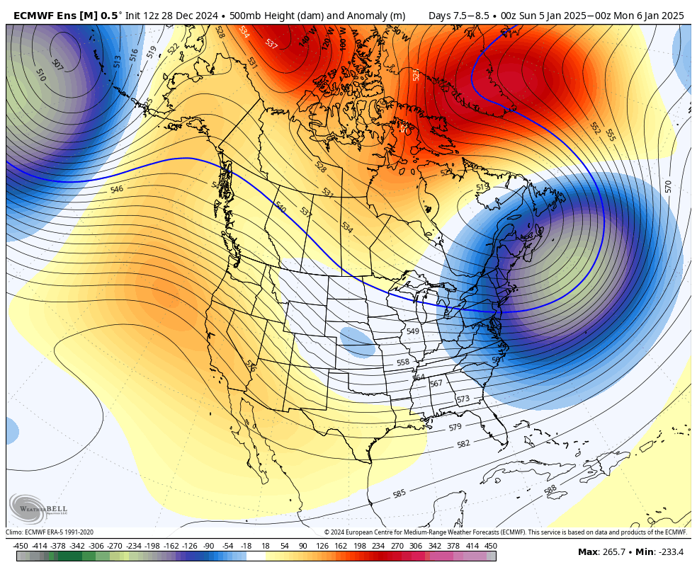
this is honestly the KU progression we’ve been waiting for. west based block retrogrades and rots over the Davis Strait with confluence in place. both waves are easily visible

-
January: Medium/ Long Range: May the Force be with Us....
brooklynwx99 replied to Weather Will's topic in Mid Atlantic
this is honestly the KU progression we’ve been waiting for. west based block retrogrades and rots over the Davis Strait with confluence in place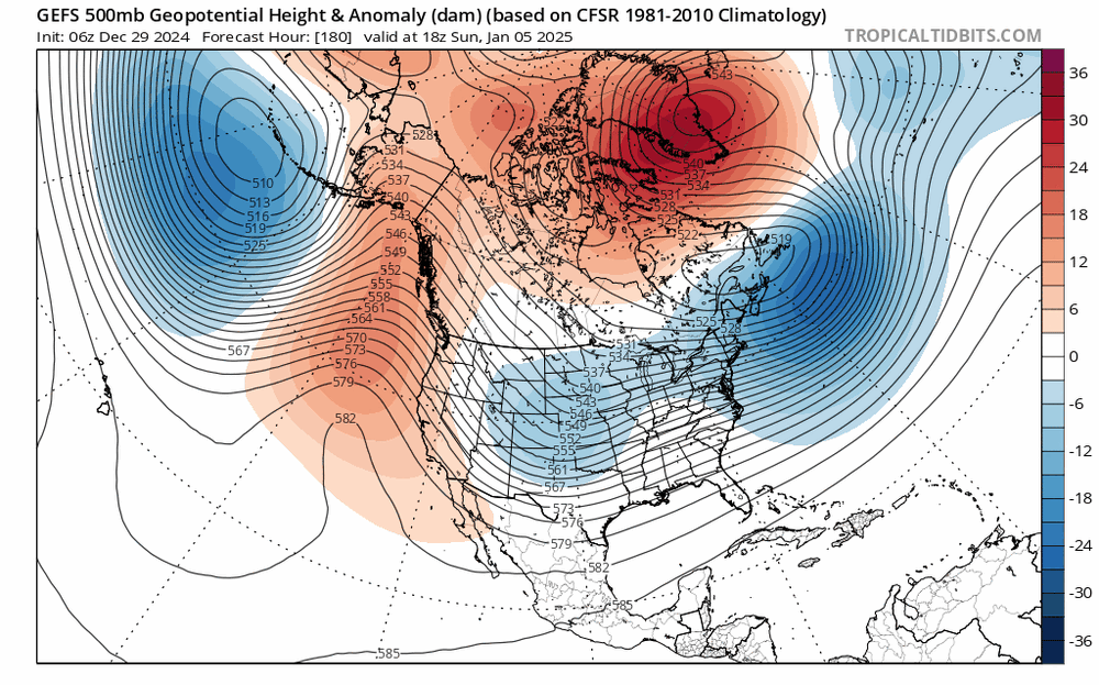
-
this is honestly the MECS progression we’ve been waiting for. west based block retrogrades and rots over the Davis Strait with confluence in place. some of our larger storms shared this same progression

-
yeah it’s not like a Nino STJ but as long as it has some influence it makes a big difference
-
wouldn’t call the STJ inactive at all. it’s definitely there with a split flow pattern
-
sure, the STJ isn’t roaring, but it’s definitely there. can see the jet dipping off the coast of Baja CA, so you’d be able to tap into the STJ if a vort does dig enough. the 18z GFS is a good example of that
-
my guess the 6-7th is a weaker wave that reinforces confluence for the 8-9th. ensembles really amplify the trough for that second window
-
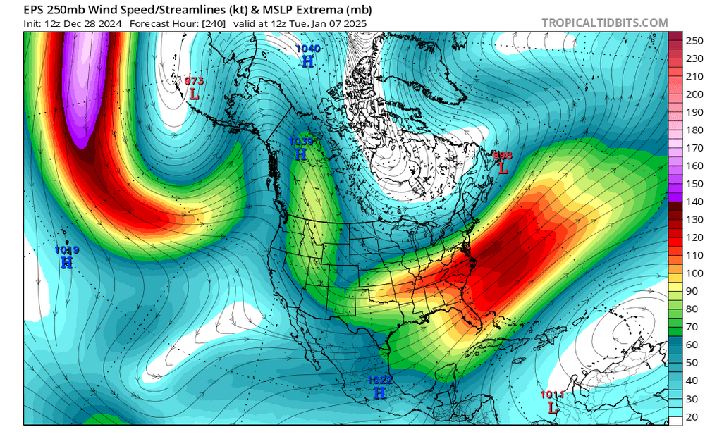
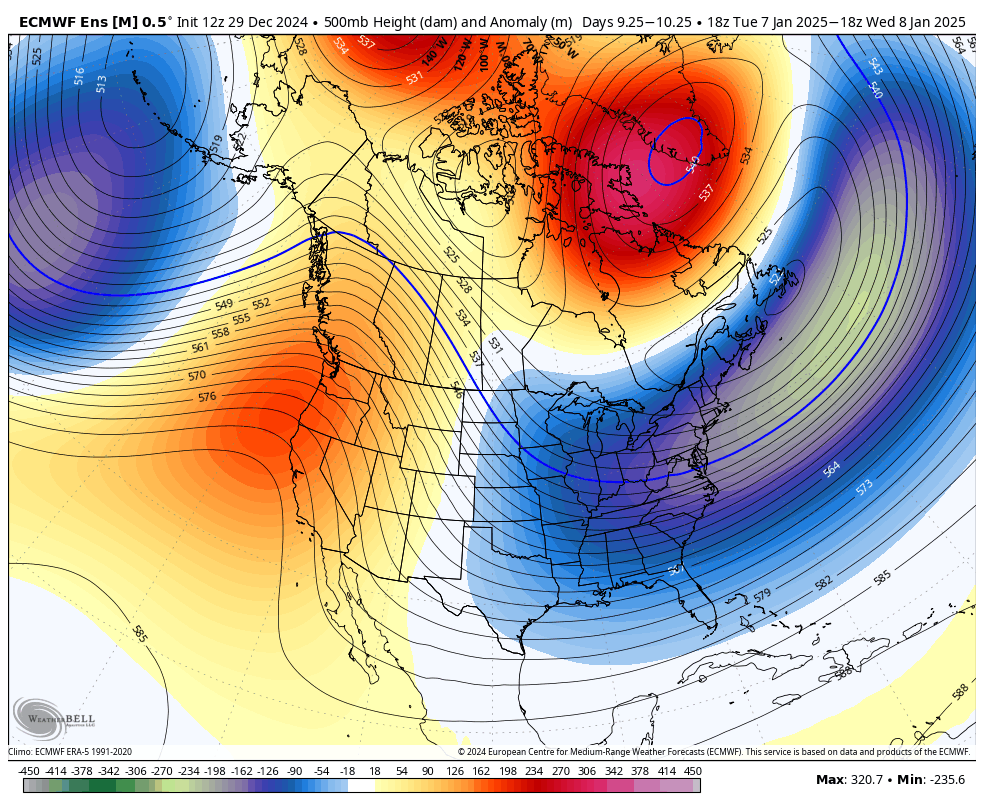
very good agreement between the three major ensembles on a MECS pattern developing... all have a -EPO, -NAO, rising PNA, a 50/50 ULL, and an elongated TPV. all have an amplifying trough over the Plains to take advantage of the setup. not really sure if it's the wave on the 6-7th or the 8-9th... ensembles have the trough really blowing up for the latter timeframe. regardless, we're getting into the timeframe where this isn't really fantasy anymore
-
very good agreement between the three major ensembles on a MECS pattern developing... all have a -EPO, -NAO, rising PNA, a 50/50 ULL, and an elongated TPV. all have an amplifying trough over the Plains to take advantage of the setup. not really sure if it's the wave on the 6-7th or the 8-9th... ensembles have the trough really blowing up for the latter timeframe. regardless, we're getting into the timeframe where this isn't really fantasy anymore

-
January: Medium/ Long Range: May the Force be with Us....
brooklynwx99 replied to Weather Will's topic in Mid Atlantic
very good agreement between the three major ensembles on a MECS pattern developing... all have a -EPO, -NAO, rising PNA, a 50/50 ULL, and an elongated TPV. all have an amplifying trough over the Plains to take advantage of the setup. not really sure if it's the wave on the 6-7th or the 8-9th... ensembles have the trough really blowing up for the latter timeframe. regardless, we're getting into the timeframe where this isn't really fantasy anymore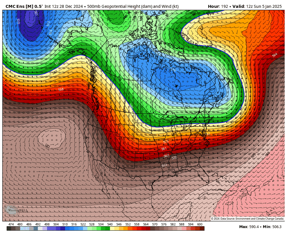
-
January: Medium/ Long Range: May the Force be with Us....
brooklynwx99 replied to Weather Will's topic in Mid Atlantic
yup, that 7-9th time period is really intriguing. super consistent on all ensembles and everything seems to be lining up for it -
the CONUS and Canada are going to be loaded with Arctic air... can easily see some overrunning / SWFE potential for NYC north (especially NE) at times if you can press the SE ridge down
-
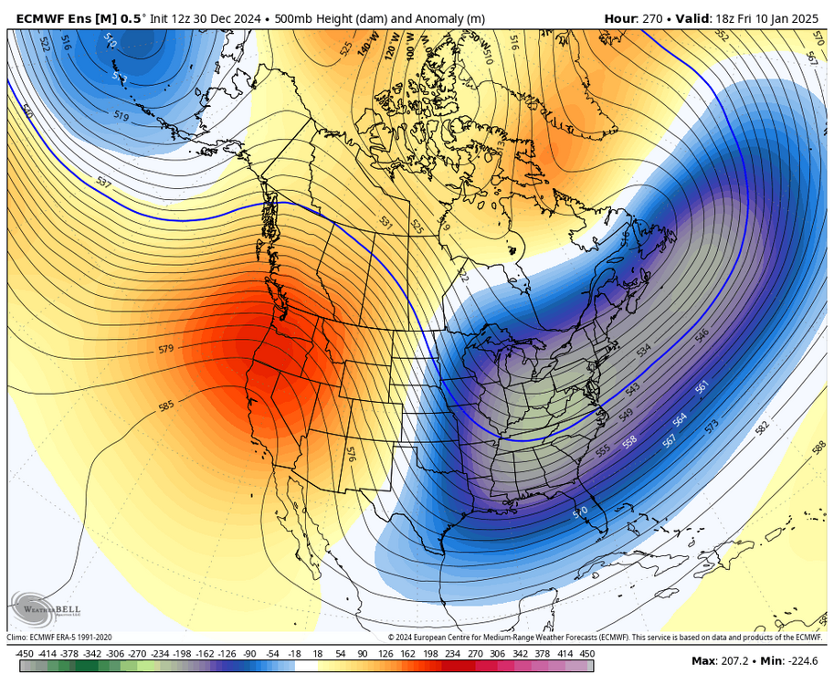
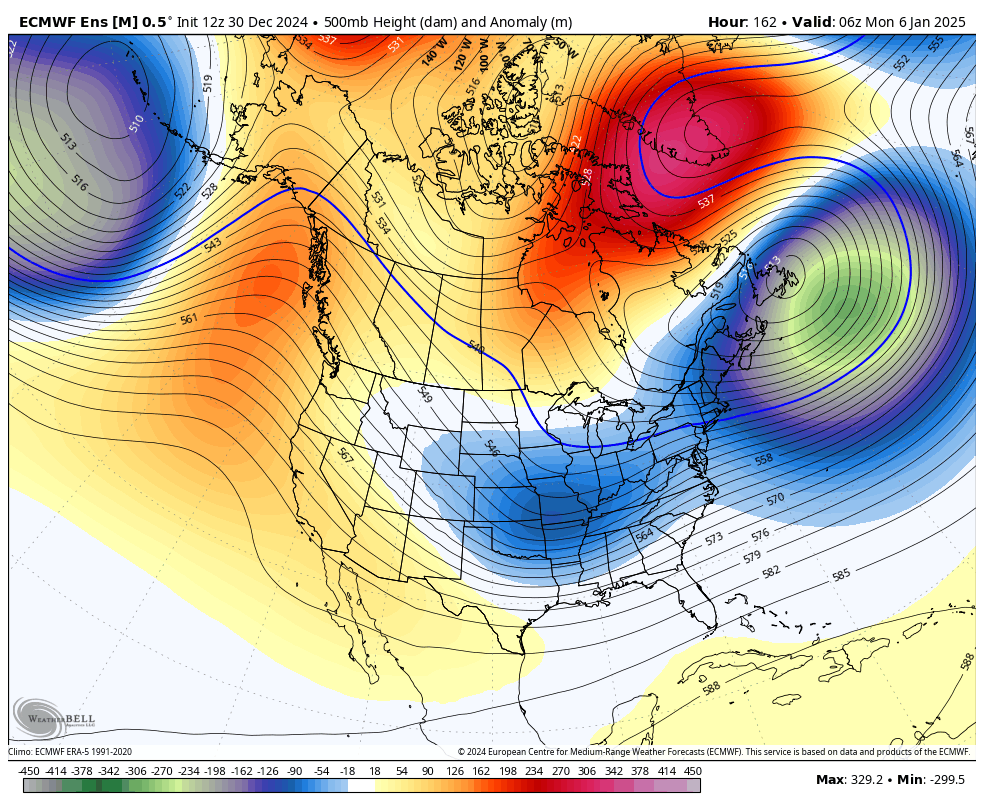
this is a really coherent signal for a larger storm for the 7-8th timeframe... 50/50 ULL moves out and trough goes to town over the OH Valley with a great antecedent airmass in place, -NAO, -EPO, +PNA GEFS and GEPS are also similar with the general configuration
.thumb.png.4dc4296cd63d9e7ef8868f84fe6d8442.png)
-
January: Medium/ Long Range: May the Force be with Us....
brooklynwx99 replied to Weather Will's topic in Mid Atlantic
lol oh man. you have everything you need on the table here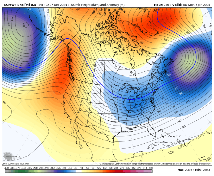
-
yeah i want to see it get to D7... you have all of the pieces there for a large storm. GEPS is similar, gonna see how the EPS looks. models have really strengthened the blocking today
-
January: Medium/ Long Range: May the Force be with Us....
brooklynwx99 replied to Weather Will's topic in Mid Atlantic
yeah I think the 4th is really difficult to pull off in terms of anything more... the 6-8th looks ripe on the GEFS as that trough becomes a 50/50 -
January: Medium/ Long Range: May the Force be with Us....
brooklynwx99 replied to Weather Will's topic in Mid Atlantic
i don't think I need to explain this one very much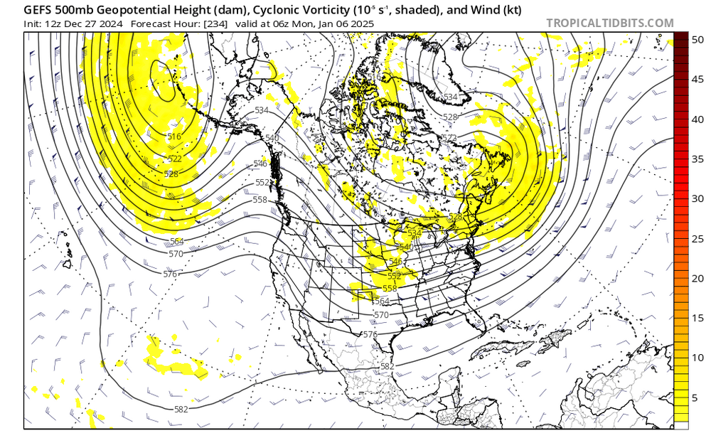
.png.7fc0d46c1a256b088531289cf9adc58e.png)


.png.d595477dc18c691793876e864d228c6b.png)


