brooklynwx99
-
Posts
6,229 -
Joined
-
Last visited
Content Type
Profiles
Blogs
Forums
American Weather
Media Demo
Store
Gallery
Everything posted by brooklynwx99
-

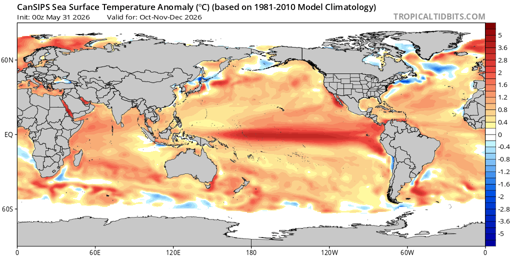
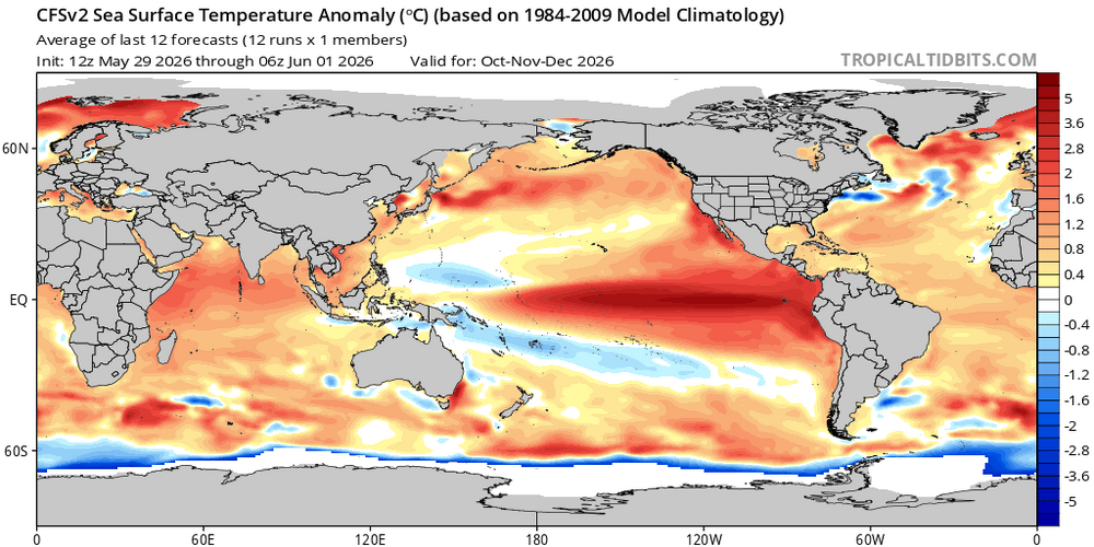
2026-2027 Super El Nino
brooklynwx99 replied to Stormchaserchuck1's topic in Weather Forecasting and Discussion
nah i mean we're likely looking at a warm winter for most anyway -
2026-2027 Super El Nino
brooklynwx99 replied to Stormchaserchuck1's topic in Weather Forecasting and Discussion
waiting until the spring barrier passes to make an ENSO forecast is pretty standard. I said a couple weeks ago that we are probably getting a super event and that a strong event was likely in early April. not sure what the issue is there -
2026-2027 Super El Nino
brooklynwx99 replied to Stormchaserchuck1's topic in Weather Forecasting and Discussion
also, let's be real, the only reason why this thread gets 95% of the traffic it does is because of the impact on the following winter, which carries the largest correlation to ENSO, anyway. i doubt anybody cares about the SW monsoon (aside from Raindance) or eastern Pacific algal blooms -
2026-2027 Super El Nino
brooklynwx99 replied to Stormchaserchuck1's topic in Weather Forecasting and Discussion
these events always begin very EP, that's nothing new. not much support on a persistent EP event... we should see things move basin-wide by the time winter rolls around. looks pretty 2015-16 esque in that regard, not 1997-98
-
2026-2027 Super El Nino
brooklynwx99 replied to Stormchaserchuck1's topic in Weather Forecasting and Discussion
there was also a major block that was poorly forecasted in February... one of the worst pattern busts I've ever seen. if that occurred, things would have turned out a whole lot differently that month -
2026-2027 Super El Nino
brooklynwx99 replied to Stormchaserchuck1's topic in Weather Forecasting and Discussion
just messing. i agree that we're probably getting a super Nino this year -
2026-2027 Super El Nino
brooklynwx99 replied to Stormchaserchuck1's topic in Weather Forecasting and Discussion
mario ramirez super nino -
2026-2027 Super El Nino
brooklynwx99 replied to Stormchaserchuck1's topic in Weather Forecasting and Discussion
if we go the super route, I actually like 1982-83 quite a bit -
2026-2027 Super El Nino
brooklynwx99 replied to Stormchaserchuck1's topic in Weather Forecasting and Discussion
for the record, this should be a strong Nino per ONI and even RONI, but taking those +2.5C euro forecasts in early April to heart is silly. wait a couple of months and see if it sticks. the euro has overdone many a Nino in the past -
2026-2027 Super El Nino
brooklynwx99 replied to Stormchaserchuck1's topic in Weather Forecasting and Discussion
gotta pass the spring barrier. this is like a 10 day EPS forecast but for ENSO at this point in the year -
2026-2027 Super El Nino
brooklynwx99 replied to Stormchaserchuck1's topic in Weather Forecasting and Discussion
hey, give me a loaded STJ and temps that aren't an abject torch and I'd like to see what happens now that we're in a paradigm of blockier winters. 2023-24 was cursed and I think people are scared about an outcome like that. I find it unlikely, there are much better analogs -
2026-2027 Super El Nino
brooklynwx99 replied to Stormchaserchuck1's topic in Weather Forecasting and Discussion
paul roundy super Nino part 2? -
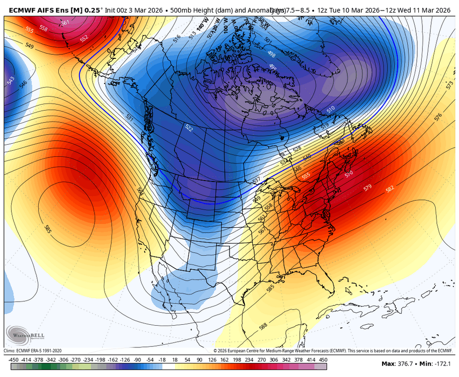
every model has the signal mid-month, worth watching for sure with the ridge rising out west. airmass is better than you'd think with the PV nearby
-
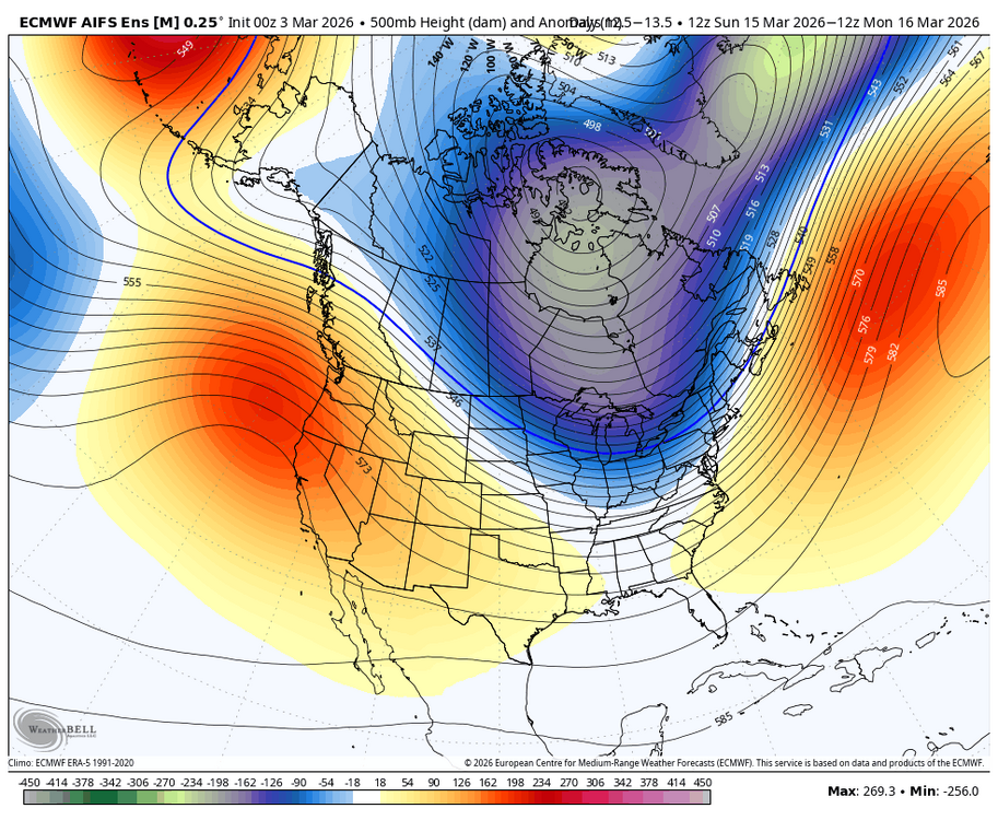
classic spring swing here
-
the snow blitzes this winter are just as much a part of CC as the warm bursts IMO
-
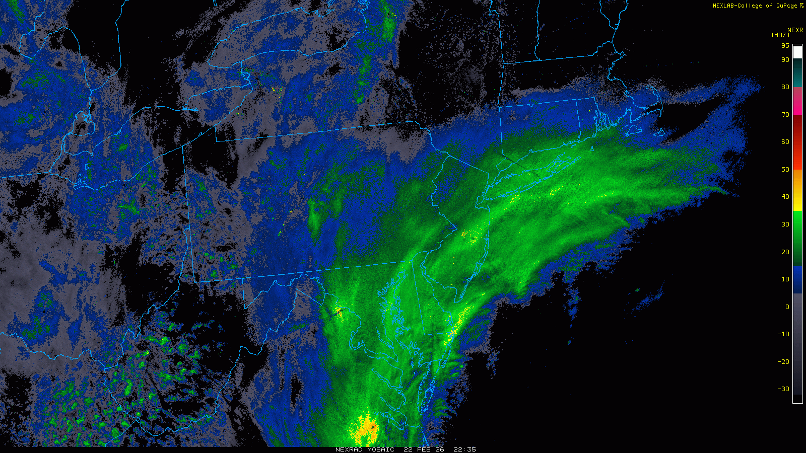
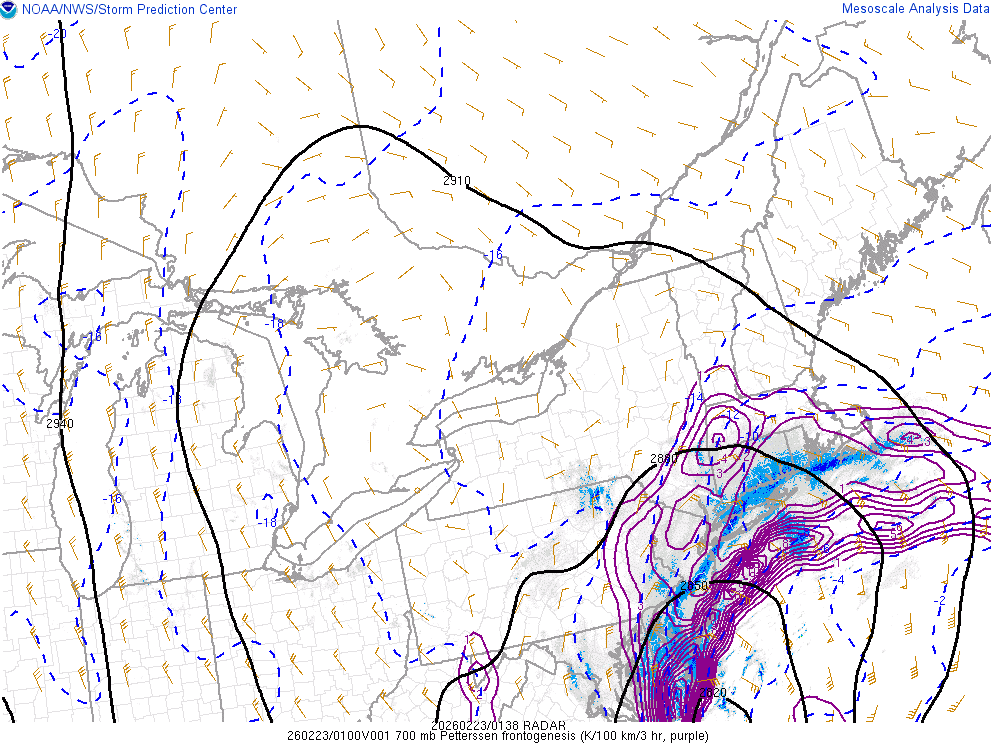
incredible storm, about 13.5" here
-
9" and some of the heaviest snow i have ever seen
-
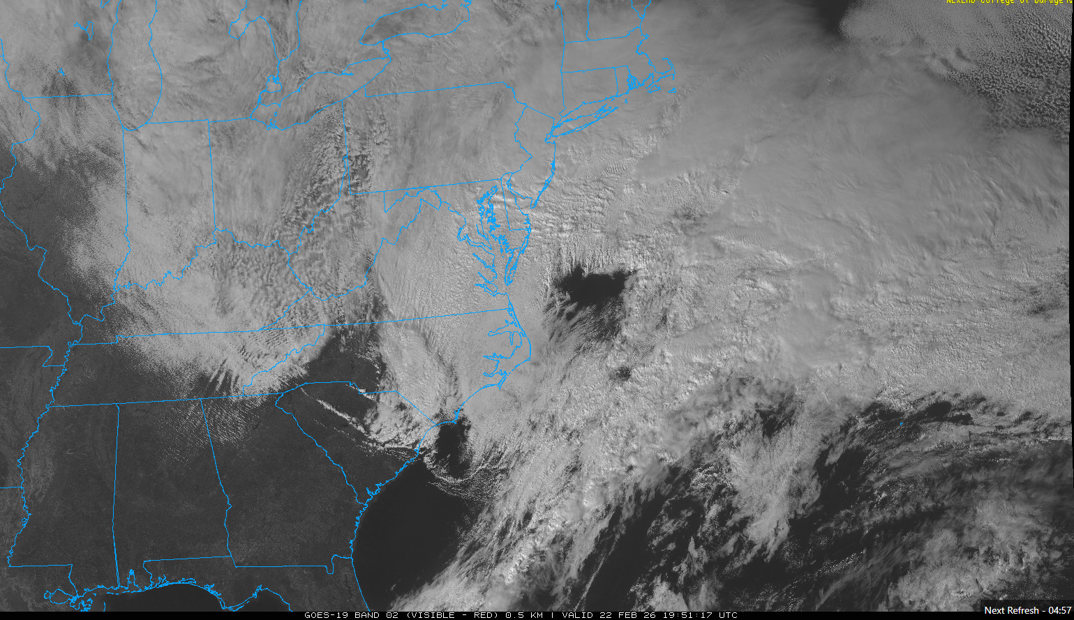
hang it in the Lourve. absolutely sick
-
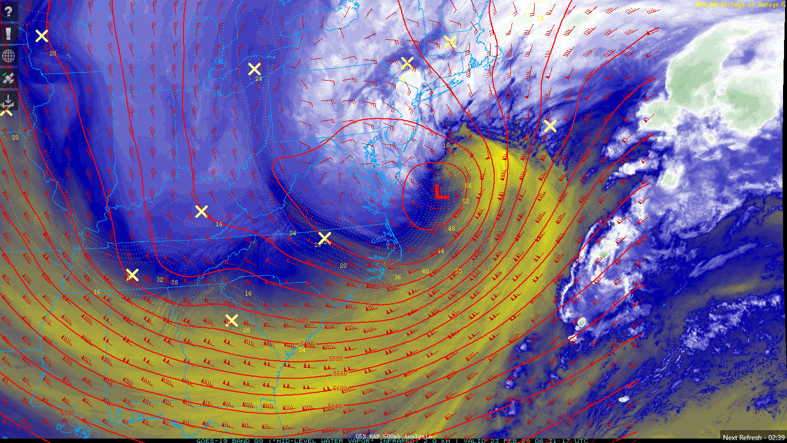
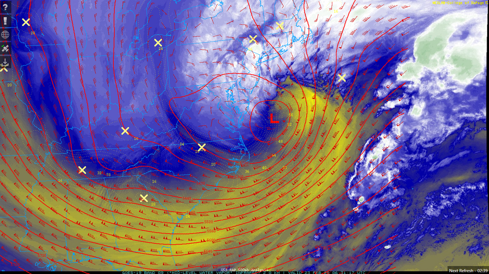
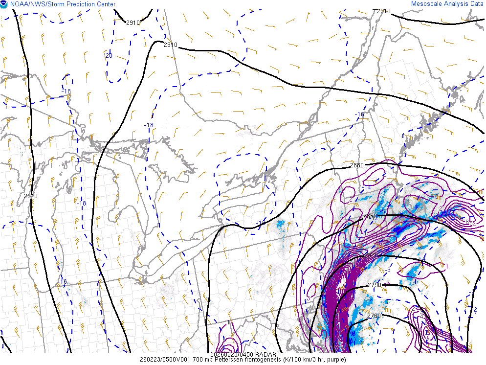
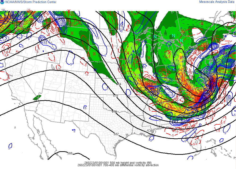
really incredible stuff. the low is just getting started
-
absolute cinema. this will be special for the area
-
rippage about to occur over the next hour
-
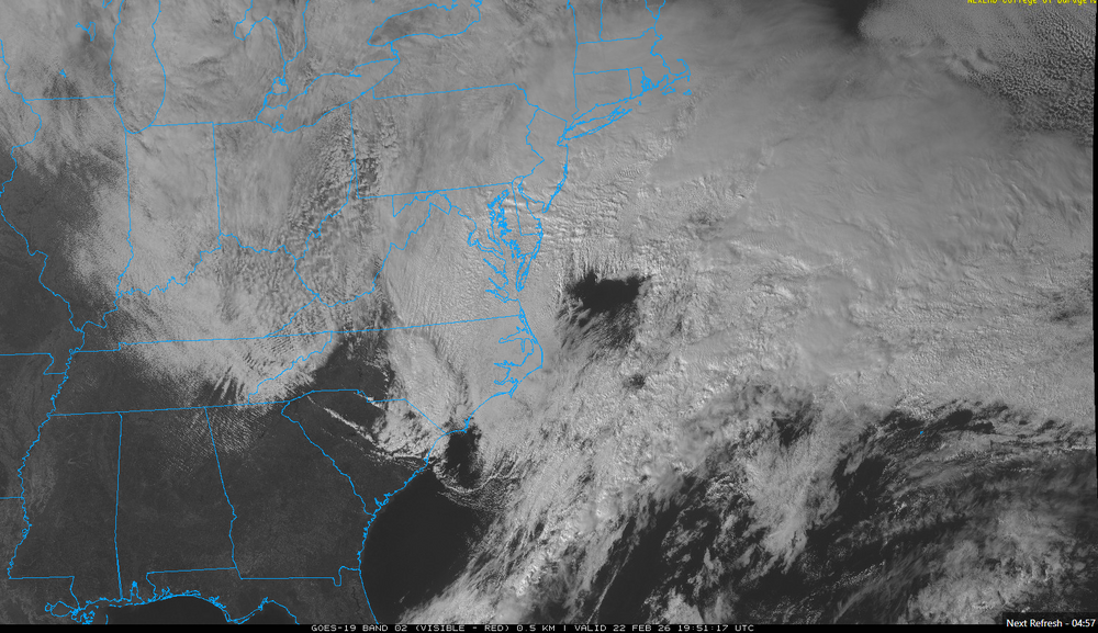
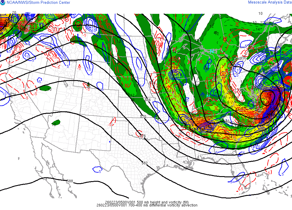
radar looks great can see that outer banding popping up over SE PA

-
steady light snow, covering colder surfaces up now
-
“Cory’s in NYC! Let’s HECS!” Feb. 22-24 Disco
brooklynwx99 replied to TheSnowman's topic in New England
this thing is locked and loaded, be sure to enjoy it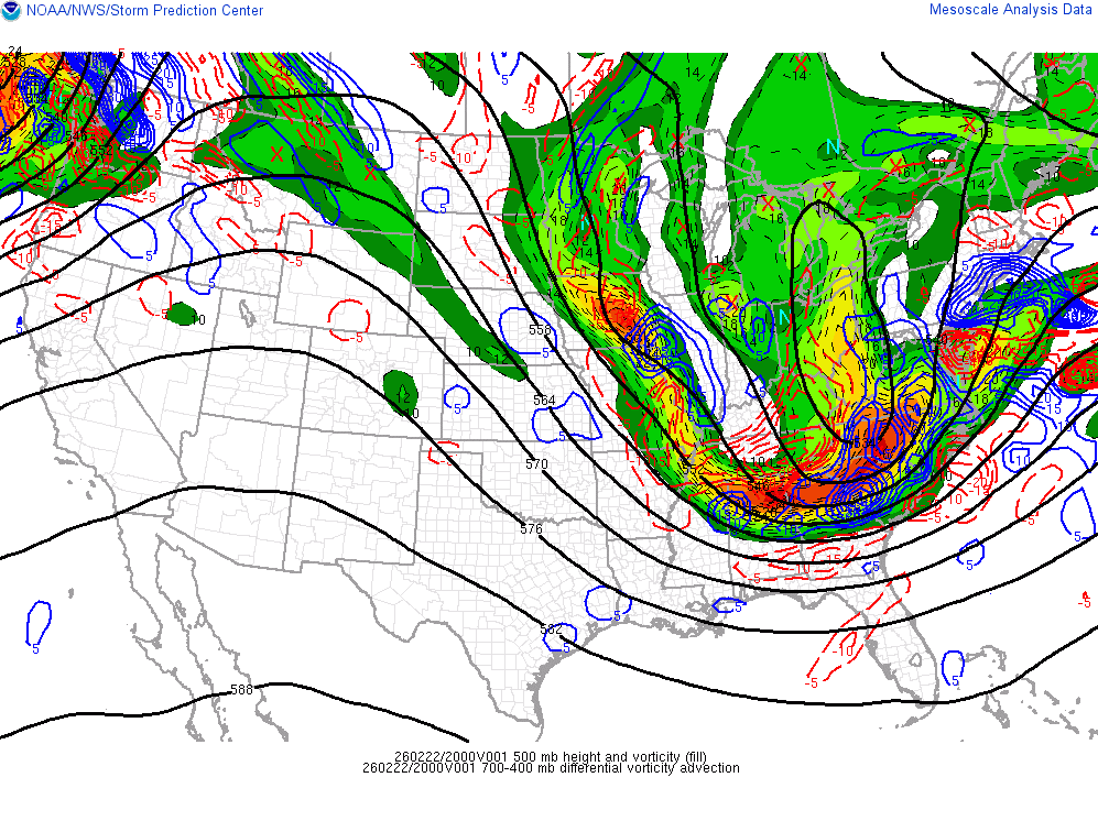
-
be sure to soak this one in, guys