brooklynwx99
-
Posts
5,630 -
Joined
-
Last visited
2 Followers

About brooklynwx99

- Birthday 06/18/1999
Recent Profile Visitors
41,851 profile views


-
the Southeast and southern MA is loving climate change right now
-
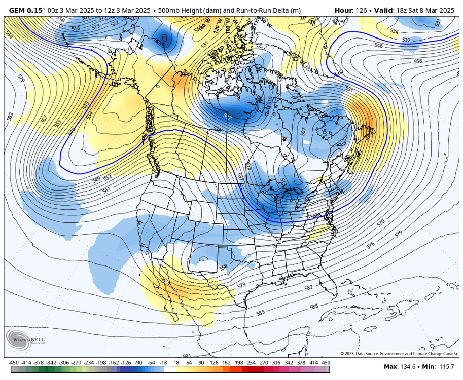
the heights over British Columbia are higher again
-
simple, the GFS is tallest with the ridge out west and allows the NS to have better momentum
-
the CMC and UKMET are also much better looking out west. I am definitely taking the GFS with a grain of salt but it's not that far off, and the PNA has been trending better for a while now
-
FWIW the CMC did make some nice shifts synoptically
-
the trend with the PNA over the last model cycle has been pretty nice. went from a trough to a full latitude ridge on the GEFS over BC
-
agreed, though the trend for more -NAO probably does limit the extent of the warmth
-
dude that was two weeks ago, damn
-
it's an operational model at 10 days out. it will do that, as will any other OP at this range
-
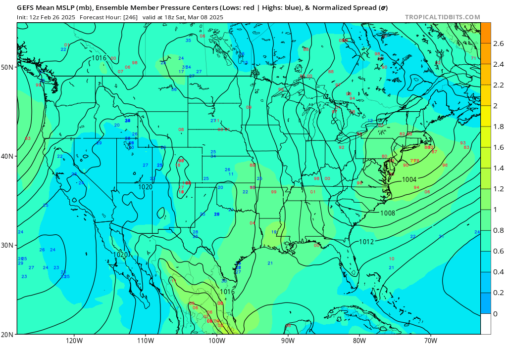
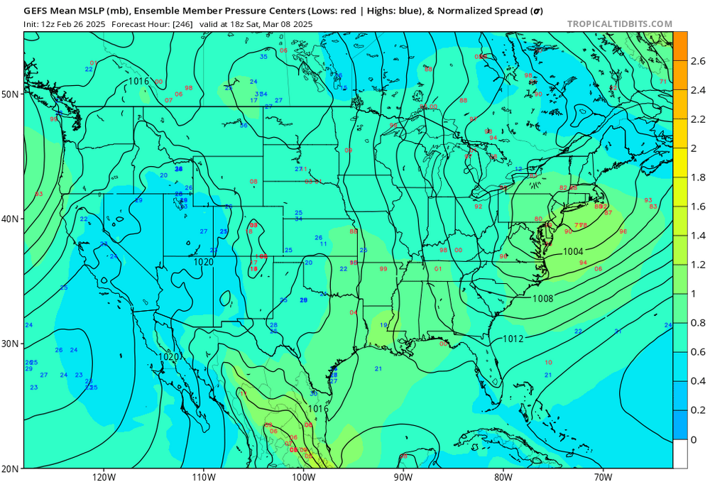
all ensembles maintain a signal for the 9-10th, just a matter of phasing. worth keeping an eye on
-
GEFS has quite a signal with lots of strong coastals
-
the transient 50/50 and -EPO do help this threat. the synoptics are there, it just needs to deliver with a phase
-
next shot at something more substantial is probably the 9-10th as the cutter drops the TPV down and a wave tries to amp into the colder airmass with the transient PNA spike. after that, it's likely curtains outside of NNE with some warm weather on the way
-
oh god please no
-
the AIFS humping is going to be unbearable for a while. past 5 days it isn't as good as any other model, really