NorthArlington101
-
Posts
12,490 -
Joined
-
Last visited
Content Type
Profiles
Blogs
Forums
American Weather
Media Demo
Store
Gallery
Everything posted by NorthArlington101
-
apply your own ratios

-
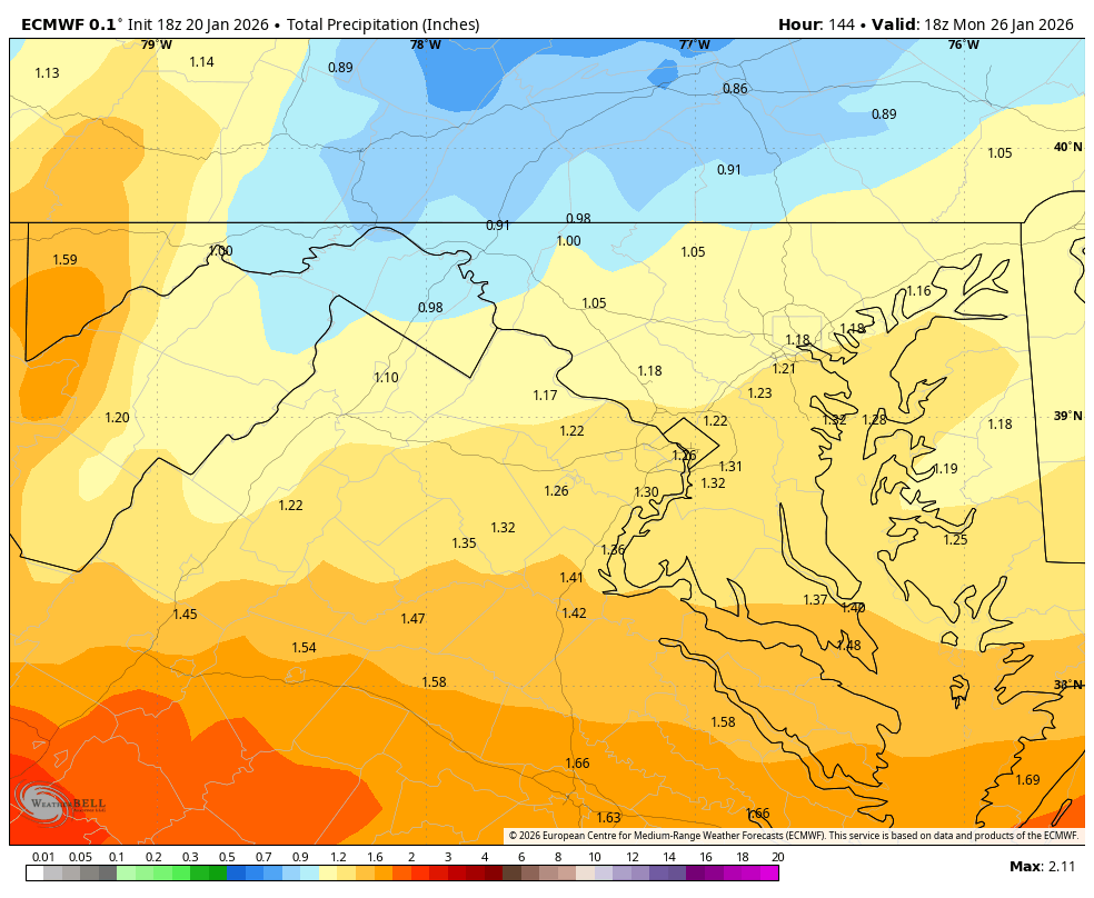
1.2” of QPF at DCA by 7pm Sunday and still chugging
-
EURO is a sweet run. Waiting for the pretty maps, but we don’t need to worry.
-
Reviving this concept... think @yoda and @nj2va said they were interested? I'm in Penn Quarter for work but could meet anywhere in DC/Arlington zone. Open to suggestions, wonder if we want a separate thread.
-
Yep. This is looking like a sloppy phase. Upside is a fair bit higher than this run. And this run is still probably on the lower tier of the great runs we’ve had today.
-
Also had the bit of snow Friday for some of our southern parts. Pulled back whatever triggered the bit of snow Saturday morning and is gearing up to smack us, I think. At least a strong jump.
-
GFS puts some light stuff over the area by Saturday morning
-
This genuinely gives me chills. I'm such a sicko
-
Little more north at 114.
-
Missing the early Jan storm last year hurt my soul. You might be a sturdier weenie than I
-
I've missed many a snowstorm in Puerto Rico. It's beautiful, hope you get to make it there (on Wednesday).
-
Congrats on not doing what I probably would've done and immediately leaning toward the most bullish outcome. 4-8"+ with a clear caveat that the + could be a fair bit more seems wise for an early guess so that you don't get shoved into a locker if school happens on Monday. Good luck!
-
Also only about 7 true disaster members on the AIFS Ens
-
I only count 7 fairly truly devastating misses to the south. 14% of disaster, what could go wrong?
-
Median outcome pretty sexy. Essentially a hold from 06z.
-
Looking at the individual EPS members (nice WxBell maps incoming) it's pretty clear the only reasonable cause for concern is suppression. Northern stream running out too far ahead of the southern stream (ULL slowing down) would be my specific concern with what we're seeing but hopefully we've got some room.
-
Gonna be a total weenie here but wish we could get better rates. The longevity of this storm is what makes it impactful for us... along with the "ratios"
-
Looking at the 3hr/snow maps, barring ratios, the hourly snowfall totals honestly aren't that all impressive... like .55-.75"/hr. Wish I knew more about airport operations, but if you feel like you can get there, I feel like the airports may be able to keep up.
-
-
I’ll be able to get total QPF shortly but think it’s about 9” 10:1 for DCA. Please hold
-
Looks like about a dead-on midnight start. WxBell maps almost at the money.
-
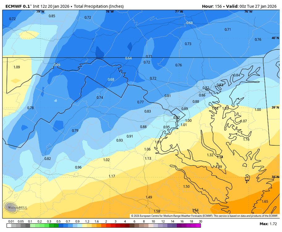
Ending my brief crashout - unless the EURO comes in and scares me. GEFS is fine. Drier. No real south shift.
-
GFS and GFSAI have tilted me a bit this morning so I'm going to restrict myself to here. Why can't we get good model agreement for more than one suite (6z)? Why is this storm always 6 days away?
-
Probably, but just flipping precip back and forth at 96 it's a 100mi jump south at least
-