NorthArlington101
-
Posts
10,913 -
Joined
-
Last visited
Content Type
Profiles
Blogs
Forums
American Weather
Media Demo
Store
Gallery
Everything posted by NorthArlington101
-
50 in UHI hell.
-
12k NAM looking like a sleet storm, colder at the surface too. See if the 3k follows.
-
Thanks - appreciate these maps. Don’t have Pivotal… can only pay so many subscriptions!
-
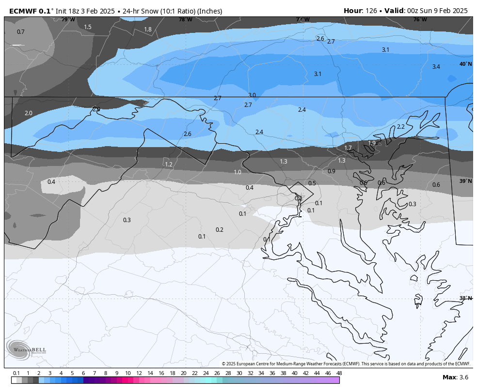
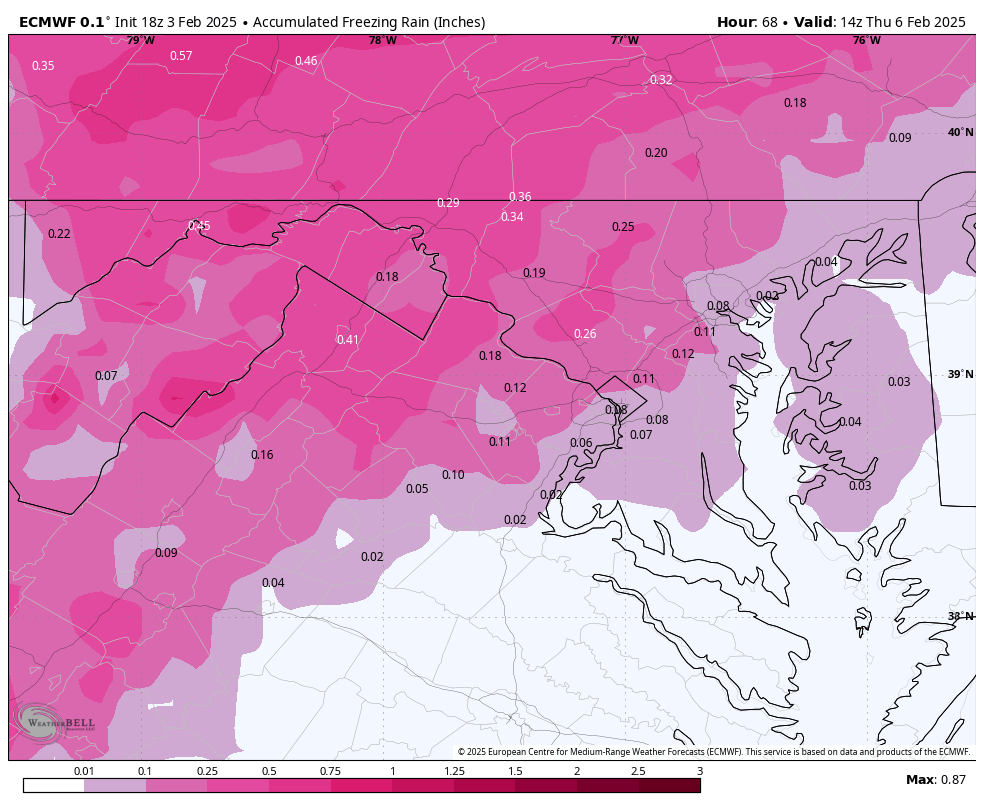
18z EURO is in for a wintry mix event (sound familiar?) for Saturday. Snowier for the northern tier, more ice everywhere, flips to rain eventually.

-
-
GFS is crazy slow to get this going. Says "what precip" and it's 1am Thursday. Finally icing around 4am
-
I based that more off my read of the LWX AFD - but ultimately yes concur that there is most likely no real impact til that late evening-10pm period. fwiw the short range FV3 does the same thing as the RGEM
-
Gotta take it with the grain of salt it deserves but RGEM is 1" of snow with sleet and 0.5" of ice for pretty much everyone, lol
-
this got delayed a bit which is helping with the impacts - looks something like this as is 10am-10pm Wednesday: light rain/sleet/snow, T-1" as you go toward NE MD 10pm-10am Wednesday Night/Thursday morning: heavier sleet/FRZA, favored spots favored, changing from sleet to FRZA to rain SW->NE
-
Still ongoing at this point but impactful-looking... still sleeting in NE MD
-
3k is pretty sleety - as others have noted this would help the ice have a chance outside the trees/power lines.
-
LWX's first pass:
-
I think @WxUSAF mentioned wanting to see the next NBM earlier - fwiw... some of this is from the 10th but most is 12th-on
-
another perspective just showing how clear this threat window is... if it wasn't already clear to the group
-
buy!
-
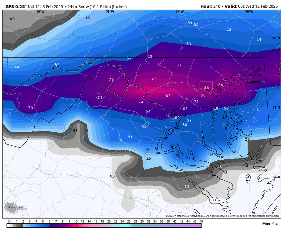
agree with all points - just to demonstrate a little, this is the 90th percentile snowstorm as shown on the EPS. MECS to maybe borderline HECS is the current "top level" outcome
-
apple weather app showing 12" of snow next tues/weds... the (general public) hype is coming
-
lwx disco, emphasis mine:
-
This is a 24 hour mean - that's a "woof woof" big dog signal right there. Timeframe has been locked in for 2-days and keeps looking better. 24hr median is equally nutso
-
It looks a lot like 00z - 6z went was less icy. But we're talking .1" of difference, though that obviously matters quite a bit
-
thump to rain for the 12th
-
It's the most meh of all guidance still for sure - but this would be impactful NW. It's ~28 in PSU-land, it's not super heavy, it should accrete.
-
Small potatoes compared to what we are eyeing but EURO took a jump south for Saturday ices everyone up pretty good again... any of this precip that isn't snow is ice
-
-
Kinda looks like the Wednesday/Thursday event tbh. Train tracks or whatever