NorthArlington101
-
Posts
12,483 -
Joined
-
Last visited
Content Type
Profiles
Blogs
Forums
American Weather
Media Demo
Store
Gallery
Everything posted by NorthArlington101
-
Bold! I like it.
-
What’s your forecast?
-
Dedicated AmWx winter retreat house? That’s what I’m hearing
-
What’s your prediction at this time
-
It would’ve been nice to see the euros improve but such marginal changes from their previous OP runs. See what the ens say in a sec (I’d gamble they are worse, but ya never know)
-
This is the real money trend. Does it continue? Idk
- 589 replies
-
- 11
-

-
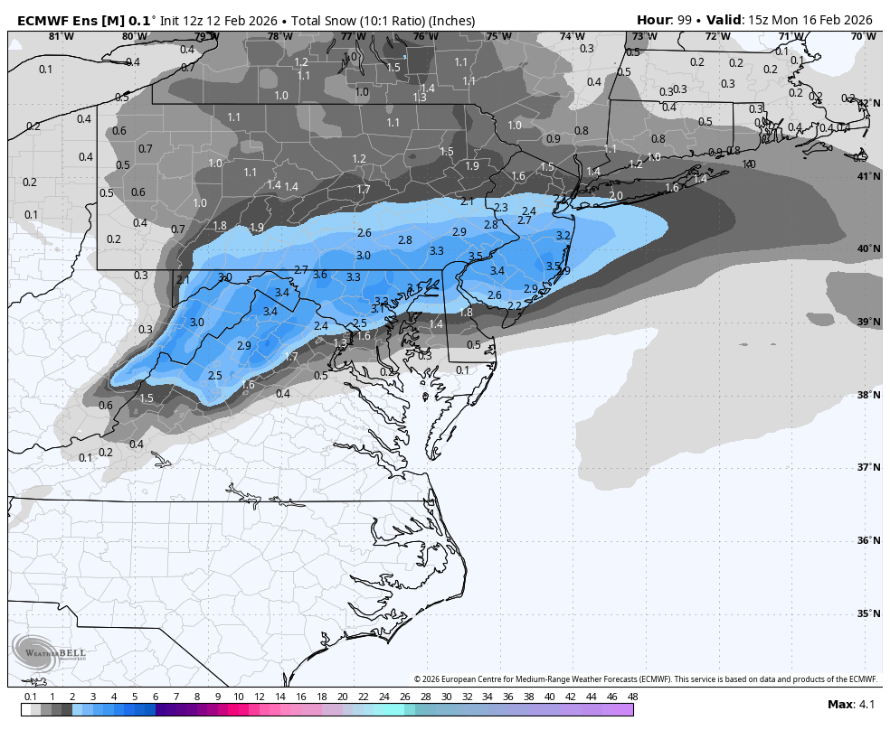
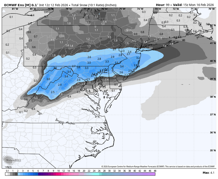
Ask and ye shall receive
-
 Other thread
 -
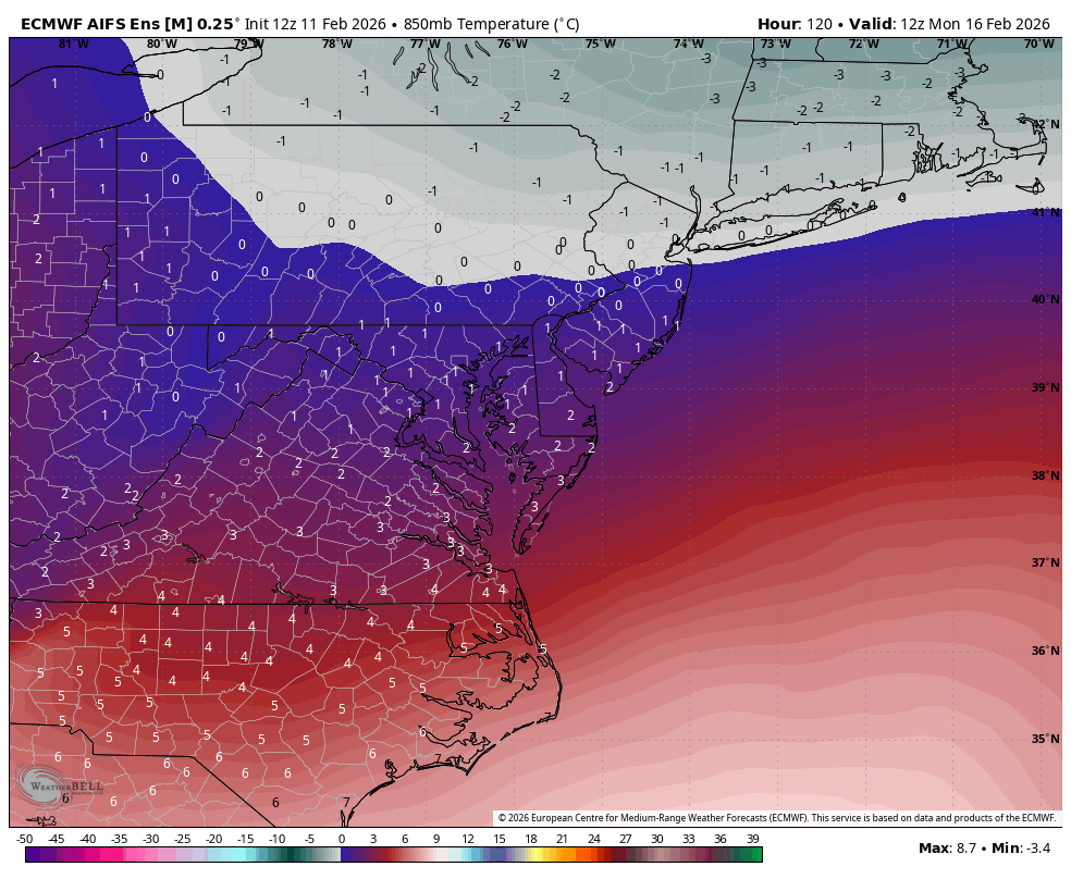
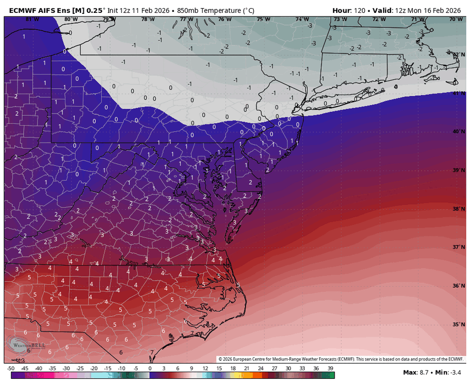
AIFS undeniably overdoes snow in marginal situations. I wish it didn't but it does. Can't hurt to see it improve but lean EPS/Euro blend + AI for funsie upside
-
-
Its better but waiting for WxBell maps to post unless someone wants to beat me to it
-
6z? Shame on you
-
75th percentile 90th percentile
-
Median not as inspiring but suggestive that favored folks should at least see "something"
-
Worth a genuine hmmm
-
we’ll see where things end up! I’d spend an afternoon to hunt 2-4” for sure.
-
I might be a sicko but I’d chase this. Take a quick hike somewhere in MD. Not gonna stick on the roads too bad anyway
-
-
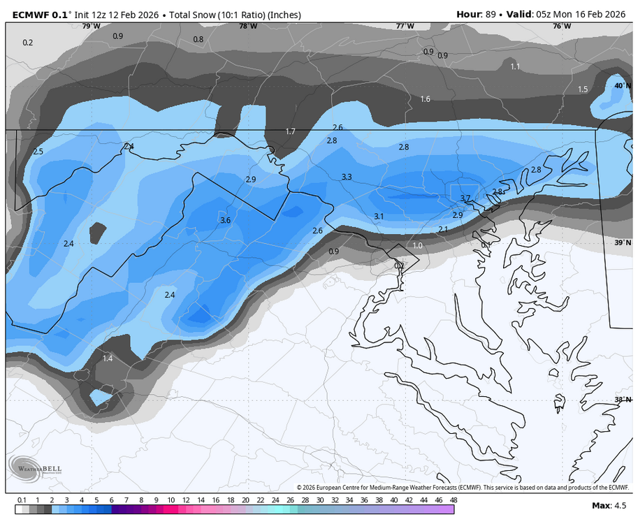
EURO gonna look a lot like the AIFS. Snow map incoming
-
Flurries in DC
-
GFS pops a fantasy storm Day 10. All I take that to mean is it’s not a shutout pattern.
-
Looks like the 6z EURO. I’m back in… for 2 hours.
-
My AI sensors are tingling
-
I work with a lot of Richmond folks and whenever they know I like snow or weather they ask about DT.
-
I don't think you've ever offered a functional alternative. I always appreciate your comments with barometer obs and your personal modeling based on those outcomes but the hit rate seems no better. If you really feel this way I'd love you to offer a clear forecast 7/5/3/1 day out from each event and we can keep score against the AIFS or whatever is performing best