NorthArlington101
-
Posts
12,444 -
Joined
-
Last visited
Content Type
Profiles
Blogs
Forums
American Weather
Media Demo
Store
Gallery
Everything posted by NorthArlington101
-

Late February/Early March 2026 Mid-Long Range
NorthArlington101 replied to WxUSAF's topic in Mid Atlantic
I mean that’s a hall of fame screengrab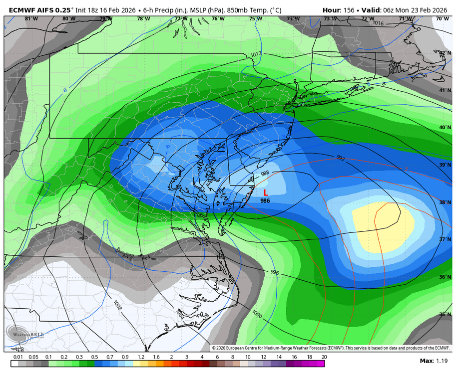
-
Late February/Early March 2026 Mid-Long Range
NorthArlington101 replied to WxUSAF's topic in Mid Atlantic
Only six days to go. One last ride -
Late February/Early March 2026 Mid-Long Range
NorthArlington101 replied to WxUSAF's topic in Mid Atlantic
Anyone still like the WeatherNext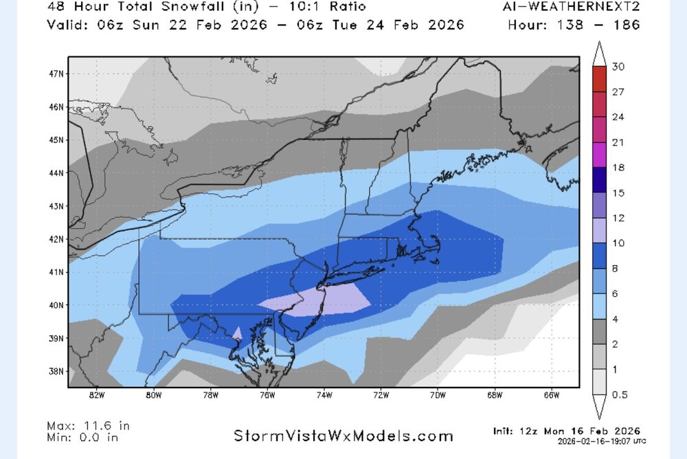
-
Late February/Early March 2026 Mid-Long Range
NorthArlington101 replied to WxUSAF's topic in Mid Atlantic
Pretty sure the EURO says what storm even for SNE but I don’t have all the panels to be 100% sure -
Late February/Early March 2026 Mid-Long Range
NorthArlington101 replied to WxUSAF's topic in Mid Atlantic
Basically 5 days out. Easy -

-
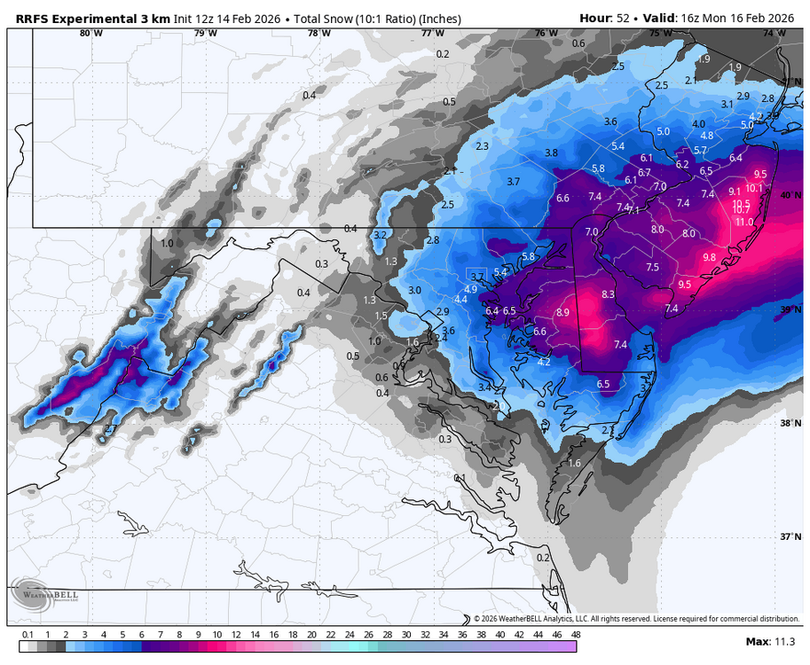
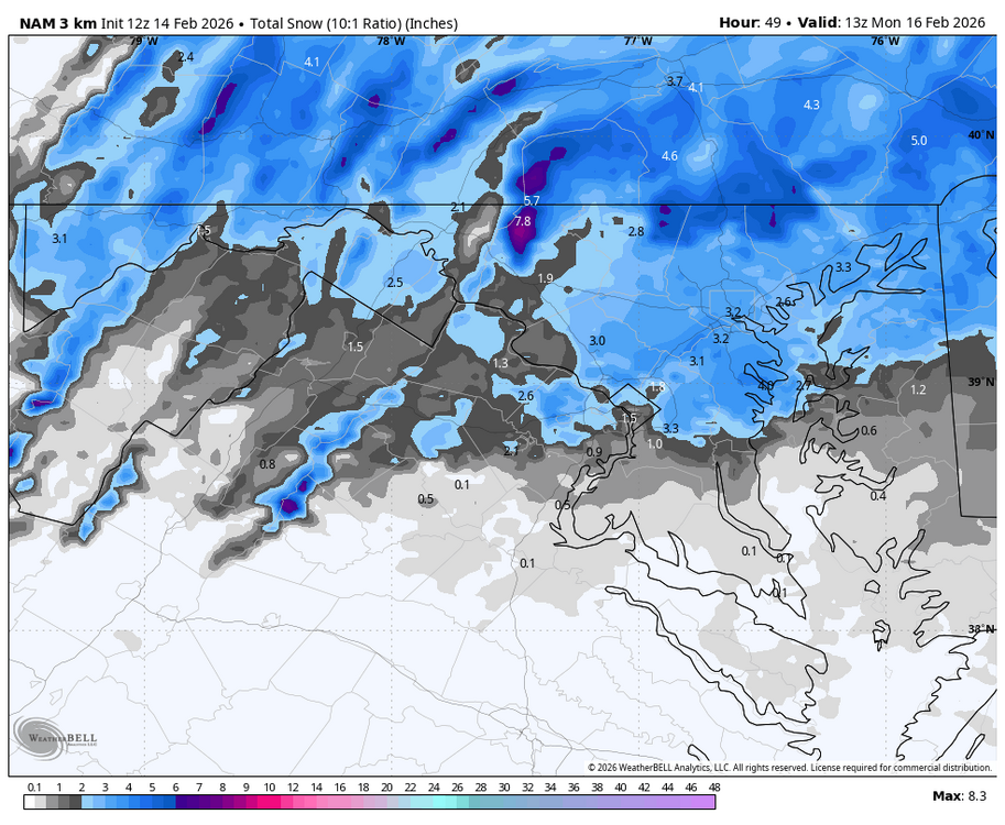
RGEM is a no, so CMC will be a no... prob same with the FV3 and the GFS. But the random hires models like it. Surely we can't lose
-
-
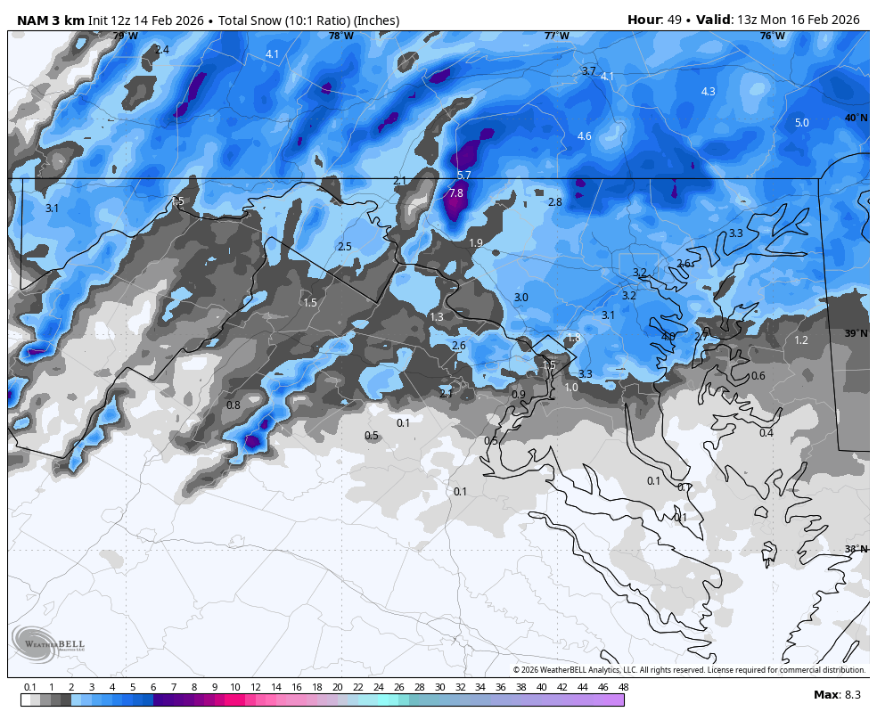
Did nobody post the 3k? Wtf?
-
Well… not none https://twitter.com/weatherprof/status/2022432636526883311
-
-
Bold! I like it.
-
What’s your forecast?
-
Dedicated AmWx winter retreat house? That’s what I’m hearing
-
What’s your prediction at this time
-
It would’ve been nice to see the euros improve but such marginal changes from their previous OP runs. See what the ens say in a sec (I’d gamble they are worse, but ya never know)
-
This is the real money trend. Does it continue? Idk
- 589 replies
-
- 11
-

-
Ask and ye shall receive
-
Other thread
-
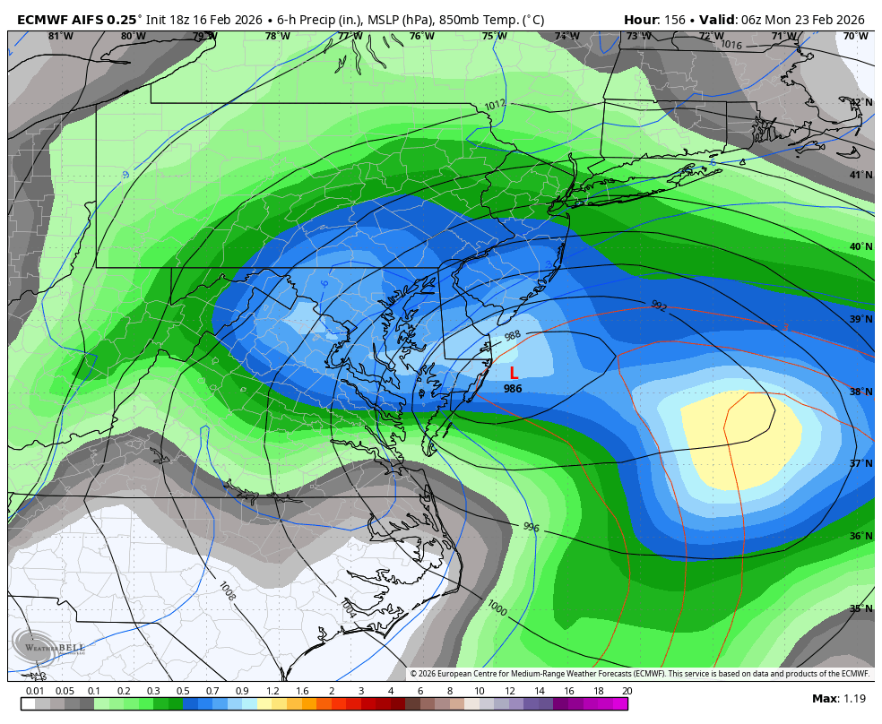
AIFS undeniably overdoes snow in marginal situations. I wish it didn't but it does. Can't hurt to see it improve but lean EPS/Euro blend + AI for funsie upside
-
-
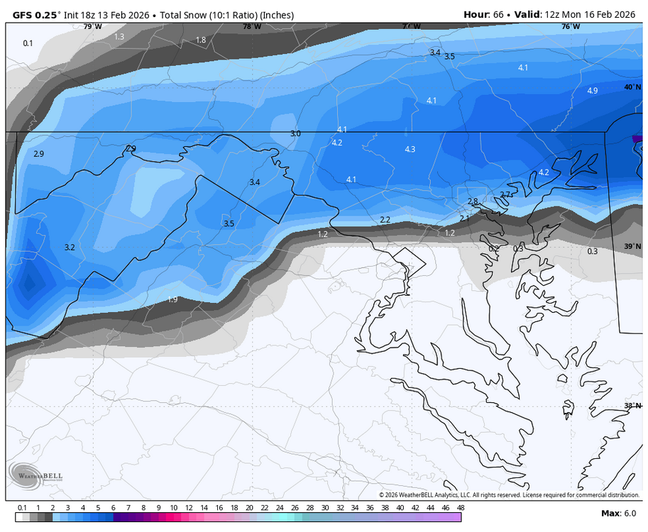
Its better but waiting for WxBell maps to post unless someone wants to beat me to it
-
6z? Shame on you
-
75th percentile 90th percentile
-
Median not as inspiring but suggestive that favored folks should at least see "something"