radarman
-
Posts
13,440 -
Joined
-
Last visited
Content Type
Profiles
Blogs
Forums
American Weather
Media Demo
Store
Gallery
Everything posted by radarman
-
I have some equally blown out (sweet) pics of 12/31/00 but every time that storm is mentioned here someone drowns a kitten in eastern MA. At any rate, we've seen things on that order here plenty of times recently. March and April 01 stand alone however.
-
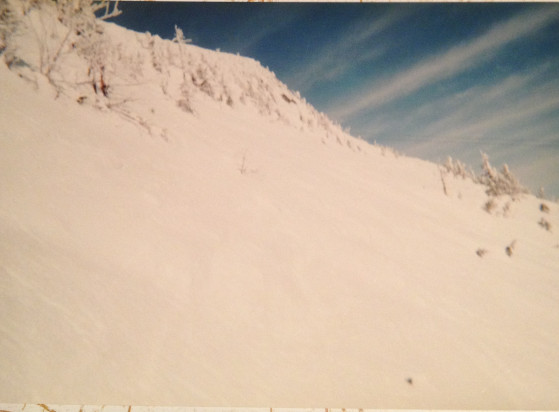
lol. Those are digital pics of faded prints from a CVS disposable wind up cam. If they weren't so epic they'd be tossed a long time ago. Hopefully we can make them obsolete some day soon.
-
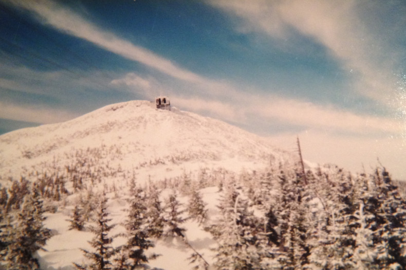
I can never pass up a chance to wax about 3/01... Jay Peak summit looked like something from way out west. Sorry for the horrific pic quality.
-

Texas/New Mexico/Louisiana/Mexico Obs And Discussion Thread Part 8
radarman replied to wxmx's topic in Central/Western States
nice job, and GL As an aside, hiked Mt. Wheeler on 10/1... snow began to appear around 11.4k', ramped up sharply above about 12.2k'. Stray post holes might swallow up your whole leg in places... And the wind was out of control near the peak as the late Sept trough finally ejected.. Beautiful, incredible place.

-
Texas/New Mexico/Louisiana/Mexico Obs And Discussion Thread Part 8
radarman replied to wxmx's topic in Central/Western States
some decent and much needed rainfall this afternoon and evening in parts of the metroplex. Ft Worth got in on it earlier. Grapevine and Irving on the north side of DFW airport had nuisance level street flooding. Even Garland and Mesquite had a nice cell move through. We'll take it at any rate. -
Texas/New Mexico/Louisiana/Mexico Obs And Discussion Thread Part 8
radarman replied to wxmx's topic in Central/Western States
FWD just tweeted out that Arlington Municipal Airport picked up .85" in 8 minutes. Good to see the metroplex cashing in here in the first couple days of June after a relatively dry May and before the ridging takes hold. I would say that the DFW airport totals for the month (4th dryest May) is a bit fluky and are not totally representative of conditions around the metro as a whole, but no doubt it was dry, particularly on the western side. Areas further east did a little better... also north up by Denton. -
Texas/New Mexico/Louisiana/Mexico Obs And Discussion Thread Part 8
radarman replied to wxmx's topic in Central/Western States
Seriously heavy rain over N Ft Worth and Denton and may move over Dallas in a bit. approaching 4" in the last hour in places. -
Texas/New Mexico/Louisiana/Mexico Obs And Discussion Thread Part 8
radarman replied to wxmx's topic in Central/Western States
Some low end straight line wind damage was recorded NW of Denton last night (Slidell, Krum), and some planes were damaged. There was a leading edge rotation signature on the UNT radar though it skirted the SW edge of the airport and started to dissipate. -
Texas/New Mexico/Louisiana/Mexico Obs And Discussion Thread Part 8
radarman replied to wxmx's topic in Central/Western States
Spotter reports of quarter size hail+ near downtown Cleburne. -
Texas/New Mexico/Louisiana/Mexico Obs And Discussion Thread Part 8
radarman replied to wxmx's topic in Central/Western States
-
Texas/New Mexico/Louisiana/Mexico Obs And Discussion Thread Part 8
radarman replied to wxmx's topic in Central/Western States
Storm is lifting N and should it continue with strength it will find itself in football game traffic. Dangerous situation. -
Texas/New Mexico/Louisiana/Mexico Obs And Discussion Thread Part 8
radarman replied to wxmx's topic in Central/Western States
Better views as it came across 67 near the Midlothian radar. New warning also mentioned it. More importantly this is a significant storm and certainly out of season for the second year in a row. That stretch of 67 near Venus has been particularly active, by chance or not, in the years since we have set up the radars. Numerous strong storms have run that stretch. -
Texas/New Mexico/Louisiana/Mexico Obs And Discussion Thread Part 8
radarman replied to wxmx's topic in Central/Western States
Might be the first time we made the text of a warning. Full disclosure the storm is fairly attenuated at X band for an ideal view, but I guess there is enough signal for the WFO to at least make out the location pretty well. -
 Congrats on the snow Jake.
 -
Texas/New Mexico/Louisiana/Mexico Obs And Discussion Thread Part 8
radarman replied to wxmx's topic in Central/Western States
nice shot. Was caught in an absolute deluge under one of those cells just ne of DFW airport this evening. Very picturesque sunset too. -
Texas/New Mexico/Louisiana/Mexico Obs And Discussion Thread Part 8
radarman replied to wxmx's topic in Central/Western States
Yeah that was a nice looking OFB. Had the radar at UNT on and when I saw that thing rolling in I was wondering if I might need to activate the entire network. Decent storms way up there. -
Texas/New Mexico/Louisiana/Mexico Obs And Discussion Thread Part 8
radarman replied to wxmx's topic in Central/Western States
KXAS, NBC DFW is getting a mobile x band radar mounted on the back of a pickup truck... it is the same kind as the CASA radar at Addison. -
Texas/New Mexico/Louisiana/Mexico Obs And Discussion Thread Part 8
radarman replied to wxmx's topic in Central/Western States
Interesting seeing that storm pop up S of Midlothian with decent gusts in its own right, and drift northward, all while the main complex drifts S. I wonder if it will flare up when it encounters the OFB or if will kill the updraft. -
Texas/New Mexico/Louisiana/Mexico Obs And Discussion Thread Part 8
radarman replied to wxmx's topic in Central/Western States
First SVR just issued and radar is showing some decent winds. -
Texas/New Mexico/Louisiana/Mexico Obs And Discussion Thread Part 8
radarman replied to wxmx's topic in Central/Western States
looks like 1.5" for a lot of the center of the metroplex. Spot 2" reports. -
3/8/13 was absolutely nooseworthy on the valley floor, but above 600' there was like 4-8".
-
Forecast/storm discussions and part II Manitoba Mauler
radarman replied to Damage In Tolland's topic in New England
This. I attribute the lackluster totals to poor growth and a somewhat glancing blow. Boxing Day I felt had more meso/micro climate reasons that caused the underperformance even though that was also a bit of a glancing blow for us N of Springfield as well. I had a massive radar hole rip open over my head in Noho that night. The classic valley screwgie is 12/92 and these were certainly not that for many reasons. -
Forecast/storm discussions and part II Manitoba Mauler
radarman replied to Damage In Tolland's topic in New England
Yikes do we have to be old to remember Dick Albert? -
Devastating tornado strikes Joplin, Missouri
radarman replied to Hoosier's topic in Weather Forecasting and Discussion
One thing I found interesting was the recommendations to radar operators to be more active changing PRFs during storm events to avoid range-folding at constant distances from the individual radars, and VCPs to reduce time between the lowest scans. In the event of a singular discrete supercell this may be feasible, but when all hell is breaking loose, with multiple TORs and developing cells (a la 4/27, 5/24, or even to a lesser extent 6/1) expecting the radar guys to execute these changes quickly for multiple radars is a lot to ask. It seems an ideal candidate task for an end-to-end optimized system. -
Reconsider majoring in meteorology!
radarman replied to stormguy80's topic in Weather Forecasting and Discussion
It may have already been mentioned but as much as a degree nowadays, it's the skill set that comes along with the degree that will likely prove useful going forward. If you're becoming adept at data processing with statistical methods, coding in a few different languages, predicting future events based on a number of factors, working odd hours, etc. it will serve you well regardless of what you end up doing. A lot of folks are changing hiring practices, looking for people with tools to attack variable problems, rather than just a degree in XYZ. Most folks I know are wearing several hats at their jobs, and therefore a variety of skills are necessary.