radarman
-
Posts
13,440 -
Joined
-
Last visited
Content Type
Profiles
Blogs
Forums
American Weather
Media Demo
Store
Gallery
Everything posted by radarman
-
 Take em down I think.
 -
The slot is killing my virga lol
-
RGEM coup incoming?
-
Yeah, it should be 100% or nearly so. Stuff that hasn't been skiable in 2 years. Happy for them. Hope they get a nice big crowd willing to human groom the woods in for the weekday morning crew
-
I'd rather positive bust an advy then negative bust a warning. 3-6" here final call. Moving quick, meso QPF red flags, less than 10:1 with lift not ideally aligned with the DGZ, maybe some downsloping on easterly flow. 3-6" cake flour is a great event regardless IMO, but selling bigger totals here IMBY right now.
-
Tracking February 6. Light to moderate event potential
radarman replied to Typhoon Tip's topic in New England
Just 21 here, but 27/28 on the hilltops nearby. -
Tracking February 6. Light to moderate event potential
radarman replied to Typhoon Tip's topic in New England
1.75" dense Maybe 3 or 3.5" at the Beast earlier when I left. Reporting 4" now. -
Now this is awesome
-
good on trail at any rate. They might find themselves hopefully on the right side of this N->S gradient for the system tomorrow, and could use a heavy stick to your bones snow to get the natural stuff open. Yesterday was great, but the snow was too fluffy to venture onto that stuff. Maybe more on Sunday too.
-
Definitely the big cold departure days, 21st to 23rd yeah. But the first half of the month was super windy out here and we weren't radiating very well at all. 27 high 22 low type days with no precip. The real feel was more BN than the actual, at least for a while. Less the 2nd half, but even the last 3 nights have been breezy.
-
A good decoding explanation here: http://www.theweatherprediction.com/models/fous/
-
local coops, with records that go back pretty far, were ~ -1 for Dec and will be ~ -1 for Jan. We take.
-
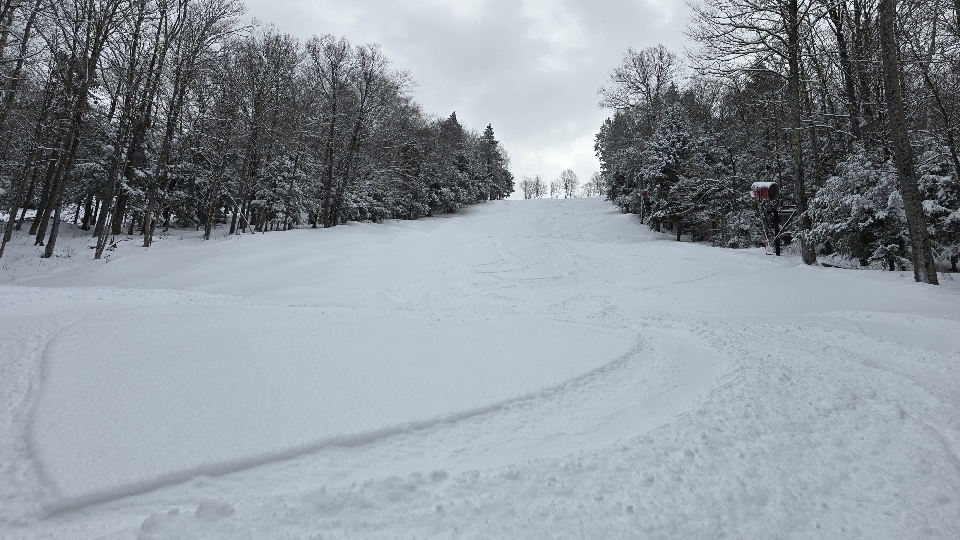
Great morning at the Beast. Been waiting for this one. 4-5" of blower on top of smooth hardpack. Super fast, super fun. And where they groomed was amazing too, cord so soft and poppy it would bounce you out of turns like a trampoline.


- 309 replies
-
- 11
-

-

-
FFD or bust. RFD was very meh.
-
Countdown to May, pffff

-
Not the best pic but this was Berkshire East around 845 this AM

-
Belchertown just assumed
-
warnings hoisted MAC011-013-015-027-291830- /O.NEW.KBOX.SQ.W.0001.250129T1758Z-250129T1830Z/ Worcester MA-Hampshire MA-Franklin MA-Hampden MA- 1258 PM EST Wed Jan 29 2025 The National Weather Service in Boston/Norton has issued a * Snow Squall Warning for... Northwestern Worcester County in central Massachusetts... Western Hampshire County in western Massachusetts... Franklin County in western Massachusetts... Northwestern Hampden County in western Massachusetts... * Until 130 PM EST. * At 1257 PM EST, a dangerous snow squall was located along a line extending from near Northfield to near Pittsfield, moving east at 40 mph. HAZARD...Intense bursts of heavy snow. Gusty winds leading to blowing snow and rapidly falling visibility. Wind gusts up to 35 mph. SOURCE...Radar indicated. IMPACT...Travel will become difficult and potentially dangerous within minutes. This snow quall is expected to move across I-91. Locations impacted include... Amherst, Northampton, Greenfield, Orange, Deerfield, Gardner, Monroe, Athol, Winchendon, Montague, Templeton, Hadley, Sunderland, Hatfield, Northfield, Williamsburg, Huntington, Bernardston, Buckland, and Conway.
-
Managed a coating on the roads. Came down hard for a few mins. Sun back out now. But the streamer should be aligning with the pike here shortly, could get a little slippery.
-
Catching some snsh from this little streamer. Maybe some heavier stuff heading into Holyoke/Chicopee/Ludlow here shortly.
-
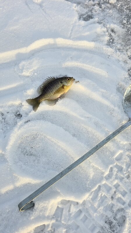
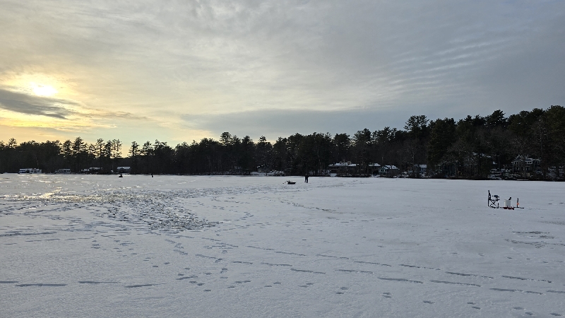
Only thing I caught this evening was aggressive little bluegills jigging a spoon. No flags. Love being out on the ice though. A foot thick in spots right now, awesome run of cold wx.

-
GFS looking great for the clipper again
-
All we have is like 60% of our snow climo left!
-
Sounded like steady rain. I still have several big standing dead oaks shedding branches on the property over time. Awful.
-
Many all time records fell and several other 2nds and 3rds all time. Feb 1899 and Jan 1985 were really the two comparable cold spells, both with the core of the cold focused a bit further east. But it was insane this morning. New Iberia hit 2, Lafayette 4, Mobile 6, Gulfport/Biloxi 7