USCG RS
-
Posts
2,799 -
Joined
-
Last visited
Content Type
Profiles
Blogs
Forums
American Weather
Media Demo
Store
Gallery
Everything posted by USCG RS
-
Going to be a rough ride for them. Hopefully no embedded tornados for them this time.
-
Absolutely perfect outflow.
-
So Bermuda is safe.
-
Thanks for weighing in. It is always nice to be able to learn from those who are the professionals.
-
I believe the difference on radar and IR imagery is where the deep convection has wrapped. The deep convection is beginning to swirl the hurricane and the IR is showing where the physics of the beast is setting up. The eye that has cleared out is pinhole. It is concerning that IR Imagery is showing that, despite the fact that radar has not quite caught up. If radar is able to catch up, well really, if the thunderstorms themselves are able to wrap tightly around the eye as to where it is cleared out then we are going to have a potentially catastrophic situation on our hands. I don't use catastrophic lightly either.
-
NARRATOR: The GFS was acting normally....
-
I see you are in Tampa. I would personally prepare for the worst and make plans in case it looks like you need to move further inland. While I personally do not believe this will be the case, it would be foolish -in my opinion- not to be ready in case something like this took place. One just need remember Charley in 2004.
-
The question is does it miss the trough... As it strengthens and remains in weak steering currents... I would think that this is a real possibility.
-
I am. You're right. Regarding the EM Workspace, there is a rationale behind it, although it might be a bit premature. --) To begin with, there are specific operations that need to be gradually discontinued. These winding-down operations do take time, but they also allow for the minimal required personnel to be present. --) Airlines can ensure that none of their aircraft get stranded there if developments unfold rapidly. --) This approach reduces the risk of individuals being trapped and guarantees that if the situation takes a negative turn, there won't be a last-minute rush at the airport, which could lead to people being caught there as the storm approaches. --) It enables the airport to swiftly open up for emergency operations and planning. --) Let's not overlook the matter of liability...
-
Surge is what kills the majority of persons in Hurricanes
-
OKX Discussion hinted earlier that any storms which develop will be moving slowly - around 5 knots - and likely redeveloping. So the thinking appears to be that any strong storms/heavy rn which develops will be training over specific areas.
-
The pop and buzz of a very close lightning strike is something you never forget.
-
This is downright dangerous tbh
-
Liability
-
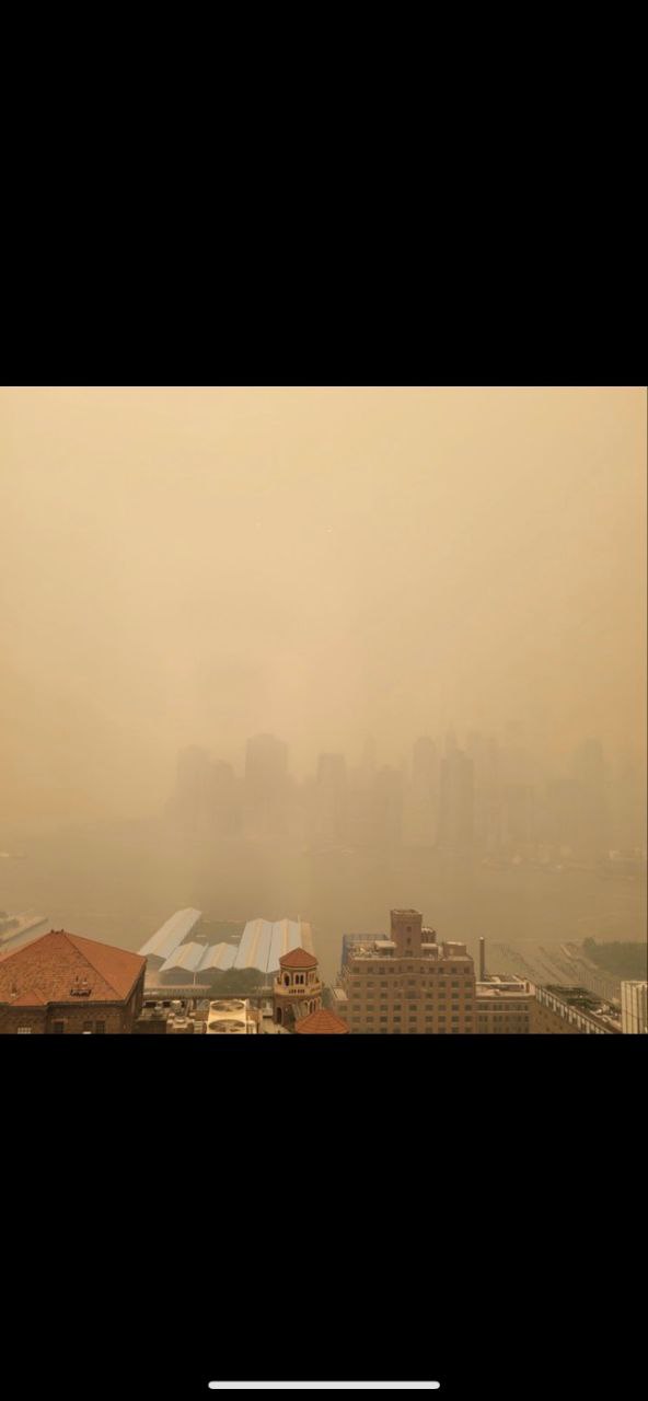
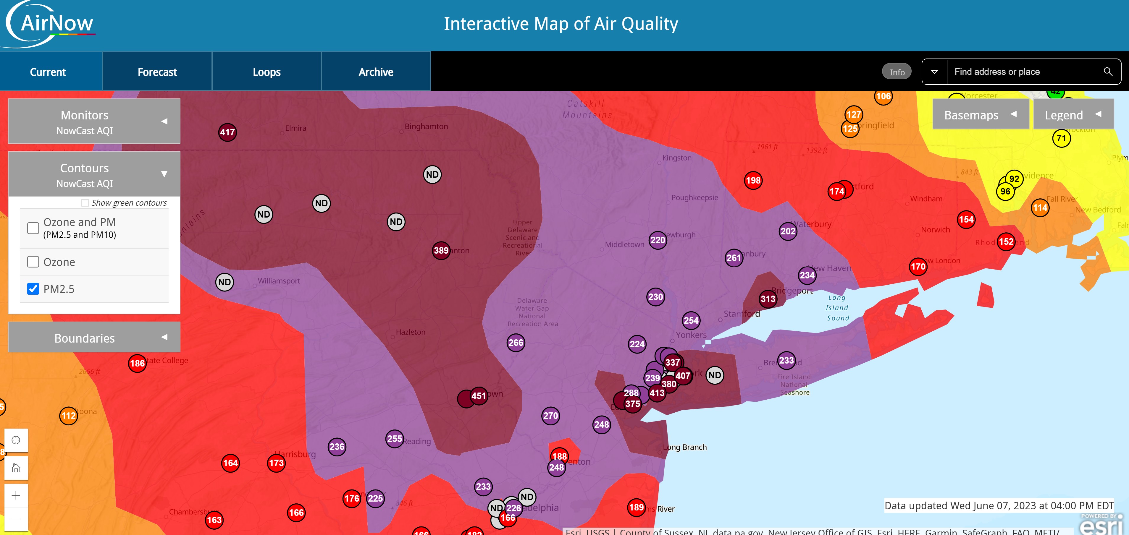
While I cannot comment as to that, I can definitely say that all the particulate in the air could allow for thunderstorms to pop up as the particulate is providing the platform for cloud formation. In fact, I wonder if the thunderstorms of yesterday were enhanced by all the particulate in the air.
-
Picture is of NYC (from a friend).


-
Excuse me. I'm getting my 12-15 inches. The Ukie storm Vista map said so
-
That's a foot of snow for my area.
-
.gif.9d3b012c185971997aa36326dff7c9da.gif)
-
Miller B was/is the biggest warning sign here imo It's still possible it develops early (even now)... However... I am rarely a fan of Miller Bs
-
For the second wave, I would be more worried about sniffing Cirrus than rain
-
I would not want to be in charge of that response. Nope.
-
Which one?
-
This about sums up my feelings rn.