MillvilleWx
-
Posts
4,884 -
Joined
-
Last visited
Content Type
Profiles
Blogs
Forums
American Weather
Media Demo
Store
Gallery
Everything posted by MillvilleWx
-
High hit 37° after a low of 12°. I think the craziest thing is the microclimate effect of the neighborhoods across from me on Monocacy in a bowl/valley. Readings ranged from 4° to 6° but as soon as you go up the hill to my place, it “only” got down to 12°. My high was 2-3° cooler however, so welcome to science 101: Density is Cool
-
I know people that work at LWX and I’m going to make sure they see this response. It is very important we gain the most accurate information possible, and I have reason to believe that some of these measurements are from snow depth and not storm total based on what is shown on this map. In Texas, we used TXDot for measurements away from populated areas because we didn’t have much of a choice. With such a density of reports available in areas around Central MD, this shouldn’t be the primary method of measurement and should very well be a secondary need if no data is available. That’s my 2 cents on the matter.
-
Has to be. Otherwise, very off. Sabillasville is gorgeous btw.
-
Hold up. That map has FDK at over 6” with that storm. What the hell am I missing? There is no damn way I got that much snow. The radar even indicated we missed the best banding. I call significant BS on that. Unless this is both storms combined…then it would be low-balling. I’m beyond confused right now
-
Finally recovered from that Ravens W. What a second half performance and the defense was lights out the entire game. I’m so stoked for next week.
-
Beautiful winter day. 6” of snow otg and temp only got to 25°. Currently 19°. Just amazing
-

Mid-Atlantic Snow Totals Thread - Winter 2023-2024
MillvilleWx replied to mattie g's topic in Mid Atlantic
That checks out. Thanks for the info. I’ll see if I can get an estimate for that date at some point. I’ll just add a note that it was estimate by someone else and not by me. Puts me closer to that 10” reading for FDK. Thanks! -
Mid-Atlantic Snow Totals Thread - Winter 2023-2024
MillvilleWx replied to mattie g's topic in Mid Atlantic
Considering the map @Terpeastjust shared, that’s probably where my difference is. I only have 9.2” but the NOHRSC has 10” over Frederick. I’m going to keep my total, but I do wonder what fell that day lol -
Mid-Atlantic Snow Totals Thread - Winter 2023-2024
MillvilleWx replied to mattie g's topic in Mid Atlantic
I was at my folks on the shore, so I don’t have any record of it and can’t verify. I’d imagine we got something, but I don’t think it was much. -
Low of 14 in my neck of the woods
-
Mid-Atlantic Snow Totals Thread - Winter 2023-2024
MillvilleWx replied to mattie g's topic in Mid Atlantic
12/19 - T 1/6 - 0.75" 1/15-16 - 4.7” 1/19 - 3.75” Total - 9.2” 5N Frederick, MD -
Technically yes, but the very northern edge before you exit. Wormans Mill area off Monocacy. It’s beautiful in this area.
-
Not quite, but over 0.5” in quick time. It was the best rates and dendrites I saw today. A beautiful smack to round out another wintry day. Up over 8” for the season now
-
Flush!
-
Our place got hit flush with the entire streamer. Place completely caved and all the work to clear the snow for our complex ended in coverage. It was a nice way to end a beautiful winter day.
-
3” measured at my place and continuous light snow. Refreshed everything, but definitely not the 5-8” they upgraded us to for some reason. I mentioned last night that I was concerned for the county with the best returns aimed for MoCo to HoCo which I’m happy materialized! I’m glad everyone in here got some snow and some really cashed on this event. Loving all the pics. Keep them coming
-
Enjoy you guys! Woke up to about 1.5” of new snow. This is definitely going to fall short in Frederick compared to the last event. Snow on snow is awesome though. Looks beautiful out. Bring home the goods today!
-
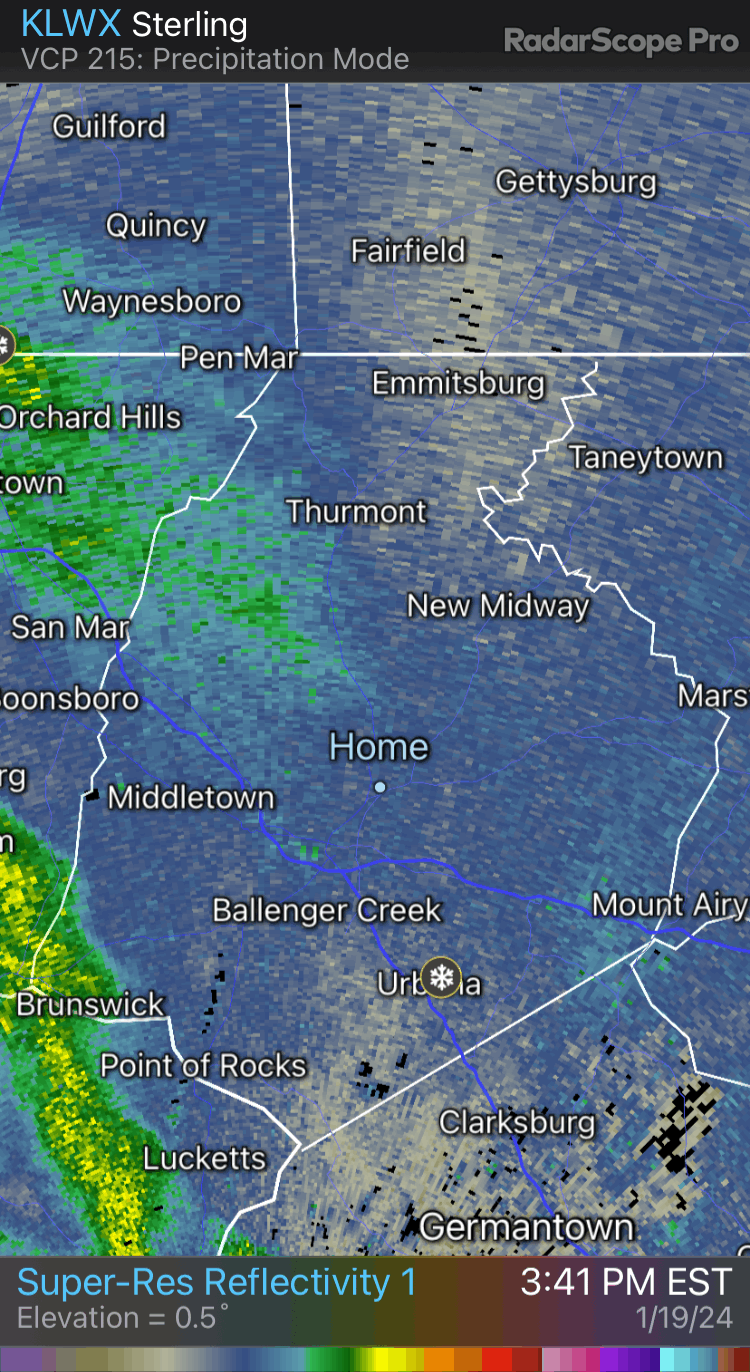
Hmmmm. Getting a little concerned about the valley here in Frederick. Might see the heaviest snow go south and east of here. We shall see later. Still looks like 2-4” is possible for me, but heavier totals might just miss here. Hopefully it plays out like the NAM, but I never want to put faith in that model when other hi-res are starting to get that look I’m mentioning.
-
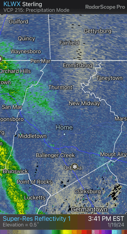
This. Before (Few days back) it was looking like that was favored for areas well to our north so I was content with the scraps. Now the trend is very much for this to happen overhead and the soundings/spatial outputs for 7H VV’s and correlated QG-convergence panels indicates that’s the expectation. We will see rates in some bands surpass what just occurred from the past event. It’s a vigorous jet streak we are working with. If you know anything about synoptic scale meteorology and translating to the mesoscale, this is prime for some surprises, so long as we aren’t being lead astray by guidance.
-
It’s going to be snow globing if these depictions are right. Amazing
-
Holy crap. It got a clue!!! Never thought I’d see that. Good stuff
-
The RAP is consistent with a band of heavy snow from the northern neck and adjacent WV panhandle up through Frederick into northern Carroll. Like, super consistent and the ECMWF had it for many runs in a row at one point as well. Might have something here! Makes sense when you look at the 7H VV panels. It is textbook for that corridor. Let’s get it!!
-
We’re a snow town again!
-
30/19 5N Frederick A crisp winter night awaiting a winter wonderland by the morning. Picking up some friends of ours at the airport in 2.5 hrs. I’ll be up very late tonight. Company is staying so they can catch an evening flight tomorrow to Iceland. Need to prep for the time change. Both meteorologists too. We are going to stay up and when it snows, go for a Sheetz run. What an awesome week I planned for this staycation. I hope my work is handling things okay. It’ll be nice to go back fully recharged and ready to roll. Let’s rock
-
Good to see. It’ll be fully caught up by 00z Saturday