

Brick Tamland
-
Posts
456 -
Joined
-
Last visited
Content Type
Profiles
Blogs
Forums
American Weather
Media Demo
Store
Gallery
Everything posted by Brick Tamland
-
I'm getting that feeling folks.
-
Oh my!
-
-
Incoming on the Canadian.
-
-
GFS has the storm, too, but warmer. Some ice in northern NC.
-
Is there a scientific explanation as to why it is is hard to drop 1 or 2 degrees here once it gets to 33 and it's raining?
-
That is the worst.
-
Euro AI seems to love to have big storms in the long range.
-
Seems the trend on the models this winter is small shifts south as the storm gets closer.
-
GFS
-
-
ICON at 96 has a little snow for the northern counties in NC.
-
Next weeks weather looks depressing for here.
-
I'd rather take today's weather all month than it get cold and rain or have a minor nuisance event with ice.
-
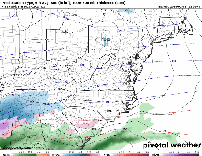
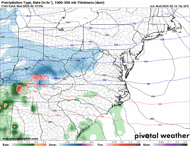
So we definitely have a storm signal for 2/11-2/14. ICON had ice at the end of the last run on 2/12 for most of NC outside the coast, and some snow at the VA border. GSF has snow for 2/11-2/12 for northern parts of NC and 85 west. Then a big ice storm 2/13-2/14. Canadian has ice for northern NC 2/11-2/12 and then snow 2/13-2/14 for a lot of NC and some ice in the eastern part of the state. I'm personally pulling for the Canadian.
-
Freezing rain on the GFS with the second storm.
-
And that's the opposite of the GFS. It has the first one farther north with a little snow here and the second one is ice.
-
-
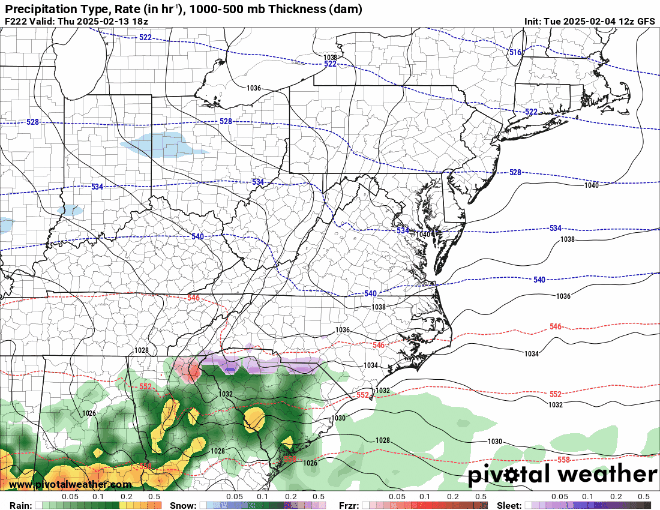
GFS has another storm further south 2/13 to 2/14.
-
GFS gives me more than I had with the last storm, though.
-
GFS has it ending as some snow for north part of NC and the mountains.
-
Looks like this one is drifting away from us right now.
-
Maybe this is the winter of the SE trend instead of the NW trend.
-
I like that the Euro has a storm signal.


