
TSSN+
-
Posts
2,673 -
Joined
-
Last visited
Content Type
Profiles
Blogs
Forums
American Weather
Media Demo
Store
Gallery
Everything posted by TSSN+
-
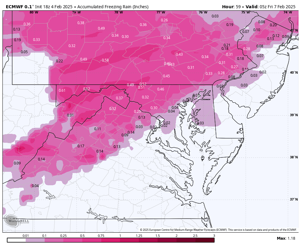
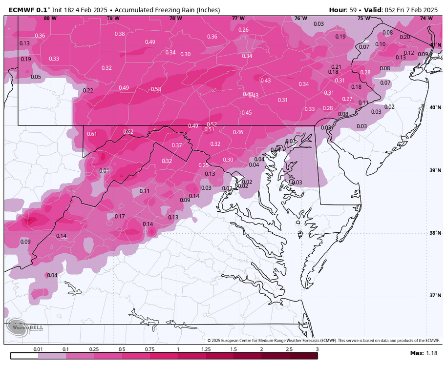
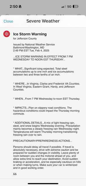
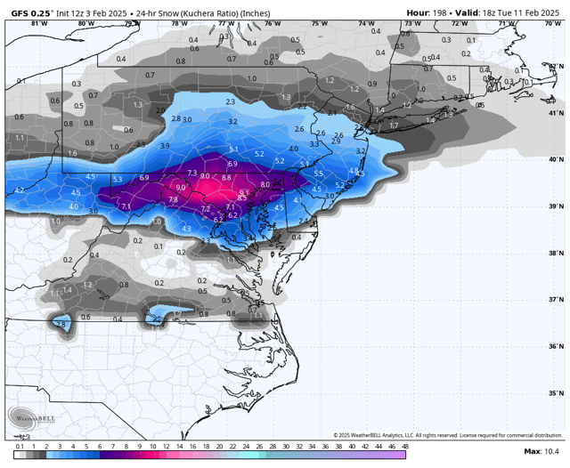
Euro caved much icer 18z for favored areas
-
Disaster solution lol. .5” zr for areas and over an inch of sleet north
-
Welp no work for me Thursday
-
Ah sorry man, my girl made chili.
-
Gfs shows 25 tonight here, 33 for high tomorrow and then 28-30 during the icing which is mainly overnight to early morning so less solar radiation. But guess we will see. I’m expecting it to be pretty icy. Either a lot of sleet or zr.
-
When will people ever learn lol.
-
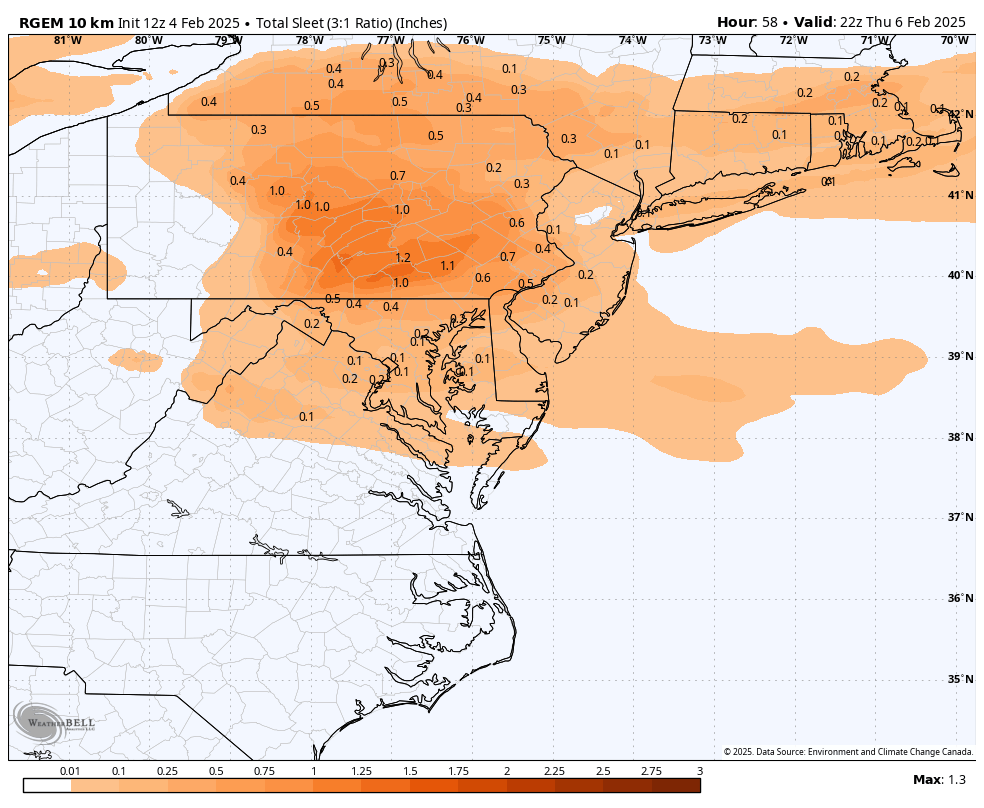
Gfs with sleet city pa line north and zr beat down pa line south to jus north of dc. Has like .6-.8” sleet and .2-.3” zr in mine and psu land.
-
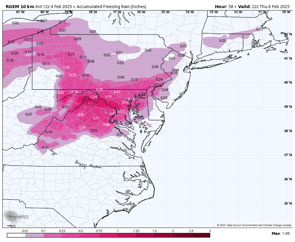
Which? The Nam? Cause rgem was def icier
-
Going to be interesting to see how this plays out. Rgem is a sleet bomb first north then zr city


-
Good to know that I don’t care. I’ve seen plenty events like this and they usually over preform.
-
I think it may be under done. Euro still playing catch up and CAD usually lasts longer.
-
Euro getting icier by the run.
-
Yes it was showing the warm solution for a while but then last min folded to colder.
-
lol well damn, tell us how you really feel.
-
It’s icy. Northern tier gets dusting if snow to 1/2” sleet and .4-.5” freezing rain.
-
Icon 1/2” qpf plus mostly frozen northern areas
-
CAD usually hangs in longer for sure
-
Did a decent job with last storm initially so will give it some credit. Also not too far from Nam.
-
Way under even the least icy model the euro. Typical under play
-
It’s been slowly folding.
-
Oh I know I hated those maps. I used to use SV but I was like these maps are ass lol
-
Thru 198
-
Definitely colder than 6z heights are lower out front.
-
Up north might even be on roads and sidewalks especially if it snows and sleets for a while first.
-
Depends what model is right. Gfs would be ice storm warning levels for northern tier.