poolz1
-
Posts
2,694 -
Joined
-
Last visited
Content Type
Profiles
Blogs
Forums
American Weather
Media Demo
Store
Gallery
Everything posted by poolz1
-
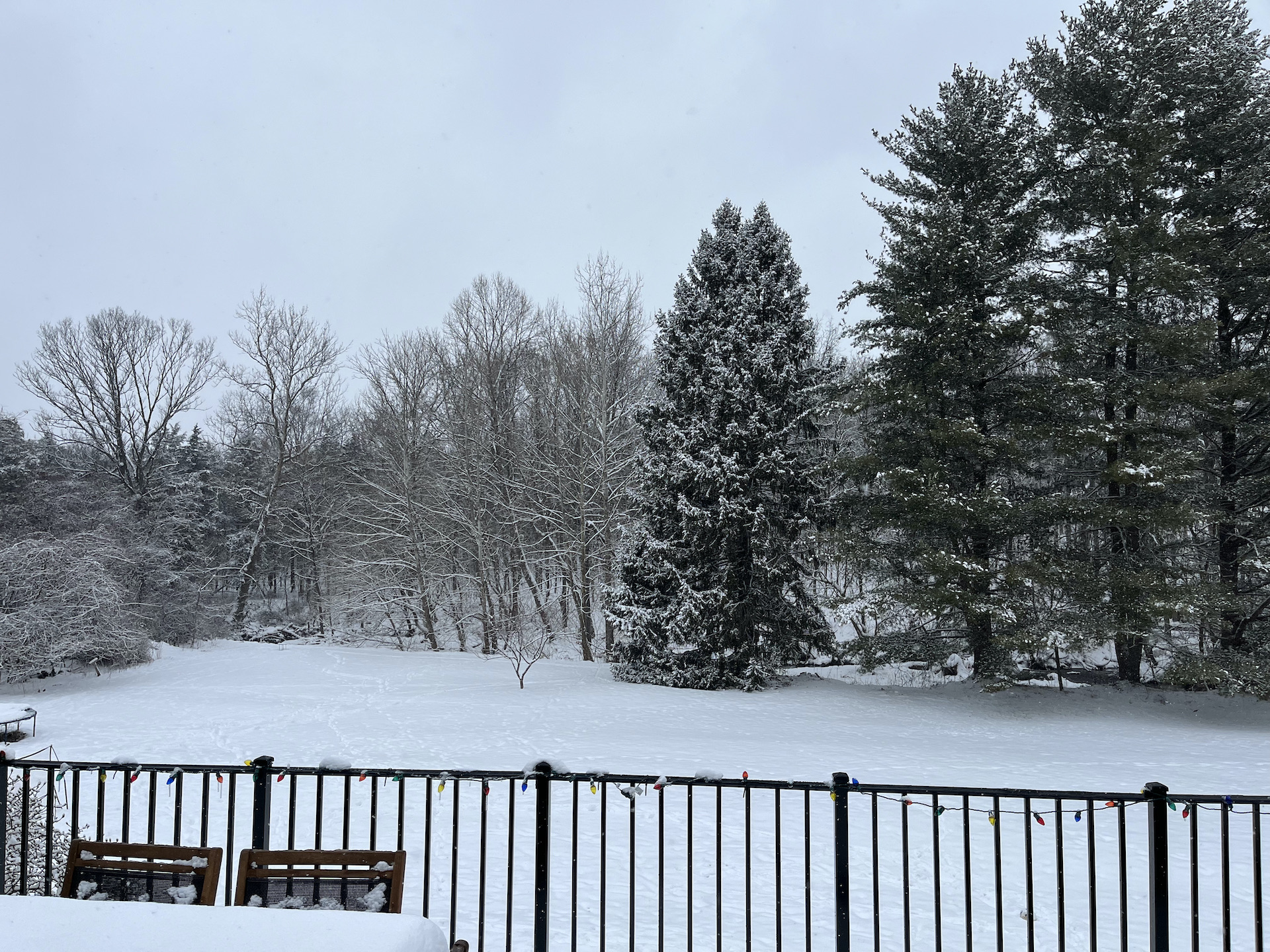
31 for the low with heavy frost this morning. Kicked the heat on for the first time yesterday with a high of only 56.
-
1.81" with that storm last night. Several large limbs down on the road when I left for work this morning.
-
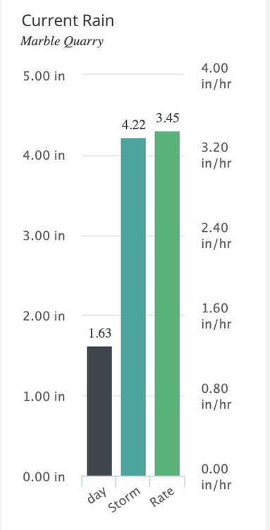
Torrential rains at the homestead right now. One final show...
-
4.09" for the event. Models did pretty good with precip forecasts imby. Always hoping for something more impressive but this was at least something to track and some interesting weather. Been a pretty boring summer in the weather department.
-
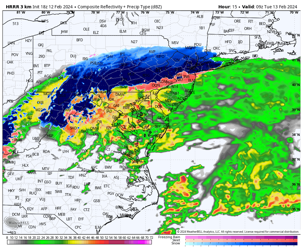
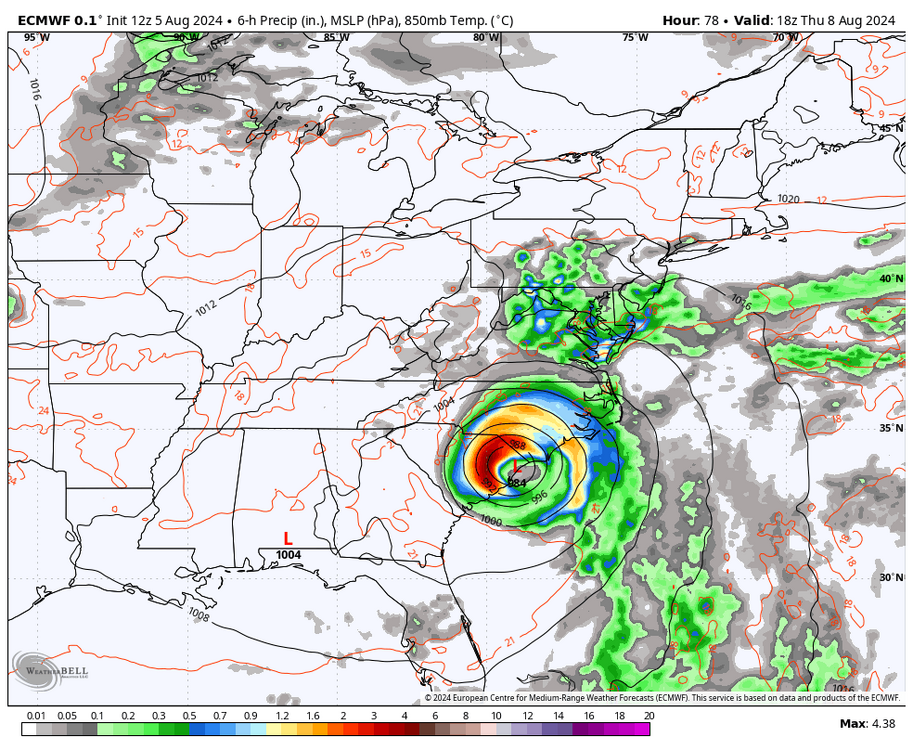
The euro signaling about 24hrs of pre storm rains from thursday morning to Friday morning. Will be interesting to see how this part of the event plays out. Should be efficient rainers with PWATs already well over 2".
-
3.63" since 330 Monday morning. Looks like some minor flooding predicted on the Potomac. Its been a few years since we have had a good flush.
-
Mid-Atlantic Snow Totals Thread - Winter 2023-2024
poolz1 replied to mattie g's topic in Mid Atlantic
12/11: .5" 1/6: 1.5" 1/15-16: 3.25 1/19: 3.25" 2/13: 3" 2/17: 2.25" Season Total: 13.75" -
The Weekend Rule? Saturday 2/17 - The Icon Storm
poolz1 replied to DDweatherman's topic in Mid Atlantic
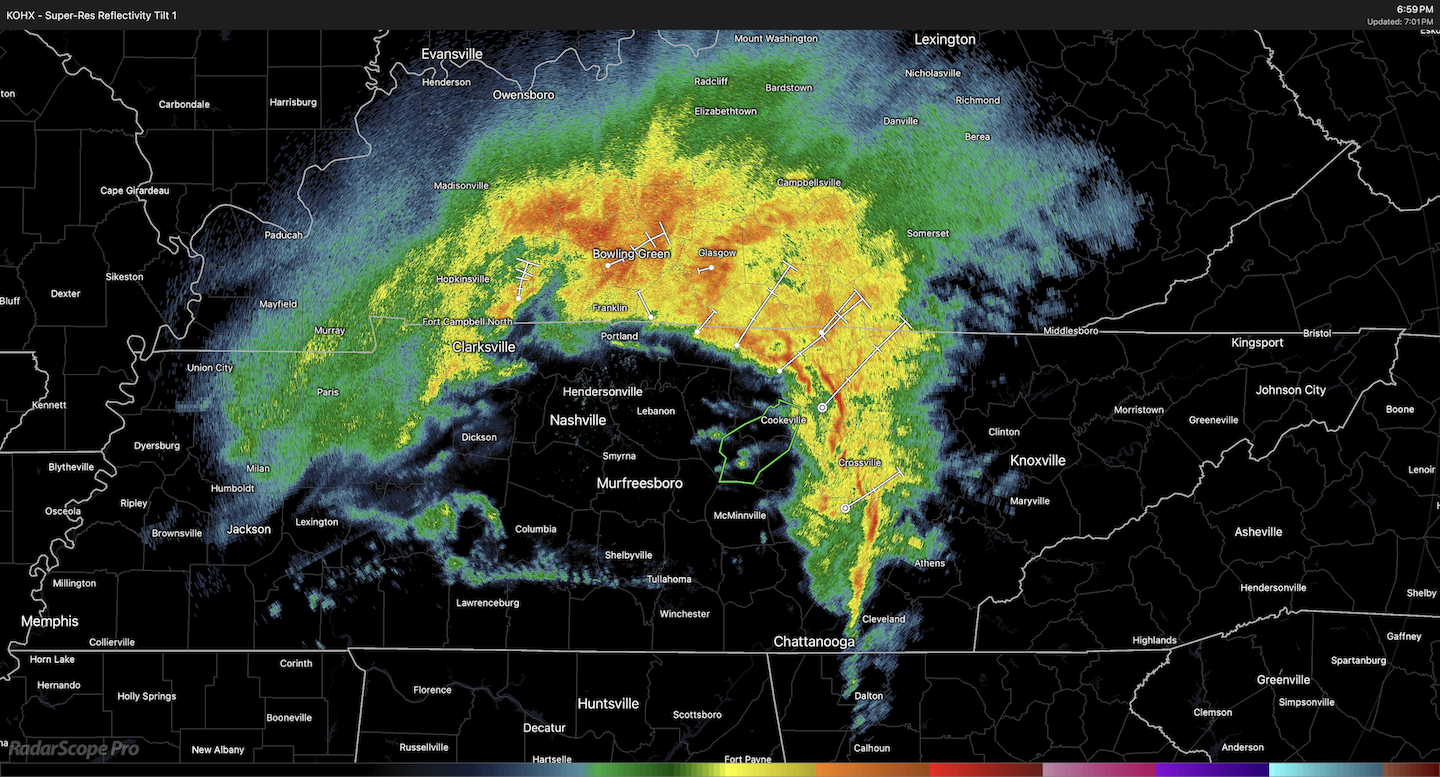
1.5" on the board. Smaller flake size now but that band was sweet. Need more of that! Mod snow 32/29 -
The Weekend Rule? Saturday 2/17 - The Icon Storm
poolz1 replied to DDweatherman's topic in Mid Atlantic
Same here. Impressive rates.. -
The Weekend Rule? Saturday 2/17 - The Icon Storm
poolz1 replied to DDweatherman's topic in Mid Atlantic
Highs Fri upper 30s low 40s across the region with a dry airmass in place 8-12hrs before snow moves in. It's not a total crap airmass to work with. Just need to juice it up!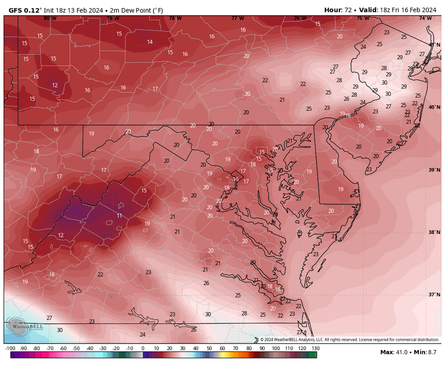
-
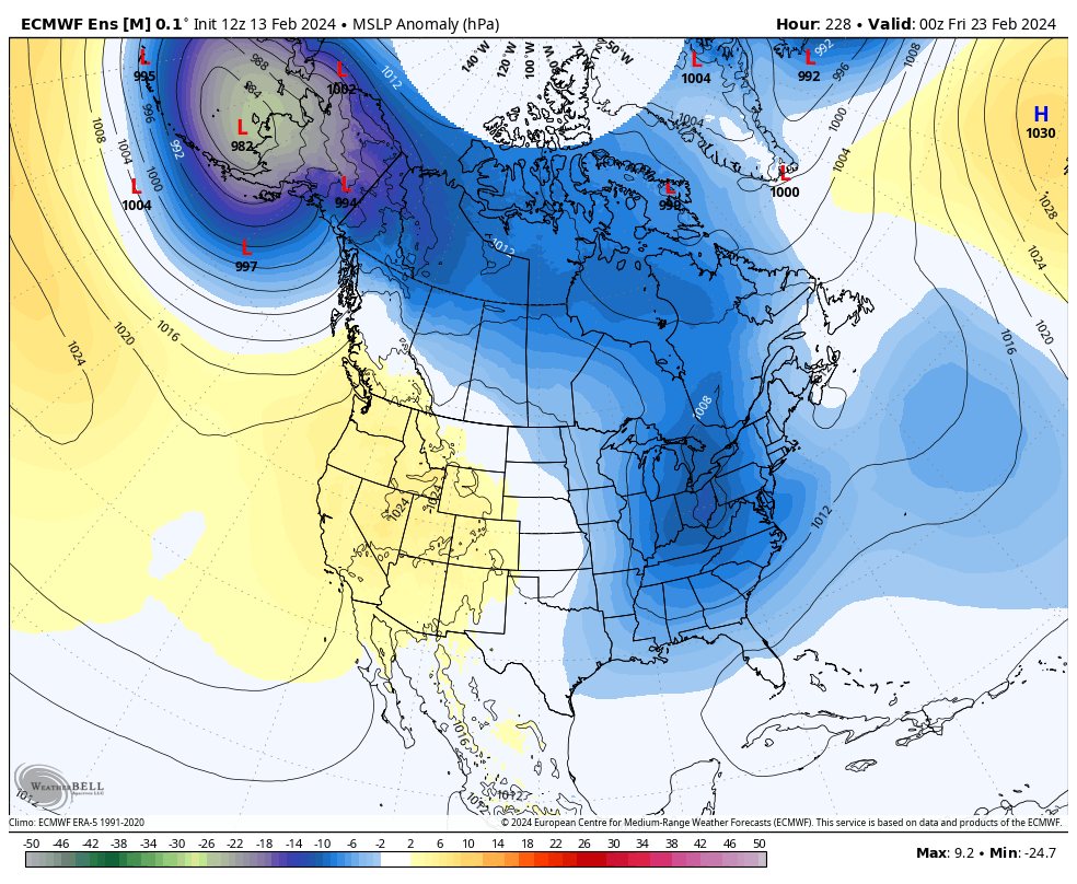
EPS with a west track/miller B look for the 23rd timeframe. Not the best look for now but a big jump south from 00z.

- 2,509 replies
-
- 2
-

-
- weenie fest or weenie roast?
- weenies got roasted
- (and 2 more)
-
Mid-Atlantic Snow Totals Thread - Winter 2023-2024
poolz1 replied to mattie g's topic in Mid Atlantic
12/11: .5" 1/6: 1.5" 1/15-16: 3.25 1/19: 3.25" 2/13: 3" Season Total: 11.5" -
2024 Valentines Day Who the Hell Knows - Comeback Thread
poolz1 replied to DDweatherman's topic in Mid Atlantic
The lighter returns behind that band are a steady mod/hvy snow. Just under 2" 32.1/31 -
2024 Valentines Day Who the Hell Knows - Comeback Thread
poolz1 replied to DDweatherman's topic in Mid Atlantic
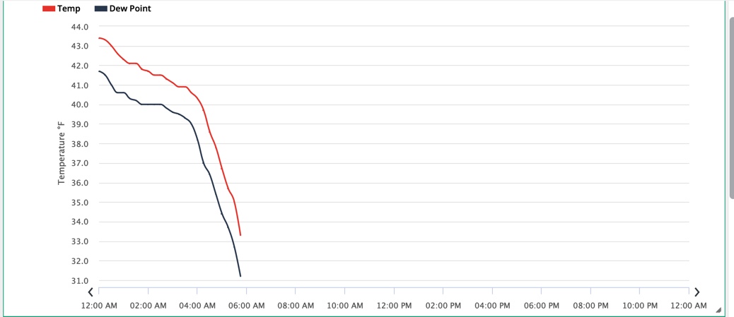
Impressive to see the dynamics play out. Temp crash started at 4am and the flip to snow was an hour later. Big pillows falling now. 32.3/30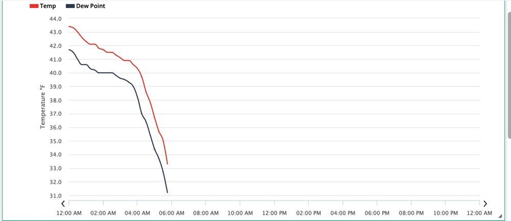
-
2024 Valentines Day Who the Hell Knows - Comeback Thread
poolz1 replied to DDweatherman's topic in Mid Atlantic
Rippage here right now. Temp is crashing a bit better than I expected. 33.2/31 A slushy coating but this should paste everything here shortly. -
2024 Valentines Day Who the Hell Knows - Comeback Thread
poolz1 replied to DDweatherman's topic in Mid Atlantic
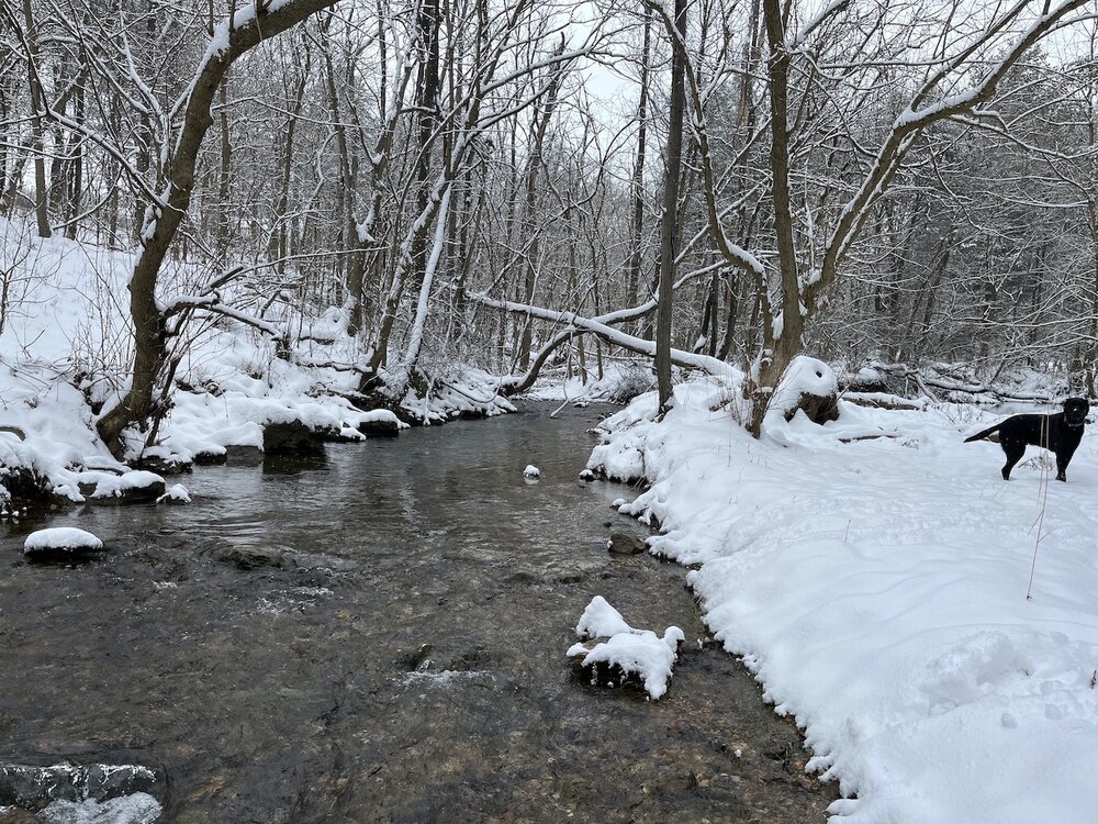
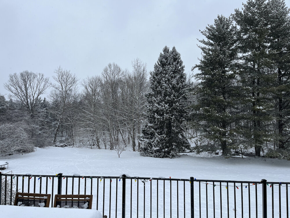
2" bar IMBY. As long as that comes in a two hour pasting I'll consider this a major victory. The local ridges will be picturesque tomorrow as the storm is departing. -
2024 Valentines Day Who the Hell Knows - Comeback Thread
poolz1 replied to DDweatherman's topic in Mid Atlantic
This thing is looking pretty damn dynamic.
-
2024 Valentines Day Who the Hell Knows - Comeback Thread
poolz1 replied to DDweatherman's topic in Mid Atlantic
These rates right before the flip. Going to be key to a fun morning of obs.
-
2024 Valentines Day Who the Hell Knows - Comeback Thread
poolz1 replied to DDweatherman's topic in Mid Atlantic
Yea, a 985 at the mouth of the Bay should be able to put on a show out this way. -
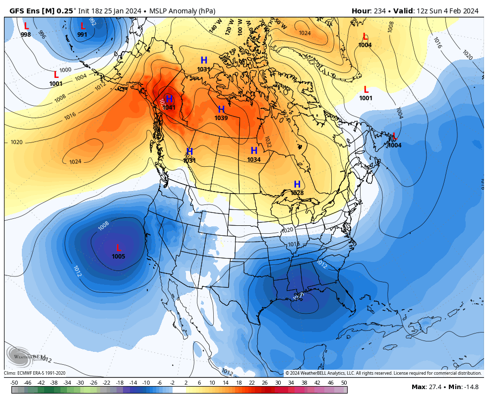
Jan/Early Feb Medium/Long Range Discussion Part 3
poolz1 replied to WinterWxLuvr's topic in Mid Atlantic
It is a lose lose situation. We need enough confluence for cold but that leads to suppression with a beast ridge flexing. Less confluence leads to the ridging pushing SE and suppressing....or too warm if precipitation does come north. I don't see a middle ground for us to win. -
Jan/Early Feb Medium/Long Range Discussion Part 3
poolz1 replied to WinterWxLuvr's topic in Mid Atlantic
How dare you show a snow mean! lol Yeah, you and others have hit on this timeframe for a few days. -
Jan/Early Feb Medium/Long Range Discussion Part 3
poolz1 replied to WinterWxLuvr's topic in Mid Atlantic
Not a bad look for an ens mean 9-10D out. Would be great to score something during the "torch" before heading into primetime.
-
3.2" matches exactly the last storm's total. Unless a streamer adds a bit more I think that's about it. Light snow 30/27 5.5" snow pack.
-
Oddly consistent this morning with such a narrow band. 3k NAM shows the same thing.
-
Gotcha. A bit west of town. I follow their reporting on Weatherlink as one of my local stations.