Boston Bulldog
-
Posts
619 -
Joined
-
Last visited
Content Type
Profiles
Blogs
Forums
American Weather
Media Demo
Store
Gallery
Everything posted by Boston Bulldog
-
Tetons and the Cottonwoods are the only good resort skiing in North America right now outside of Alyeska and the interior Canadian Rockies. Pretty brutal December for the Cascades and Coastal BC with extremely warm ARs bringing rain to the peaks and washing away snowpack. Sierras have been pretty high and dry so far, save for some warm cutoffs bringing some snow way up high (8-9k+), and mostly rain to the resorts. The Northern Pacific is just so incredibly warm right now, outside of where the storms directing the ARs have been upwelling water southeast of Alaska. Mets more knowledgeable than me on this part of the world (Bryan Allegretto) have been attributing the lack of a strong PAC latitudinal SST gradient as one of the causes behind why the West Coast simply not getting the typical El Nino connection so far. Large scale ridging assisted by the warm pool has been directing moisture north of California, with no cold air around to tamp down snow levels when these features make landfall. When those warm ARs go away, cutoffs have been meandering just offshore and out of reach. Moving into the new year it seems as though more windows will open, but the one lesson I've learned so far is no matter how strong an El Nino is in ONI, if you don't have that gradient in SST across the PAC throw away traditional ENSO climo for the West Coast. Synoptic fundamentals often win out, no matter how strong your subseasonal forcings are.
-
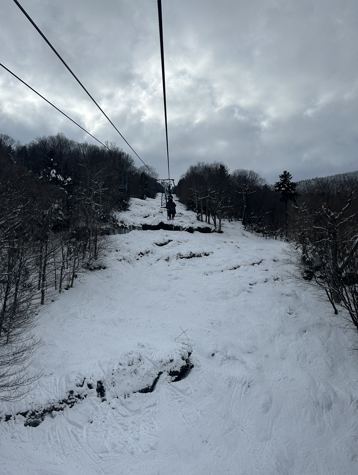
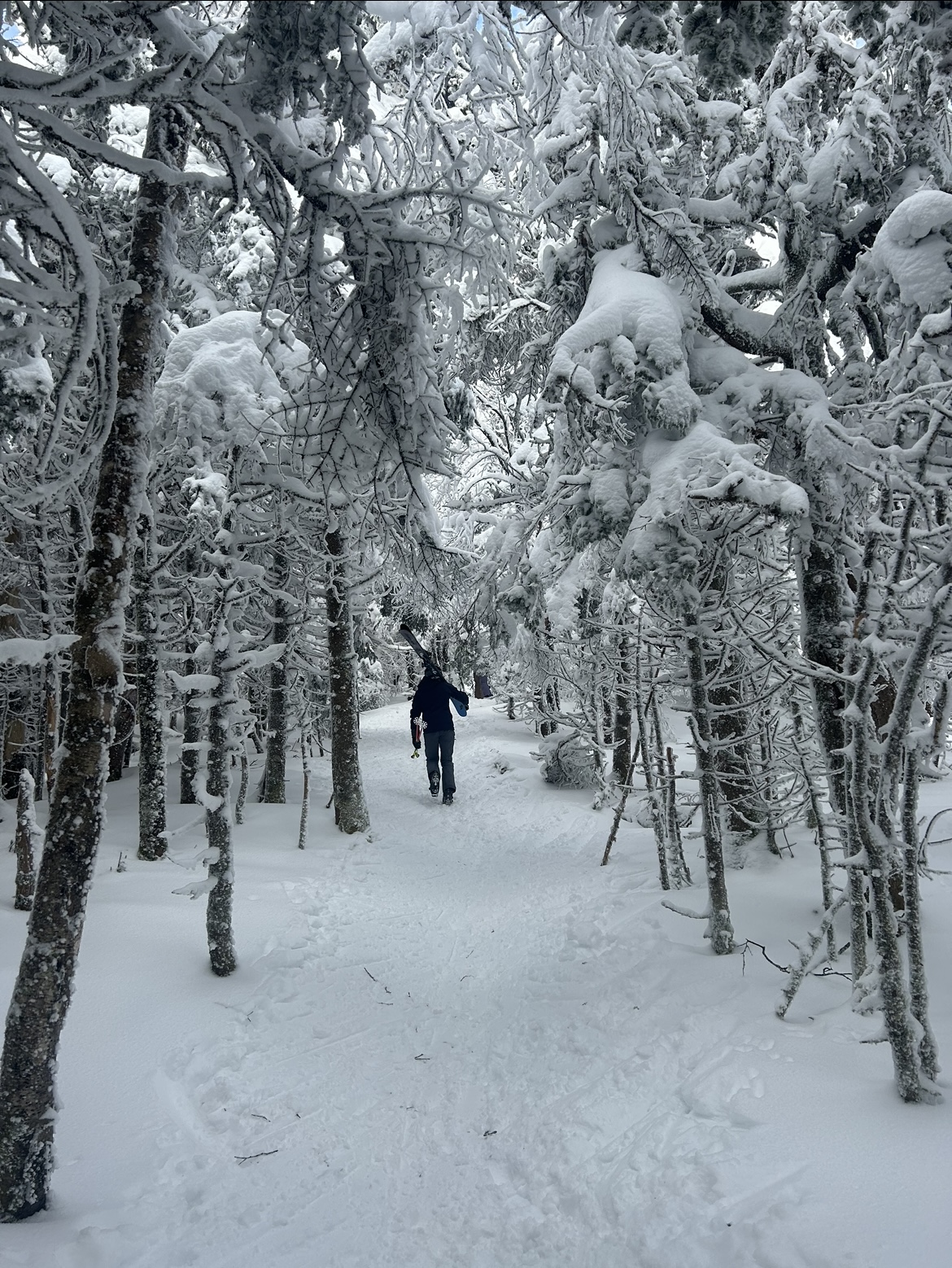
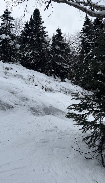
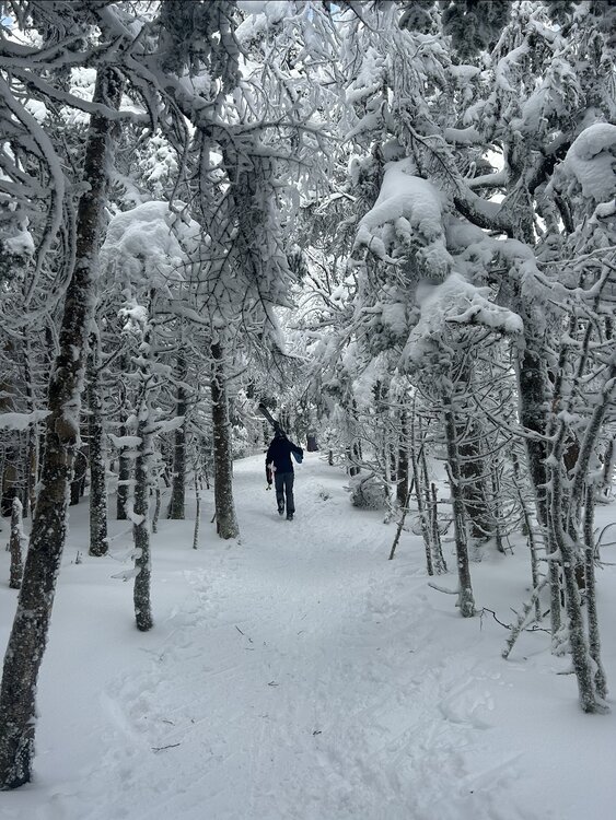
Today was no exaggeration a top tier spring skiing day at Mad River Glen. Variable conditions with elevation (packed powder up high, hard pack down low) evolved into a universal corn surface that peeled away underfoot with ease in the bumps. I was concerned when I skinned to the top of the double before opening bell, as the entire place was either a coral reef or threatening to become manky. Instead, the hard pack softened and the wet snow ended up being confined to a small slice of elevation around mid mountain. Some sort of shallow funky inversion must have been in place last night. The trails themselves were super spicy with rocks and stumps everywhere. You had dealers choice of fun techy bump lines in all directions off the summit. Caution was necessary though, troughs were often rock riddled, forcing some quick decision making in order to find creative lines. Cat Bowl skied the best I can remember. Paradise was totally ledged out down low, quick feet were needed to navigate this chokepoint. The thin base exposed several very fun features all over the mountain, with normally hidden ledges appearing on Chute and cliffs/ledges on lift line growing dramatically in size. Given how forgiving the surface was, many of these airs were very much in play. Chute in particular had a sporty double drop up high. Meanwhile the tower 10 and 11 ledges on Lift Line offered several big combos. So rare to ride this terrain before the new year, let alone in conditions like this! What a start to the season

-
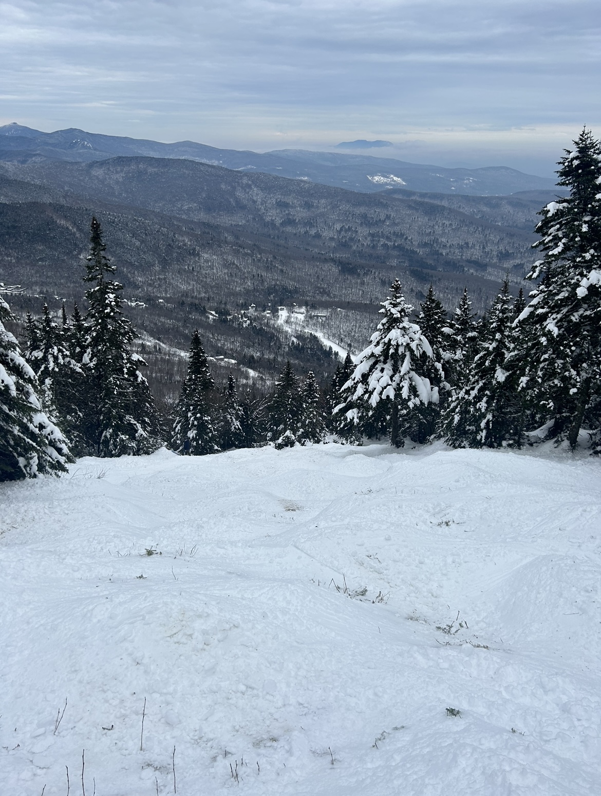
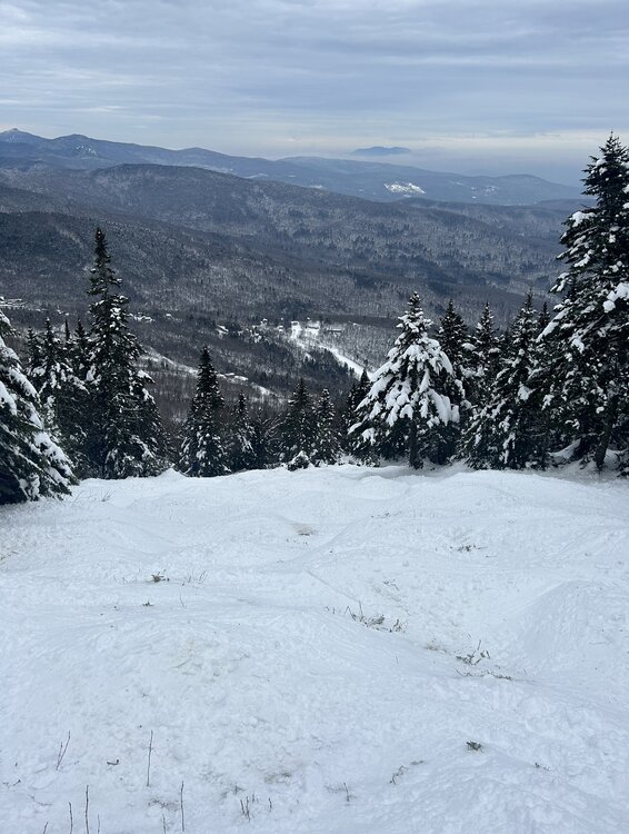
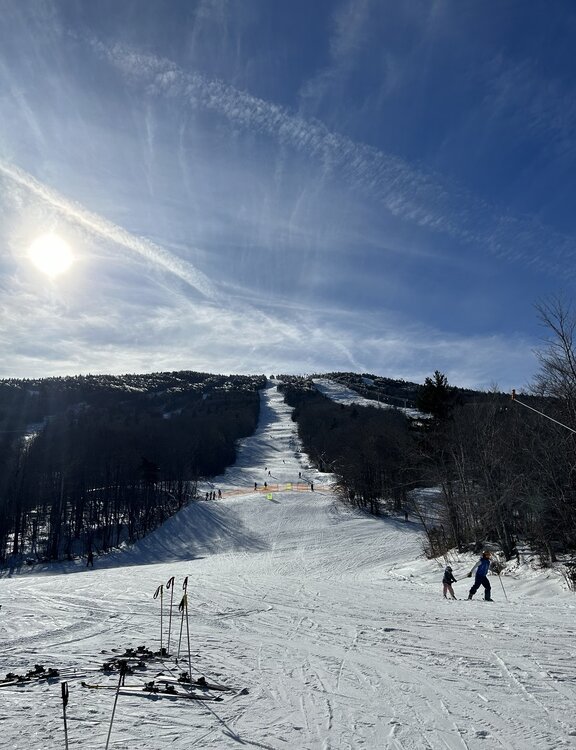
A beauty of a day up high at Sugarbush with immaculate views north towards Camels Hump and Mansfield. Getting a bit skied off in most spots, but taking the hike along of the Long Trail to Castlerock was well worth the effort for some softer turns. For December 8th, hard to do better than this

-
How legitimate is this emerging upslope signal once the coastal low passes? I assume further east trends would help bring the flow into a more favorable direction
-
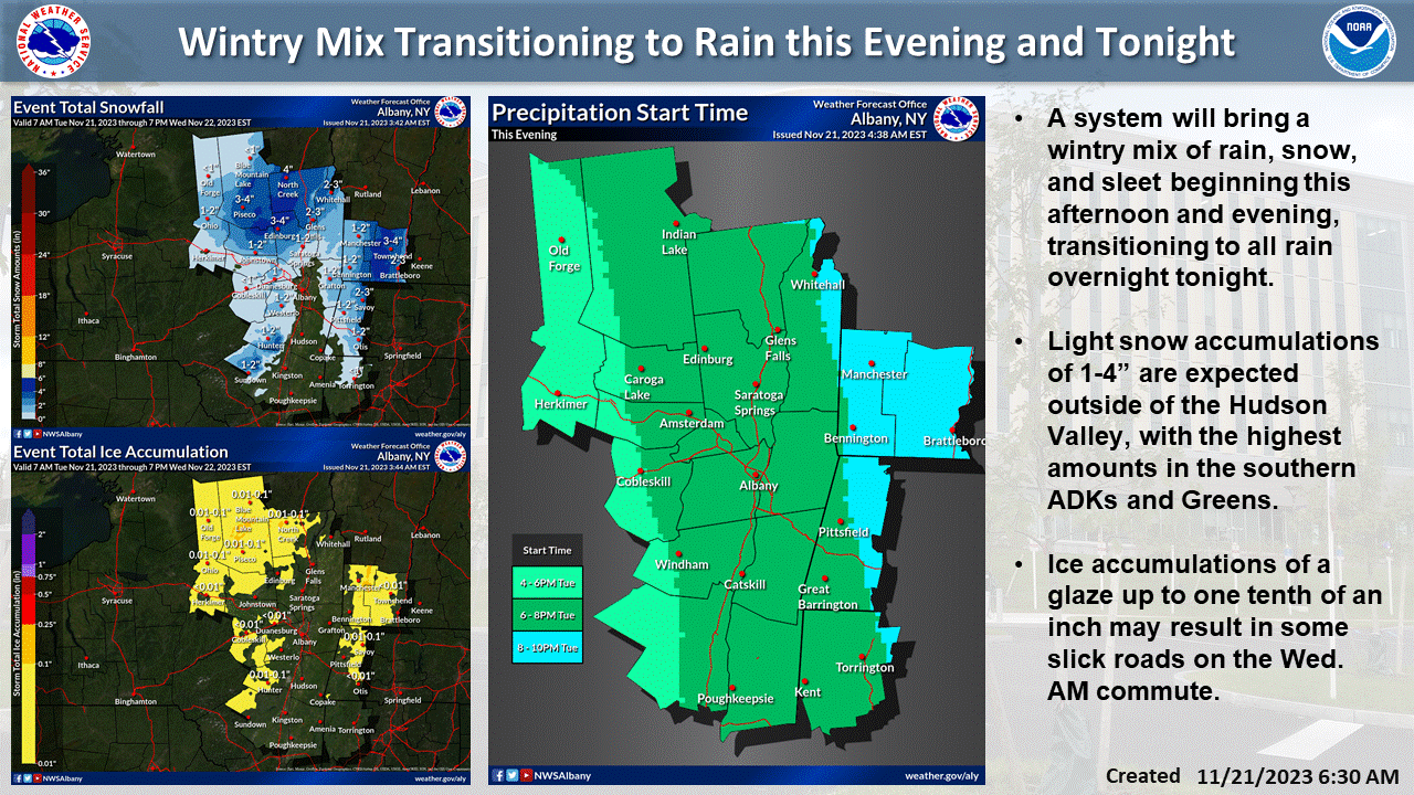
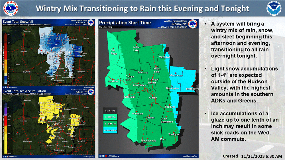
I would normally caution against those snowfall maps on the backside of a cutter’s cold front. As we frequently see, CAA often arrives too late/dries everything out. This looks a bit different though, given how disjointed this system is as the primary passes through the Great Lakes. The redevelopment along the front grows more impressive with each run, and that seems to be the dynamic boost needed to overcome the issues noted above. Good trends for resorts along the spine of the Greens!
-
I really like how this map from BTV shows the intersection of synoptic and mesoscale dynamics at play in Central VT. If there was ever going to be a Killington bullseye with QPF distributed relatively evenly across the VT, this would be it. Ample forcing for orographic ascent is delivered to the region by SE flow curling around the vortmax that is both traveling across far southern VT and is tilted SE to NW with height. Simultaneously, the flow which "originates" from the CRV is relatively unimpeded until reaching the peaks just south of the Killington area. Add in a more little elevation near Killington to help take care of the marginal airmass and... bullseye! Meanwhile, orographic dynamics are not maximized farther north given the amount of terrain upstream
-
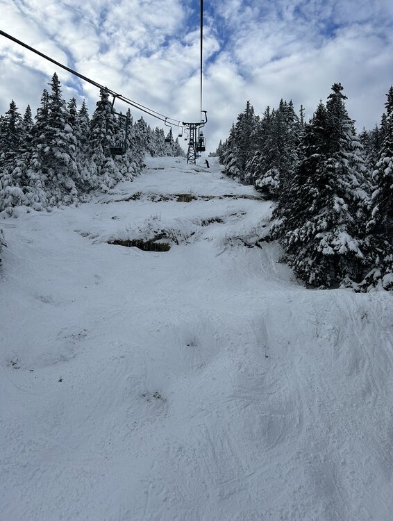
Certainly no natural snow options at Stratton today, but major props to the snowmaking team there for getting a decent slice of terrain open. 3 distinct 1350' vert routes were available to lap off the Ursa Express, with one extremely crowded egress route back to the base. Icy conditions for sure, but for day 1 on snow I can't complain. Looking up North American/Frank's Fall Line from the mid mountain lodge
-
Bright banding approaching Canton MA as the column saturates and precip picks up, would love to see some flakes mix in. 39/31 right now so I'm skeptical there is enough oomph behind the wet bulb to do the trick. Correlation coefficent is hinting that some mixing may be to the NW, slicing through Dedham and Westwood, so good rates are gonna be needed for that to crash south. Hardly has gotten into the 30s at all this year down in the tropics (Manhattan), never really understood how powerful the heat island is there until I moved there. Appreciating the wintery feel up here today
-
Wow, NWS had zilch and the HRRR had about 0.5" for Albany. Nice little overperformer over there
-
Great looking band heading into Southern VT and the Berkshires!
-

Central & Eastern Pacific Thread
Boston Bulldog replied to Windspeed's topic in Tropical Headquarters
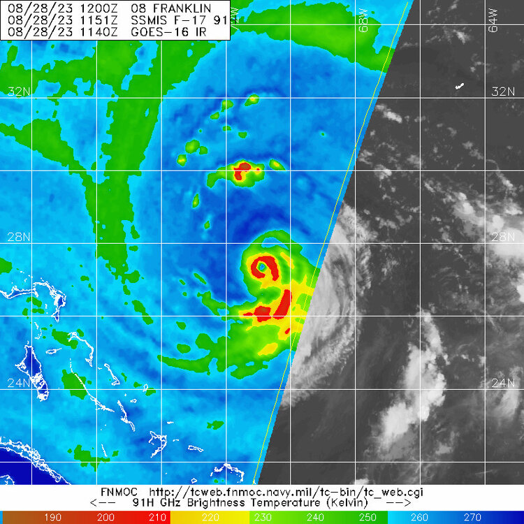
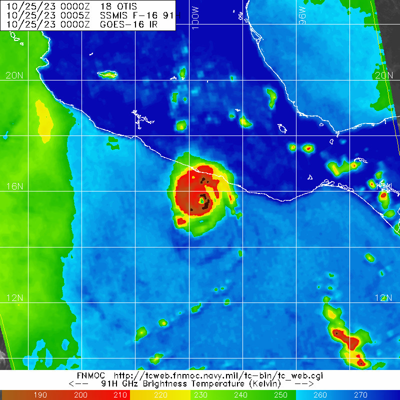
A sensational and horrifying microwave pass on Otis
-
Octorcher or Roctober 2023 Discussion Thread
Boston Bulldog replied to Damage In Tolland's topic in New England
Been a bit tuned out on recent developments for our weekend storm, so I only just now have caught up on how this thing has trended... what a shame if this was January. Hopefully we are getting our blown phases out of the way in the preseason (at least according to the GFS) Looking at the Z500 evolution is especially painful with the southerly vort getting slung out east. Make no mistake about it, this would be a solid hit, but more in the "close but no cigar" caliber rather than a true classic. One final note, take a look at a rare October Manitoba Mauler diving into the midwest upstream of our weekend storm. Seems like the clipper train has really dried up in recent years, maybe getting it going early is a good omen? -
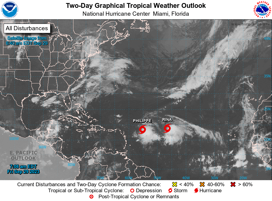
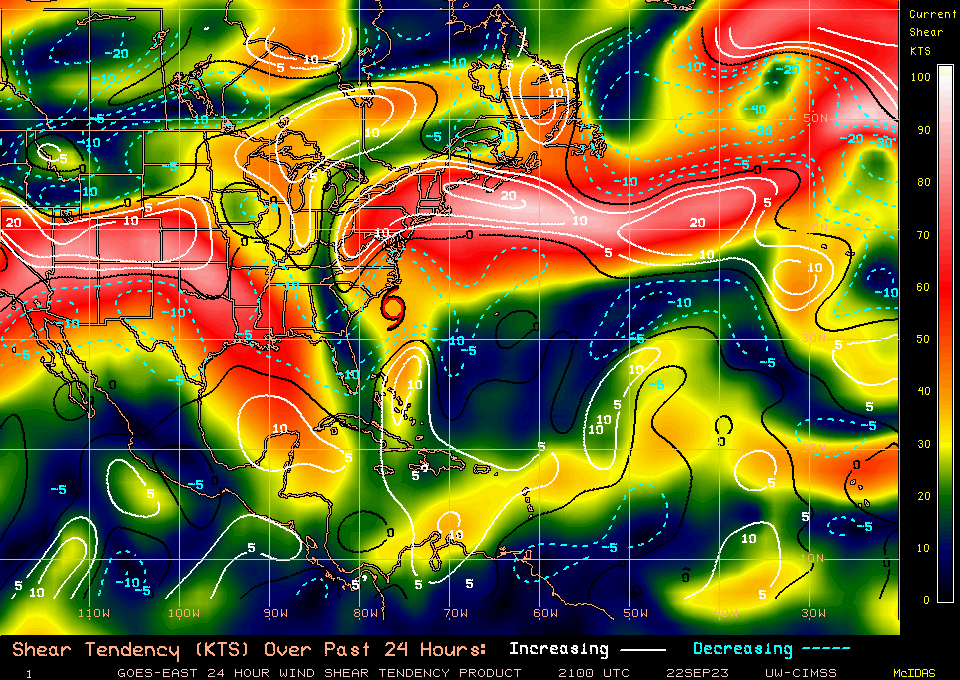
Can anyone guess the direction of the shear over the western MDR this morning?
-
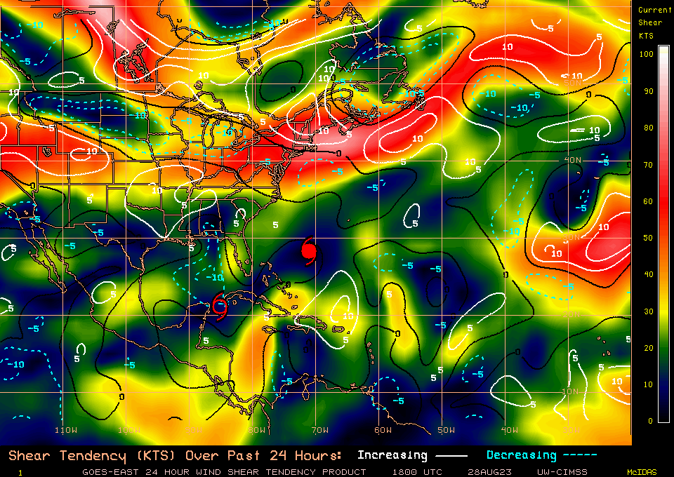
Still lots of shear over Ophelia, but a pretty strong weakening trend in shear values. It's pretty easy to tell why this has managed to wrap up it's core a bit
-
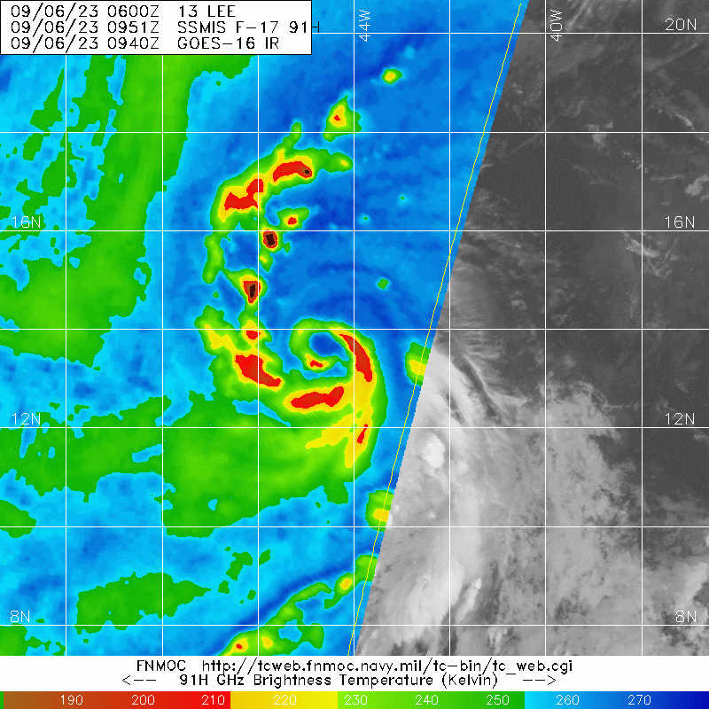
Some initial guidance on Lee's eventual extratropical transition as it parallels the East Coast

-
-
Pretty spot on. Spatial gridding resolution for global model outputs are significantly more coarse than mesoscale models. This is especially true when compared to hurricane models like HWRF or HAFS that can "telescope" in on hurricanes and move with them in space and time with storm following nests. Here is a great BAMS article on hurricane model "nesting" for those who want to learn more: https://journals.ametsoc.org/view/journals/bams/103/3/BAMS-D-20-0134.1.xml Tight pressure gradients, such as the inner core of an intense hurricane, are on the subgrid scale and thus the model will interpolate values for given variables to fill the gap between grid points. Interpolation algorithms will not be able to correctly render the pressure gradient surrounding the MSLP of an exceptionally deep TC, hence why we see so many models initialize runs at significantly higher pressures.
-
Lee already has an impressive inner core structure despite the E-NE shear its been dealing with

-
2023 Atlantic Hurricane season
Boston Bulldog replied to Stormchaserchuck1's topic in Tropical Headquarters
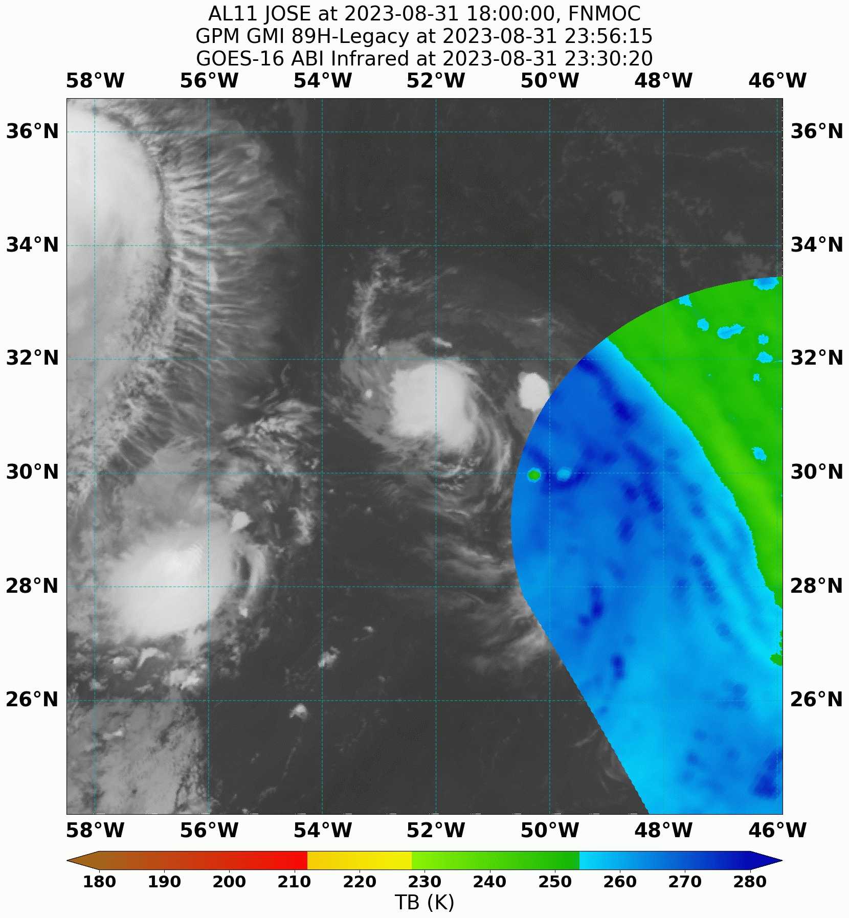
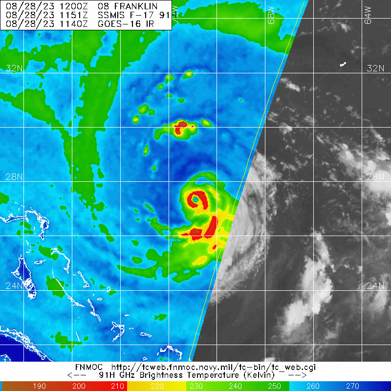
Brutal miss on the latest pass of GMI for Jose Regardless, interesting discussion included in tonight's 11pm EDT package. Yet another innocuous spin-up in the subtropics defying expectations. A clean shave of Jose's convection is likely incoming tomorrow once Franklin draws closer. Tropical Storm Jose Discussion Number 11 NWS National Hurricane Center Miami FL AL112023 1100 PM AST Thu Aug 31 2023 Jose is a tiny tropical cyclone with the convective cloud tops only extending 50 to 60 n mi across. However, geostationary satellite and microwave images indicate that the storm has a tight circulation with evidence of a mid-level eye feature. A recent ASCAT pass showed peak winds in the 40-45 kt range, but since the system is so small that instrument likely can not resolve the peak winds. The initial intensity is increased to 50 kt, which is above the Dvorak estimates. Jose is likely near its peak intensity. There is no way Jose will escape the outflow associated with Hurricane Franklin, that is expected to begin affecting the small storm by midday Friday. Therefore, the forecast shows a steady weakening trend until it becomes absorbed by Franklin in about 36 hours. The storm is moving northward at 11 kt and is moving in the flow between Franklin and a mid-level ridge over the central Atlantic. A faster motion to the north is expected until the system dissipates on Saturday. The NHC track forecast is slightly to the west of the previous one. FORECAST POSITIONS AND MAX WINDS INIT 01/0300Z 32.7N 52.4W 50 KT 60 MPH 12H 01/1200Z 35.5N 52.0W 40 KT 45 MPH 24H 02/0000Z 39.9N 51.1W 35 KT 40 MPH 36H 02/1200Z...DISSIPATED $$ Forecaster Cangialosi/Bucci/Fritz
-
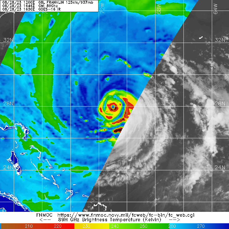
I will admit I am unsure if that is flight level winds or not. SFMR adjusted is 128kts
-
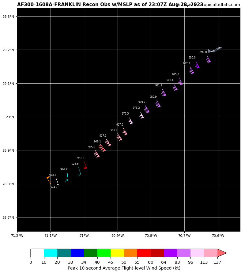
923.3mb per recon EDIT: 140kts it appears. That's a category 5 230030 2855N 07057W 6982 02635 9491 +100 +059 141136 140 128 028 0

-
Stage is now being set for Idalia to organize significantly once it clears Cuba and enters the gulf
-
Now we are seeing signs of one, though the inner eyewall is very thick

-
No sign of EWRC yet. A run at Cat 5 is not out of the question today.