Boston Bulldog
-
Posts
619 -
Joined
-
Last visited
Content Type
Profiles
Blogs
Forums
American Weather
Media Demo
Store
Gallery
Everything posted by Boston Bulldog
-
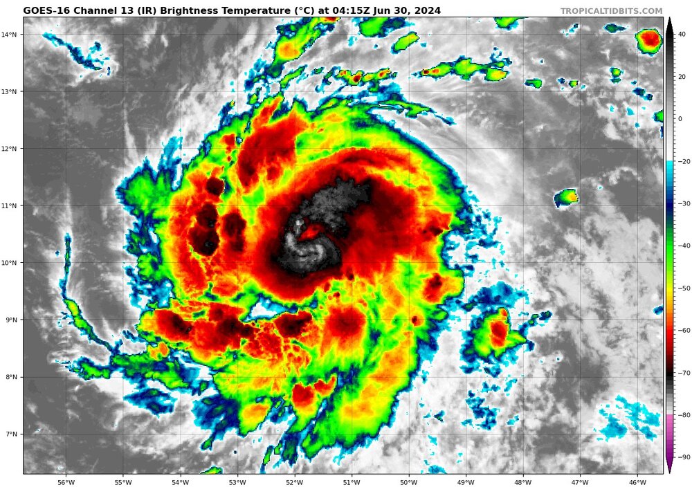
None of that shows a closed vortex at the low levels as I cannot see low level westerlies. There is some mid level spin present, but no indication of a TC at this time. Satellite imagery, especially IR satellite, can play tricks
-
Long ways to go people, once cyclogenesis occurs we can actually glean some insight into land interaction near the Caribbean. The long term prospects on this system are still a crapshoot. Only insight I can feel confident in is that generally next week doesn't have a synoptic pattern that screams quick recurve due to the possibility of a weak trough over the E US and weaker westerlies (given climatology). Of course these chess pieces are being modeled in fantasy land, ride with the ensembles for now. I think Webb had a great explanation on this.
-
Getting crushed in the Upper East Side. Big gust of wind accompanied its arrival
-
 hmmmmm, good burst of upshear convection and the eye pops back out
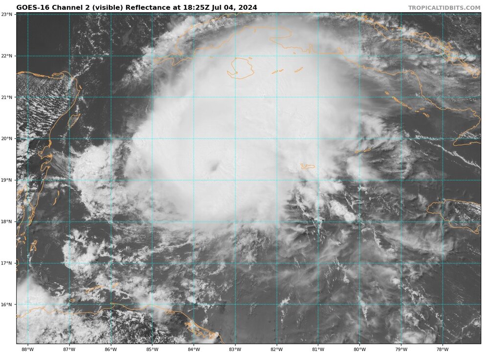
-
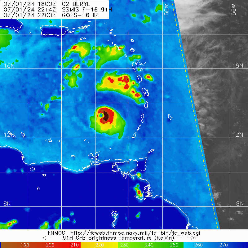
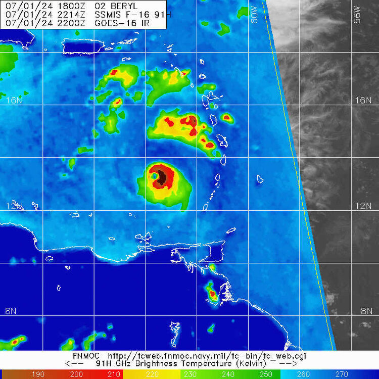
SSMIS does suggest that there is indeed westerly shear impacting the core already. Lots of convective activity in the east eyewall, can Beryl wrap it upshear and rebuild out west?
-
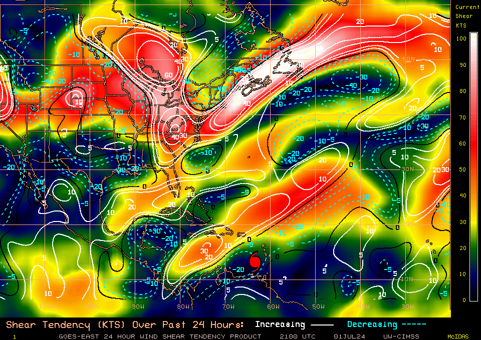
Still some time for Beryl to take advantage of low shear. A bit outdated considering the 21Z timestamp, but still anomalously low shear values over and near the storm. The quickening easterlies (causing a Westerly shear direction) and the TUTT will begin to erode it significantly more tomorrow.
-
Impressive core, no hints of eyewall replacement yet
-
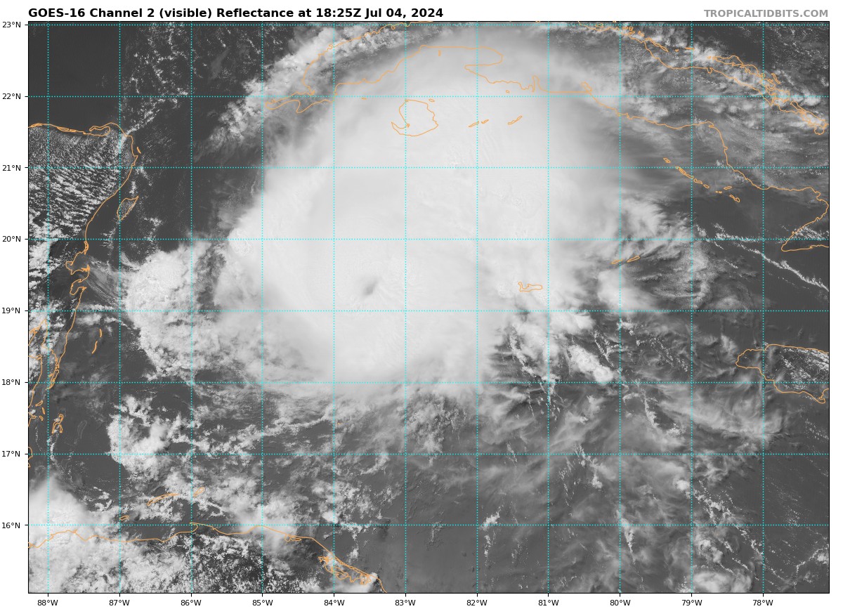
This isn't just a random warm spot in the central convection. This is the eye. Also note the eastward expansion of the CDO, indicating that easterly shear has abated. Wish we had new SSMIS microwave imagery, what a poor performance by those polar orbiting satellites today. Infrequent passes and several misses during critical moments of organization EDIT: Animation shows these CBs rotating around the eye moving upshear without a problem. IR satellite can often lead to the illusion of intensification, but the hallmarks of organization are all present. This storm looked pretty good last night, but it still wasn't totally stacked yet. This thing probably stacked about 18 hours afterward, definitely on the early end of my range
-
Yeah this thing is popping an eye as we speak
-
Agreed, it is necessary to keep a level head when discussing what climate change has the potential to do. There are many effects that climate change has demonstrated, and will continue to demonstrate on TCs. Frequency is NOT one of them. Across all corners of the field, research has discovered several concerning effects on rain rate, intensity, and rapid intensification, but TC frequency and landfall frequency conclusions remain either unclear or firmly outside the current state of the science. Apologies for banter outside of Beryl, though I think this is an important distinction. This topic is one that often muddies the waters, and if not properly communicated can lead to the many bright minds researching this field getting discredited by folks who take established research and run with it to places it was never intended to be.
-
As an older Gen Z myself, can confirm I have a vague idea about what they're saying but can also confirm only the deepest corners of brainrot internet speak like this. Get ready to learn Barrettese buddy, or maybe just touch grass. Not quite sure what declaring everything "Joever" does for the overall discussion (it does make the thread a bit unreadable) but I do appreciate the enthusiasm for the field. We all end up on this site for the same reasons. Regardless, what a show put on so far by Beryl so far. I am glad the medium term outlook beyond initial impacts in the Lesser Antilles is getting more shine on here. Shear awaits, and unfortunately it will impact the system after the Windwards. There is a cap on what the storm can do down the line, it's so difficult to have a Caribbean Cruiser thread the needle, especially in early July. My only pause is that the NHC forecast seems to be flaunting climatology towards the tail end of their forecast, though it makes total sense to not forecast rapid weakening at 96-120 hours. It's foolish to stamp your name on an RI forecast that far out, equally so to do the same for rapid weakening outside of the high latitudes.
-
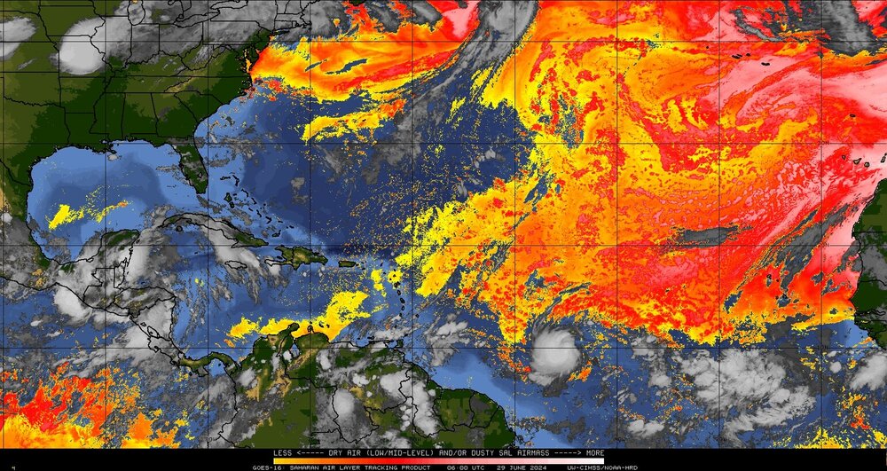
I would attribute the lack of banding structures to Beryl's young age AND the prominence of the Saharan Air Layer nearby. Hard to expand a moist convective envelope when the desert is a few kilometers away to the north. The MDR is dry, but favorable. There isn't much of a mechanism to push this SAL into the system...yet. If there was one thing that can stop this system from achieving the lofty heights the models currently show, it's the Saharan Dust in tandem with quickening easterlies.
-
Beryl is quite impressive and anomalous right now. We all know the E-Carib "graveyard" well, and this system seems uniquely positioned to put up a fight against the July status quo. Remember Hurricane Danny in 2015? It is possible for early season storms to ramp up in the MDR (granted Danny was in August but the environment we see now is quite August like). It is also very easy for these nascent hurricanes to get shredded apart in the Caribbean. Danny was a small Cat 3 with impressive organization, and it was shredded to a vortically stretched mess by the time it made it to the Windwards. For Beryl, trade winds and shear are looking to pick up. This should shave the storm down from a stacked system to one that is tilting vertically. Nonetheless, at least for now it seems like all systems go for the short term forecast. Conventional thinking would say that the peak of this system should occur just short of the Windward islands, though anomalous begets anomalous. Watch for vertical stacking over the next 18-36 hours... I can't recall such intrigue this early in the season since Elsa in '21, and Beryl's short term environment is much more impressive than what we saw back then. Despite this I remain skeptical of its long term prospects. A stronger storm gets lifted poleward into the Greater Antilles, a weaker storm gets caught up in strong easterly flow and its local vorticity max gets attenuated.
-
Invest 92L in SW Atlantic reached SE US Fri
Boston Bulldog replied to GaWx's topic in Tropical Headquarters
A few hours old SSMIS pass... certainly a bit of organization there. Some curved banding band near the center, albeit on the ragged side. Tough miss from the most recent ASCAT, would have helped determine if there are substantial W winds. 92L is starting to come into view on KMLB which should be very illuminating in a few hours.
-
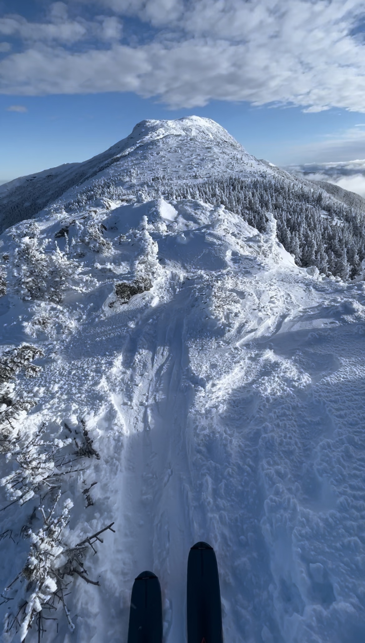
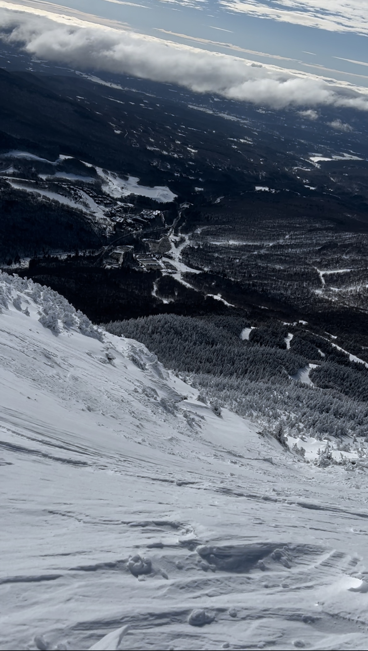
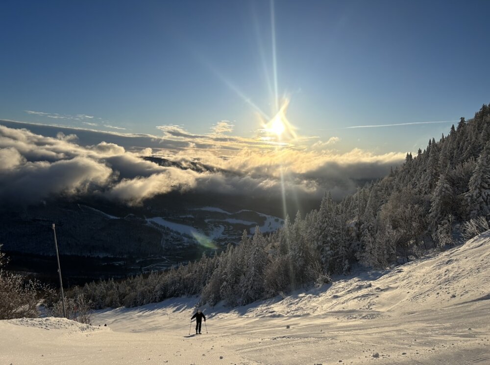
Tour de Mansfield today. Began with a dawn patrol skin up Nosedive. Upon reaching the top of the quad and turning down the toll road, we began an adventurous skin across the Amherst Trail before linking back up with the Long Trail. Views were impeccable, but much caution was needed to remain on route through the thick krummholz. Profanity was wind buffed and skied very well (no reaction in ECT tests). Banner day up high, certainly didn’t feel like April! Was getting sticky and thick down low in the trees, probably a great corn harvest this afternoon in the bumps.

-
Significant Miller B Nor'easter Apr 3rd-4th OBS
Boston Bulldog replied to wxeyeNH's topic in New England
Nasty little band has set up over Sunapee NH, thumping snow up here right now. Looks even heavier south of here in Newbury, Goshen and Bradford. -
Yeah it’s from his latest blog post from yesterday. I’m a fan of his work and always appreciate the optimism, however he can get a bit carried away at times to say the least. Regardless I will be at MRG no matter how the storm pans out! “Mountains: Some wet snow early, more powder Thursday, Friday and into early Saturday with 27-54 inches.”
-
Lots of hype flying around with this system. Funniest forecast I’ve seen is Single Chair weather going with 27-54” above 3K. Tight range!
-
Anyways, it's definitely right to be skeptical of this upcoming PNA driven period being productive for the vast majority of the forum given climatology and a blowtorched Quebec.
-
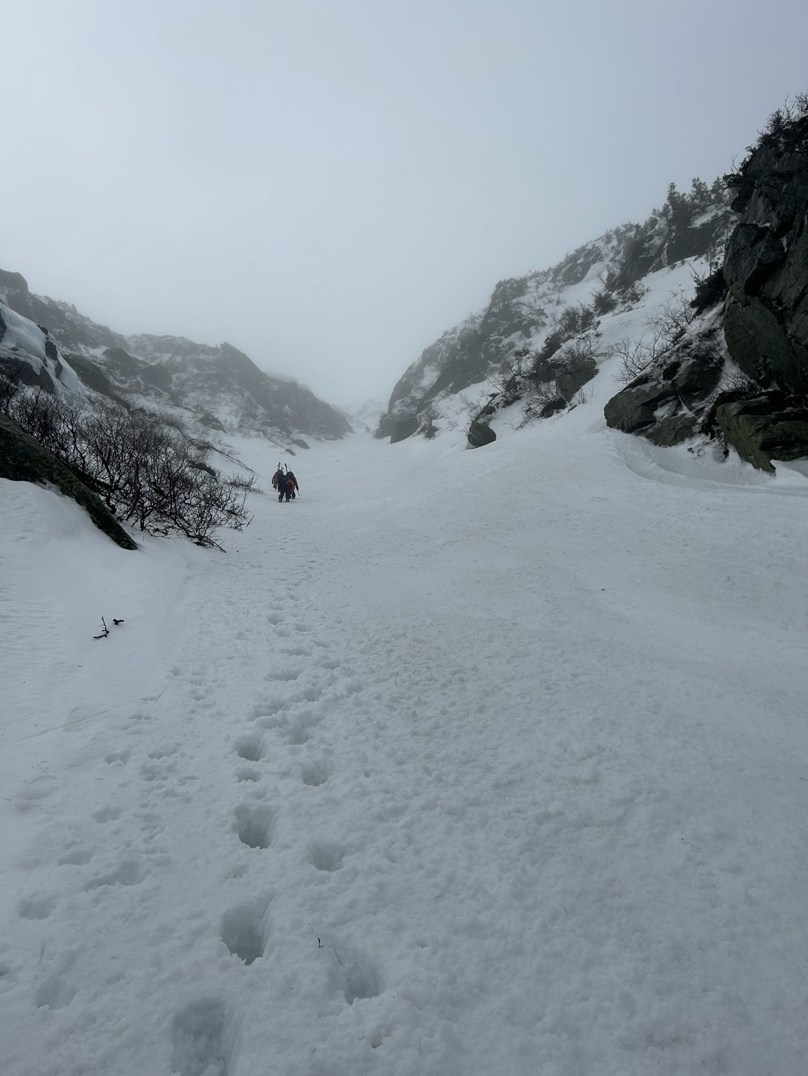
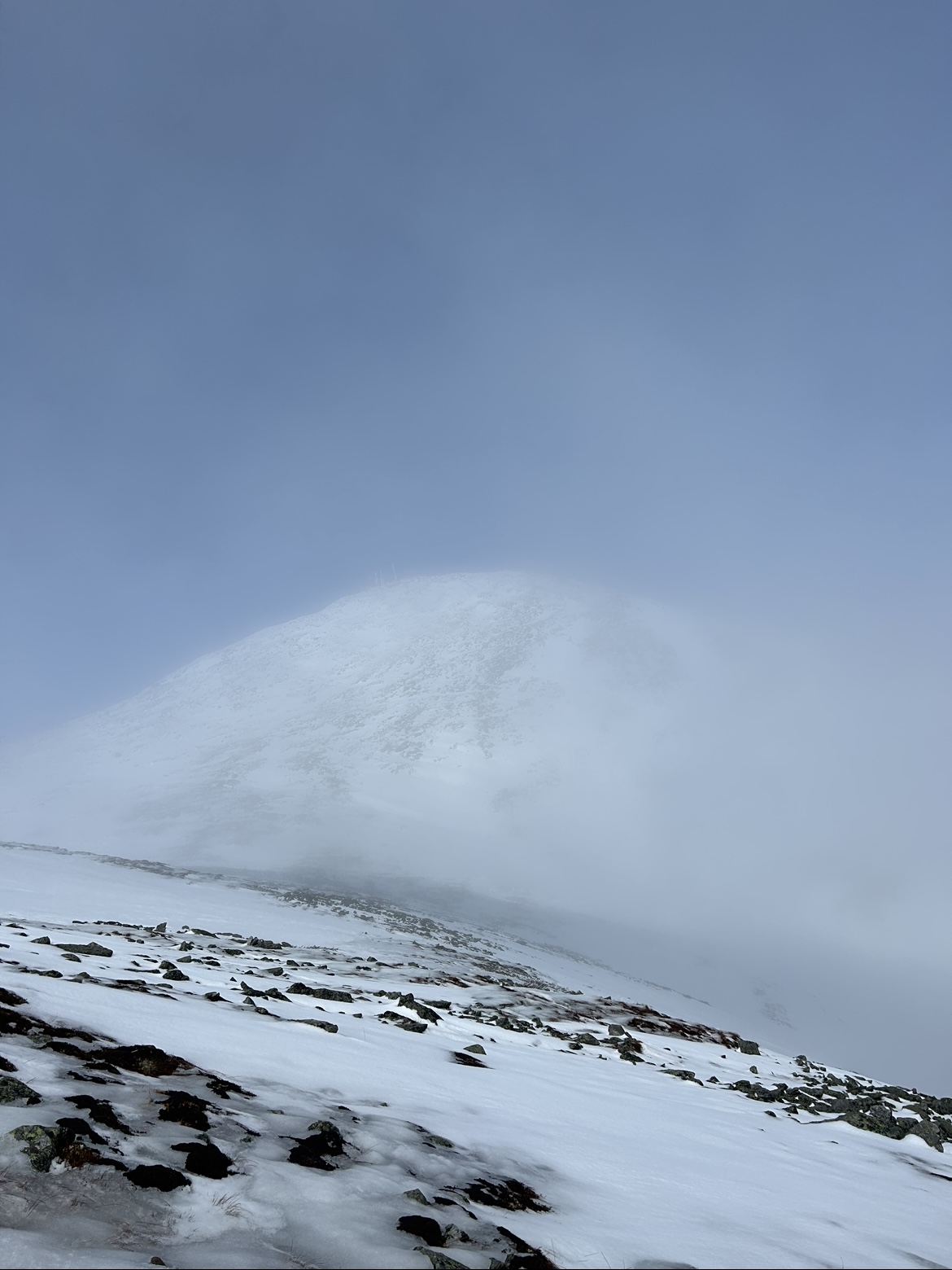
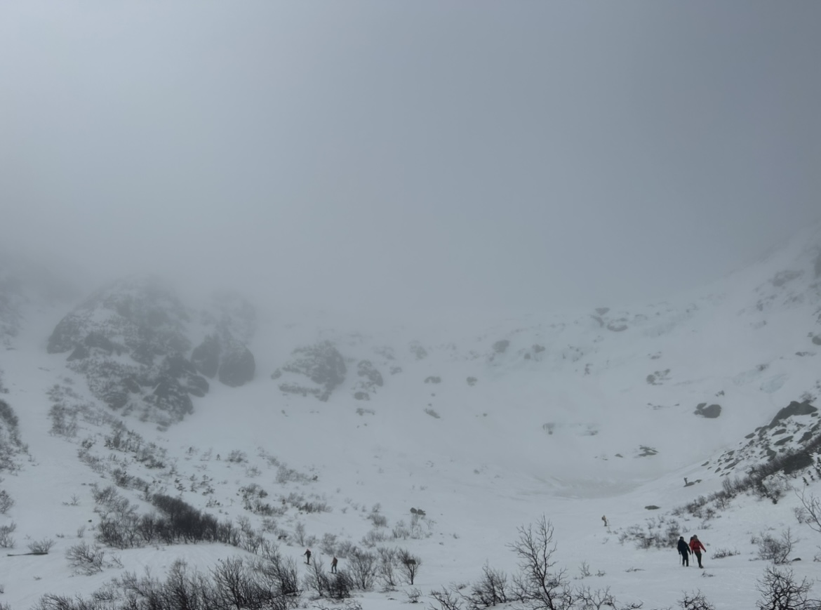
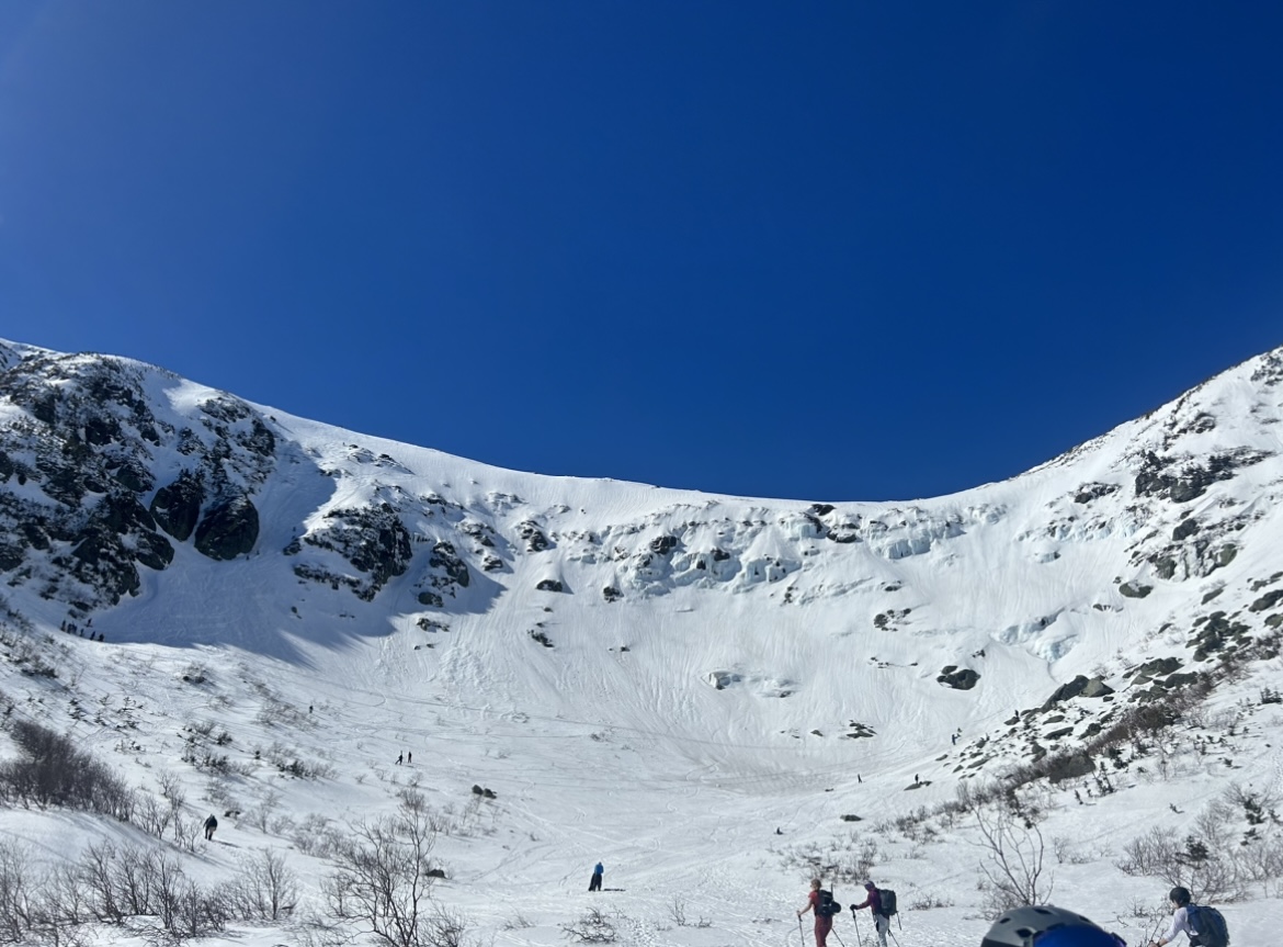
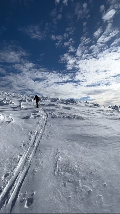
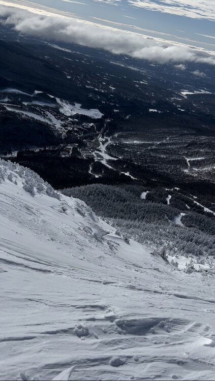
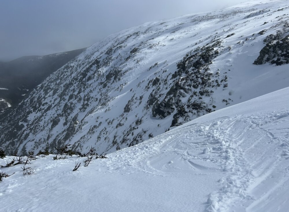
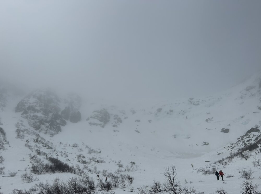
Well if it's going to act like April, might as well ski like it's April! Fantastic day up in Tuckerman Ravine. Trekked up to Hojos in stubborn mist and fog. As we approached the ravine floor, the sun was showing signs of emerging but in general the bowl was still a cauldron of fog. As we began booting up Left Gully, skies began to brighten a bit up high... Upon reaching the top of the Ravine, clouds were thinning with the summit beginning to emerge to skiers left. Suddenly the bowl rapidly cleared and we had clean sightlines for the descent. By the time we finished the line, it was a spectacular bluebird day out on the Rockpile It's low tide up there for sure, not many skiable lines outside of the gullies right now. The sherburne is open all the way to the parking lot, but I don't expect it will be for much longer. Go get it while you can!


- 546 replies
-
- 15
-

-
GFS and EURO backing off from 18z yesterday has been a bit of a bummer, hoping the mesos are onto something! The dense nature of any snow that falls should bind well with the base and provide some relief.
-
Welp they delayed the opening of Black, surprise surprise. Hopefully they have it up and running before the weekend.
-
BIG news out of Southern Vermont: "Black Line Quad passed its load test on Tuesday. And yesterday it passed State Inspection. A few punch list items to take care of today and getting it some run time before it launches Monday! The Quad will open to passholders first on Monday morning! So long and farewell to lift lines at Magic!" (From Magic's Snow Report today) After 4 years of construction woes, mishaps, and some bad luck, Magic Mountain is finally opening their Black Quad! This is a game changer for several reasons. Red is aging quickly and it every year seems like a high wire act to get it approved by the state for the season. Having Black online will take significant pressure off of that workhorse lift and help extend its life. Lines at Red have gotten crazy in recent years due to the mountain hopping on the Indy Pass, so tripling capacity to the summit will go a very long way to increasing efficiency. Some may worry about additional congestion on the trails, but this should be negligible as the mountain is broad enough to disperse skiers. Until they finished Black, Magic seemed to be on tenuous footing due to aging infrastructure and limited finances (exacerbated by this albatross of a lift project). Happy that they seem to have finally figured it out.
-
Saturday February 16th - Another CT/ Cape special?
Boston Bulldog replied to Sey-Mour Snow's topic in New England
It snowed. Nice! -
Saturday February 16th - Another CT/ Cape special?
Boston Bulldog replied to Sey-Mour Snow's topic in New England
Wet bulb temps never dropped below 33F on Tuesday down here in Manhattan so we never accumulated very well… as such tomorrow is trending towards being our biggest of the season