

Boston Bulldog
-
Posts
619 -
Joined
-
Last visited
Content Type
Profiles
Blogs
Forums
American Weather
Media Demo
Store
Gallery
Everything posted by Boston Bulldog
-
Nice little band developing here. Best rates and snow growth since 9am
-
Binghamton radar being down may make the back edge appear to be approaching faster
-
Does anyone have any good intel on Gore? Heading up there for the first time on Saturday. I'm very excited, Gore's been on my list for quite a while and now that I live only a 9 Iron away it seems like it's time to check it out. With the pack pretty decimated I'm not so sure heading into the trees will be worth it even after this storm, which is a shame because I've heard a lot of great things about the zones off of Burnt Ridge. Mostly looking to cruise around each pod and sample a few bump runs. The pitch off of Straight Brook looks very enticing.
-
The trailing "weaker" squall in Albany was substantially windier than the main line. I wonder if the lack of consolidation in this area made it difficult for winds to mix down as efficiently as they were able to in PA for example. Nice little event though, spent many years watching these dry up on approach to BOS, glad I finally had sufficient longitude to cash in.
-
Wrapping up here, looks like we have a weaker line coming in as a parting gift. Wow at that screengrab! I'm probably 2 miles SW of that location and we didn't see whiteout like that, looks like I just missed the wind
-
Main band has just arrived in Albany. Dumping snow but no wind yet
-
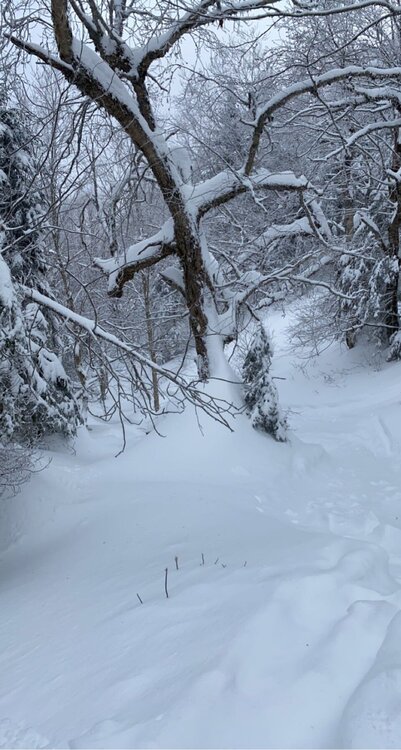
The goods are certainly still out there for those willing to look. Mad River was knee deep just outside of the boundary yesterday. Certainly some caution is still required with the thin base under the new snow, but tons of fun lines are back in play
-
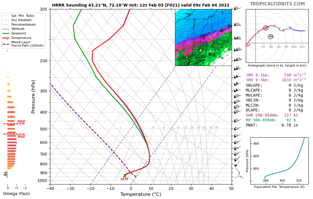
All 3 will certainly have rain on the onset, and the mesos definitely have all 3 right on the knife’s edge with regards to sleet/snow totals (with Pat’s Peak looking especially tenuous on recent runs). Given the orientation of the snowfall gradient, as well as its latitude, Ragged is likely to walk away the best. Regardless, looks like plenty of sleet will be present throughout the region, as this 12z Hrrr sounding for Sullivan County shows.
-
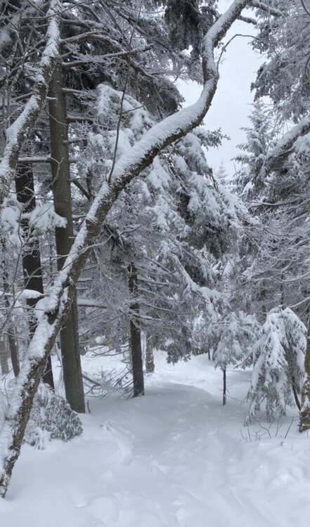
Looking like this incoming event is just what the doctor ordered for MRG. Their most recent snow reports have been sounding increasingly concerned, but beginning the event with a nice layer of paste to buff out the base should work wonders. Top that off with fluff as the storm departs on Friday and most of NNE should see great turning conditions!
-

OBS/DISCO - The Historic James Blizzard of 2022
Boston Bulldog replied to TalcottWx's topic in New England
Measured 20 here in Canton and it was clear we were on the western edge of the band. Was shocked by the 30 measurement in Sharon, considering they are even further west -
OBS/DISCO - The Historic James Blizzard of 2022
Boston Bulldog replied to TalcottWx's topic in New England
It's crazy here too! 6-7 inches in 2 hours -
OBS/DISCO - The Historic James Blizzard of 2022
Boston Bulldog replied to TalcottWx's topic in New England
Heaviest rates yet, and strangely this is the calmest the wind has been all day. Huge flakes -
OBS/DISCO - The Historic James Blizzard of 2022
Boston Bulldog replied to TalcottWx's topic in New England
2-3 an hour for sure out there. 13"+ and still dumping -
OBS/DISCO - The Historic James Blizzard of 2022
Boston Bulldog replied to TalcottWx's topic in New England
Looks like Nantucket has found the slot -
OBS/DISCO - The Historic James Blizzard of 2022
Boston Bulldog replied to TalcottWx's topic in New England
Measured in about 6-7 different spots and came out with an estimate of 9". Good stuff here, though not as impressive as to the SE. 16/14 -
OBS/DISCO - The Historic James Blizzard of 2022
Boston Bulldog replied to TalcottWx's topic in New England
Measured 5.75 right before the band hit. Dumping now -
OBS/DISCO - The Historic James Blizzard of 2022
Boston Bulldog replied to TalcottWx's topic in New England
Rates are picking up here in front of the band, better snow growth too 19/16 -
OBS/DISCO - The Historic James Blizzard of 2022
Boston Bulldog replied to TalcottWx's topic in New England
-
OBS/DISCO - The Historic James Blizzard of 2022
Boston Bulldog replied to TalcottWx's topic in New England
700mb fronto pivoting in towards Nantucket means business -
OBS/DISCO - The Historic James Blizzard of 2022
Boston Bulldog replied to TalcottWx's topic in New England
Great band moving in now. Going to be a real pain to measure given that it is already blowing around. 25/22 and measured an average of just over 3 inches in 3 spots -
OBS/DISCO - The Historic James Blizzard of 2022
Boston Bulldog replied to TalcottWx's topic in New England
Not seeing too much evidence of a dumbbell at this hour -
OBS/DISCO - The Historic James Blizzard of 2022
Boston Bulldog replied to TalcottWx's topic in New England
Light snow has begun. 29/24 so it appears I am just northwest of the coastal front -
OBS/DISCO - The Historic James Blizzard of 2022
Boston Bulldog replied to TalcottWx's topic in New England
Arrived in Canton. 32/22 and overcast -
The Plan? Increase barometric pressure over the ENE Low by flying a gigantic plane in an anticyclonic direction over it and depositing tons of sinking air from the storage compartment, thus eliminating the Low and consolidating our storm.
-
34.7" right on top of Blue Hill


