snowdude
-
Posts
776 -
Joined
-
Last visited
Content Type
Profiles
Blogs
Forums
American Weather
Media Demo
Store
Gallery
Everything posted by snowdude
-
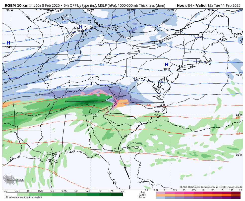
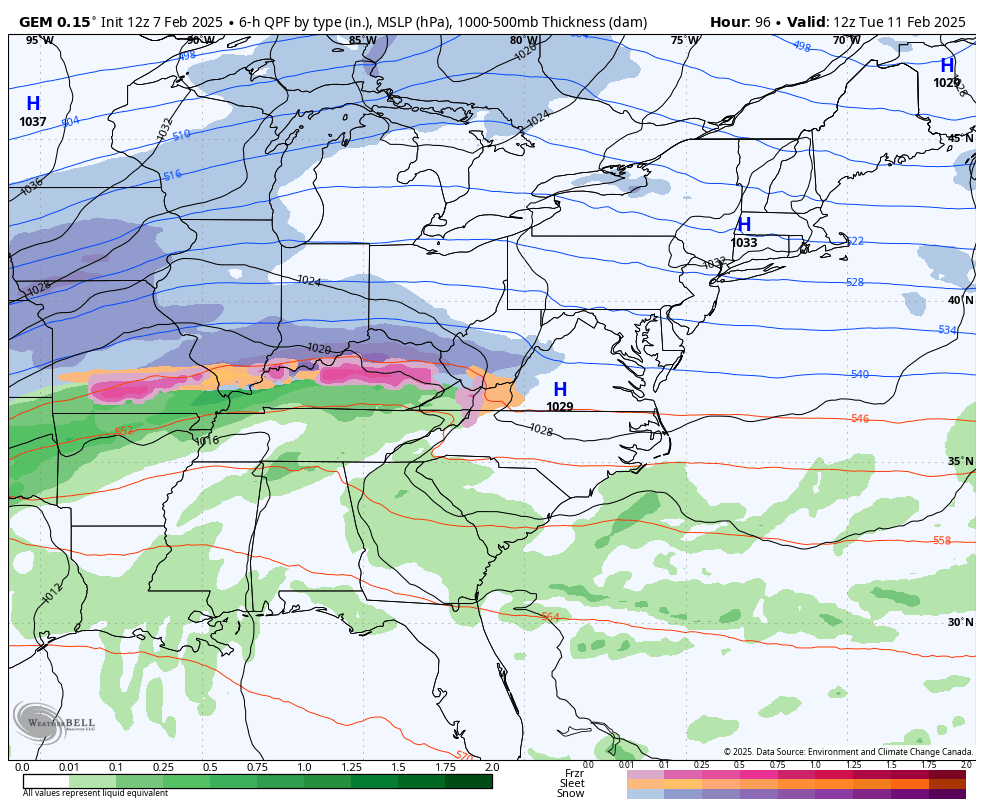
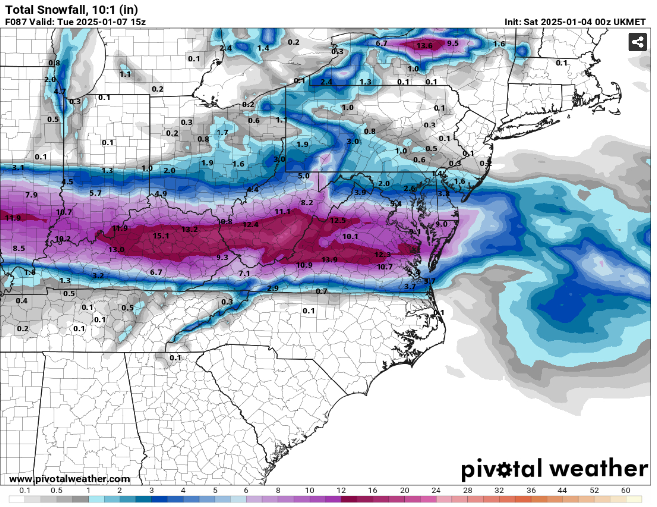
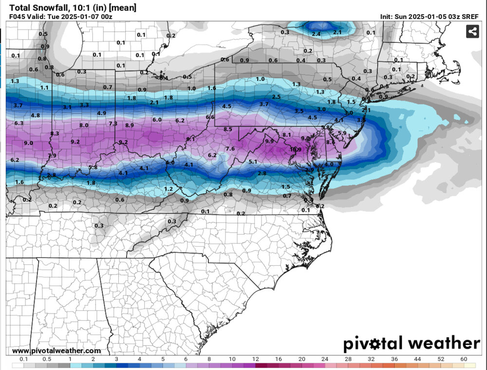
Canadian is south when you compare the 00z RGEM at hour 84 with hour 96 of the 12z CMC.


-
1/19 - The Roulette Wheel 29 Black Storm - OBS
snowdude replied to DDweatherman's topic in Mid Atlantic
32/30 Stafford, VA GO COMMANDERS! Hoping we get at least 2-3” here! -
Figured I was missing something lol
-
Except the Germans never bombed Pearl Harbor. That would be the JMA. What does that model say? No one cares.
-
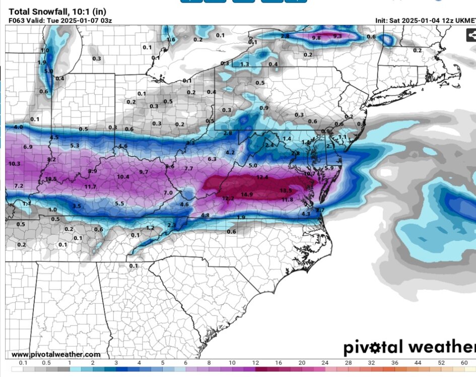
CMC has a 984mb low pressure pulling away off the Jersey coast after burying us with 10-20 inches of snow!
-
Nice, right? Got a coating on everything here in Stafford.
-
Adding the 1” so far with round two, we’re up to 8” in Stafford for storm total. A little more snow to go. 28/24
-
6.5” in Stafford so far. Briefly switched to sleet around 5-6am, back to snow now. 29/27
-
Flakes getting bigger and falling heavier in Stafford. Nice coating on the ground, including the roads. 30/27
-
Light snow in Stafford. 32/20
-
Cloudy, 33/15 in Stafford, VA. Dewpoint was 7 last hour.
-
Um, WOW!

-
Latest SREF is in and it’s farther south and juicy! With a little more snow to get through past this hour.

-
Yeah Ukie is way south. Wow, what an epic battle between the models.
-
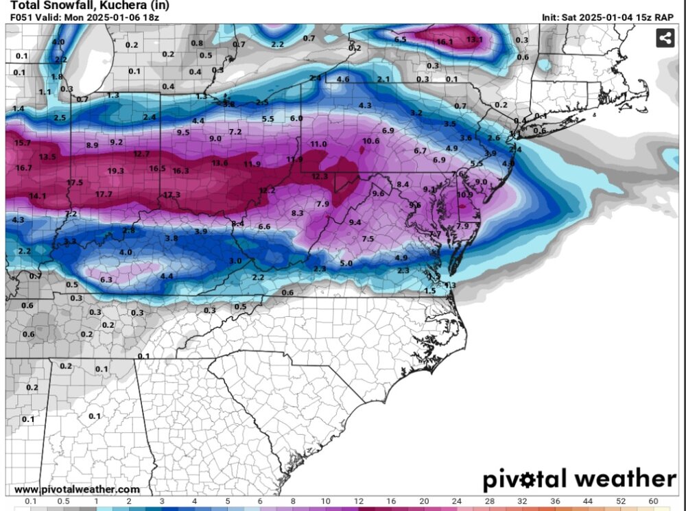
The RAP says “fine, I’ll give you all a win!” I like to use the RAP during winter storms, especially within 24 hours, so this is a little extended out, but still.
-
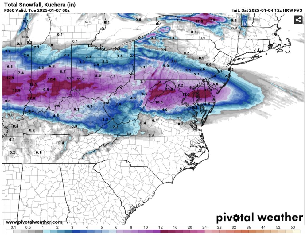
Yeah I don’t use it a lot but it is a branch of the GFS I believe. I don’t think it’s horrible, just still a “fairly new” model.
-
I know it’s the FV3 but here it is 12z run. These totals are all from the thump, with some wraparound to still get through after the run.
-
00z Ukie

-
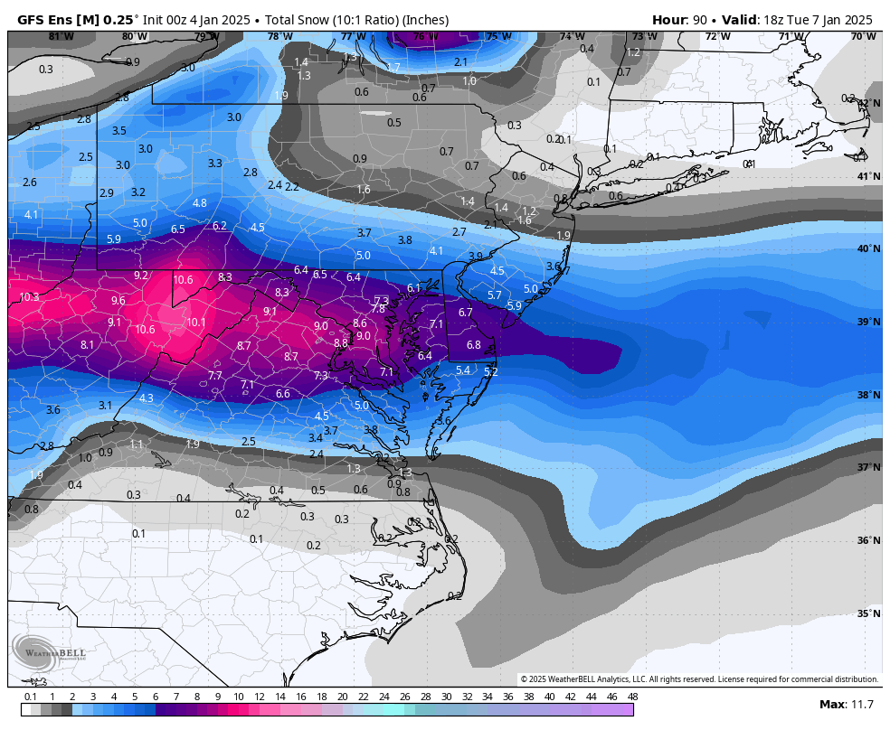
00Z GFS ensembles look good, a bit south.

-
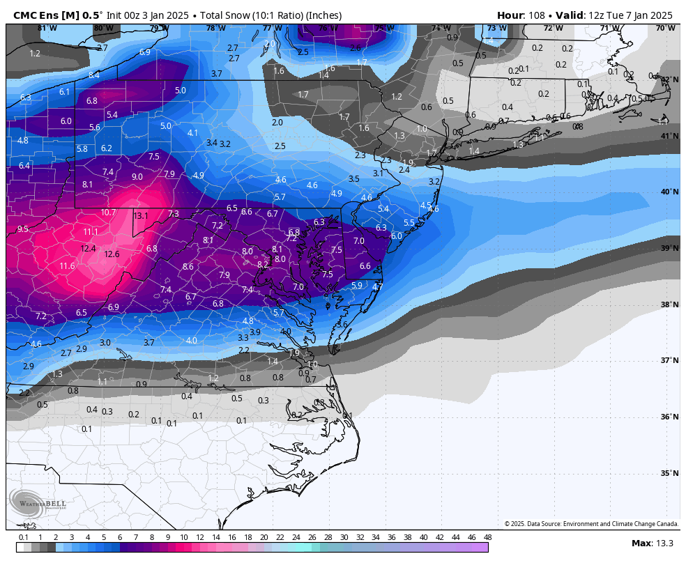
Canadian ensembles shift south as well. 00z Canadian and 18z Euro ensembles scarily alike. We lock?

-
Jan 21 - 22 Weekend SE VA and Eastern Shore Snow
snowdude replied to stormtracker's topic in Mid Atlantic
Post your snow totals! Would love to see them. I’m the local ABC Met here in SBY. Enjoy the snow! -
Jan 21 - 22 Weekend SE VA and Eastern Shore Snow
snowdude replied to stormtracker's topic in Mid Atlantic
Yeah from Salisbury to OC and points south got about 1-2 inches of snow with that front yesterday. More tonight! -
Southern MD / Lower Eastern Shore weather discussion
snowdude replied to PrinceFrederickWx's topic in Mid Atlantic
Good idea to issue the advisory tonight to be safe. Even if temps climb above freezing which they’re supposed to do very late tonight, any rain/drizzle that falls can still freeze on contact since ground temps are now below freezing due to snow cover. Especially on untreated areas. Also, I’m hoping for more snow Thursday night! I like what models are showing so far. I’ll take the 18z GFS.
-
Southern MD / Lower Eastern Shore weather discussion
snowdude replied to PrinceFrederickWx's topic in Mid Atlantic
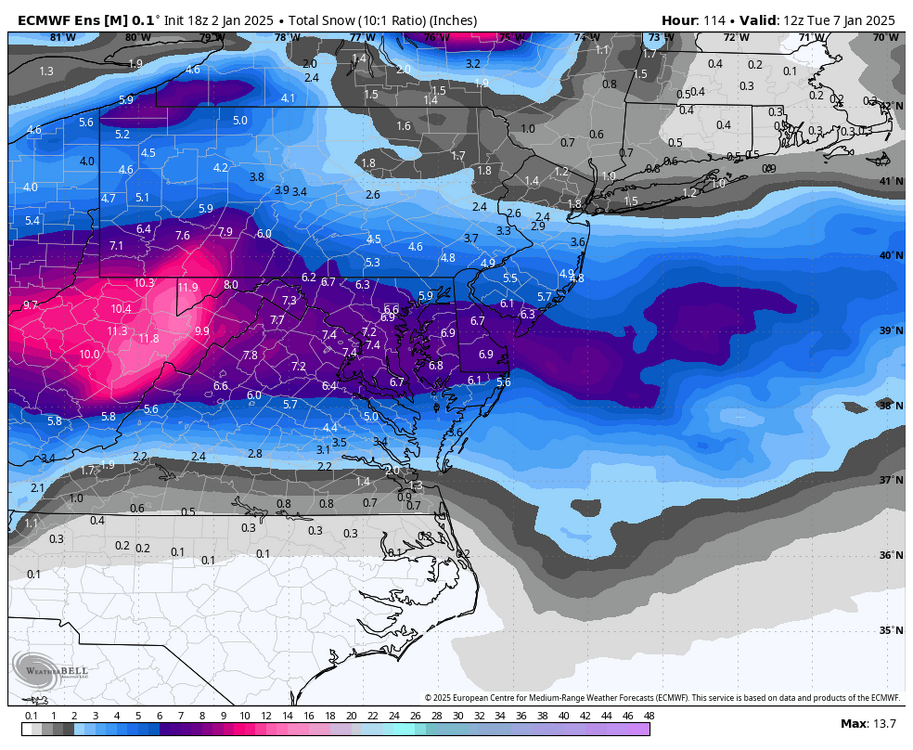
Yeah I saw. Haha. A lot of tonight’s runs are showing high totals like that. That tells me it’s going to rip! Although some of that in SBY is sleet. But I’m excited! Hopefully temps crash. -
Southern MD / Lower Eastern Shore weather discussion
snowdude replied to PrinceFrederickWx's topic in Mid Atlantic
New 00z GFS! Geez! This is going to put down some great rates when that deformation band gets going.