NepaJames8602
-
Posts
384 -
Joined
-
Last visited
Content Type
Profiles
Blogs
Forums
American Weather
Media Demo
Store
Gallery
Everything posted by NepaJames8602
-
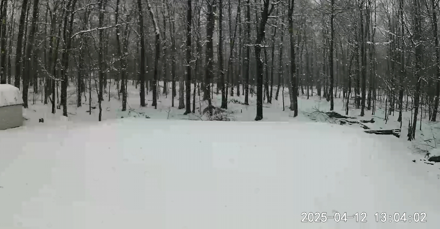
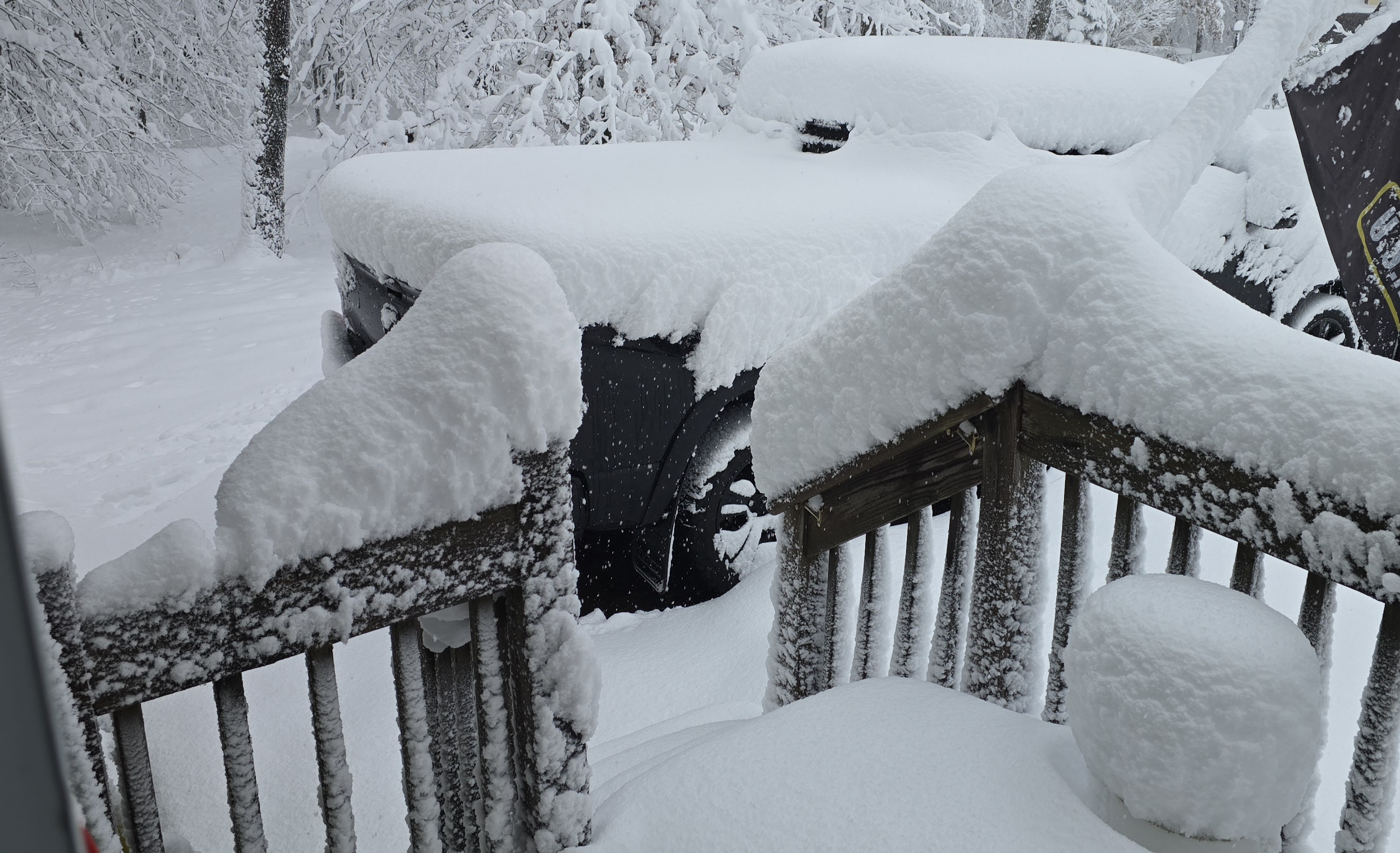
Still snowing moderately here in the Poconos and flirting right around that 32 degree mark. It's virtually impossible to measure with how fast it's compacting. Looks like another half inch to inch back on the deck, of pure slop. Easily close to 5.5 to 6" storm total now, atleast on the grassy areas. Beautiful scenery! Nice late season event for sure!
-
I saw reports in Monroe county of around 3.0". This was highly elevation dependent, and banding played a role too. High Point was located in some beautiful banding early this am.
-
Yeah if this continues 6.0" is very likely atleast on the grass. Totals are much lower once you're below 1,800 feet.
-
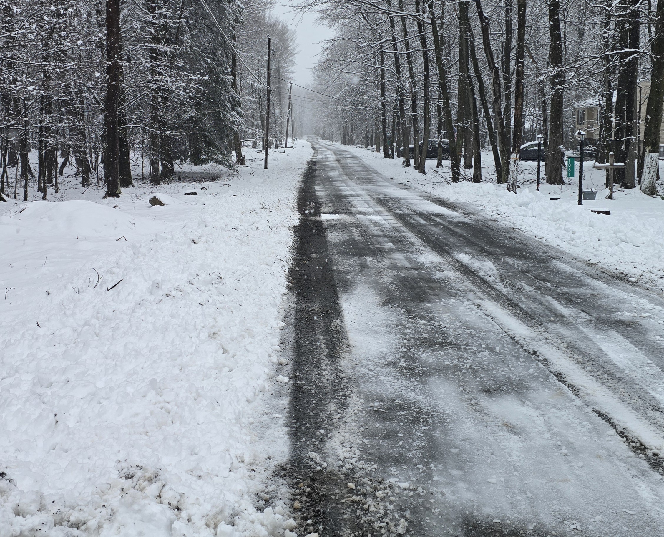
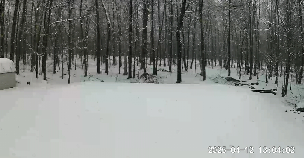
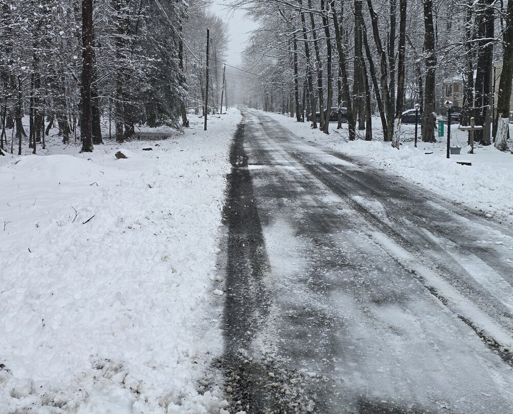
30 degrees and moderate snow continues here in the Poconos. Having difficulty sticking even above 2k now. I measured 5.0" on the grass, 4.0" on my deck and around 2.0" to 3.0" on the road and driveway. Gotta love late season wet snow lol. Beautiful late season event! Picture is looking down my road.

-
5.0" inches on grass, 4.0" inches on deck and 2.0 to 3.0" on the road. Have to love late season wet snow on warm ground lol. Moderate snow continues but having difficulty sticking. Temp is right around 30. Picture is looking down my road.
-
4.0" is what I'm coming up with here in the Poconos so far. Light snow continues.
-
4 inches of a heavy wet mess this morning in my part of the Poconos so far.
-
Full transition to wet snow just occurred here 15 min ago on the Pocono plateau; at 2,075' feet. It will be interesting by morning.
-
Hey Neighbor! I see they have hoisted advisories for my area to your east. I would not be surprised to see Lackawanna and Luzurne counties for the higher elevations added in there as well. You guys should also get in on deformation fun!
-
Sitting pretty here in my parts of the Poconos for tonight's event at 2,075' feet elevation. It looks like it's official as well. I'm located in Southern Wayne county on the n.w portion of the Pocono plateau. URGENT - WINTER WEATHER MESSAGE National Weather Service Binghamton NY 206 PM EDT Fri Apr 11 2025 PAZ040-048-072-120615- /O.NEW.KBGM.WW.Y.0020.250412T0400Z-250412T1800Z/ Northern Wayne-Pike-Southern Wayne- Including the cities of Honesdale, Equinunk, Milford, and Damascus 206 PM EDT Fri Apr 11 2025 ...WINTER WEATHER ADVISORY IN EFFECT FROM MIDNIGHT TONIGHT TO 2 PM EDT SATURDAY... * WHAT...Wet snow expected. Total snow accumulations of 1 to 4 inches, locally up to 5 inches above 2000 feet. * WHERE...Northern Wayne, Pike, and Southern Wayne Counties. * WHEN...From midnight tonight to 2 PM EDT Saturday. * IMPACTS...Plan on slippery road conditions over the higher elevations. * ADDITIONAL DETAILS...The higher end snow totals will be over the higher elevations, with lower elevations and valleys seeing lower amounts. PRECAUTIONARY/PREPAREDNESS ACTIONS... Slow down and use caution while traveling. The Pennsylvania Department of Transportation and Pennsylvania Turnpike Commission remind motorist to adjust speeds based on driving conditions as winter weather impacts Pennsylvania roadways. Visit www.511pa.com for the latest travel, roadways, and traffic conditions. && $$ MJM
-
Well it's official. URGENT - WINTER WEATHER MESSAGE National Weather Service Binghamton NY 206 PM EDT Fri Apr 11 2025 PAZ040-048-072-120615- /O.NEW.KBGM.WW.Y.0020.250412T0400Z-250412T1800Z/ Northern Wayne-Pike-Southern Wayne- Including the cities of Honesdale, Equinunk, Milford, and Damascus 206 PM EDT Fri Apr 11 2025 ...WINTER WEATHER ADVISORY IN EFFECT FROM MIDNIGHT TONIGHT TO 2 PM EDT SATURDAY... * WHAT...Wet snow expected. Total snow accumulations of 1 to 4 inches, locally up to 5 inches above 2000 feet. * WHERE...Northern Wayne, Pike, and Southern Wayne Counties. * WHEN...From midnight tonight to 2 PM EDT Saturday. * IMPACTS...Plan on slippery road conditions over the higher elevations. * ADDITIONAL DETAILS...The higher end snow totals will be over the higher elevations, with lower elevations and valleys seeing lower amounts. PRECAUTIONARY/PREPAREDNESS ACTIONS... Slow down and use caution while traveling. The Pennsylvania Department of Transportation and Pennsylvania Turnpike Commission remind motorist to adjust speeds based on driving conditions as winter weather impacts Pennsylvania roadways. Visit www.511pa.com for the latest travel, roadways, and traffic conditions. && $$ MJM
-
Hazardous Weather Outlook National Weather Service Binghamton NY 1109 AM EDT Fri Apr 11 2025 NYZ057-062-PAZ040-048-072-121515- Delaware-Sullivan-Northern Wayne-Pike-Southern Wayne- 1109 AM EDT Fri Apr 11 2025 This Hazardous Weather Outlook is for central New York and northeast Pennsylvania. .DAY ONE...This afternoon and tonight. Rain will change to a period of dense, wet snow overnight especially over the higher elevations. Several inches of wet snow accumulation will be possible across the higher terrain. .DAYS TWO THROUGH SEVEN...Saturday through Thursday. A period of wet snow will continue into the day on Saturday. Storm total accumulations of a few to several inches will be possible, especially across the higher elevations. .SPOTTER INFORMATION STATEMENT... Weather spotters are encouraged to report significant weather conditions according to Standard Operating Procedures. Please relay any information about severe weather to the NWS.
-
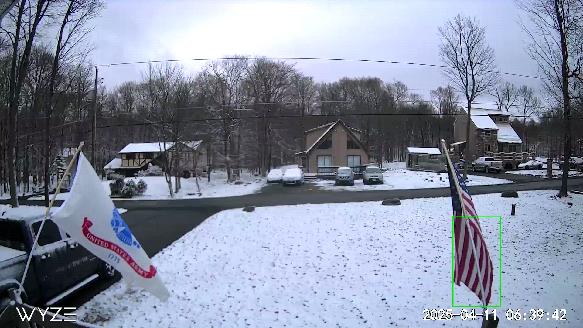
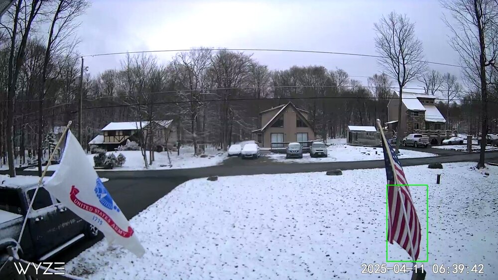
Pic from around 7 am this morning at 2,075'. Tonight looks interesting here in the Poconos above 2,000', especially the higher terrain of the Catskills.
-
29 here with moderate snow in the Poconos. The grass and deck have about a half of an inch. Roads are completely wet at 2,075' elevation.
-
17 degrees when I left for work in the Poconos. Beautiful bright blue skies today.
-

Snowfall NYC subforum Jan 6 and OBS if needed
NepaJames8602 replied to wdrag's topic in New York City Metro
I'm east of Moscow, and 10 min north of Gouldsboro at 2,075' feet. I had about an inch of snow on the ground previously. Today was a coating on driveway so far, yes. Just surprised the dry air truly didn't eat today's snow here. Nice to see a small refresher. -
Snowfall NYC subforum Jan 6 and OBS if needed
NepaJames8602 replied to wdrag's topic in New York City Metro
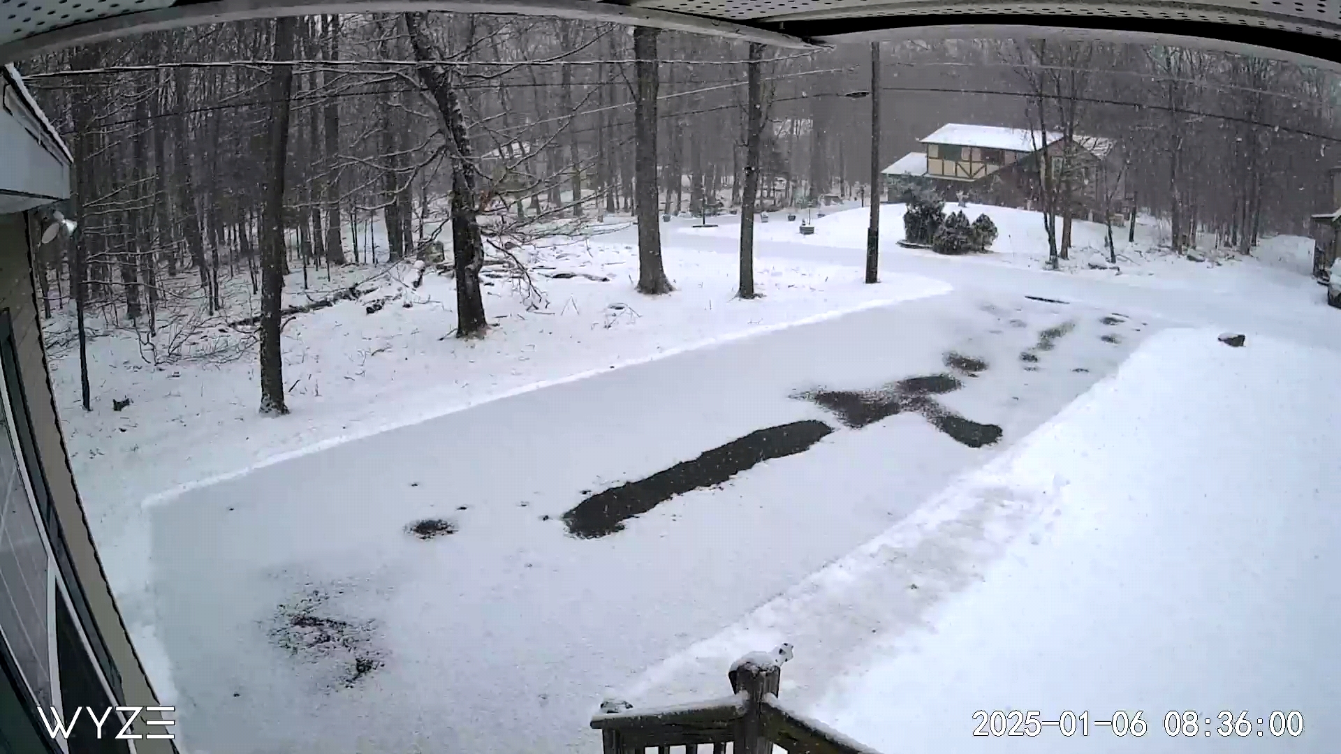
I'm 30 min north of Mt. Pocono. Im at work, but this is my Webcam at home right now. Today's new snow is on driveway. Surprised its snowing like that honestly, that far north.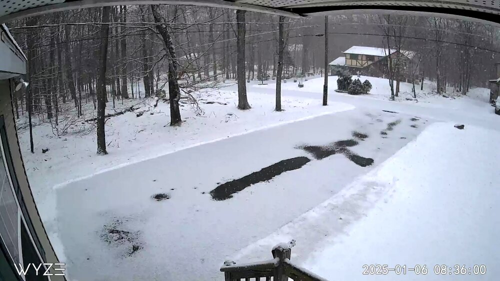
-
Central PA Winter 2024/2025
NepaJames8602 replied to Voyager's topic in Upstate New York/Pennsylvania
Slightly chilly night here in the Poconos. First goose egg of the year!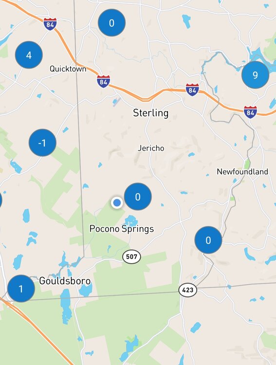
-
Awesome little event once again. Measuring right around 5.8" inches here in the Poconos of pure fluff.
-
Nice event this am here in the Poconos. Right about 4.0", enough to plow and make roads a mess.
-
Good morning everyone. My house in the Poconos. Newfoundland Pa, Wayne county. Elevation 2,075' feet. Haven't measured, but I'd say a foot. Nice early season event. And holy crap at High Point NJ getting 20". I'm about 275' feet higher than them and didn't get that much. Must of had some great banding overnight!

-
Central PA Autumn 2024
NepaJames8602 replied to Itstrainingtime's topic in Upstate New York/Pennsylvania
Good late morning everyone. My house in the Poconos. Newfoundland Pa, Wayne county. 2,075' elevation. Haven't measured, but I'd say atleast a foot. Its still snowing as well. Will measure and take more photos later. Nice early season event!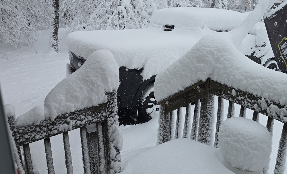
-
Central PA Autumn 2024
NepaJames8602 replied to Itstrainingtime's topic in Upstate New York/Pennsylvania
36 for a low here in my part of the Poconos. Love this weather, frost Advisory up for tonight. -
10.5” was the final here in my part of the Poconos. Newfoundland, Wayne county 2,075’. Just to my south and south west, I’m seeing reports of 12 to 14 inches. 20 to 30 miles to my north and northwest; its bare ground. What a cutoff with amounts and what a disaster of a storm to track.
-
10.5” inches final here in my part of the Poconos. I was actually shocked to wake up and see we got dumped on. Thought for sure this threat was dead after seeing the models slip south. Amounts ranging from 12 to 14” to my south and southwest in other areas of the Poconos as well. What a cutoff though, just to my north and nw; in a matter of 20 to 30 miles it goes down to absolutely nothing. What a headache of a storm and a disaster of model output, my god. Seasonal total now sits at 37.5”.