Winter Wizard
-
Posts
678 -
Joined
-
Last visited
Content Type
Profiles
Blogs
Forums
American Weather
Media Demo
Store
Gallery
Everything posted by Winter Wizard
-

2021 Mid-Atlantic Severe Weather - General Discussion
Winter Wizard replied to Kmlwx's topic in Mid Atlantic
Yeah very close to there, right off Old Hanover Road. That’s funny. -
2021 Mid-Atlantic Severe Weather - General Discussion
Winter Wizard replied to Kmlwx's topic in Mid Atlantic
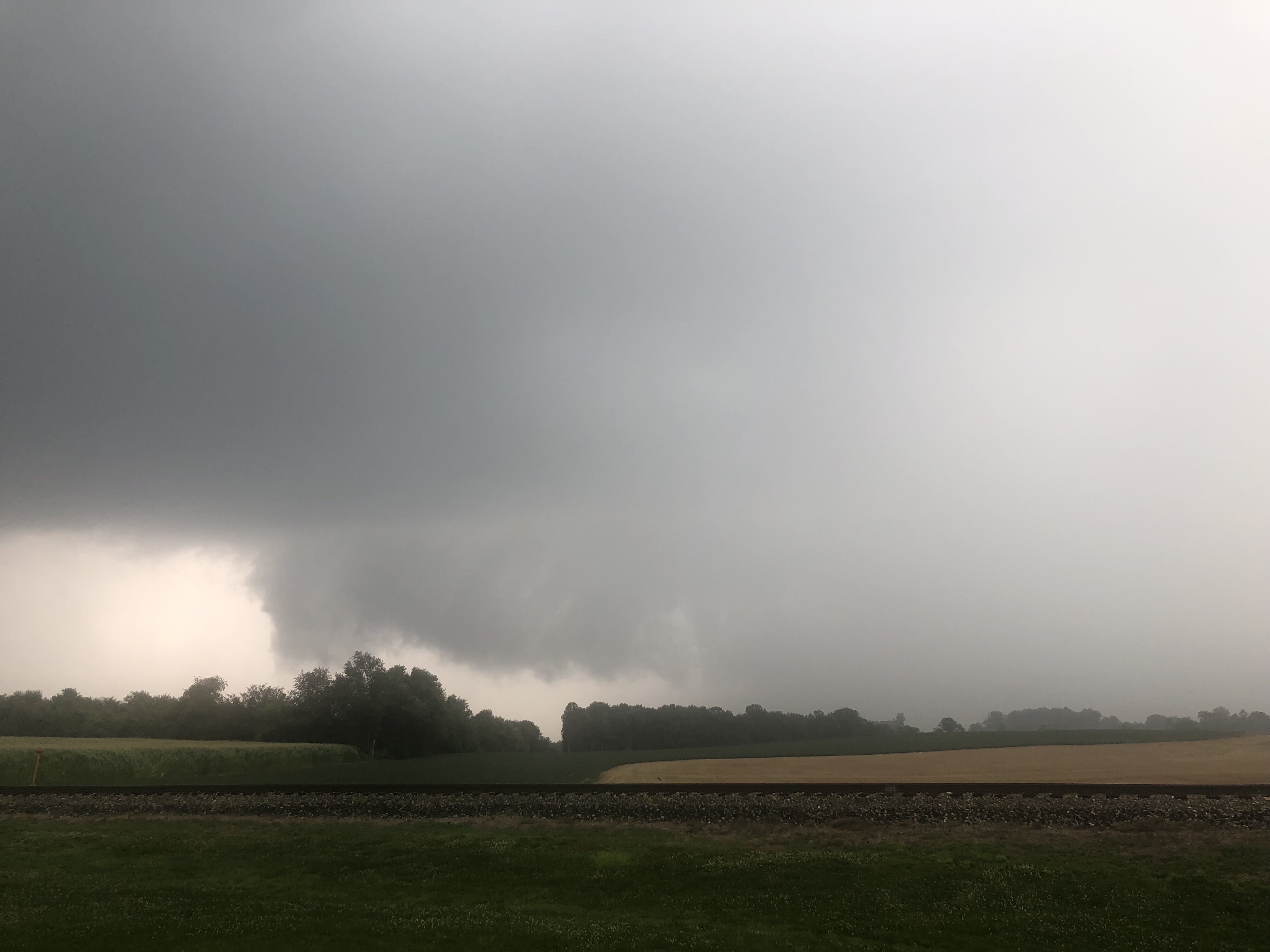
Captured this wall cloud from the storm near Reisterstown earlier today. Tried to capture that storm near Elliott City but ended up getting caught in the rain shaft and 695 traffic. Hope everyone stays safe out there.
-
2021 Mid-Atlantic Severe Weather - General Discussion
Winter Wizard replied to Kmlwx's topic in Mid Atlantic
Could say that about 90% of these severe weather setups around here. -
2021 Mid-Atlantic Severe Weather - General Discussion
Winter Wizard replied to Kmlwx's topic in Mid Atlantic
Not sure if it was mentioned, but CAMs did an abysmal job last night and this morning with the MCV over the Great Lakes region, everything developed farther south and west than progged. Obviously we have the usual limiting factors in this area, but best jet dynamics still appear to be near the Mason-Dixon Line despite the enhanced moving northward. Need to keep a close eye on that line today. -
Stuck in the low 50s here in Annapolis. Thank you bay breeze.
-
Yay! Thanks to this post I just checked and got my grandparents an appointment this weekend at CVS, over 2 months before their originally scheduled date!
-
Annapolis, MD: 38.968532, -76.513223
-
The returns over Wilmington are heavy snow, according to family members on the ground.
-
Flipped to a snow/sleet mix. Mostly sleet at the moment.
-
Moderate snow and immediately accumulating on all surfaces. Sun angle season, am I right?
-
It's snow here in Annapolis, let's go!!
-
35/25 in Annapolis. Going to be a close call for getting flakes here.
-
Light snow/sleet mix in Annapolis. Had a decent glaze of ice on hard surfaces this morning.
-
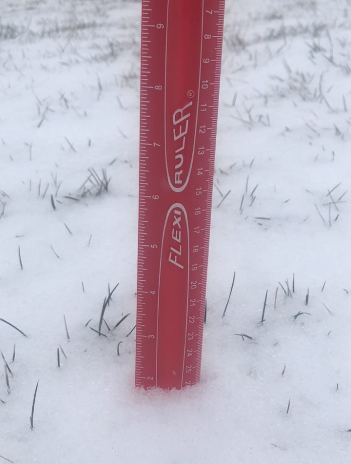
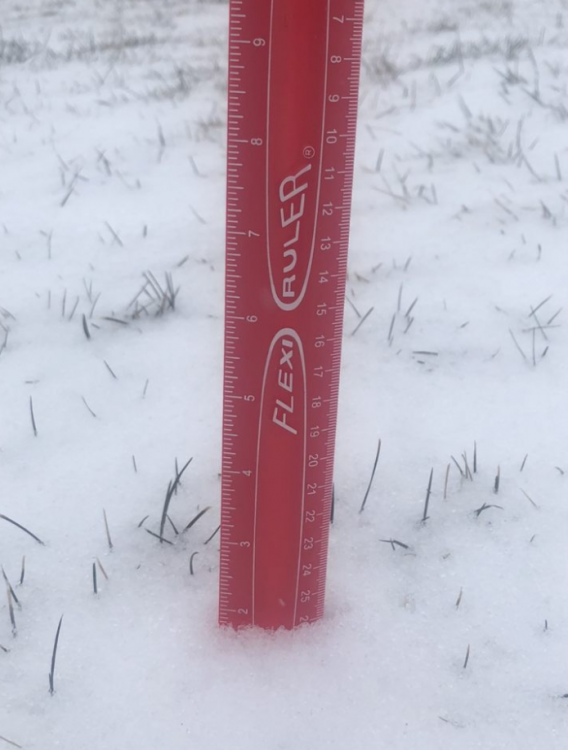
I'm a bit farther west than you. Sleet bomb continues here. Measurements in the grass range from 1.2-1.8" or so.
-
And now we're back to sleet but that was probably the heaviest snow we've seen all year.
-
Wow, just flipped to mostly snow in Annapolis!
-
Got about an inch of sleet on the ground and still assaulting at the moment. It's brutal outside. Can't even be mad about missing out on the snow, this is a unique event and it's better than freezing rain.
-
Wow, heaviest and loudest sleet I've experienced in years.
-
Light sleet in Annapolis, been that way since the very beginning.
-
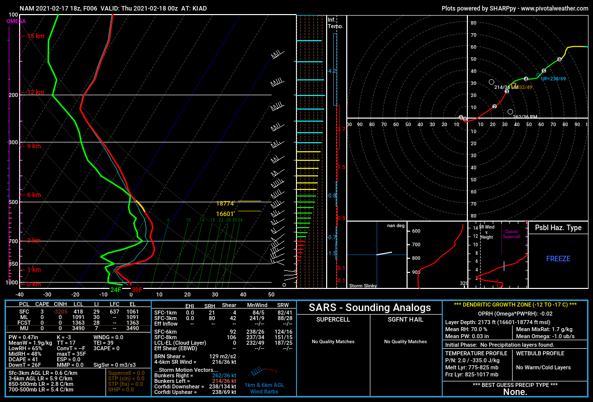
Biggest takeaway from that is the mid-levels are about a degree warmer which is not a good sign. Being drier does mean more radiation cooling so while it’s not a bad thing, doesn’t mean much if the 850s torch.
-
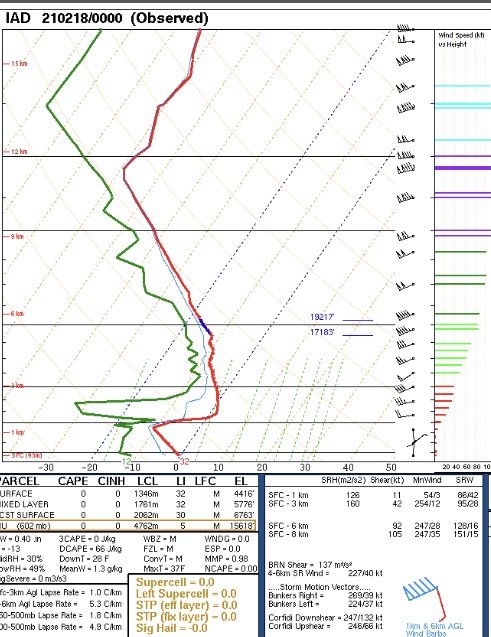
Here is a side by side comparison of the observed 0z sounding at Dulles vs. the 18z NAM depiction.

-
I'll throw my hat in the ring this time. I like 1-3/2-4" for DC before the changeover, a little more in Baltimore with amounts steadily increasing to the north and west. More concerned about the potential for prolonged icing along and east of I-95.
- 352 replies
-
- 17
-

-

-

-
Looks like 18+ straight hours of ice near I-95 on top of a few quick inches of snow. If that verifies, yikes.
-
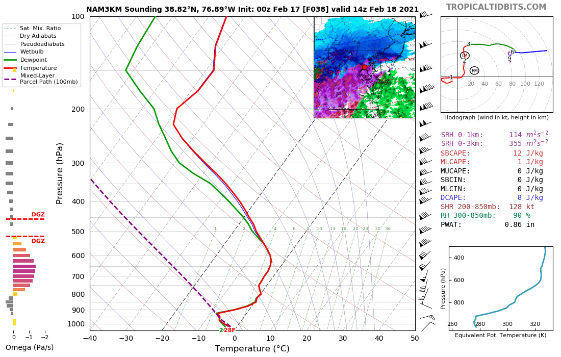
Yes, the issue with this storm is almost entirely in the mid-levels. Surface track does matter to an extent, and it is favorable for us, but the upper-level low tracks right over us - you want it to be south and east. Trough axis as a whole is too far west. We end up getting stronger warm air advection at the 700-850 mb level and that's what changes the cities over to sleet and freezing rain. The stronger warm air advection is also what's helping create lift and why you're seeing the intense FGEN bands depicted on the front end.
-
This is a sounding near DCA right as it flips to sleet at 14z. Razor thin margin.