

Winter Wizard
-
Posts
642 -
Joined
-
Last visited
Content Type
Profiles
Blogs
Forums
American Weather
Media Demo
Store
Gallery
Everything posted by Winter Wizard
-

Fall/Early Winter 2019 Forecasts and Discussion
Winter Wizard replied to pasnownut's topic in Upstate New York/Pennsylvania
And what's more impressive is the cold that follows it. State College drops into the low single digits for at least three consecutive mornings next week on the GFS. -
Fall/Early Winter 2019 Forecasts and Discussion
Winter Wizard replied to pasnownut's topic in Upstate New York/Pennsylvania
12z GFS is another pretty solid run for C-PA snow next week. Classic anafront situation. -
Looks anafrontal to me. Obviously not as great as 6z but still eventually turns to snow everywhere but the MD/DE shore through 168.
-
Hour 132 shows frozen precip into central PA. The most notable change I see it northern stream vort isn't digging as much as on the 6z run. 144 has a mix for the N and W suburbs, rain for DCA and BWI
-
I agree that the 11/12-13 threat has much more potential. The late week storm threat seems more like a frontal boundary that could bring some snow on the backend to interior New England and maybe parts of western NY and PA. Even some mood flakes are possible in the far northern and western suburbs depending on the track. This would shift the baroclinic zone farther southeast, which could end up working out in our favor if all goes right. You have a highly amplified west coast ridge, a deep trough, fresh injection of cold air, and some semblance of Greenland blocking starting this weekend. Actually a fairly similar setup to November 2014 and 2018. We've seen D10 threats fall apart in the medium range, but this one is definitely worth monitoring. At the very least, a colder-than-normal November seems pretty likely at this point.
-
Congrats La Plata

-
Skins will never come close to a championship as long as Snyder is in charge. Beal is probably gone by next year, but at least the Wizards will suck enough to have decent draft capital.
-
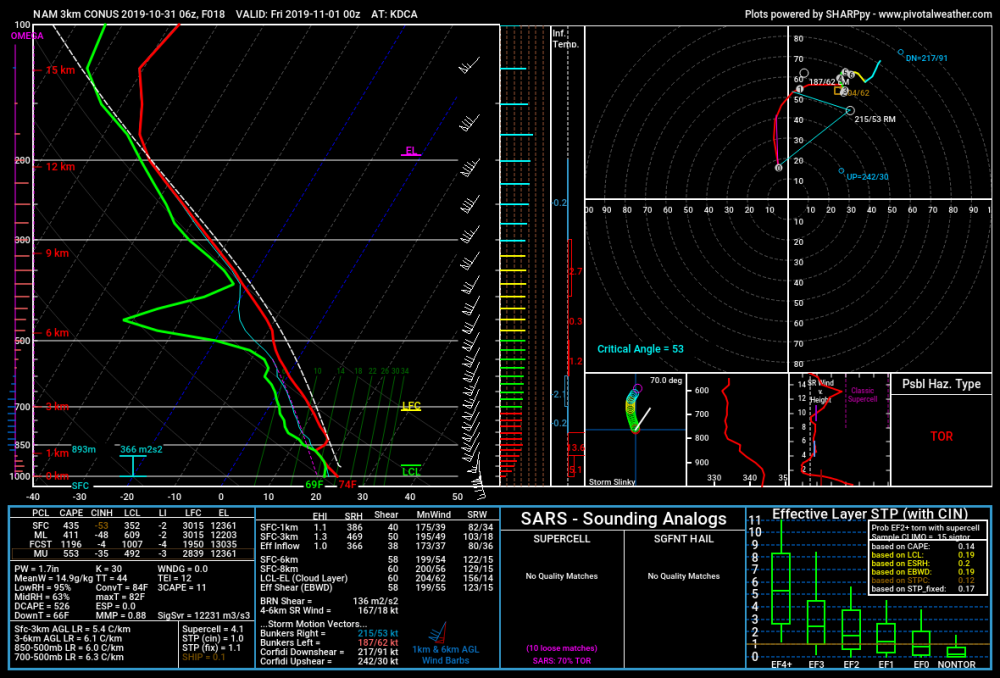
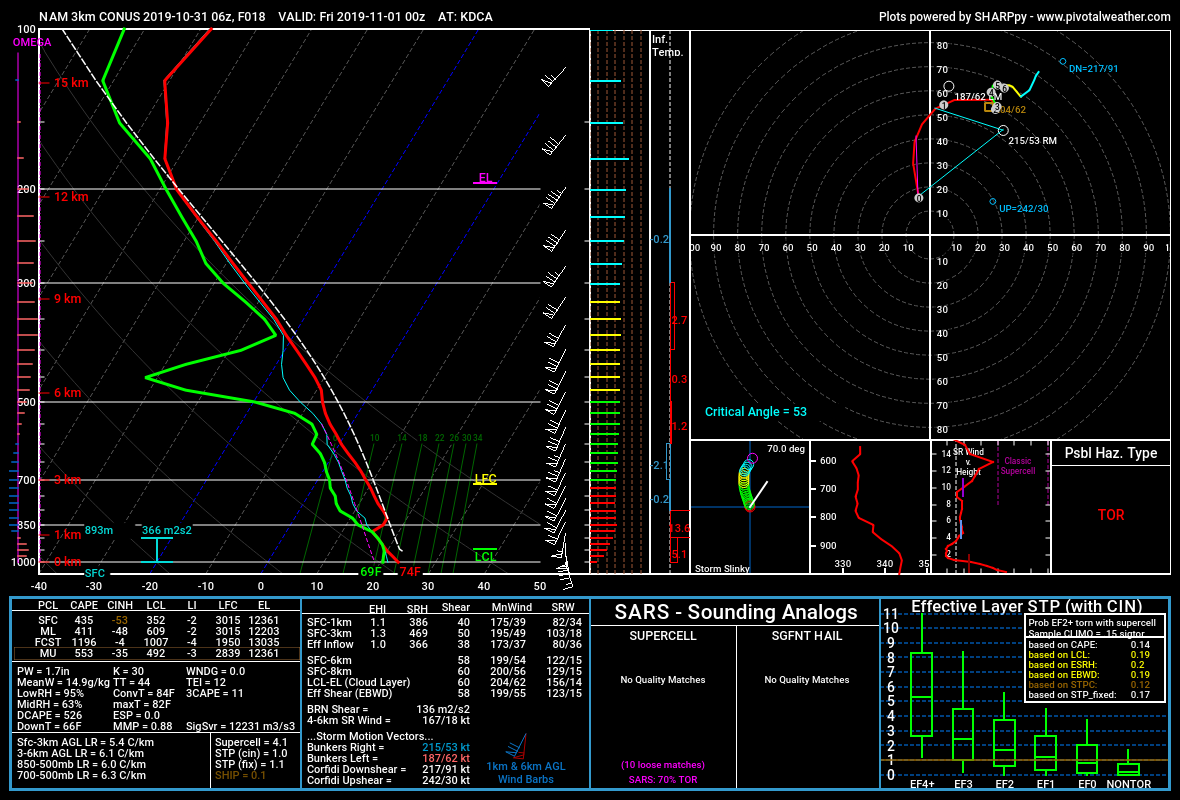
This is a pretty classic high shear, low cape severe event. Anything that develops later this afternoon (should be around 0z in the Blue Ridge, 2z near I-95) should quickly congeal into QLCS. The biggest concern is definitely the straight-line wind threat, although a brief spin up is not out of the question, with very strong speed and directional shear near the surface and a cranking LLJ. Question is, can we overcome that mid-level capping inversion and mix down to the surface as shown in the 0z DCA sounding?
-
Mid-Atlantic winter 2019-20 snowfall contest
Winter Wizard replied to PrinceFrederickWx's topic in Mid Atlantic
BWI: 23.2" DCA: 13.7" IAD: 25.1" RIC: 10.8" Tiebreaker SBY: 10.3" -
Since 1950, there has been a -AO in November 38 times. Among those 38, 23 were also followed by -AO in December, but 27 featured a mean -AO for DJF. The average snowfall since 1950 at DCA is 16.1". Among those 38 Novembers, 23 had a strong -AO of <-0.5. 16 of those years (70%) also had a -AO for the winter. Interestingly, the last four times this occurred (2018, 2016, 2014, 2007), there was a +AO in the winter. Conversely, there have been 17 Novembers with strong +AO of >0.5. 11 of the following winters (65%) also had a +AO. The mean snowfall in -AO November years is 15.2", but in strongly negative years (<-0.5), the average climbs to 18.4". -AO Novembers where the winter also featured a -AO DJF have a mean snowfall of 17.7". In total, 12/38 (31.5%) of -AO November winters had above normal snowfall. Interestingly, the mean snowfall in +AO November years is above normal at 17.2". 13/31 of those winters featured above average snowfall (41.9%). Another interesting tidbit I found was in DC's top 10 snowiest winters, 5 of them had a -AO November, but only 2013-14 had a +AO November and +AO winter.
-
Yes, I was talking strictly December snowfall vs. rest of the season. Rest of season snowfall is about average with +AO Decembers.
-
Just ran through the numbers: Since 1950, there have been 33 winters with a positive AO in December. 25 of those winters featured 1 inch or less of snow in DCA and among those, 15 were complete shutouts. The average snowfall in +AO winters is just 1.2" while only 3 have featured 6" or more in December. However, the rest of those seasons averaged 12.7" which is in line with the long term average of 13.2". 12 of those winters featured a 6"+ snowfall at another point in the winter including 6 of the shutout winters. Conclusion? If the AO is positive then odds are very high December is doomed in DC. However, there is definitely still hope especially if the AO eventually turns negative, which was the case in most of above average winters.
-
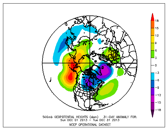
One quick note: it's definitely a stretch to call December 2013 a torch. Most places in the Mid-Atlantic finished the month right around average and that was largely skewed by a torch around 12/20. The first half of the month was below normal and the week of 12/8 brought three separate snow events to the Baltimore/DC metro, all of which featured WSW in the LWX zones. In fact, going off of the discussion yesterday in the medium/long range discussion thread, it's a good example of when having a strong SE ridge works in our favor since it shifted the baroclinic zone northward enough to get us in the action, but thanks to the strong -EPO, we remained on the right side of the gradient.
-
The trend is not your friend.

.thumb.gif.4dc96ac949feff875f72a377a55f6bd7.gif)
-
Interestingly the 12z GEFS has jumped considerably NW in the SLP track and ensemble mean. Now shows 0.5"+ for everyone south and east of Frederick.
-
Looks like the final total here in Annapolis was right around 1.2".
-
Yellow-banded here in Annapolis. RadarScope estimate has us around 0.4” so far today.
-
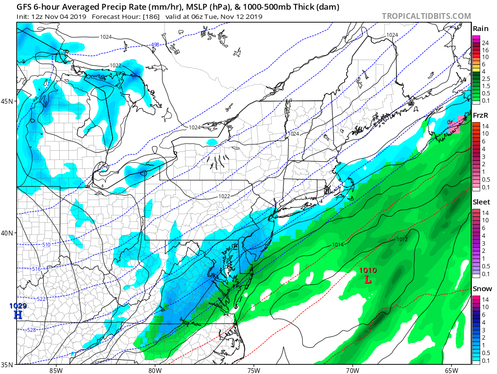
Looks like it's all from the primary low, especially N and W of DC. As soon as the transfer occurs, precip shuts off rapidly from W to E. Huge dry slot through central PA and NW Virginia. Let's hope this storm isn't a sign of things to come in the winter.
-
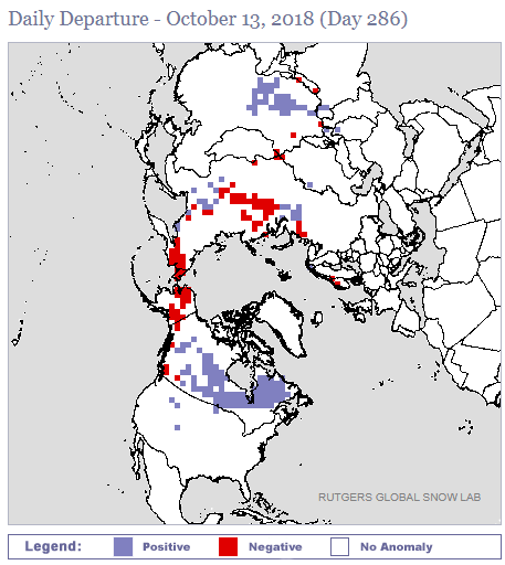
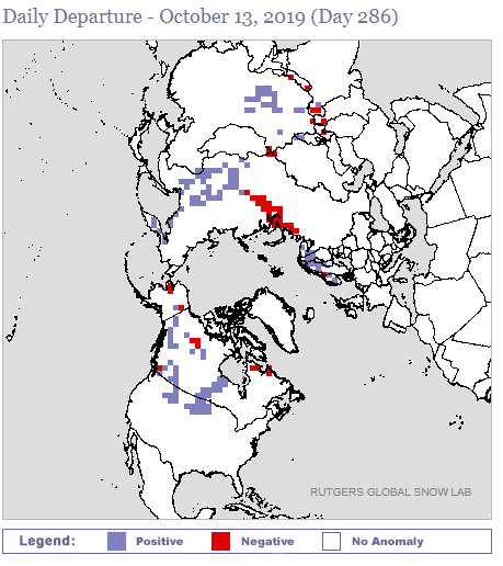
So far it's advancing at a pretty steady pace. As of October 11, Siberia had the second highest coverage over the past decade trailing only 2014.
-
Essentially a Miller B. The latest GFS has the primary vort holding strong all the way to Ontario before fully transferring off the coast of Mass. We all get some rain from the initial low but re-development is way, way too late for us to get in on the good stuff. The Euro, on the other hand was much closer to rainier solution as it had an earlier transfer (DE coast) and stronger secondary low, which brought the deluge into PHL and even far northeastern MD. Will be interesting to see the trends at 12z. I do wonder if the GFS is being too progressive, especially since the 6z GEFS re-developed the secondary farther south and west than the operational.
-
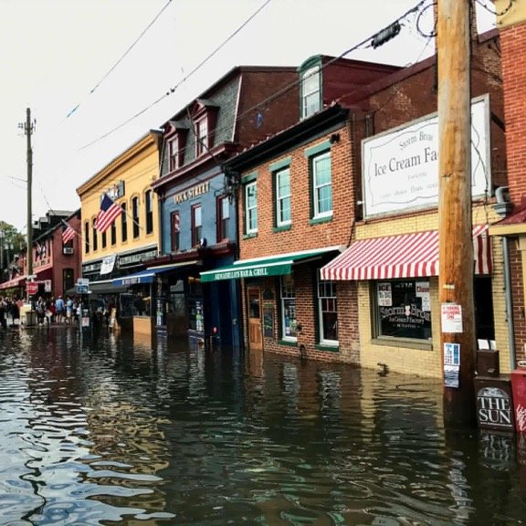
Had a decent band of rain earlier today in Annapolis, which brought us 0.11” in total. Photo is from Instagram but there was pretty significant coastal flooding near the Bay, which made things extra interesting for the Boat Show this weekend.
-
Another deluge of 0.01” here in Annapolis overnight.
-
Pretty stark contrast between last night's 0z GEFS and EPS runs for next week. EPS is much weaker with the troughing over the central US, which allows the southeast ridge to flex its muscles out ahead of it and torches the east through the 17th. The GEFS meanwhile continues to show a strong trough over the northern Plains that gradually moves east, which would put us solidly below normal through the 19th or so.
-
Yup, we actually were under a solid band for a bit around 11 last night. Tonight is a pretty tricky forecast but I think there's a decent chance we see at least some rain.
-
Looks like we had a whopping 0.05" of rain last night here in Annapolis. Solid deluge.


.gif.8f09636975ce65c50052e01548a5822c.gif)
