hudsonvalley21
-
Posts
4,027 -
Joined
-
Last visited
Content Type
Profiles
Blogs
Forums
American Weather
Media Demo
Store
Gallery
Everything posted by hudsonvalley21
-
It was a Flop... February 2024 Disco. Thread
hudsonvalley21 replied to Prismshine Productions's topic in New England

-
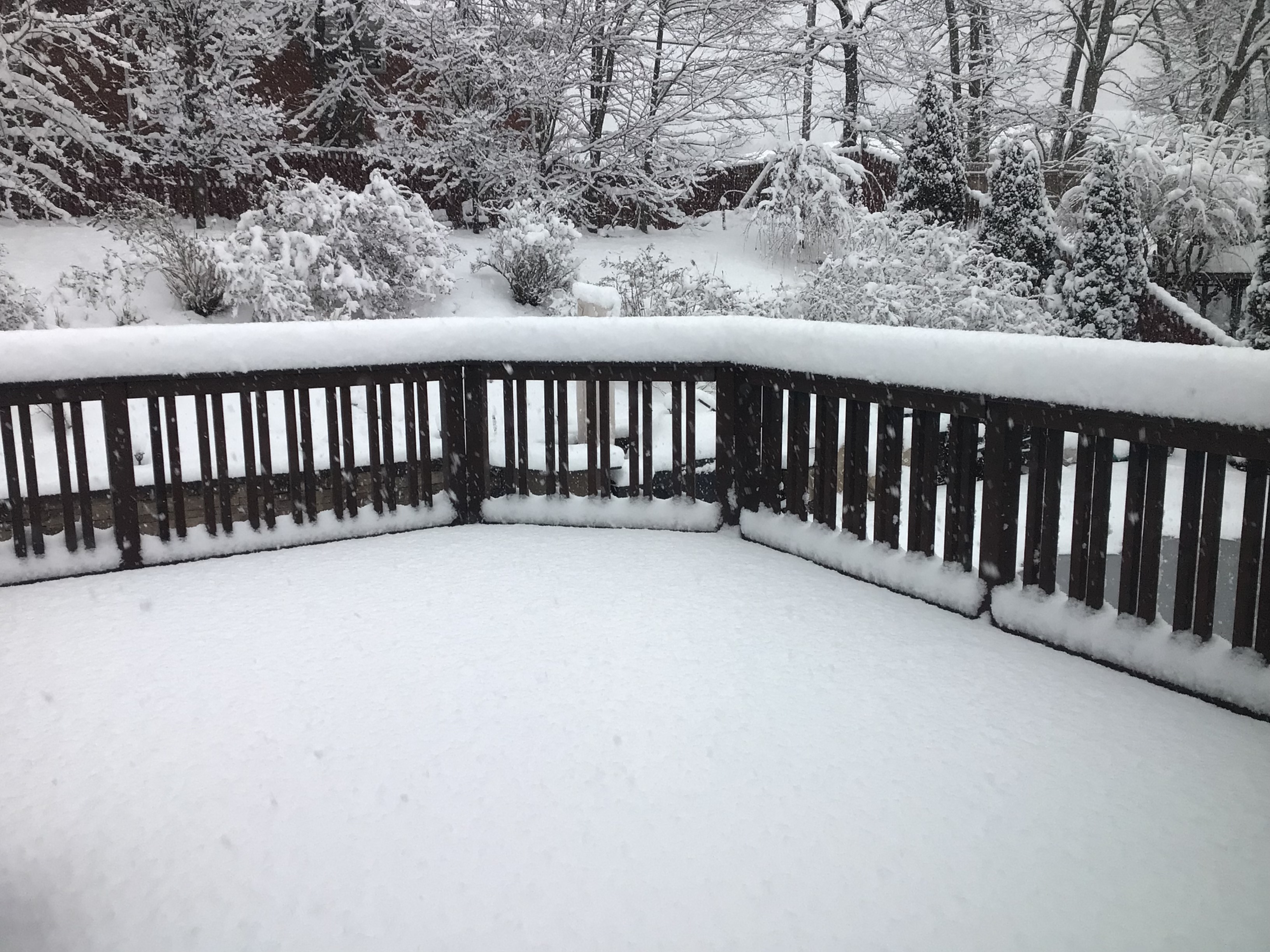
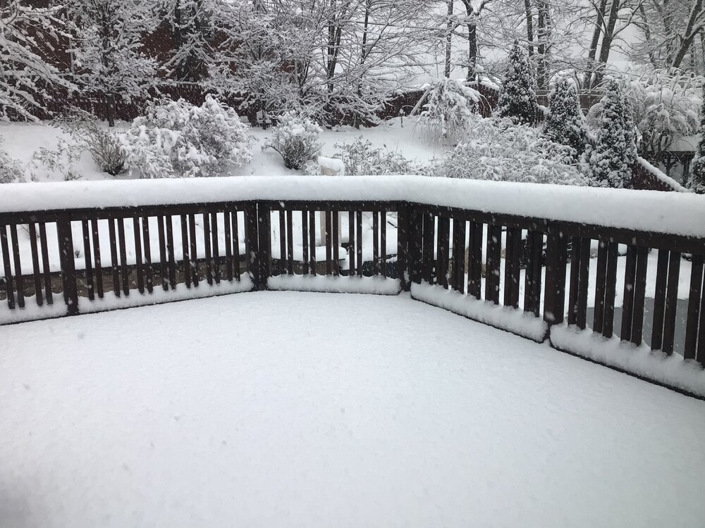
12.2” here.
-
Agree, a lot of hair pulling for the last couple of model runs. I came in at 12.2”, nice to see some snow cover.
-
Same here
-
9” OTG

-
9” OTG
-
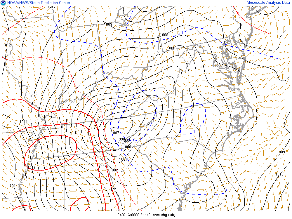
2hr pressure drop map
-
Strange indeed. All other models are showing snow ptype
-
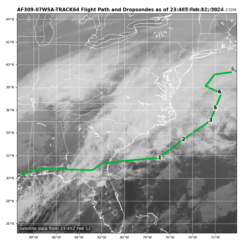
Interesting that they have a recon sampling in the open waters.

-
Funny how it’s showing rain on the backside

-
Borrowed from the New England thread,
-
Thanks Don
-
Nice write up. It will be interesting when the short range models such as the HRRR and HRDPS are in range.
-
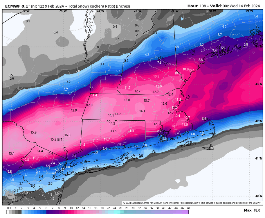
Don, does it have estimates for other locations inland such as KSWF?
-
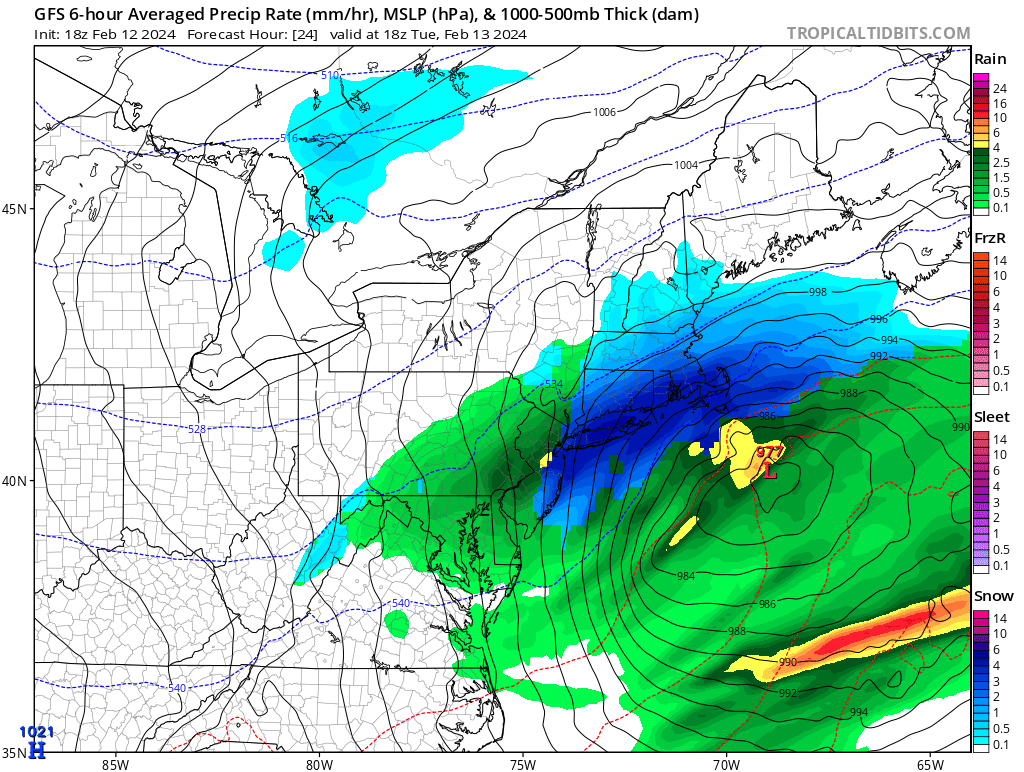
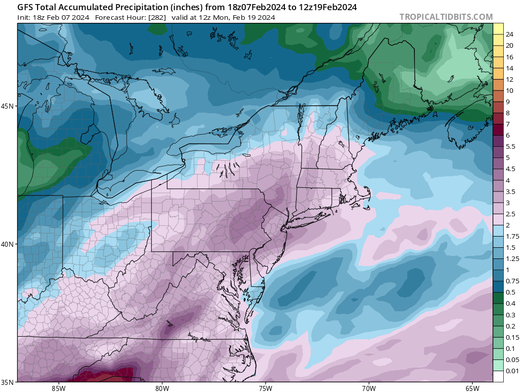
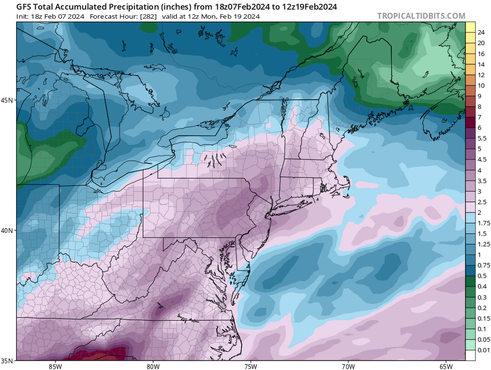
And a general 2-3” of QPF thru 274 hours. And as we know this will flip flop like a fish out of water for the next runs. Some better sampling in the next few days will get a better read.
-
It was a Flop... February 2024 Disco. Thread
hudsonvalley21 replied to Prismshine Productions's topic in New England

-
Same here. Also heard that the speed was reduced on the Newburgh-Beacon bridge and it was treated for icy conditions.
-
DCA _ NYC _ BOS __ ORD _ ATL _ IAH __ DEN _ PHX _ SEA 1.5 1.2 1.4 1.4 0.3 2.1 1.6 1.1 -0.4
-
1.26” was the total in the Davis for the event. A dusting of ice pellets this morning here. I see that up on Storm king at 700-1000’ it was snow covered. Not sure what was actually accumulated tho.
-
34 here with just plain light rain. Had a mixed bag about an hour ago during the heavier precipitation at 125’ of elevation. 1.01” in the Davis so far in precipitation.
-
34 here with just plain light rain. Had a mixed bag about an hour ago during the heavier precipitation at 125’ of elevation. 1.01” in the Davis so far in precipitation.
-
18z NAM held ground from the 12z run
-
I feel the same way. I’d be happy seeing white rain. The 12z NAM kicked up it’s totals. I’d wait a few more runs maybe by 18z tomorrow we’ll see how things are trending.
-
Thanks Walt for the heads up. OKX mentions the possibility of the wintery mix for us folks inland in their AFD. A section of Upton’s is below. Thermal profiles look just warm enough such that anything that falls Tuesday morning is probably rain. After some wet-bulbing, precip type gets tricky starting in the afternoon in addition to an elevated warm layer pushing in from the SW. Further complicating the forecast is a period of potential low level cold advection over the eastern zones during the night as the stationary front sags south and winds flip NE to E. Won`t go into details, but currently have chances of freezing rain, sleet and snow for inland areas. Rain elsewhere