hudsonvalley21
-
Posts
4,027 -
Joined
-
Last visited
Content Type
Profiles
Blogs
Forums
American Weather
Media Demo
Store
Gallery
Everything posted by hudsonvalley21
-
Had a max rain rate of 7.29 per hour. This cell formed over head and continues to back build. 3.53 in the Davis rain gauge so far with this event.
-
Had a max rain rate of 7.29 per hour. So far 2.56 in the bucket from this first cell edit. 3.53 in the bucket.
-
Got fringed on that one. A few light showers and rumbles just to my west.
-
July 2020 temperature forecast contest
hudsonvalley21 replied to Roger Smith's topic in Weather Forecasting and Discussion
DCA +2.8 NYC +3.0 BOS +2.8 ORD +2.6 ATL +1.3 IAH +1.6 DEN +0.2 PHX +0.8 SEA 0.0 -
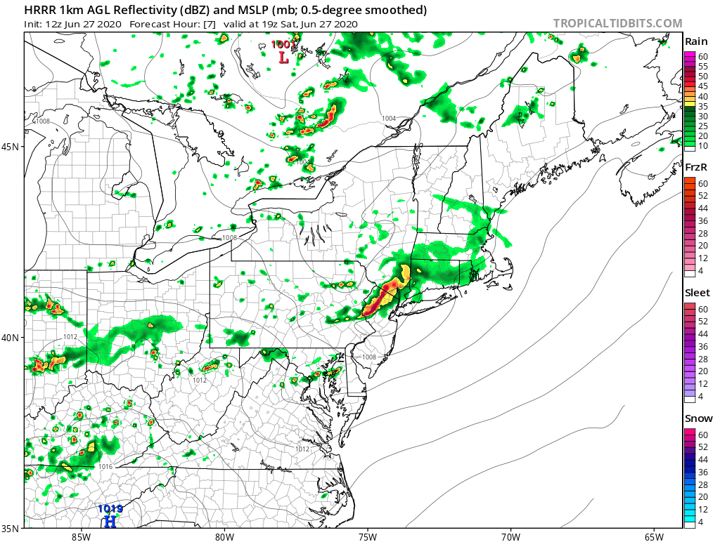
SVR potential Sunday June 28 130P-10P NY metro
hudsonvalley21 replied to wdrag's topic in New York City Metro
0.12 with this one too. Fell apart on top of us. -
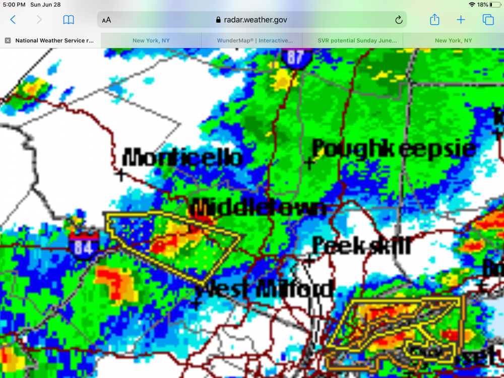
SVR potential Sunday June 28 130P-10P NY metro
hudsonvalley21 replied to wdrag's topic in New York City Metro
-
SVR potential Sunday June 28 130P-10P NY metro
hudsonvalley21 replied to wdrag's topic in New York City Metro
Hopefully some of it soaked in the ground. Total of 0.56 in this 1st one. Next one about an hour away.- 58 replies
-
- 1
-

-
- hail
- damaging wind
- (and 1 more)
-
SVR potential Sunday June 28 130P-10P NY metro
hudsonvalley21 replied to wdrag's topic in New York City Metro
Just getting under the main part of the cell here. Rain rate at 4.43 per hour. Pea sized hail currently edit just had an rain rate at 5.01 per hour- 58 replies
-
- 1
-
-
- hail
- damaging wind
- (and 1 more)
-
SVR potential Sunday June 28 130P-10P NY metro
hudsonvalley21 replied to wdrag's topic in New York City Metro
Severe Thunderstorm Warning NYC071-079-281945- /O.NEW.KOKX.SV.W.0021.200628T1841Z-200628T1945Z/ BULLETIN - IMMEDIATE BROADCAST REQUESTED Severe Thunderstorm Warning National Weather Service New York NY 241 PM EDT Sun Jun 28 2020 The National Weather Service in Upton NY has issued a * Severe Thunderstorm Warning for... Northeastern Orange County in southeastern New York... Western Putnam County in southeastern New York... * Until 345 PM EDT. * At 241 PM EDT, a severe thunderstorm was located over New Windsor, or near Newburgh, moving east at 40 mph. HAZARD...Golf ball size hail and 60 mph wind gusts. SOURCE...Radar indicated. IMPACT...Minor damage to vehicles is possible. Wind damage to roofs, siding, trees, and power lines is possible. * This severe thunderstorm will be near... Cold Spring around 250 PM EDT. -
At least it fell across 2 hours so some of it soaked in.
-
0.53 in the bucket. No thunder up this way.
-
We’ll see what happens. As crossbowftw3 mentioned, us folks north of the city might be stuck in this slowly decaying area of showers.

-
0.37 here for the day.
-
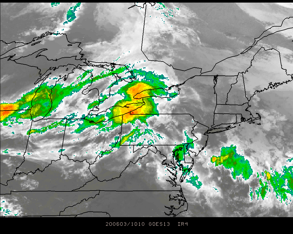
June 2020 General Discussions & Observations Thread
hudsonvalley21 replied to Rtd208's topic in New York City Metro
78/57 with partly cloudy skies near KSWF. Point and click has a high of 90. We’ll see if the clouds burn off to get the temps up there later. -
Yup it was a quick hit not at severe criteria here. Had 0.17 in the early am event and 0.52 in this recent one. 0.69 for the day.
-
Till now
-
June 2020 General Discussions & Observations Thread
hudsonvalley21 replied to Rtd208's topic in New York City Metro
Looks to be going further south.
-
June 2020 General Discussions & Observations Thread
hudsonvalley21 replied to Rtd208's topic in New York City Metro
Bumped north again. Have a feeling it will be bumped a little north again in the next update rth -
I’ll second that.
-
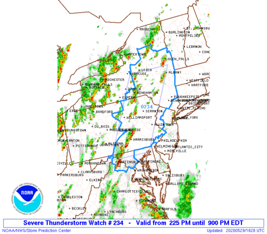
May 2020 General Discussions & Observations Thread
hudsonvalley21 replied to Rtd208's topic in New York City Metro

-
Hazardous Weather Outlook National Weather Service New York NY 227 PM EDT Fri May 29 2020 NYZ067-301830- Orange- 227 PM EDT Fri May 29 2020 ...SEVERE THUNDERSTORM WATCH 234 IN EFFECT UNTIL 9 PM EDT THIS EVENING... This Hazardous Weather Outlook is for southeast New York. .DAY ONE...This afternoon and tonight.
-
DCA: +1.3 101 NYC: +1.1 100 BOS: +1.4 98 ORD: +0.6 97 ATL: +1.7 101 IAH: +1.5 105 PHX: +2.1 118 DEN: +1.8 98 SEA: +1.9 95
-
0.42 in the bucket will do it for today here.
-
I don’t get it.
-
Similar here with the two rounds. First found had a few gusts to 35-40. Total in the bucket so far 0.74. Looks like another round in an hour or so.