hudsonvalley21
-
Posts
4,027 -
Joined
-
Last visited
Content Type
Profiles
Blogs
Forums
American Weather
Media Demo
Store
Gallery
Everything posted by hudsonvalley21
-
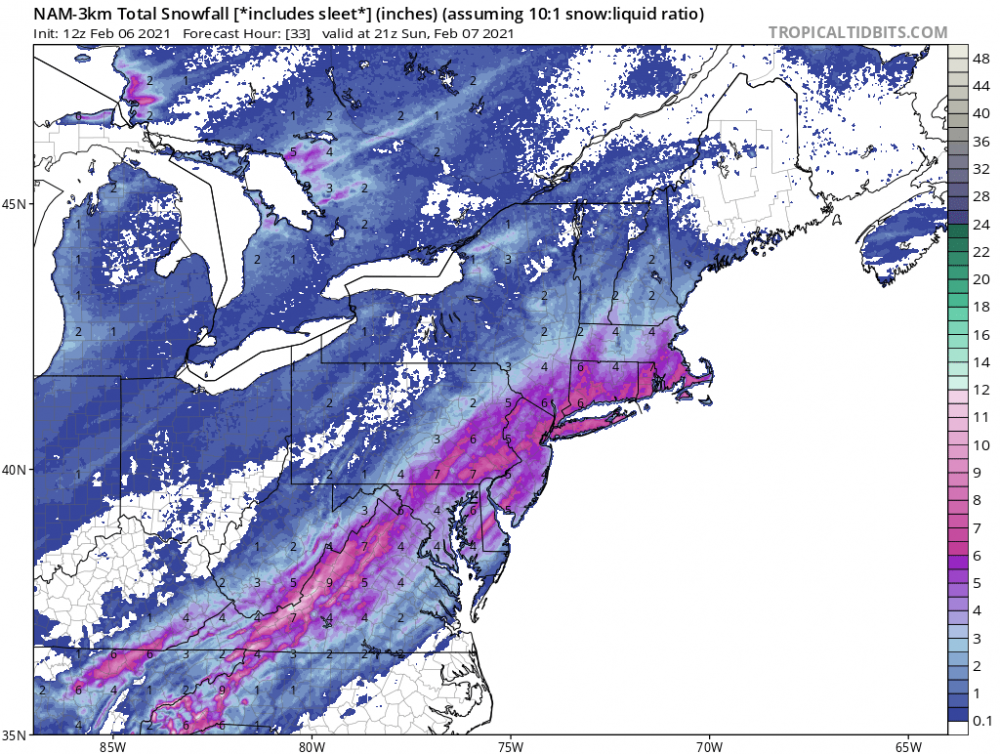
2-7-21 Sunday 8-12 hour nor'easter snowstorm roughly 5A-5P
hudsonvalley21 replied to wdrag's topic in New York City Metro
30/13 here -
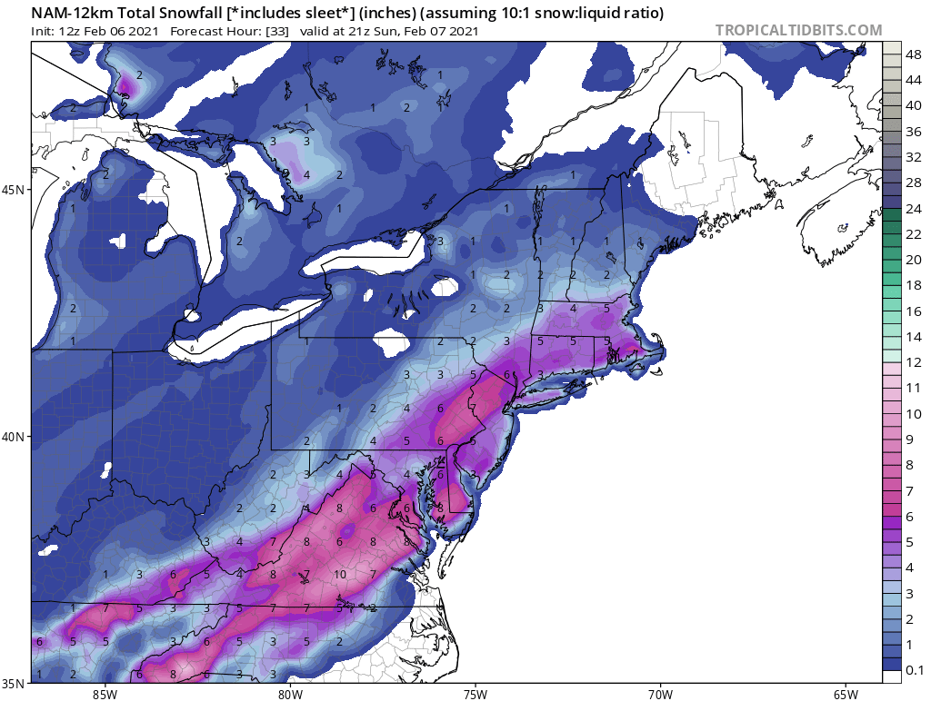
Additional 1-5" snow mostly North of I80 Tuesday Feb 9
hudsonvalley21 replied to wdrag's topic in New York City Metro
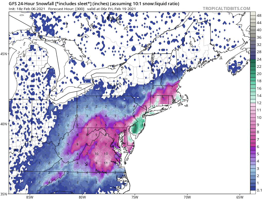
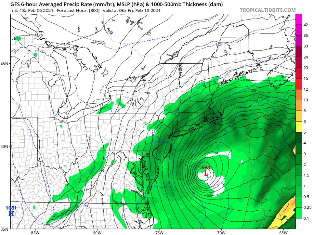
Today’s 18z GFS 24 hour snowfall map for the Tuesday event.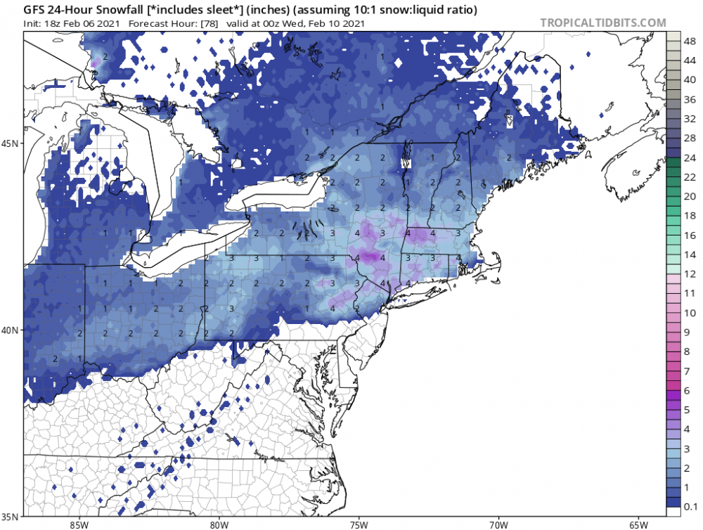
-
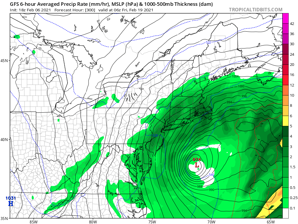
It’s showing a nice event on the 18-19th. Here is the 24 hour snowfall and surface maps for that timeframe.

-
2-7-21 Sunday 8-12 hour nor'easter snowstorm roughly 5A-5P
hudsonvalley21 replied to wdrag's topic in New York City Metro
Looks good for all the folks in the NYC metro thread. Let’s hope it holds serve. Not much more time till the event begins.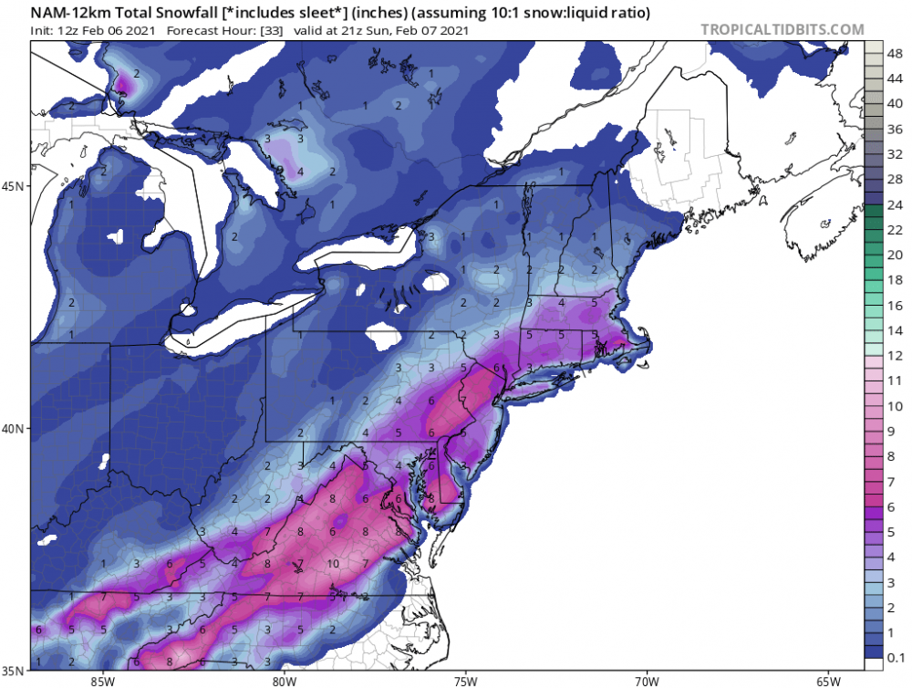
-
2-7-21 Sunday 8-12 hour nor'easter snowstorm roughly 5A-5P
hudsonvalley21 replied to wdrag's topic in New York City Metro
-
2-7-21 Sunday 8-12 hour nor'easter snowstorm roughly 5A-5P
hudsonvalley21 replied to wdrag's topic in New York City Metro
Even into Orange dutchess Sullivan counties if there are any further ticks west -
2-7-21 Sunday 8-12 hour nor'easter snowstorm roughly 5A-5P
hudsonvalley21 replied to wdrag's topic in New York City Metro
Looks good for us interior folks. -
So sad to hear, my thoughts and prayers go out to him and his family. I remember him from way back on the eastern board.
-
Hope you had some extra sheer pins
-
2-7-21 Sunday 8-12 hour nor'easter snowstorm roughly 5A-5P
hudsonvalley21 replied to wdrag's topic in New York City Metro
Basically 0.75 north and west of NYC to 1.25 in Long Island of QPF -
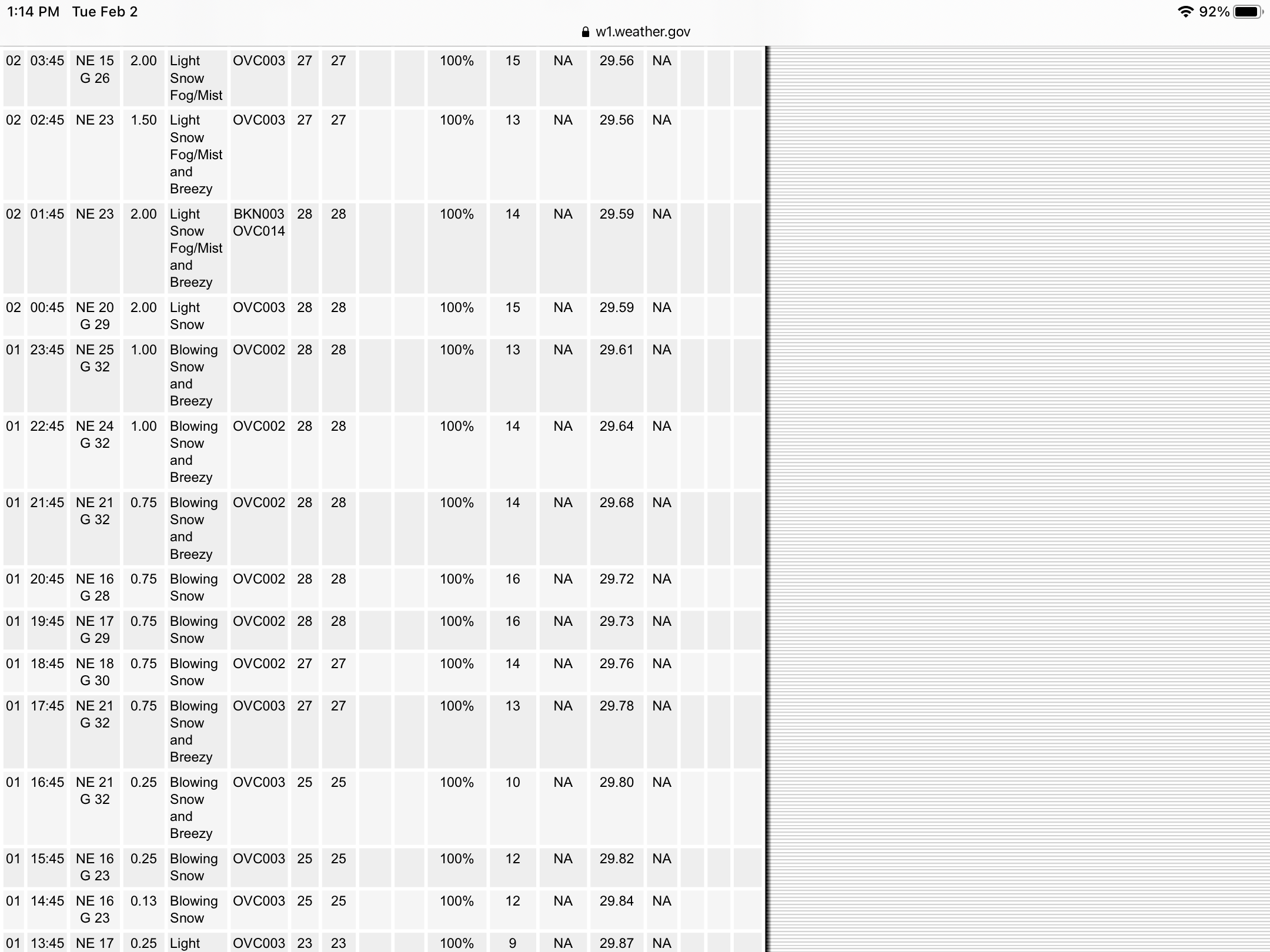
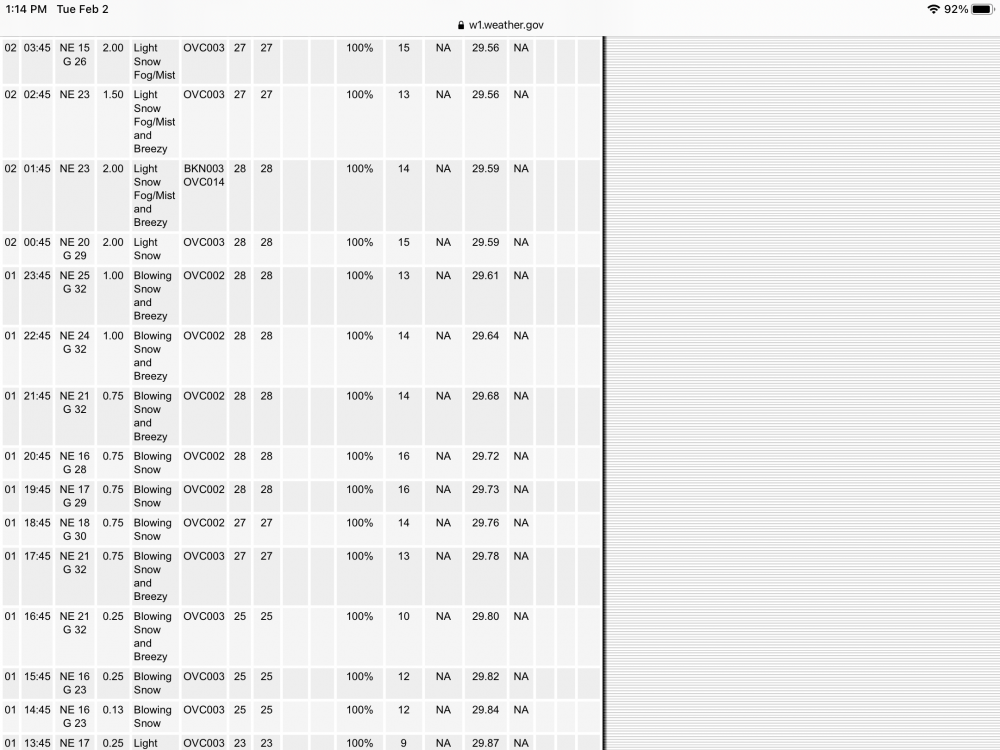
Had good winds here and for many hours. Gusts in the 30’s. Sustained winds around 15. There are some roofs with the drifting very noticeable. A screenshot from the Obs. from KSWF
-
17.3 as of 9:30 last night. Another 2.2 since then so 19.5 will do it here so far. Light snow still falling. That was with measures around 6-7 hours between.
-
It looks like 2’ is definitely possible by the latest radar.
-
Here too snow is much wetter and compacting vs earlier.
-
17.3 OTG as of 9:30 pm. Still moderate snow falling. 28/27 NE wind.
-
I believe slightly east too. Not much tho.
-
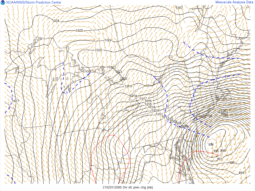
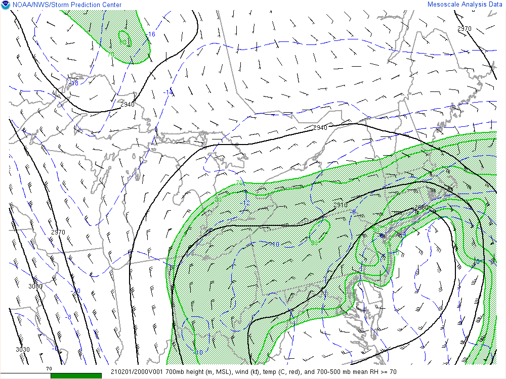
You have to say most models handed this very well with the 700 mb
- 1,932 replies
-
- 1
-

-
- heavy snow
- wind damage
- (and 1 more)
-
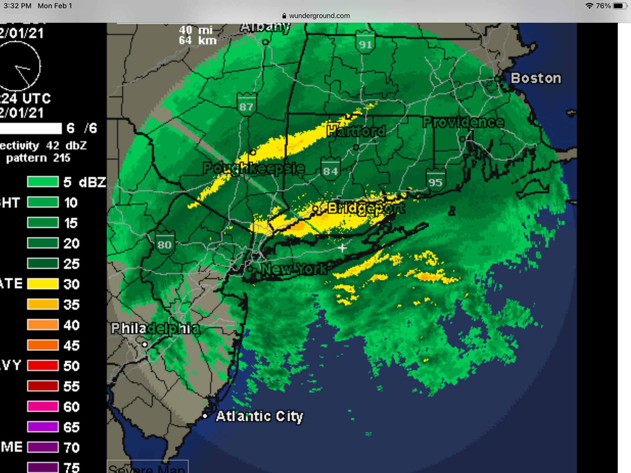
Thanks. Real cool. That band is impressive from the Atlantic over Queens and right up to our area.
-
It’s still forming out there south of Long Island and pivoting into Ct and the Hudson valley
-
I used the snowblower a couple of times already. 13.6” OTG so far. Measured at 5:00 pm. 25/25
-
There is that band over Long Island sound/ southern Ct that looks to pivot up this way too.

-
Same here. 2-3” rates per hour. More bands to follow. Could easily get 8-12” in a few hours
-
Snow rates have ramped up I was at around an inch per hour and looks to have doubled currently under the band that had recently pivoted in. Several more bands are lined up to follow.
-
The heavy band is now pivoting up here that you are experiencing. Falling at a good rate now.